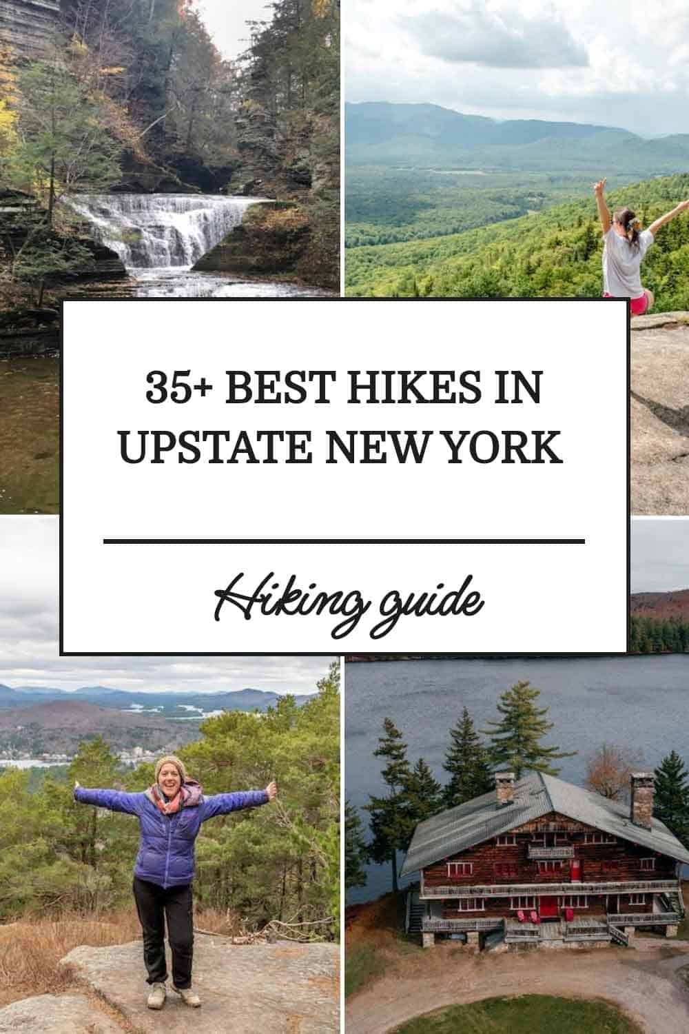
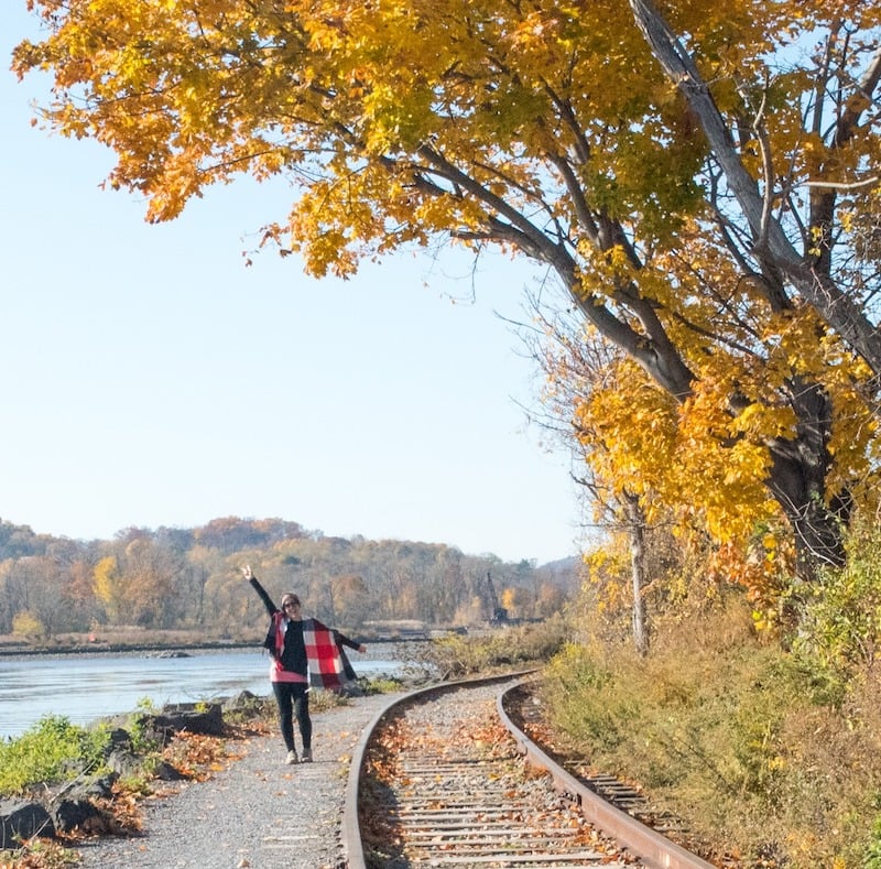
37 Best Hikes In Upstate New York (Epic Views!)
This post contains affiliate links, including Amazon affiliate links. If you purchase through these links, I may earn a commission at no extra cost to you. As an Amazon Associate, I earn from qualifying purchases. Thank you for your support!
Looking for the best hikes in Upstate New York?
Then you’re in the right place!
Whether you’re looking for scenic but easy hiking trails in upstate NY or more challenging treks with epic mountain views, this list has you covered.
Along with adding in a number of my personal favorite options for hiking in New York I also reached out to some of my favorite travel bloggers to have them provide input into which trails should make it into this guide.
The result?
A list of the best Upstate NY hikes that you absolutely should add to your outdoor adventure bucket list.
Pro tip: Before going hiking, make sure to download the AllTrails app to have trail guides, maps, photos, and reviews right at your fingertips. You can also sign up for a free trial of AllTrails+ to download offline maps, get alerts for wrong turns, find trails by distance from you, and more!

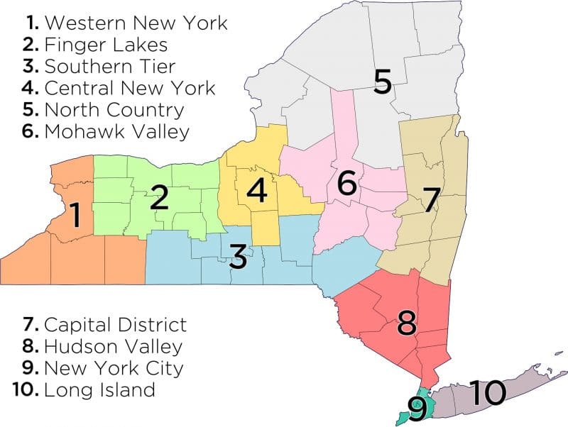
New York State Map
Additionally, to give you a lay of the land and to help you get a sense of New York State‘s geography, here is a map showing the regions of New York:
You can also click here for the Google Map version of a New York State map.
Best Hikes In Upstate New York By Region
This list of the best hiking trails in Upstate New York is broken up by region, which, by the way, do sometimes overlap.
Also, yes, I realize that while people from Long Island and NYC consider Upstate New York to begin at the northern Bronx border, others would not include places like the Hudson Valley in the definition.
However, for the sake of how people search for Upstate New York hiking trails online, I’ve included any hikes that are north of New York City.
If you’d prefer to hike downstate, I’ve also got guides on the best places to hike on Long Island as well as the top places to go hiking in Manhattan.
On that note, let’s discover some of the best hiking trails in NY!
Adirondacks Region Hikes
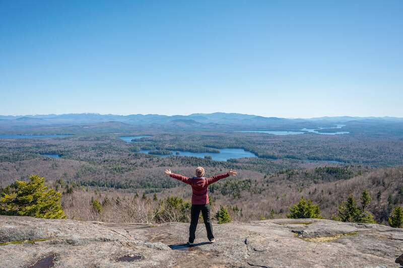
1. Mount Marcy Hike
Trail difficulty: Difficult
Length: 14.8 miles round-trip
Location: Keene, NY — though I recommend basing in nearby Lake Placid, which is a lively village with loads of restaurants, hotels, and local shops.
Trailhead: You can access Mount Marcy — as well as many other Adirondack hiking trails — from the Adirondak Loj & Wilderness Campground at Heart Lake, part of the Adirondack Mountain Club.
Trail map: Click here for a Mount Marcy trail map
Mount Marcy Video:
About This Upstate New York Hike:
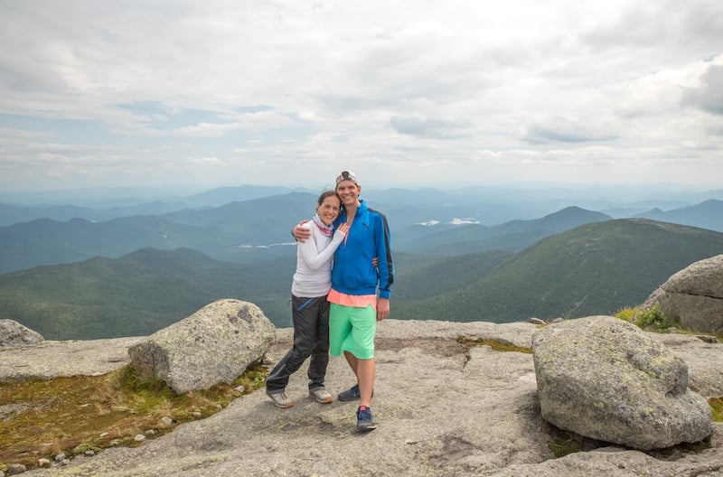
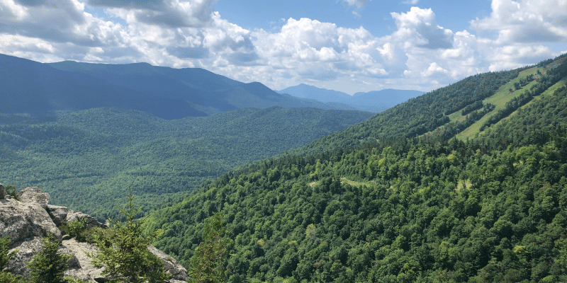
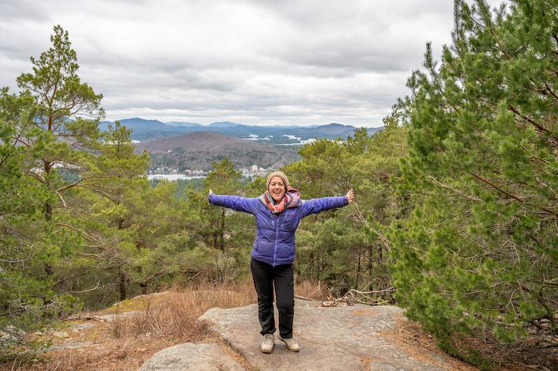
No Adirondacks travel guide would be complete without mentioning Mount Marcy. Hands down, this is one of the best hikes in the world!
Mount Marcy is the highest peak in New York at 5,344 feet.
Expect to hike for about eight hours, though you’ll never be bored thanks to the intensity of the hike as well as the many lookouts along the way, as you can see here.
There is even a waterfall along the way called Indian Falls from which you can see Wright, Algonquin, and Iroquois Peaks perfectly framed by pines and other Adirondack trees.
One of the most challenging sections is toward the end, where you’ll scramble over rocks for about 30-40 minutes.
Afterward, you’re rewarded with 360-degree views of the Adirondack High Peaks Region from the Mount Marcy Summit (shown above!).
Hiking with your partner? Note that Lake Placid is home to some of the best romantic getaways in Upstate New York, like Whiteface Lodge and the Lake Placid Lodge.
That being said, the Mount Marcy Trail is also great for those hiking alone as a woman, as the trail is well-trafficked. Just keep in mind it’s physically challenging so you should have very good physical fitness.
– Jessie Festa from Jessie on a Journey
2. Phelps Mountain
Trail difficulty: Hard
Length: 8.7 miles out-and-back
Location: Keene, NY
Trailhead: Adirondak Loj & Wilderness Campground at Heart Lake
Trail map: Click here for a Phelps Mountain trail map
Phelps Mountain Video:
About this Upstate New York Hike:
At 4,161 feet, Phelps Mountain ranks as the 32nd highest peak in the Adirondacks—though don’t let that intimidate you. Much of the trail is surprisingly gradual, winding through shady forest, across wooden planks and smooth stones, and alongside the scenic Marcy Dam.
Don’t miss the chance to snap a photo from the elevated wooden bridge as you cross the dam. It’s a serene spot with a postcard-worthy backdrop.
Be aware that a river crossing may be required depending on your chosen route. When you reach the trail sign giving two options for Phelps, the more direct path via Indian Falls includes a water crossing (which can be tricky if water levels are high).
The alternate route is slightly longer but avoids the crossing.
The final mile is where things get tough. Expect a steep, rocky scramble that may require using your hands in places.
But your efforts are rewarded with panoramic views of High Peaks like Haystack, Saddleback, and Marcy, the tallest mountain in New York.
Pro tip: Phelps is often paired with nearby Tabletop Mountain, another High Peak. While Tabletop is worth checking off your list, the views from Phelps are far superior.
Even if you skip Tabletop, a short detour to Indian Falls is absolutely worth it for the stunning scenery alone.
– Jessie Festa from Jessie on a Journey
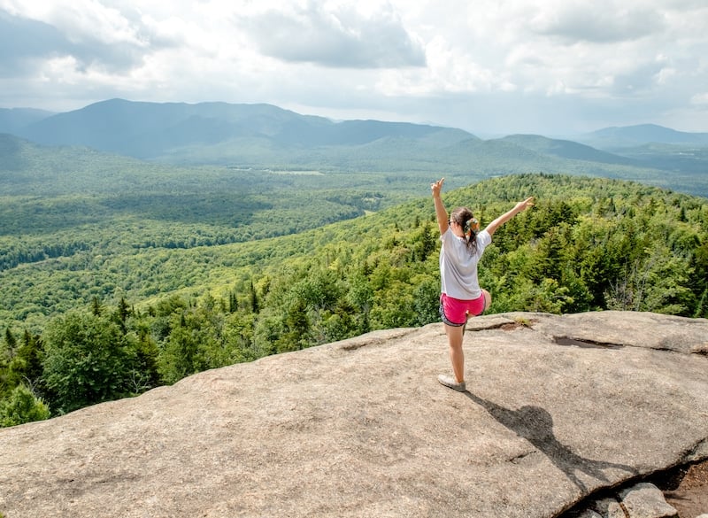
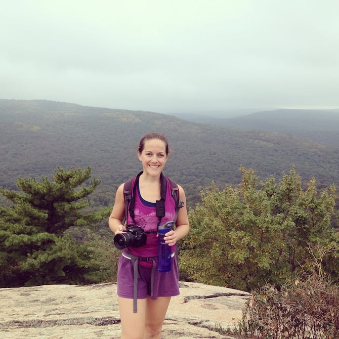
3. Mount Van Hoevenberg Trail
Trail difficulty: Moderate
Length: 2.2 miles one way (or 4.4 miles round-trip)
Location: North Elba, though I highly recommend staying in the fun tourist-friendly village of Lake Placid, which is nearby.
Trailhead: There are two trailhead options for this epic upstate New York hiking trail, including an East Trail and a West Trail. Personally, I did the West Trail and started the hike at the South Meadows Camping Area, located within the Adirondack High Peaks Wilderness Area.
Trail map: Click here for a Mount Van Hoevenberg trail map
Mount Van Hoevenberg Video:
About This Upstate New York Hike:
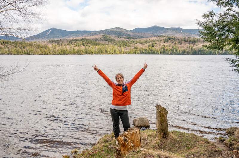
The Mount Van Hoevenberg Trail starts off flat, and you’ll leisurely stroll under the shade of pine trees.
During this time, keep your eyes peeled for wildflowers and giant mushrooms growing off of the tree bark.
After about an hour, you’ll come to a scenic beaver pond offering a nice place to take photos.
I recommend taking the break, as soon after this the hike gets steep — and continues being steep for the rest of the way up.
It’s worth it though for the epic view out over the Adirondack High Peaks Region (pictured above) from the top!
– Jessie Festa from Jessie on a Journey
4. Saint Regis Mountain Trail
Trail difficulty: Moderate
Length: 6.6 miles round-trip
Location: Saint Regis Canoe Area
Trailhead: There is a parking lot right at the trailhead at 432 Keeses Mill Rd, Paul Smiths, NY 12970
Trail map: Click here for a Saint Regis Mountain Trail map
About This Upstate New York Hike:
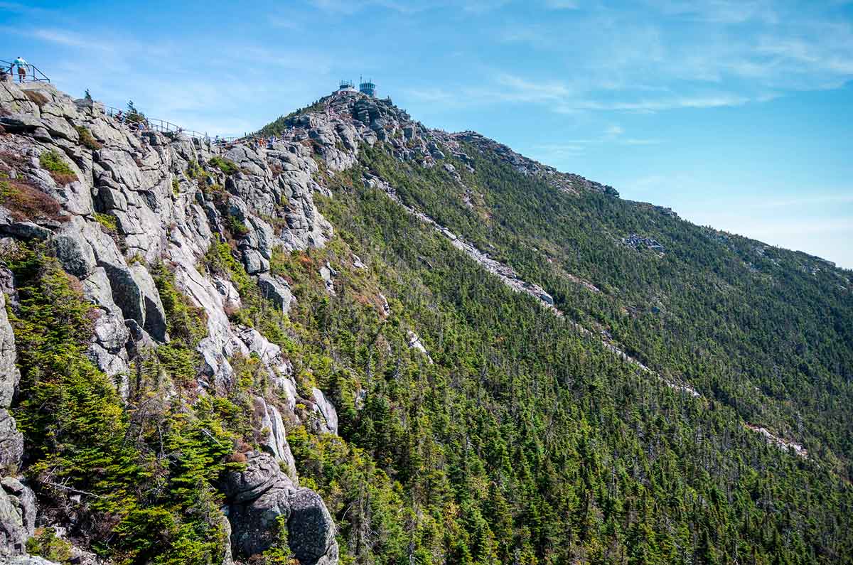
If you’re looking for absolutely epic views but don’t want to hike the 46 Adirondack High Peaks above 4,000 feet, the Saint Regis Mountain Trail should be on your list.
The 6.6 round-trip hike is pretty moderate, winding through the woods with a gradual ascent, with a few steep and rocky spots as you follow the yellow blazes.
It’s not too challenging until the very end, with the last 30 minutes providing a steep uphill and rocky climb.
Luckily, it’s worth the effort as you’re rewarded with gorgeous panoramic views of the surrounding peaks and lakes.
For a true 360-degree view, head up the fire tower. From there, you’ll see famous Adirondack High Peaks like Mount Marcy, Whiteface, and Algonquin as well as natural attractions like Upper and Lower St Regis Lakes, Bear Pond, and Lake Clear.
– Jessie Festa from Jessie on a Journey
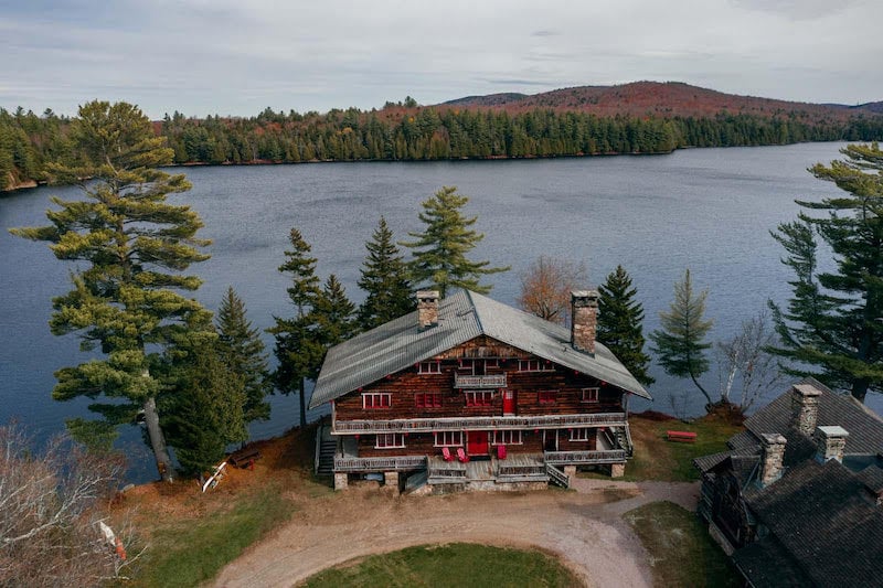
5. Great Camp Sagamore Lake Trail
Difficulty: Easy
Length: 3.7-mile loop
Location: Near Raquette Lake in Hamilton County
Trailhead: You can start the trail on either side of the main lodge at Great Camp Sagamore
Trail map: Click here for a Great Camp Sagamore Lake Trail map
About This Upstate New York Hike:
This is one of the most serene hikes in the Adirondacks, located at the historic Great Camp Sagamore, a former summer home to the Vanderbilt family and one of those quintessential “American” summer camps on a lake — complete with a lodge that looks straight out of a Wes Anderson film.
Great Camp Sagamore is located on its own private lake, Lake Sagamore, with wooded forests and a 3.7-mile loop trail that goes all the way around the lake.
To get to the trail, you can start at either side of the lake from the main lodge. We started on the left-hand side and began our journey on a pretty, flat trail through the forest with small pockets of views of the lake, before getting to a fragrant pine forest with a mossy floor.
This Upstate NY trail is incredibly peaceful and suitable for all ages.
It took us — with plenty of photo breaks — around two hours to complete the trail.
My favorite part of the hike is when we got to the deep pine forest on the opposite end of the lake. The fresh air and the scent of the pine trees were really relaxing.
– Megan Indoe & Scott Herder from Your Brooklyn Guide
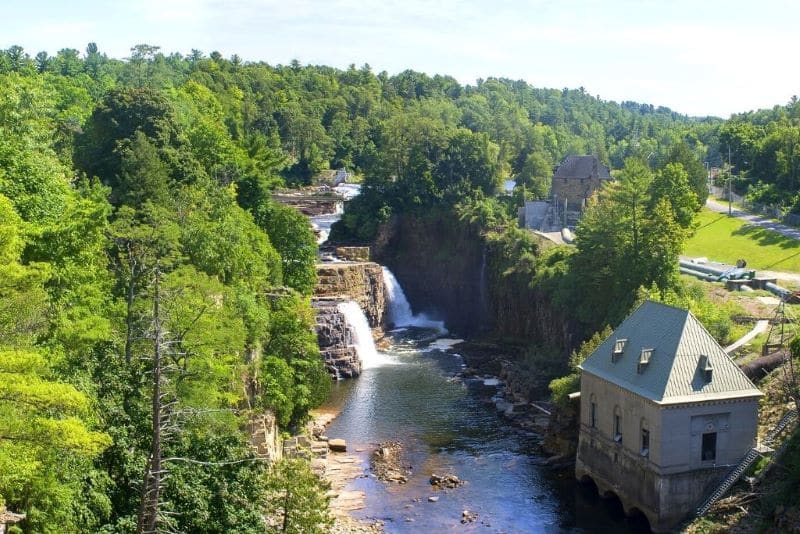
6. Ausable Chasm
Trail difficulty: Easy
Length: 1.9 miles
Location: Ausable Chasm, New York
Trailhead: The main entrance is at 2144 U.S. 9, Ausable Chasm, NY 12911
Trail map: Click here for an Ausable Chasm trail map
About This Upstate New York Hike:
Easily one of the best hikes in upstate New York is Ausable Chasm.
It’s located in the Adirondacks Region, right near Lake Placid and Saranac Lake, and is a fun family-friendly hike that starts with an incredible view of Rainbow Falls.
Depending on your budget, you can either hike along one of the many trails that take you behind the chasm, or enter the park through the main entrance and walk along the main trail here.
Bear in mind that you will have to pay $17.95 for adults and $9.95 for children between the ages of 5 and 12 if you want to hike along the well-paved trail that takes you through the center of the park.
But once inside, you’ll enjoy an easy 1.9-mile loop hike that features stunning views of a unique, vertical-walled canyon that is made of 500 million-year-old rock.
If you can, time your visit for the spring, right after the snow melts, when the flow from all of the waterfalls in the area is at its most impressive. And if you want, you can even do a bit of easy, white water rafting through the chasm — making this a lovely day trip from Lake Placid for anyone with small children.
All in all, a walk through Ausable Chasm is one of the best hikes in the Adirondacks and an experience not to be missed by anyone traveling to the region.
– Kelly from Girl with the Passport
7. Bear Den Mountain
Trail difficulty: Hard
Length: 3.4-mile out-and-back
Location: Wilmington, New York
Trailhead: Whiteface Mountain Ski Center
Trail Map: Click here for a Bear Den Mountain trail map
About This Upstate New York Hike:
From the Lake Placid and Whiteface Mountain Kampgrounds of America (KOA), Bear Den Mountain is an out-and-back trail in the Adirondack Region of Upstate New York.
The trail is located in Wilmington, NY, which is just 15 minutes outside of Lake Placid.
To access the trailhead, you’ll enter the Whiteface Mountain Ski Center and park in the Bear Den lot. You can use the restroom at the ski center as well as ask questions if you are unsure about where to park or where the trailhead is located.
The hike begins along a river but quickly shifts into the woods. The wooded area doesn’t offer much in terms of views throughout the hike but it does provide ample shade.
While considered a difficult hike, I actually found it to be more moderate. The 1,300 feet of elevation gain doesn’t come without some steep inclines, but it’s nothing overly strenuous and is certainly still family-friendly.
The incredible views of Whiteface and Little Whiteface at the summit make this hike worth the effort. Once you arrive at the rock outcropping, you’ll see the lush, rolling hills of the Adirondacks as far as the eye can see.
Make sure to save some time to grab lunch or dinner and enjoy the stunning views of Mirror Lake in downtown Lake Placid after your hike.
– Maddy from Madelyne On The Move
8. The Whiteface Mountain Summit Trail
Trail difficulty: Difficult
Length: 9.9 miles one way
Location: Wilmington, New York
Trailhead: Reservoir Road, close to White Brook
Trail Map: Click here for a Whiteface Mountain Summit Trail map
About This Upstate New York Hike:
The Whiteface Mountain Summit Trail is one of the best hikes in Upstate New York and should be high on your list of must-do activities in the area if you love the great outdoors.
The route is around 9.9 miles long and is not a loop so you need to hike back the same way you came.
This trail is definitely a more advanced option so it’s not recommended for beginners. If you’re an inexperienced hiker you could choose to only hike the beginning and then turn back after a few miles. That way you can still enjoy the picturesque views with far less effort.
The most difficult part of this hike is without a doubt the elevation gain. At over 3,200 feet this means that parts of the trail are very steep so make sure you wear sturdy footwear. This is one of the most important items when it comes to what to wear when you go hiking.
Also note:
This trail is quite popular so expect to encounter a lot of other hikers, especially on days with good weather or weekends. The peak and endpoint of the hike are also accessible via car, which means that a lot of other visitors tend to gather here.
For the best experience go early in the morning.
– Victoria from Guide Your Travel
9. Mount Jo
Trail difficulty: Easy
Length: 2.4-mile loop
Location: North Elba, New York
Trailhead: Find the Mount Jo trailhead near the High Peaks Information Center at the end of Adirondack Loj Road, off Route 73 south of Lake Placid. There is a fee to park that supports the Adirondack Mountain Club projects.
Trail Map: Click here for a Mount Jo trail map
About This Upstate New York Hike:
Hikers flock to the High Peaks of the Adirondacks to scale the lofty mountains.
Mount Jo is a gorgeous mountain in the High Peaks that is easy to get to and popular to climb.
The views from the top of Mount Jo are spectacular. Heart Lake is nestled at the base of the peak and views of Mt. Marcy and the MacIntyre Range stretch out across the horizon.
Families with kids will enjoy scrambling up the 700-foot elevation gain to crest this small peak. There are two trails to the summit, aptly named the Long Trail and the Short Trail that combine for an enjoyable loop.
The Short Trail is steeper so it is advisable to ascend it and then descend on the Long Trail. The Adirondack Mountain Club has built stone and wooden stairs to make the climb easier.
Henry Van Hovenberg, who built the original Adirondack Loj, named Mount Jo.
The story goes that he proposed to Josephine Schofield on a hike in the High Peaks, so he changed the name of Clear Pond to Heart Lake and named the adjoining mountain on his property after his fiancée.
Sadly, they were never married, but the name remains.
– Karen from Outdoor Adventure Sampler
10. Indian Head
Trail difficulty: Challenging
Length: 6.1-mile round hike
Location: Greene County, NY
Trailhead: Next to Highway 73 in Keene Valley. You can type “Indian Head trailhead” into Google Maps to have it populate. Note that because this trail is so popular, you’ll need a permit to park in the main lot. You can find parking across the highway if the lot is full.
Trail Map: Click here for an Indian Head trail map
About This Upstate New York Hike:
Indian Head in the Adirondack Mountains is a beautiful hike, especially in the fall months.
This trail goes through trees as you climb higher until it finally opens up to an outlook overlooking Lower Ausable Lake.
This is a challenging hike with around 1,700 feet of elevation gain. It takes five hours to complete, though it is very rewarding at the end with spectacular views.
Pro tip: If you’re trying to get the best photos of the views, go at sunset.
– Jenny from Limitless Hiker
11. Cat and Thomas Mountain Trail
Trail difficulty: Moderate
Length: 7.3-mile loop
Location: Near Bolton Landing in Lake George
Trailhead: 707 Valley Woods Rd, Bolton Landing, NY 12814. Or you can put “Cat & Thomas Trailhead” into Google Maps and it will show up.
Trail map: Click here for a Cat and Thomas Mountain Trail map
About This Upstate New York Hike:
If you love active travel adventures that include epic views, then I recommend immersing yourself in the beauty of the Cat and Thomas Mountains Preserve!
The trail offers a mix of flat woodland paths and steeper rocky climbs, with some lovely places to stop along the way, like a beaver pond where you can look for bullfrogs.
You’ll also hike through various types of forest, which keeps things interesting.
The real highlight though is the bird’s-eye views of Lake George and the Adirondacks from atop the two mountains.
Getting to Thomas Mountain is easier, as you’ll hike about 1.5 miles to reach the 716-foot summit.
From there, you can choose to continue on to Cat Mountain, which is challenging although totally worth it if you have the stamina, especially as this portion of the hike takes you along the ridge of the mountain.
Additionally, Cat Mountain offers a more expansive view of Lake George from 1,956 feet elevation.
Warning:
While stunning, this Upstate NY hiking trail gets muddy, so bring waterproof shoes you don’t mind getting dirty as well as bug spray.
– Jessie Festa from Jessie on a Journey
12. Baker Mountain
Trail difficulty: Moderate
Length: 1.6-mile out-and-back trail
Location: McKenzie Mountain Wilderness Area
Trailhead: Across from Moody Pond at 189 Forest Hill Ave, Saranac Lake, NY 12983. You can park alongside the lake.
Trail map: Click here for a Baker Mountain trail map
About This Upstate New York Hike:
This 1.6-mile out-and-back trail is short and sweet. Expect a steady uphill climb that will test your calves and work up a sweat.
The trail is easy to follow even without looking at the red blazes, as you wind your way up and up through thick forest.
At the top—which takes about an hour to reach—you’ll have a beautiful view of the surrounding lakes and peaks. There are also numerous outcroppings to sit on while enjoying lunch with a view.
Tip: When I did the hike it was mud season (aka spring), so some spots were muddy and slippery. If hiking during this time, microspikes may be needed.
– Jessie Festa from Jessie on a Journey
13. Moose Pond
Trail difficulty: Easy
Length: 3.1 miles round-trip
Location: McKenzie Mountain Wilderness Area
Trailhead: You can put “Moose Pond Trailhead” into Google Maps. There is a parking lot right before the trailhead or, if it’s mud season, you can park along Route 3.
Trail map: Click here for a Moose Pond trail map
About This Upstate New York Hike:
If you’re looking for an easy and flat trail with beautiful views, Moose Pond is the perfect pick.
The lovely vistas begin immediately as you cross a bridge over a river. Spend a few minutes enjoying the sound of babbling water rushing over rocks before heading into the woods.
The trail is flat and woodsy almost the entire time; that is, until you have to turn to get to the lookout.
Honestly, I would have missed it if I didn’t have AllTrails on, so I recommend using the app to make sure you get to the correct final destination.
Here, you’ll have a beautiful view of the Adirondack High Peaks across Moose Pond.
– Jessie Festa from Jessie on a Journey
Western New York Region Hikes
14. Niagara Gorge Rim Trail Hiking Trail
Trail difficulty: Moderate
Length: 9.1 miles out-and-back
Location: Niagara Falls, New York
Trailhead: The trailhead is in Devil’s Hole State Park and begins near the Devil’s Hole parking area.
Trail map: Click here for a Niagara Gorge Rim Trail Hiking Trail map
About This Upstate New York Hike:
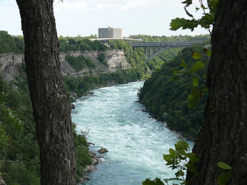
One of the best hikes in Western New York is undoubtedly the Niagara Gorge Trail.
It’s a flat, family-friendly hike that takes you through the trees along the rim of the stunning Niagara Gorge.
A highlight along the way is Whirlpool State Park, where you can see the magnificent swirling waters of Niagara River’s rapids.
You’ll also visit Niagara Falls State Park. Here, take in views of the famous Bridal Veil Falls and Horseshoe Falls.
Note that along the Rim Trail, you’ll also have the option to do other trails within the Niagara Gorge Trail Network. You’ll even be able to descend down into the gorge, if you wish!
– Jessie Festa from Jessie on a Journey
Finger Lakes Region Hikes
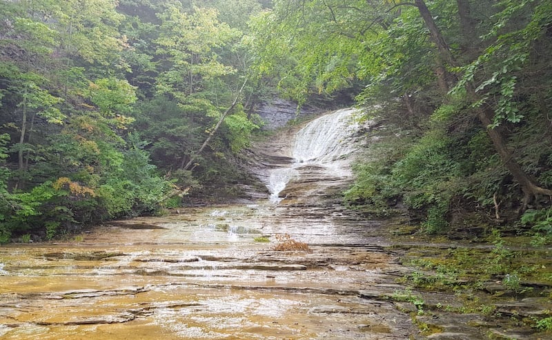
15. Grimes Glen Park
Difficulty: Easy
Length: 1.1 miles out and back
Location: Naples, Ontario County
Trailhead: Find parking down at the end of Vine Street and head to the trailhead where you will begin.
Trail map: Click here for a Grimes Glen Park trail map
About This Upstate New York Hike:
One of the best hidden gems in the Finger Lakes region are the waterfalls and hike at Grimes Glen Park in the village of Naples, New York. This is a true highlight of Finger Lakes tourism.
Here, you can head out on a scenic journey through this glen with two beautiful waterfalls.
This trail is easy, flat, and suitable for families; however, after the first bit of the trail you will be required to walk through the creek bed. This means you will need water shoes for hiking or shoes that have great grip and traction that you don’t mind getting completely wet.
This is not a great hike in the winter because of ice and water. Moreover, in the fall the hike is beautiful, but you’ll want to be mindful of the wet foliage that can be a little slippery.
The first waterfall will be located off the creek bed to the left about 0.5 miles into the hike. It’s known as French Hill Falls and it cascades down the tributary that feeds into the creek.
Continue another 0.25 miles through the creek bed and you’ll make your way to the next waterfall, which is surrounded by dramatic cliffs above it.
There is a third waterfall, but it is not advised to visit as unless you’re an experienced rock climber it’s incredibly dangerous and a fall could be fatal.
After the second waterfall, you can turn around and head back out.
We spent around one hour doing the entire hike with stops admiring the first two waterfalls. Don’t forget a fresh pair of socks and perhaps shoes so you don’t have wet feet all day!
– Megan Indoe & Scott Herder from Bobo & Chichi
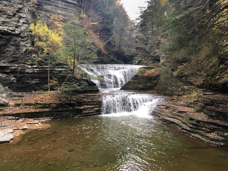
16. The Gorge And Rim Trail Loop At Buttermilk Falls State Park
Trail difficulty: Moderate
Length: 1.6 mile loop
Location: Ithaca, NY
Trailhead: Buttermilk Falls State Park, main parking lot off Rt 13 S.
Trail Map: Click here for a Gorge and Rim Trail Loop map
About This Upstate New York Hike:
In order to get a sense of what Ithaca is like, visitors must see the many gorges and waterfalls scattered throughout this Finger Lakes college town.
One of the best ways to do this is by hiking the Gorge and Rim Trail Loop at Buttermilk Falls State Park.
The best part about this hike is that the views begin immediately. Before even parking the car, you’ll see the park’s namesake, the 165-foot Buttermilk Falls, at the base of which is a deep clear pool that’s open for swimming and watched over by lifeguards during summer months.
The Gorge Trail begins at the base of the falls. Hikers will climb a stone stairway that follows alongside the gorge, which was carved over millions of years by the cascading waters of Buttermilk Creek.
On the way up, hikers will pass waterfalls both large and small, bottomless plunge pools of swirling waters, and interesting rock formations created by layers of siltstone and shale.
Much of the hike involves a steep climb beside the gorge but the trail does level off at points as it passes through wooded areas.
The Gorge Trail eventually connects with another trail for hikers who would like to continue on. Those wishing to return to the base of Buttermilk Falls can connect to the Rim Trail, which runs up above the gorge and is more of a wooded path.
It’s also possible to simply turn around and retrace your steps on the Gorge Trail. Both will terminate back at the main parking lot.
Because of the steep rocky terrain, the Gorge Trail is closed in the winter.
– Michele from From Inwood Out
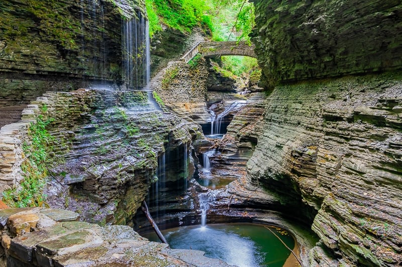
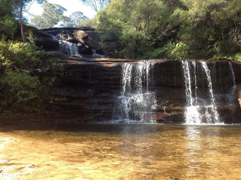
17. Watkins Glen State Park Gorge Trail
Trail difficulty: Moderate
Length: 1.5 miles one way
Location: Watkins Glen, NY
Trailhead: 1009 N. Franklin Street is the address of the park’s main entrance.
Trail Map: Click here for a Watkins Glen State Park Gorge Trail map
About This Upstate New York Hike:
Watkins Glen State Park Gorge Trail offers arguably the best effort to reward ratio of all Upstate New York hikes.
Nineteen waterfalls including Rainbow Falls — one of the most visually stunning scenes in New York — cascade and plunge through an extraordinarily beautiful gorge right in the heart of Watkins Glen village.
Watkins Glen is located in the extremely popular Finger Lakes region of Western New York and the State Park welcomes over 1 million visitors each year.
A moderate 1.5-mile man-made path with around 800 stone steps transports visitors through the dramatic Watkins Glen Gorge. Besides the steps, the trail is flat, easy and relaxing.
The hike has a fantasy novel aura — like Rivendell from Lord of the Rings or walking through the wardrobe into Narnia.
Certain sections of the wafer-thin Watkins Glen Gorge are smooth, whereas others are rugged. Hikers will walk past, around, and even underneath waterfalls thanks to excellent craftsmanship and stone masonry.
Watkins Glen State Park’s climax is a heart-in-mouth, magazine front cover landscape that is sure to blow away even the hardest to please:
Rainbow Falls.
Rainbow Falls isn’t just a waterfall, it’s a picture-perfect scene from left to right and from foreground to background.
Bonus:
The trailhead for Watkins Glen Gorge conveniently begins just a half mile walk from the bustling restaurants and bars in town.
– Mark and Kristen from Where Are Those Morgans
18. Robert H. Treman State Park Rim Trail and Gorge Trail Loop
Trail difficulty: Moderate
Length: 4.5-mile loop
Location: Ithaca, NY
Trailhead: At the Upper Entrance of Robert H. Treman State Park.
Trail Map: Click here for a Rim Trail and Gorge Trail Loop map
About This Upstate New York Hike:
One of the most beautiful hikes in New York State is the Rim Trail and Gorge Trail Loop in the Robert H. Treman State Park.
This stunning winding trail through Enfield Glen allows visitors to experience 12 waterfalls, including the 115-foot Lucifer Falls, as Enfield Creek cascades toward the Cayuga Inlet.
It is considered a moderate hike due to several impressive sets of stone staircases and an elevation change of over 500 feet.
The Lucifer Falls Overlook features a spectacular view of Enfield Creek cascading down the gorge.
Other viewpoints allow visitors to look nearly a mile-and-a-half toward the lower gorge.
The Gorge Trail can be incorporated into a loop by connecting with the Rim Trail and heading back to the lower/main park trailhead. The out-and-back route clocks in at two miles in length, while the full loop trail is 5.3 miles.
The park is located conveniently in Ithaca, NY near the bustling college town as well as renowned wineries in the region.
As an added reward for completing this wonderful hike, the Lower Falls themselves are a cool 50 feet tall and are located near the parking area. They have a swimming pool to cool off in on a warm summer day.
– Lina from BucketListPlaces.com
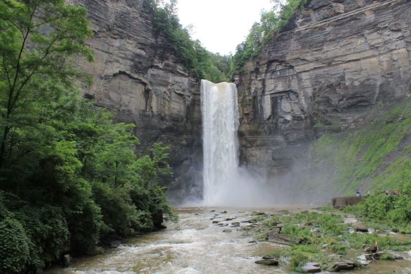
19. Taughannock Falls Gorge Trail
Trail difficulty: Easy
Length: 1.8-mile out-and-back trail
Location: Trumansburg, NY
Trailhead: The trail begins from the Taughannock State Park Parking lot located on route NY 89.
Trail Map: Click here for a Taughannock Falls Gorge Trail map
About This Upstate New York Hike:
The Finger Lakes Region of Upstate New York is famous for its scenic lakes, delicious wineries, and beautiful waterfalls.
One of these majestic waterfalls is Taughannock Falls; which, by the way, is even taller than Niagara Falls!
The falls are best explored by hiking the Gorge Trail, which takes you to the base of the falls. It’s located in the Taughannock Falls State Park, by the scenic Cayuga Lake.
This stunning Upstate NY trail is an easy family-friendly option featuring a flat path covered by green shady trees throughout. It is open year-round, but the best time to visit is summer to autumn.
In terms of distance, it’s just under a mile long to the base of the drop of the falls.
The trail traverses along the Taughannock Creek towards Cayuga Lake and is very scenic with the creek and huge gorge cliffs keeping you company the entire way.
At the end, you’ll be welcomed by the misty spray of the falls — indeed a sight to behold!
– Neha from Travelmelodies
Central New York Region Hikes
20. Vroman’s Nose Trail
Difficulty: Easy
Length: 1.5-mile loop trail
Location: Middleburgh, NY
Trailhead: The trailhead is located at the back of the parking lot off West Middleburgh Road, to the right of the Under the Nose café. You can type “Vroman’s Nose Hiking Trail” into Google Maps to be taken to it.
Trail map: Click here for a Vroman’s Nose Trail map
About This Upstate New York Hike:
If you’re looking for the best hikes in Central New York, this trail should definitely be on your list!
Located in Schoharie County, just north of the Catskill region, Vroman’s Nose is a favorite hiking spot for both locals and visitors.
The 1.7-mile loop is fairly easy, gaining an elevation of roughly 450 feet. I recommend you choose to start the loop to the right, as the incline is more gradual.
Coming back down to close the loop is fairly steep — so be careful! A mix of shale layers and roots creates natural “steps” as hikers make their way to the top.
The trail is very family and dog-friendly and offers a perfect spot to picnic at the top.
When you reach the summit halfway through the loop, there will be lots of open, flat rock. People have even nicknamed the area the “dance floor”! Make sure to leave some time to take in the views of the surrounding hills and farmland.
Altogether, expect to spend about an hour along the Vroman’s Nose Trail.
When you’re done, treat yourself to lunch at Under the Nose, the café near the trailhead. Their cookies alone are incredible!
If you’re looking for other things to do in the area, check out Howe Caverns or the village of Sharon Springs.
– Danielle Benjamin from Wandercuse
Catskills Region Hikes
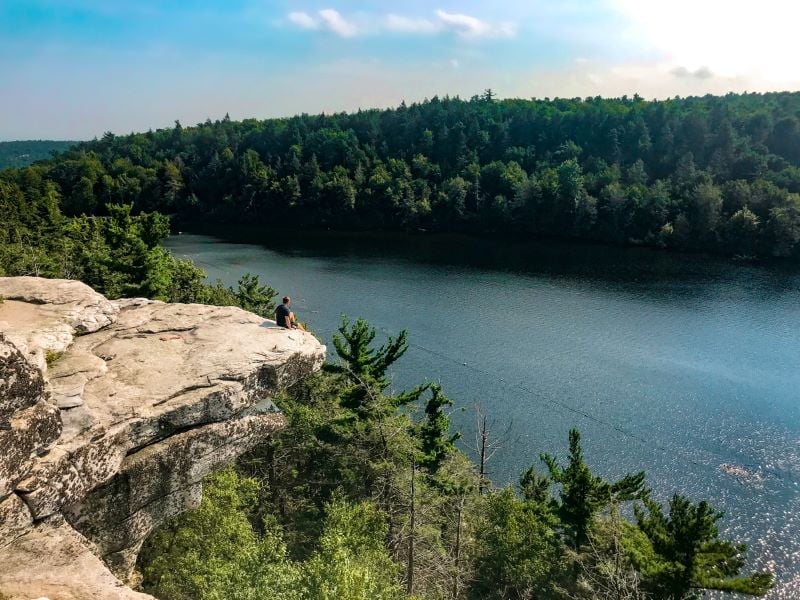
21. Lake Minnewaska Loop Trail
Trail difficulty: All levels
Length: 1.9-mile loop
Location: Kerhonkson, New York
Trailhead: You can access this trail from the Upper Awosting Parking Lot in Minnewaska State Park.
Trail Map: Click here for a Lake Minnewaska Loop Trail map
About This Upstate New York Hike:
The Minnewaska State Park Preserve is a fascinating place to explore year-round. The 22,275-acre preserve is located on the dramatic Shawangunk Ridge in Ulster County and features a number of hiking trails.
The most popular hiking trail in the area is the Lake Minnewaska Loop Trail, a well-trafficked 1.9-mile loop that is accessible and manageable for all levels of hikers.
The trail follows the shoreline of Lake Minnewaska, the undeniable highlight of the state park preserve. Despite it being a bit less than half a mile long by eight of a mile wide at its widest point, the lake makes for an unforgettable setting for hiking in Upstate New York.
The beginning of the trail is accessed via the upper parking lot that overlooks Lake Minnewaska. If you enter the preserve at the Awosting Falls entrance on route 44/55, continue driving up the winding road until you reach the parking lot.
Shortly into the trail, you will also find a small roped-off area in the water, where visitors are able to swim in the summer months. This is the only area of the preserve where guests are authorized to swim.
For those looking for a slightly longer hike, you are able to combine the Lake Minnewaska Loop Trail with the Lake Minnewaska Awosting Falls — an additional one-mile loop that features the beautiful Awosting Waterfall.
Lake Minnewaska Preserve — which is a mere 17-minute drive from the college town of New Paltz — features rugged, rocky terrain and a number of sheer cliff faces. This makes it the perfect landscape to explore and go hiking in Upstate New York.
– Ben from Ticket 4 Two Please
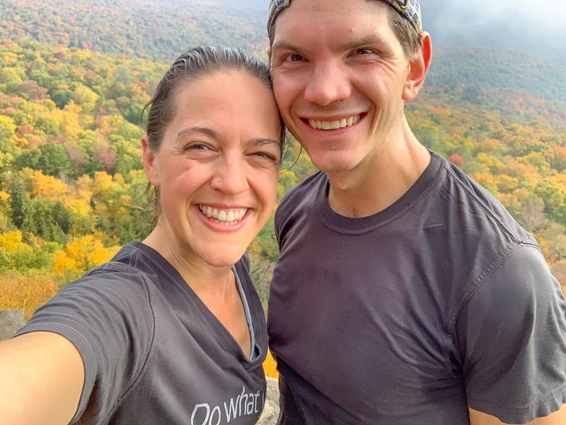
22. Giant Ledge & Panther Mountain
Trail difficulty: Moderate (but steep!)
Length: 3.2 miles round-trip if you just visit the first ledge; 4 miles round-trip if you do all of the ledges; 7.1 miles round-trip if you go to the Panther Mountain summit.
Location: Big Indian, New York
Trailhead: Type “Giant Ledge trailhead” into Google Maps and it will automatically come up.
Trail map: Click here for a Giant Ledge & Panther Mountain trail map
About This Upstate New York Hike:
This trail is a must when you visit the Catskills! Giant Ledge features a series of five ledges, each rewarding hikers who choose to embark on the trail’s steep ascent with some of the best views in the Catskills. These views are exactly what makes this one of the best hiking trails in Upstate NY.
Located in the Slide Mountain Wilderness Area, the hike itself is rugged, rocky, and short — but scenic, as you cross over a wooden footbridge, take in a lovely stream, and enjoy the serenity of the forest.
If you’re flexible with dates, I highly recommend doing this hike in the fall, as you can see the beautiful foliage.
After taking in stunning views from Giant Ledge, you have the option to continue up Panther Mountain. It’ll take about 45 minutes and 1,000 vertical feet to get to the top.
While challenging, the views from the summit at 3,720 feet — which is covered in lush alpine forest — are spectacular.
Fun fact:
Panther Mountain sits on top of a 375 million-year-old meteorite hit!
-Jessie Festa from Jessie on a Journey
23. Overlook Mountain Hike
Trail difficulty: Moderate
Length: 4.6 miles out-and-back
Location: Woodstock, New York; by the way, this Woodstock NY travel guide shares some of my favorite things to do in this quirky town
Trailhead: 353 Meads Mountain Rd, Woodstock, NY 12498. There is a small parking lot here, too.
Trail map: Click here for an Overlook Mountain trail map
About This Upstate New York Trail:
While hiking up a steep old gravel road may not be the most exciting, it’ll be worth it for the highlights along the way — not to mention the views that await you at the top.
First of all, you’ll find the ruins of the once-grand Overlook Mountain House. Many hikers like to actually explore the ruins, which can make for fun photos.
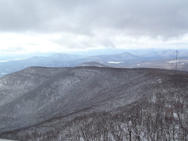
Another highlight of hiking Overlook Mountain is climbing up a fire tower, which dates back to 1927 and offers views of the Catskills from 3,140 feet. From here, you can see the Hudson River Valley, Ashokan Reservoir, and the multi-peak Devil’s Path Hiking Trail.
Interestingly, it’s one of only a handful of fire towers left in the Catskills Region, making the experience extra special.
Pretty soon after this, you’ll come to a ranger station, where you’ll be close to a stunning cliff lookout. This is a great spot to relax with a packed lunch and stare out at views that seem to go on forever.
Note:
This hike is pretty steep the entire way, so be prepared for a workout!
Also, be aware that there tends to be timber rattlesnakes along this trail and in the hotel ruins, so be careful.
– Jessie Festa from Jessie on a Journey
24. Pratt Rock
Trail difficulty: Moderate
Length: 1.8 miles out-and-back
Location: Prattsville, New York
Trailhead: The trailhead is located on Highway 23, just south of Prattsville. You’ll see a green sign with a white horse. Parking is on the side of the road. If you type “Pratt Rock Trailhead” into Google Maps it comes right up, too.
Trail Map: Click here for a Pratt Rock trail map
About This Upstate New York Hike:
Touted as “New York’s Mount Rushmore” by Ripley’s Believe it or Not, Pratt Rock is one of the state’s more unique hikes.
You’ll hike in Huntersfield State Forest up a hill, passing seasonal wildflowers and taking in views of the surrounding mountains and nearby Schoharie Creek.
The highlight is reaching Pratt Rock, a quirky Catskills attraction covered in white carvings dating back to the 1800s that depict busks, horses, a brawny arm holding a sledgehammer, and other images from the life of Zadock Pratt.
Pratt was an entrepreneur and statesman who quadrupled Prattsville’s population by building the world’s largest tannery at the time.
During his life, he hired a begging stonecutter to continue creating the carvings from 1843 until Pratt passed away in 1871.
While up there, you’ll also see Pratt’s grave where he is buried with his dogs.
– Jessie Festa from Jessie on a Journey

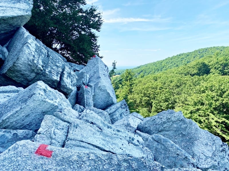
25. Tanbark Loop Trail
Trail difficulty: Moderate-hard; expect short and intense
Length: 2-mile loop
Location: Phoenicia, New York
Trailhead: 16 Mount Ava Maria Dr., Phoenicia, NY 12464. Note that you’ll feel like you’re parking in someone’s driveway. Look for a park with fields and a playground. The trailhead is near the playground, and you’ll see a wooden footbridge leading into the woods with blue trail markers.
Trail map: Click here for a Tanbark Loop Trail map
About This Upstate New York Trail:
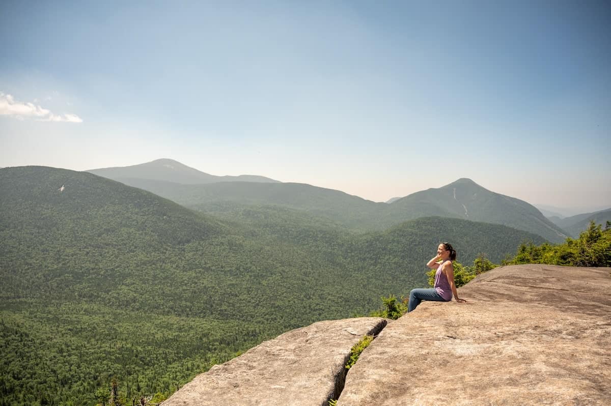
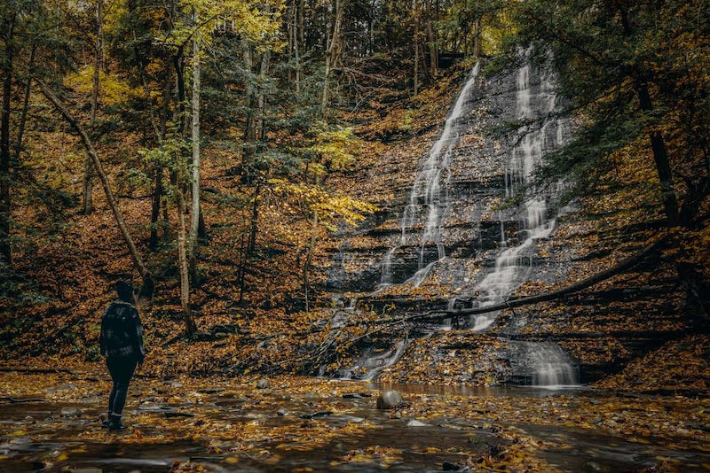
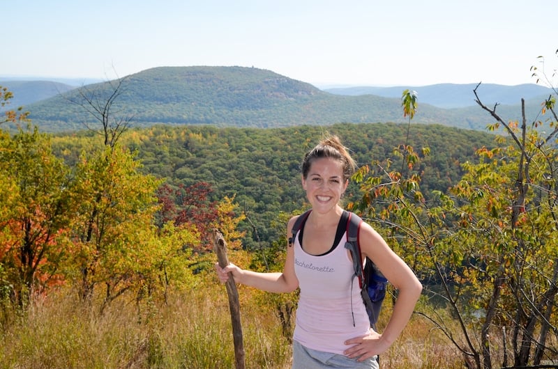
Right in the town of Phoenicia is the trailhead for Tanbark Trail, a short but difficult trail that offers incredible Catskills views as you hike up Mount Tremper.
It starts off hard, as you ascend a switchback trail up a steep cliffside. This part is challenging, though things level out as you reach the loop section of the trail at the top of the cliff.
Pretty soon, you’ll find yourself at your first viewpoint, the Phoenicia Overlook (pictured above). From here, you can see Romer Mountain, Mount Pleasant, and Panther Mountain — the latter of which is also one of the best hiking trails in Upstate NY, at least in my opinion.
From here, you’ll switch between ascending and descending, taking in dramatic Catskills geology and inhaling the scent of oak and pine trees.
Eventually, you’ll come to Grandview Ledge, the other highlight of this trail. From here, you’ll gaze out over Phoenicia toward Panther Mountain from an open ledge — so be careful!
Personally, I did this hike during a Catskills winter getaway. The snowy views were beautiful.
– Jessie Festa from Jessie on a Journey
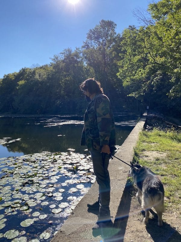
26. Kingston Point Rail Trail
Trail difficulty: Easy
Length: 2.3 miles out-and-back
Location: Kingston, New York
Trailhead: The trail begins all the way to the right of the park.
Trail map: Click here for a Kingston Point Rail Trail map
About This Upstate New York Hike:
This easy paved rail trail is the perfect way to spend an hour, as you wander along the lovely Rondout Creek waterfront.
At certain sections of the trail, you’ll see bits of the old Ulster and Delaware Railroad, which once transported travelers out to the Catskills Mountains. You can actually walk on the former tracks.
Take your time and really enjoy the natural beauty.
There is also a lovely footbridge at the beginning of the trail that’s nice to stop at and take some photos.
Afterward, make the short seven-minute drive to the Kingston Waterfront, where you can eat right on the water or opt for a scenic boat ride.
– Jessie Festa of Jessie on a Journey
27. Ashokan Quarry Trail
Trail difficulty: Easy
Length: 1.8-mile loop trail
Location: Olivebridge, New York
Trailhead: There is a parking lot right at the trailhead. The address is NY-28A, Olivebridge, NY 12461 or you can just put “Ashokan Quarry Trail” into Google Maps.
Trail map: Click here for an Ashokan Quarry Trail map
About This Upstate New York Hike:
In my opinion, it can be difficult to find easy hiking trails that also offer gorgeous mountain views.
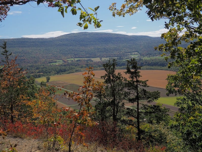
Luckily, that is exactly what the Ashokan Quarry Trail delivers as you can see in the photo above. In fact, you’ll see a gorgeous view of Ashokan High Point, Little Ashokan, Samuels Point, and the Burroughs Range about halfway through the trail.
The loop trail is a leisurely walk through the woods among towering trees and slate formations, and is the perfect way to connect with nature, with an ascent of just 189 feet.
Along with the lovely views, another highlight is getting to walk through the old abandoned quarry and railway ruins. Very fun!
Just one warning:
Watch out for ticks! They can be prevelant on this trail, so check your body thoroughly after hiking and try to rubber band your pant leg ends over your socks.
Hudson Valley Region Hikes

28. Bull Hill Full-Loop Hike
Trail difficulty: Moderate — though you’ll definitely work up a sweat on some of the steeper parts!
Length: 5.4-mile loop
Location: Cold Spring, New York
Trailhead: Right across from Little Stony Point. It’s well-marked with a parking lot.
Trail map: Click here for a Bull Hill trail map
About This Upstate New York Hike:
Looking for things to do in the Hudson Valley? Head to Cold Spring, which is one of my favorite New York State destinations. Here there are numerous hikes you can walk to right from the Metro-North train station, including this one!
If you’re looking for the best hiking trails near NYC, this is a great option — and as you make the 1,400-foot climb up to the Bull Hill summit you’ll even get a view of the New York City skyline.
Along the way, as you hike through the Hudson Highlands State Park, there are other highlights as well, like a viewpoint offering a vista over the Hudson Valley and West Point Military Academy, gazing out toward Storm King Mountain over the Hudson River, and exploring the ruins of the former 650-acre Cornish Estate dating back to 1910.
Pro tip:
Afterward, walk across the street from the trailhead to Little Stony Point Park, which has a small beach that is a great place to watch the sunset.
– Jessie Festa from Jessie on a Journey
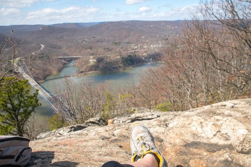
29. Anthony’s Nose Hike
Trail difficulty: Moderate
Length: 2 miles out-and-back (though this varies a bit depending on which trailhead you choose)
Location: Cortlandt Manor in the Hudson Valley
Trailhead: Type “Anthony’s Nose Trailhead” into Google Maps and you’ll get three trailhead options. Each offers a different trail experience worth trying out — though all eventually get you to the beautiful Anthony’s Nose lookout.
Trail map: Click here for an Anthony’s Nose trail map
Anthony’s Nose Video:
About This Upstate New York hike:
While many people choose to hike Anthony’s Nose on their own during the day, I did it in the evening as part of REI’s Full Moon Hike series.
It was a brisk February evening, and one of the most memorable hikes ever — especially as it was my first winter evening hike.
As I prepped my gear — an Osprey daypack, two liters of water, and snacks — I had to account for plenty of winter layers and a personal headlamp.
Now, I’d hiked up Anthony’s Nose before. It’s a stunning trek through the Hudson Highlands State Park Preserve, up natural steps that eventually level out after about 0.6 miles onto a flat woodland trail passing giant rock formations and a pond before reaching the incredible view at the end.
However, what made this special was seeing it in a whole new light; the trails looking dream-like on this cool, quiet night with the full moon shining on us.
At the top, I looked up at the evening sky while sipping hot chocolate prepped by our guides. With only the light sound of the wind surrounding us and views of the Hudson River and Bear Mountain Bridge below, it was a level of bliss and serenity I will never forget.
– Nicolette Orlemans from CultureTrav
30. Breakneck Ridge Hike With South Beacon Mountain
Trail difficulty: Hard — while short, you’ll definitely need both hands for the steep climbs you’ll encounter on this Upstate New York hike
Length: 3.7 mile-loop to do just Breakneck Ridge or 9 miles if you add on South Beacon Mountain
Location: Cornwall-on-Hudson, New York
Trailhead: You can access this trail from New York State Route 9D near the Breakneck Ridge Metro-North train station, making this a great option for hiking in Upstate NY near NYC.
Trail map: Click here for a Breakneck Ridge trail map & click here for a map of Breakneck Ridge to South Beacon Mountain
About This Upstate New York Hike:
If you’re wondering which Upstate New York hike to pick and you haven’t done Breakneck Ridge yet, I highly recommend you choose this one.
While challenging, the views along the way and from the cliff overlooks are outstanding. In fact, you’ll see Storm King Mountain, the Newburgh-Beacon Bridge, the Hudson River, and even Bannerman’s Castle, an abandoned military surplus warehouse sitting on its own little island.
Plus, the landscape shifts numerous times along the way to help ensure you’re never bored.
Just note that the hike has some very steep sections where you’re essentially climbing straight up vertically — so you may want to reconsider bringing small children and pets!
Want a longer hike?
Keep hiking toward the Beacon Fire Tower on South Beacon Mountain, which awards incredible views over the Hudson Valley from about 1,670 feet high!
If you choose to do this, you can do the hike as a loop and head back to the Breakneck Ridge trailhead.
Alternatively, you can walk into the city of Beacon. There is a deli near the base if you’re hungry. From there, walk or Uber to the train station.
– Jessie Festa from Jessie on a Journey
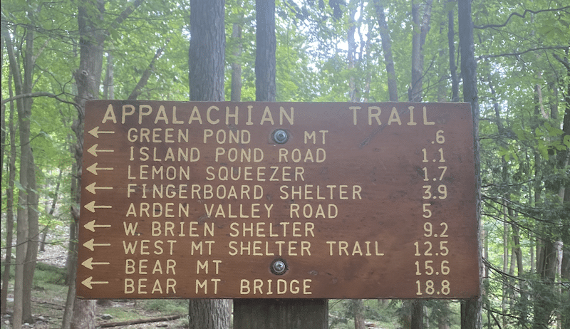
31. The Island Pond/Lemon Squeezer Loop Trail
Trail difficulty: Moderate
Length: 3.8-mile loop
Location: Tuxedo, New York in Harriman State Park in the Hudson Valley
Trailhead: The trailhead starts at the Elk Pen parking lot in Harriman State Park and ends in the same place.
Trail Map: Click here for an Island Pond/Lemon Squeezer trail map
About This Upstate New York Hike:
Want to check out the Appalachian Trail without devoting months of your life to it? You can get a taste of it on the Island Pond/Lemon Squeezer Loop in Harriman State Park.
You’ll start out at the Elk Pen parking lot, which has plenty of parking spaces. The trailhead starts in a lovely meadow where it is common to see deer munching on lunch or dinner.
This trail has some lush greenery, is really quiet with few hikers, and is overall a moderate hike other than a short scramble right after the famous “Lemon Squeezer.”
This rock formation that the trail passes through is quite a tight fit, especially with a large backpack. After you squeeze through, there is a quick scramble that gets you back to the trail.
If you don’t feel like scrambling, that’s okay! There’s an easy option that takes you around the rocks — though scrambling is part of the fun!
Make sure to download a map and directions beforehand since the trail isn’t always clearly marked and it can be easy to get lost.
– Alex from Alex on the Map
32. The Appalachian Trail
Trail difficulty: Varied
Length: 2 miles (minimum)
Location: 991 State Rte 55, Pawling, NY 12564
Trailhead: Near Greenwood Lake. If you’re arriving via public transportation from New York City, take the Harlem Line from Grand Central Terminal. After about two hours, you’ll arrive at the Appalachian Trail station.
Trail Map: Click here for an Appalachian Trail map (for the New York section)
About This Upstate New York Hike:
The Appalachian Trail is one of the most iconic hiking trails in North America. If you’re looking for a challenge, this is definitely the hike for you — a colossal hiking trail stretching from Springer Mountain in Georgia to Mount Katahdin in Maine.
The trail passes through 14 states: Georgia, North Carolina, Tennessee, Virginia, West Virginia, Maryland, Pennsylvania, New Jersey, New York, Connecticut, Massachusetts (the second-to-last state), Vermont (the last state), and New Hampshire and Maine.
With over 2,200 miles to cover and an elevation change of well over 100,000 feet, this trail will test your endurance and mental fortitude.
If you are up to the task and have plenty of time there is no better way to see America’s beautiful landscape than from atop one of its highest peaks.
However, for this post on Upstate NY hiking trails, I’ll only cover the New York section of the trail.
The trail runs through New York State for 90 miles and covers some glorious scenery and foliage — especially in the autumn.
There are many different places that you can get to the trail from, however, it actually enters New York State near Greenwood Lake on Bellvale Mountain and continues to the Connecticut State Line.
A few of the most popular spots include Bear Mountain (an hour outside NYC) which has stunning views from the summit, Prospect Rock located close to the New York/New Jersey border, and Fitzgerald Falls (near Southfields), which is a beautiful 25-foot-high waterfall.
The level of difficulty depends on which part of the trail you pick. Trails range from two miles long up to much longer. You could even do the full 90 miles if you fancied it!
– Alice from Adventures of Alice
33. The Bonticou Crag Trail
Trail difficulty: The main trail is moderate. The rock scramble section is challenging, though it is possible to take a trail to the top that avoids the rock scramble.
Length: 2.3-mile loop
Location: Marbletown, New York. The trail is located in Mohonk Preserve in the mid-Hudson Valley.
Trailhead: The trail starts at the Spring Farm Trailhead in Mohonk Preserve. Note that there is a $15 day visitor fee or $60 annual membership fee for Mohonk Preserve.
Trail Map: Click here for a Bonticou Crag Trail map
About This Upstate New York Hike:
The Bonticou Crag Trail has some of the most spectacular views in the Hudson Valley and a super fun rock scramble to get there!
The trail starts easily, walking through the woods. It crosses a couple of historic carriage roads, and even goes along one of the roads for a short way.
About halfway through the loop, you come to a cliff of huge boulders. It seems impossible to climb up the rockfall, but if you look closely, you can see red paint dots on some of the boulders, which mark the trail.
Here, you have two choices. If climbing up that rockfall seems fun, go straight and start climbing.
However, if this seems too intimidating, then you can take the trail to the left and get to the top of the crag on a standard hiking trail.
The rock scramble requires you to climb through narrow crevices and pull yourself up over the top of boulders with steep drop-offs. In my opinion, it’s lots of fun, but may not be for you if you’re afraid of heights!
At the top, there are expansive views of the Mohonk Preserve and the wide Hudson Valley spread out beyond. Take your time and soak up some of the best scenery in upstate New York!
There is no need to return the way you came. Hike along the top of the ridge, and then the trail starts down and loops back a different route towards the trailhead.
Near the end of the trail, there is another viewpoint called The Million Dollar View that offers a vista of the entire Catskill Mountain Range beyond the valley.
– James Ian from Parks Collecting
34. Teatown Lake Reservation
Difficulty: From easy (a nature walk) to moderately difficult (the longest is a 3.8-mile loop with lots of hills, but you could also connect multiple loops if you’re looking for more)
Length: 15 miles total, broken up into different trails
Location: Ossining, New York
Trailhead: You can access the trailhead from and the Teatown Nature Center, which has a parking lot and is $5 to park for non-members. The address is 1600 Spring Valley Road Ossining, NY 10562.
Trail map: Click here for a Teatown Lake Reservation trail map
About This Upstate New York Hike:
My husband and I love Teatown! It’s our go-to hiking spot for a number of reasons.
For one, it’s close to NYC where we live. On a good day we can make it in 40 minutes, so it feels like something we can do in the morning and still have an afternoon at home.
I also appreciate the variety of trails. Sometimes we don’t have a lot of time, or I might be feeling tired or sore from something else, so we’ll just do the easy loop around the lake. It just feels good to be outdoors!
Other times we opt for the longer loop which takes us about two hours and definitely works up a sweat.
It also has a lot more amenities than other, more “hardcore” hikes.
For example, there’s a small food stand at the Visitor’s Center that sells locally baked goods, fruit, coffee, and cider, so you don’t have to worry about packing snacks.
There’s also an outhouse (that’s pretty clean too!) near the trailhead which is really nice to have, either before or after the hike.
Additionally, there’s a farm nearby called Fable that has a great market with meats, veggies, dairy, and some baked goods. We’ll usually stop there for groceries on the way home and sometimes walk around the farm and say hi to the goats.
Dogs are also allowed as long as they’re leashed so it’s a nice way to get our older pup some exercise!
– Nikki Padilla Rivera from The Toursmith
35. Perkins Tower Trail in Bear Mountain State Park
Trail difficulty: Moderate
Length: 3.8 miles round-trip
Location: Bear Mountain, New York
Trailhead: You can access the trail from within Bear Mountain State Park. You’ll need to pay a parking fee ($10 per vehicle), and you can ask the parking attendant to better direct you once you’re there.
Trail map: Click here for a map of the Perkins Tower Trail
About This Upstate New York Hike:
Bear Mountain State Park is a fun New York attraction full of amenities, like sports fields, areas for fishing, picnic spots, onsite lodging, restaurants, and more.
It’s also full of trail options, though if you want an epic view, the Perkins Tower Trail is highly recommended, as it offers the opportunity to summit Bear Mountain and visit a historic museum at the top.
The trail is pretty popular, so if you’re a solo female traveler like me it can be nice to have other hikers nearby in case anything happens and you need help.
You’ll head uphill through the woods quite frequently — and will even spend some time on the Appalachian Trail — though at no point is it overly steep.
At the top of Bear Mountain, you can explore Perkins Memorial Tower, a small three-floor museum showcasing old photos, historic exhibits, and incredible 360-degree views of Bear Mountain State Park.
More specifically, you’ll see Anthony’s Nose Mountain, Manitou Mountain, Annsville Creek, Breakneck Ridge, New York City, West Point Military Academy, and more.
Fun fact:
The Tower dates back to 1934, when it was built to honor George W. Perkins, founder and first president of the Palisades Interstate Park Commission.
– Jessie Festa from Jessie on a Journey

36. Sugarloaf Hill Trail
Trail difficulty: Moderate — there are some steep parts but nothing crazy and it’s short
Length: 2.9 miles out-and-back
Location: Garrison, New York
Trailhead: You’ll enter the Castle Rock Unique Area from New York State Route 9D, walking onto Wing & Wing Road. You’ll actually see two stone pillars flanking the entrance, one that says “Wing & Wing 1857” and another that says “Castle Rock 1881”. You can plug “Sugarloaf Hill, Osborn Loop Trail” in Philipstown into your Google Maps to help direct you.
Note that you can reach the trailhead on foot from the Garrison Mero-North train station, making this one of the best hikes near NYC for those without a car.
Trail map: Click here for a Sugarloaf Hill Trail map
About This Upstate New York Hike:
Located within New York’s beautiful Hudson Highlands State Park, this short but scenic trail is full of views.
In fact, before you’re even on the official trail you’ll be taking in views of Castle Rock, a grand gilded-age landmark dating back to 1881 that seems to stare down at you from atop its prominent position at the top of Castle Rock Hill.
While the castle sits on private property and you shouldn’t walk up its driveway, you will walk along carriage roads that take you through farmland and passed barns and silos.
After a short while, you’ll enter the woods and will begin hiking up Sugarloaf Hill, which takes you through the forest until you emerge onto the edge of the hill for lovely views of the Hudson Valley.
The best view is from the top, where you can sit with your lunch and enjoy vistas of the idyllic Hudson Valley and West Point Military Academy across the Hudson River.
Optional:
Many hikers like to add Osborn Loop on the way back, as Sugarloaf on its own is quite short. Along the way, you’ll get some more beautiful Hudson River views before reconnecting again with the Sugarloaf Hill Trail.
– Jessie Festa from Jessie on a Journey
37. Long Path to Long Mountain Summit in Harriman State Park
Trail difficulty: Moderate-easy
Length: 4.8-mile loop
Location: Harriman State Park in Sloatsburg, New York
Trailhead: You’ll see a sign for the Long Path trailhead within Harriman State Park. There is actually a Long Path Hikers Parking Lot, as you can see in this parking lot map.
Trail map: Click here for a Harriman State Park trail map, and here is a map of the Long Path to Long Mountain Summit
About This Upstate New York Hike:
While the Long Path is, well, long at 375 miles, you can do a scenic portion of it in Harriman State Park to reach Long Mountain Summit.
This trail is a quick one, though it offers stunning panoramic views of Bear Mountain, Turkey Hill Lake, and the Popolopen Torne from the 1,155-foot summit.
Another interesting feature of this trail is seeing a memorial dedicated to Raymond H. Torrey carved into the stone at the top of the mountain.
Torrey was President of the New York–New Jersey Trail Conference from 1931 until he died in 1938. Additionally, he scouted part of the trail and absolutely loved the views from Long Mountain Summit.
– Jessie Festa from Jessie on a Journey
Renting A Car To Go Hiking In Upstate NY
The best way to explore all that Upstate New York has to offer is by car, as many hotels, trails, and attractions aren’t within walking distance and public transportation isn’t a common way to get around locally.
My recommendation:
Use Discover Cars to quickly compare your car rental options.
Their comparison tool does the homework for you, so there’s no need to have up 10+ tabs trying to figure out which company is the most affordable. Actually, you can save up to 70% using their tool!![]()
Check it out here:
Tips for Hiking Upstate New York
Here are a few things to keep in mind as you plan your hike in upstate New York.
Leave no trace. No matter where you hike, it’s important to always follow the guidelines of Leave No Trace, which include being a responsible and respectful hiker.
Wear appropriate hiking shoes. Flip flops and sandals will not cut it on many of these upstate NY hikes, especially the ones with a moderate, hard, or challenging difficulty level. Be sure to wear shoes with proper ankle support.
Be cautious of ticks. Ticks are common in upstate NY and something you want to be aware of. Wear long sleeve shirts or pants, especially if you’re hiking through thick vegetation, and always check for ticks after hiking.
Download offline maps. Some of these hikes in upstate NY are in fairly rural areas, which means there may not always be cell service. I like to download the maps from AllTrails.
Consider buying an Empire Pass. If you plan on doing several of the hikes within NY state parks, consider buying an Empire Pass which offers unlimited entry into the NY state park system.
Hiking Upstate NY FAQs
Q) Where is the best hiking in upstate NY for beginners?
Some of the best trails in upstate NY for beginners are the Great Camp Sagamore Lake Trail, Ausable Chasm, and Mount Jo.
Q) Where is the best hiking in upstate New York for serious hikers?
If you want more challenging hikes, consider Indian Head, Giant Ledge & Panther Mountain, and Breakneck Ridge Hike.
Q) What are the best trails in upstate NY with waterfalls?
Many of these upstate NY hikes will take you to stunning waterfalls. Some of the most notable are the Watkins Glen State Park Gorge Trail, Robert H. Treman State Park Rim Trail, and Buttermilk Falls State Park.
Upstate New York Hotels
Looking for Upstate New York accommodation?
➡️ Click here for a list of Upstate NY hotels, or use this map. It’s set to Cold Spring, which is a popular Upstate New York hiking destination, but you can easily change it to your preferred location:
Tours In Upstate New York
After enjoying the best hiking trails Upstate NY, explore the state through fun tours, like:
- Farms, Flights: Finger Lakes Brewery Tour from Geneva
- Full-Day Walkway Over the Hudson & Hudson Valley Winery Tour from Poughkeepsie
- Canandaigua Finger Lakes Wine Trail Experience from Farmington
- Niagara Falls American-Side Tour with Maid of the Mist Boat Ride
- Lewiston New York Food Tour from near Niagara Falls
Upstate New York Travel Insurance
When visiting Upstate New York, make sure to get travel insurance to protect yourself and your trip.
If you’re looking for something straightforward, comprehensive, and budget-friendly, SafetyWing is an excellent choice. They offer two plan options:
🟡 Essential, for mid-to-short-term travelers
- Covers emergency medical care, trip delays, and evacuations
- Flexible 28-day subscription or fixed-date coverage for specific trips
- Add-ons available for adventure sports, electronics theft, and U.S. coverage
🔵 Complete, for long-term travelers and digital nomads
- Includes most Essential benefits, plus routine care, mental health support, and maternity coverage
- Covers you both abroad and in your home country
- Comes with adventure sports coverage, cancer screenings, outpatient services, and therapies like chiropractic care
What would you add to this list of best hikes in Upstate New York?
Enjoyed this guide to the best hiking trails Upstate NY? Pin it for later!