27 Best Places To Hike On Long Island
By Alex Schnee. This guide to hiking on Long Island contains affiliate links to trusted partners!
Looking for the best places to hike on Long Island?
During my time living on Long Island, I was pleasantly surprised to discover some truly incredible local hikes — all of which also make for great day trips from New York City.
Simply hop on the Long Island Railroad, and soon enough you’ll be immersed in nature, whether you want to hike among seals, bird-watch while trekking, or take in Atlantic Ocean views.
Curious about which Long Island hiking trails might be best for you?
There are plenty of choices depending on what you are looking for. Here is a list of where to hike on Long Island! I’m sharing some of my personal favorites.
Lace-up your hiking boots and let’s hit the trail!
🥾 Pro tip: Before going hiking on Long Island, make sure to download the AllTrails app to have trail guides, maps, photos, and reviews right at your fingertips. You can also sign up for a free trial of AllTrails+ to download offline maps, get alerts for wrong turns, find trails by distance from you, and more!
💪 Safety: Additionally, whether you’re hiking solo or in a group, it’s smart to keep safety in mind. One piece of advice is to carry a She’s Birdie Personal Safety Alarm, which features a 130db alarm and flashing strobe light designed to deter an attack. I also love the Garmin inReach Mini, a compact satellite communicator with SOS capabilities that can truly save your life in an emergency.
How To Get To Long Island From NYC
Getting to Long Island from NYC is easy thanks to public transportation options.
First of all, there is the Hampton Jitney, which is a bus that goes to Eastern Long Island from various stops in New York City.
Moreover, there is the Long Island Railroad, which leaves from New York City’s Pennsylvania Station and goes all over the island, as you can see in this Long Island Railroad map:

You can also click here for a Long Island Railroad Map PDF.
One thing to note is that if using public transportation to get to a hiking trail on Long Island you’ll likely have to call an Uber, Lyft, or taxi to get you to and from the train station stop and the trailhead.
For this reason, it’s recommended to look into driving or renting a car — which also allows you to explore other highlights of the destination, like Long Island wine country, the many beaches, and the many farms and orchards.
To find the best deals on rental cars, Discover Cars allows you to save up to 70% on your rental just by comparing your options!
Depending on your budget, simply doing Uber to and from NYC might be a worthwhile option, too.
What Type Of Hiker Are You?
Now, before we dive into the Long Island hiking trails, I want to invite you to take my free hiking personality quiz.
Answer a few short and fun questions and your results will share what type of hiker you are. Moreover, each hiking persona comes with suggested hikes around the world!
Best Places To Hike On Long Island
On that note, let’s dive into our Long Island travel guide, which shares some truly scenic Long Island hikes. Most of these spots are also great for those hiking alone as they’re safe, not too technical, and are well-trafficked.
Best Hikes On Long Island In Suffolk County
1. Montauk Point State Park (Seal Haul Out Hike)

Length: 1.6 miles
Difficulty: Easy
Estimated time: 30 minutes
Elevation gain: 55 feet
Trail type: Out-and-back
Trailhead: Google Maps location
Map: Click here for a Seal Haul Out Hike map
Getting here from NYC: If you are planning on doing this hike from NYC, you’ll want to take a train from Penn Station to the last stop in Montauk. From the train station, it’s a 15-minute taxi/Uber to the trail. If you’re driving, you can park on the shoulder of Camp Hero Road, just off Montauk Highway (Route 27).
Tour option from NYC: You can also book this private tour from NYC that includes visiting Montauk!
About this beach trail:
Seal Haul Out is a hike that can be enjoyed at the very end of Long Island in Montauk, within Montauk Point State Park. This is one of the best places to hike on Long Island for many reasons.
For instance, it offers a great opportunity to see adorable seals — a true highlight of any New York State travel guide!
You can see them both from the beachfront and also from a nearby observation tower after you have completed the trail to Montauk Point.
The best time to visit is from the late fall to early spring, as this offers your best chances at seeing seals.
Be prepared for relatively easy and scenic hiking.
If you love wildlife, you’ll likely agree that this is one of the best places to hike in the world.
2. Montauk Point State Park (Money Pond Trail)
Length: The Money Pond Trail is an additional 1.2 miles from Seal Haul Out (so about 3 miles in total)
Difficulty: Easy
Estimated time: 1 hour
Elevation gain: 144 feet
Trail type: Loop (it brings you back to the trailhead that connects both Money Pond Trail and Seal Haul Out)
Trailhead: Google Maps location
Map: Click here for a Money Pond Trail map
Getting here from NYC: Like Seal Haul Out, you will want to take the train from Penn Station to the last stop in Montauk. From there, it is a 15-minute Uber or taxi ride to the trailhead.
About this unique hike:
If you want to extend your hike from Seal Haul Out, keep walking along the Money Pond Trail to wander into a beautiful forest. It’s one of my favorite and shortest hikes in Long Island!
Pro tip:
Consider wearing your boots since this area can get a bit muddy during certain times of the year. Knowing what to wear when you go hiking is always important.
Along with a few hills, there is the actual “money pond” — as in, it is one of the places where Captain William Kidd hid his treasure.
Rumor also has it that the pond is bottomless, though I don’t recommend trying to find out.
Regardless, it’s a nice way to keep hiking in the village of Montauk.
3. Sunken Meadow State Park (Sunken Meadow Trail)
Length: 4.2 miles
Difficulty: Moderate
Estimated time: 1.5 hours
Elevation gain: 403 feet
Trail type: Loop
Trailhead: Google Maps location
Map: Click here for a Sunken Meadow State Park trail map
Getting here from NYC: You will want to take the Port Jefferson train from Penn Station to Kings Park. From there, you can take a 4-minute Uber or taxi ride to reach the trailhead.
About this loop trail:
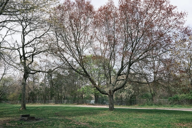
Some of the best Long Island hiking trails take you right by the water of the Long Island Sound.
The Sunken Meadow Trail is a few miles long with some hills, making it a little more challenging than some of the other options you might consider when heading out east for a hike.
Be on the lookout for various species of wildflowers and make sure to pack a picnic lunch that you can share with a friend on the Long Island Sound.
The views are truly beautiful, so you’ll want to take your time and really soak them up.
Bonus: Consider taking your furry pal along, as this Long Island hike is dog-friendly!
4. Cold Spring Harbor State Park (Nassau-Suffolk Trail: Cold Spring Harbor to Uplands Farm Sanctuary Trail)
Length: 5.2 miles
Difficulty: Moderate
Estimated time: 2.5 hours
Elevation gain: 839 feet
Trail type: Out-and-back
Trailhead: Google Maps location
Map: Click here for a Nassau-Suffolk Trail map
Getting here from NYC: From Penn Station, take the Port Jefferson train to Huntington Station. Once you arrive, you can either hop on the H10 bus and ride for 16 minutes, or take an Uber or taxi for 9 minutes and you’ll be dropped off right at the entrance.
About this day hike:
For more challenging hiking in Long Island, Cold Spring Harbor State Park has an uphill trail called the Cold Spring Harbor to Uplands Farm Sanctuary that offers a view overlooking its famous namesake harbor.
And with over 40 acres, there is a lot to explore.
This Long Island trail can be completed in an afternoon, so you can have plenty of time to head back to New York City when you’re done — though don’t forget to check out some of the incredible mansions in the area on your way out.
A few favorites include the famous Oheka Castle — where you can pop in for a drink at their grand bar — and the historic Hewitt House, built in 1815.
You’ll need to have a car, but seeing these estates reminds you of The Great Gatsby, which takes place on Long Island’s Gold Coast.
5. Long Island Greenbelt Trail
Length: 32 miles
Difficulty: Difficult
Estimated time: Start early and give yourself a full day to complete this hiking trail
Elevation gain: 888 feet
Trail type: Out-and-back
Trailhead: This Long Island trek starts in Heckscher State Park (trail map here) and ends in Sunken Meadow State Park, passing through a number of state parks along the way
Map: Click here for a trail map of the north section and click here for a trail map of the south section
Getting here from NYC: You’ll want to take the Ronkonkoma line from Penn Station. Once you arrive in Central Islip, take an Uber or taxi to the trailhead.
About this fun LI trail:
Hiking trails in Suffolk County are often overlooked for Upstate New York hikes; but, there are some amazing options that can be explored here, too.
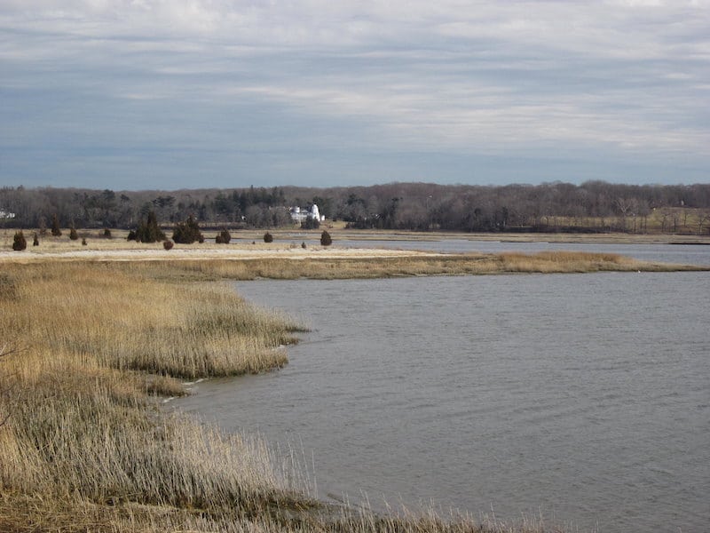
One top Suffolk County hiking pick is the Long Island Greenbelt Trail, which runs 32 miles along the Nissequogue and Connetquot Rivers.
Some of the trail features boardwalk while the other areas are sand, giving you two very different hiking experiences.
It also has several trails that split off from the main one, making it a spot you can go back to again and again to continue finding new things.
You can complete the whole trail in a day if you want, or you can choose to hike in and back depending on how much time you have and how much physical activity you want.
6. Blydenburgh County Park (Stump Pond Loop Trail)
Length: 6.1 miles
Difficulty: Easy
Estimated time: 2 hours
Elevation gain: 187 feet
Trail type: Loop
Trailhead: Google Maps location
Map: Click here for a Blydenburgh County Park Stump Pond Loop trail map
Getting here from NYC: Just like getting to the Long Island Greenbelt Trail, you’ll want to take the Ronkonkoma line from Penn Station to Central Islip. Grab an Uber or taxi from there to take you to the main entrance.
About this easy route:
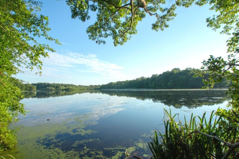
For some more amazing Suffolk County hiking trails, you’ve got to check out Blydenburgh County Park, one of the best places to hike on Long Island if you’re a nature lover.
Along with winding trails like the Blydenburgh County Park Stump Pond Loop, it also offers additional active adventures like horseback riding, bird-watching, fishing, and more — including options for kids.
Moreover, it’s dog-friendly, so feel free to bring your pet along for the fun.
For a great family-friendly hiking option, the 6-mile walk around New Mill Pond is an easy and scenic stroll, particularly in fall when you can see the changing foliage.
You’ll likely also see lots of swans, ducks, swans, Canada geese, and other waterfowl.
7. Cedar Point County Park (Cedar Point Lighthouse Loop)
Length: 5.3 miles
Difficulty: Easy
Estimated time: 1 hour and 45 minutes
Elevation gain: 180 feet
Trail type: Loop
Trailhead: Google Maps location
Map: Click here for a Cedar Point Lighthouse Loop trail map
Getting here from NYC: Take the Montauk line from Penn Station to East Hampton. From there, you will want to take a 12-minute Uber or taxi ride to the entrance of the park.
About this easy route:
This abandoned lighthouse held a solid presence in the 1800s and was the beacon of light between the Cedar and Shelter Islands that helped ships safely navigate to shore.
Cared for by Charles Mulford, it holds a creepy story involving peg legs and a fire.
Mulford himself wore a peg leg, and after collecting these wooden prosthetics from all the local shops and hiding them in the lighthouse, Charles later set them on fire to cover his tracks.
No one knows quite why he did it other than he was a bit of a character.
You can hike the Cedar Point Lighthouse Loop which covers 5.3 miles and offers an easy walk along the ocean.
If you wish to continue on after the lighthouse, you can also head to Gardiners Bay and Sag Harbor for more history and natural beauty.
8. Caleb Smith State Park (Caleb Smith Pink and Red Loop)

Length: 1.7 miles
Difficulty: Easy
Estimated time: 35 minutes
Elevation gain: 108 feet
Trail type: Loop
Trailhead: Google Maps location
Map: Click here for a digital map of Caleb Smith State Park
Getting here from NYC: Take the Port Jefferson line from Penn Station until you reach Smithtown. The park is walkable from the train station.
About this easy route:
For those who love learning about unique local plants, this Smithtown park offers a chance to see Indian Pipe, Trailing Arbutus, Pink Lady Slipper, and much more.
With 545 acres, you have plenty of space for hiking or taking pictures as well as discovering some of the local flora and fauna on Long Island.
It also has a 3.7-mile portion of the Long Island Greenbelt Trail and the easier Caleb Smith Pink and Red Loop at 1.7 miles.
Along with a large lake, you also have the opportunity to spot herds of deer and to fish if you have the proper gear.
If you bring your car, it is $8 to park for the day.
9. West Hills County Park (Walt Whitman Trail)
Length: 8.2 miles
Difficulty: Moderate
Estimated time: 3 hours and 15 minutes
Elevation gain: 81 feet
Trail type: Out-and-back
Trailhead: Google Maps location
Map: Click here for a PDF trail map of this Long Island park
Getting here from NYC: This Long Island hike is easy to get to using public transportation, as you can take the Long Island Railroad from Penn Station to Huntington. From there it’s about a 12-minute taxi or Uber ride.
About this unique hike:
Long Island nature walks tend to be packed with history, and this one is no different.
Known as a favorite of poet Walt Whitman, you can follow the wooded paths to Jayne’s Hill — located right near where Whitman was born.
As a child, Whitman is said to have loved climbing the hill, which is the highest point on Long Island at 400 feet above sea level.
Oh, and the hill is said to be haunted by Whitman’s ghost, so you may want to bring a trail buddy on this Long Island hike just in case.
Another reason to visit West Hills County Park:
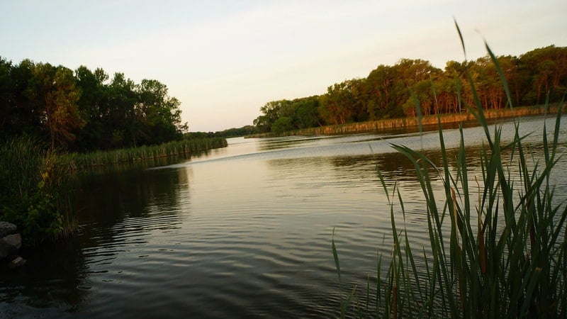
The stunning views of the surrounding area, including marshes and the West Hills Nature Preserve on the West Hills County Park Loop trail.
10. Hither Hills State Park (Walking Dunes Trail)
Length: 2.7 miles
Difficulty: Easy
Estimated time: 1 hour
Elevation gain: 59 feet
Trail type: Loop
Trailhead: This Long Island trail begins near Iodine Beach (Google Maps location here)
Map: Click here for a Walking Dunes Trail map
Getting here from NYC: Take the Montauk line from Penn Station to East Hampton. After arriving, you can hop on the 10C bus to the trailhead; however, keep in mind that it only runs five times a day. If this doesn’t align with your schedule, it might be easier to take an Uber or taxi to the entrance.
About this easy route:
Did you know that there are sand dunes for hiking on Long Island?
Along the coastline, shifting sand dunes rise up and down, leading into a barren forest on the Walking Dunes Trail, which is one of many trail options in Hither Hills State Park.
The park also has a number of different animal species like osprey and red-tailed hawks that are often difficult to see elsewhere on the island.
This moderate hike offers something very different than your traditional Long Island hiking spots and a beautiful view of the Napeague Harbor.
Stay overnight at the Hither Hills Campsite to continue the fun into the next day, too!
11. Quogue Wildlife Refuge (Red, Yellow, and Green Loop)

Length: 3.1 miles
Difficulty: Easy
Estimated time: 1 hour
Elevation gain: 55 feet
Trail type: Loop
Trailhead: Google Maps location
Map: Click here for a Red, Yellow, and Green Loop trail map
Getting here from NYC: You’ll want to get on the Montauk train from Penn Station until you reach West Hampton. From there, it’s a 6-minute Uber or taxi ride to the entrance.
About this easy route:
Another great spot for viewing wildlife, the Quogue Wildlife Refuge has plenty of foxes, songbirds, fishes, eagles, and more.
It also has more than seven miles of hiking and 300 acres of open space.
Looking for some easy Long Island hiking?
There are a number of shorter trails, like the Red, Yellow, and Green Loop. This Long Island hike showcases a clear lake that is perfect for a picnic.
While all color coded trails in the Red, Yellow, and Green Loop are connected, you have a choice of which one you want to explore. All are easy.
Along with an included nature center, yoga classes are available during the summer.
12. Caumsett State Historic Park Preserve (Caumsett State Historic Park Perimeter Loop)

Length: 5.2 miles
Difficulty: Easy
Estimated time: 2 hours
Elevation gain: 334 feet
Trail type: Loop
Trailhead: Google Maps location
Map: Click here for a Caumsett State Historic Park Perimeter Loop trail map
Getting here from NYC: You’ll want to take the train toward Port Jefferson to Cold Spring Harbor. From there, it is a 20-minute Uber or taxi ride from the station to the preserve.
About this loop trail:
Whether you are looking for paved walking trails on Long Island or one that weaves through the woods, you can find it within the 1,750-acre grounds of Caumsett State Park.
The Caumsett State Historic Park Perimeter Loop is 5.2 miles and goes through the entire park, taking hikers to the edge of the Long Island Sound.
It also offers other sights like salt marshes, a dairy complex, fishing, horseback riding, and more.
For a relaxed day at the beach, you can also hike to Fiddler’s Green Beach or East Beach and spend the day before following the loop back to the parking lot. All of these beaches are accessible from the trail.
13. David A. Sarnoff Preserve (Paumanok Path)

Length: 20.7 miles (though the entire trail is much longer)
Difficulty: Moderately challenging
Estimated time: 7 hours
Elevation gain: 1,066 feet
Trail type: Out-and-back
Trailhead: Google Maps location
Map: Click here for a Paumanok Path trail map
Getting here from NYC: This segment of the Paumanok Path is located in Riverhead, New York. Located about 1 hour and 45 minutes by car from NYC, there are several parking areas throughout the preserve.
Alternatively, you can ride the LIRR to Riverhead, which takes about 2 hours from Penn Station. From Riverhead Station, it’s about a 5-minute taxi or Uber ride.
About this beautiful trail:
One of the best trails on Long Island is Paumanok Path, a 120-mile hiking trail on Long Island that begins in Rocky Point and ends in Montauk Point State Park.
While there are many different segments that you can hike, this particular section is a popular one.
Part of the trail passes through the David A. Sarnoff Preserve in Riverhead, a scenic nature preserve that is known for being a bird sanctuary, though you can also see other animals.
Some wildlife to look out for on the trail include eastern towhee, common nighthawk, whip-poor-will, brown thrasher, blue-winged warbler, white-tailed deer, red foxes, and box turtles.
Plan a full day for this moderately challenging albeit hilly Long Island hike, which takes you along a 20-mile piece of the Paumanok Path showcasing beautiful views of ponds and pine barrens.
14. Connetquot River State Park Preserve (Blue Trail)

Length: 8.3 miles
Difficulty: Easy
Estimated time: 4 hours
Elevation gain: 82 feet
Trail type: Loop
Trailhead: Google Maps location
Map: Click here for a Connetquot River State Park Preserve Blue Trail map
Getting here from NYC: Connetquot River State Park Preserve is located in Oakdale, about 1 hour and 35 minutes from New York City by car. Parking is available at the state park and costs $8 per car.
If taking the train, take the LIRR from Penn Station to Great River. From the train station, it’s about a 30-minute walk or 7-minute taxi or Uber to the trailhead.
About this loop trail:
Connetquot River State Park Preserve is the largest state park on Long Island. Located in Suffolk County, it’s home to 3,473 acres of preserved land, water, and wildlife.
Visitors can spot rare nesting birds like osprey as well as other birds, fish, and animals — like deer!
There are also more than 50 miles of hiking and nature trails at Connetquot River State Park Preserve, including the Blue Trail.
This popular trail is considered an easy hike that is mostly flat. The trail is sandy, so be sure to wear proper footwear.
If you’re looking for a long hike that is not too difficult, this is a great one to do. It’s truly one of the best places to walk on Long Island.
15. Edgewood Oak Brush Plains Preserve (Trail Loop)

Length: 3.9 miles
Difficulty: Moderately challenging
Estimated time: 2 hours
Elevation gain: 22 feet
Trail type: Loop
Trailhead: Google Maps location
Map: Click here for an Edgewood Oak Brush Plains Preserve Trail Loop map
Getting here from NYC: Edgewood Oak Brush Plains Preserve is one of the most convenient Long Island walking trails from NYC. It’s a 1 hour and 10-minute drive from the city, or you can take the Long Island Railroad from Penn Station on the Ronkonkoma Branch to Deer Park station. From here, the preserve is just a short walk away.
About this beautiful hike:
If you’re looking for one of the best nature walks on Long Island, the trail loop at Edgewood Oak Brush Plains Preserve is a great one to check out.
This multi-use trail allows both hikers and bikers.
Located in Deer Park, the preserve features 813 wooded acres that provide a peaceful oasis in the center of Long Island.
This is a great place to go to enjoy a walk through the woods, and you should keep your eyes peeled for wildlife like warblers, red-tailed hawks, eastern cottontails, red foxes, and hognose snakes.
Dogs are welcome on this trail as long as they are kept on a leash.
16. Sears Bellow County Park (Hubbard County Park Trail)

Length: 2.6 miles
Difficulty: Easy
Estimated time: 1 hour
Elevation gain: 29 feet
Trail type: Out-and-back
Trailhead: Google Maps location
Map: Click here for a Hubbard County Park Trail map
Getting here from NYC: This trail is located in Hampton Bays, a hamlet on Long Island that’s about a 2 hour and 10 minute drive from NYC. There are several parking areas in the park where the trail is located.
If you prefer the train, take the LIRR from Penn Station to Hampton Bays, which takes about 2.5 hours. From the train station, it’s about 30-minute walk or a 5-minute taxi or Uber to the trailhead.
About this Long Island hiking trail:
Sears Bellow County Park and Hubbard County Park are two adjacent parks in Hampton Bays with unique scenery, including low-lying wetlands and several ponds.
The Hubbard County Park Trail stretches 2.6 miles across the parks, taking hikers past freshwater ponds, grasses, pinewoods, and wildlife.
This is considered to be an easy trail that is one of the best hiking trails on Long Island NY due to its beautiful scenery; however, keep in mind that waterproof boots may be required on parts of this trail, especially if it’s been raining recently.
The trail is in a low-lying wetlands area, so it can get extremely muddy. But as long as you come prepared with the proper footwear, you’ll have a great time.
17. David Weld Sanctuary (Loop Trail)

Length: 2 miles
Difficulty: Easy
Estimated time: 45 minutes
Elevation gain: 95 feet
Trail type: Loop
Trailhead: Google Maps location
Map: Click here for a David Weld Sanctuary Loop Trail map
Getting here from NYC: The David Weld Sanctuary is located in St. James, New York. It’s about a 1.5-hour drive from New York City. There’s a small parking lot at the preserve, so it’s recommended to arrive early to get a parking spot.
If opting for the train, you can take the LIRR from Penn Station to St. James, which takes about 1.5 hours. From the train station, it’s about a 10-minute taxi or Uber ride.
About this beach trail:
The David Weld Sanctuary is a nature preserve located on the North Shore of Long Island.
This peaceful preserve includes diverse scenery such as a red maple swamp, red cedars, and a rocky beach.
If you follow the sanctuary’s loop hiking trail, you will be able to admire all of the park’s beauty, as well as climb a 50-foot bluff overlooking the Long Island Sound for truly spectacular views.
Be sure to pack a towel, as the trail leads to a rocky beach where you can enjoy a picnic lunch overlooking the water.
18. Robert Moses State Park (Fire Island Lighthouse Trail)

Length: 6.3 miles
Difficulty: Easy
Estimated time: 3 hours
Elevation gain: 19 feet
Trail type: Out-and-back
Trailhead: Google Maps location
Map: Click here for a Fire Island Lighthouse Trail map
Getting here from NYC: Fire Island is an island off the coast of Long Island. Cars are not allowed to drive down the stretch of the island, but you can drive across the Fire Island Inlet Bridge to the Fire Island Lighthouse, where parking is available.
Otherwise, you can drive or take the Long Island Railroad to Bayshore, Patchogue, and Sayville, all of which have ferry terminals to Fire Island. It’s about a 2-hour drive from NYC, plus ferry time.
About this fairly flat trail:
This scenic trail is one of the best hidden hiking trails on Long Island.
Well, technically, it’s not “on” Long Island; it’s on Fire Island, which is only connected to Long Island by bridge or ferry. Nonetheless, it’s considered part of Long Island.
On this trail, you’ll be able to enjoy walking along the beach and taking in views of the lighthouse.
If you’d like to climb to the top of the lighthouse, the entrance fee is $10.
19. Avalon Nature Preserve (Avalon/East Farm Preserve Trail)
Length: 3.5 miles
Difficulty: Easy
Estimated time: 1 hour 45 minutes
Elevation gain: 269 feet
Trail type: Loop
Trailhead: Google Maps location
Map: Click here for a map of the Avalon/East Farm Preserve Trail
Getting here from NYC: This trail is located in Stony Brook, New York. It’s a 1.5-hour drive from NYC, or you can take the Long Island Railroad from Penn Station to Stony Brook Station via the Port Jefferson Branch. From Stony Brook Station, it’s a pleasant 25-minute walk through town to the nature preserve or a 5-minute taxi or Uber.
About this Long Island hiking trail:
Avalon Nature Preserve is home to five distinct habitats, including ponds and forests. During the summer, the trail passes through beautiful sunflower fields.
This is an easy hike along a well-maintained trail — or trails, as the path actually combines a few different LI hiking trails within Avalon.
One highlight of the trail is the labyrinth near Mill Pond, the perfect place to do a meditative walk to center yourself.
Along the hike, you’ll also enjoy walking through groves of oak trees and tulips, immersing yourself in lush forest, and viewing large glacial boulders and the sparkling Long Island Sound.
Note that if you want to bring your dog you can, but only on a leash. Moreover, this trail can get crowded due to its local popularity, so arrive early in the morning if you want more solitude – just not on Mondays, as the park is closed.
20. Brookhaven State Park (Brookhaven Trail)
Length: 3.9 miles
Difficulty: Moderately challenging
Estimated time: 2 hours
Elevation gain: 104 feet
Trail type: Loop
Trailhead: Google Maps location
Map: Click here for a Brookhaven Trail map
Getting here from NYC: Brookhaven State Park is in the town of Ridge, NY on Long Island. From NYC, it’s about a 1 hour and 45 minute drive. There are several parking areas for the park.
If taking the train, you can take the LIRR to Mastic Shirley, which takes about 2 hours. From there, it’s about a 15-minute taxi or Uber to Brookhaven State Park.
About this Long Island hiking trail:
Some of the best nature trails on Long Island can be found in Brookhaven State Park.
This 1,638-acre state park boasts numerous trails through its landscape of pine barrens and low-lying wetlands.
If you’re looking for a secluded place to hike, this is a great place to go. It’s one of the best Long Island trails that flies under the radar and is often very calm and quiet. You’ll also see some ponds along the way, too.
Just be aware that hunting is permitted at Brookhaven State Park, so it’s important to stay on-trail and avoid the hunting areas.
21. Wildwood State Park (Loop Trail)

Length: 3.3 miles
Difficulty: Easy
Estimated time: 1 hour 20 minutes
Elevation gain: 173 feet
Trail type: Loop
Trailhead: Google Maps location
Map: Click here for a map of the Wildwood State Park Loop Trail
Getting here from NYC: Wildwood State Park is located in Wading River, NY, which is about 1 hour and 45 minutes from New York City by car. There’s an $8 entrance fee per car.
If arriving by train, take the LIRR from Penn Station to Port Jefferson, which takes about 2 hours. From there, it’s about a 30-minute taxi or Uber to Wildwood State Park.
About this Long Island hiking trail:
For some of the best hiking on Long Island, head to Wildwood State Park. This scenic 767-acre state park contains hundreds of acres of undeveloped hardwood forest and a high bluff overlooking the Long Island Sound.
The Wildwood State Park Loop Trail will take you on an easy circuit around the park. Then make your way over to a 2-mile stretch of beach and admire the water views up close. Be sure to bring a towel for this part of the trek.
This state park is also a popular place for camping if you want to extend your visit into more than a day trip.
Best Places To Hike On Long Island In Nassau County
22. Cedar Creek County Park
Map: Click here for a Google Map of Cedar Creek County Park
Getting here from NYC: Take the Babylon line from Penn Station to Merrick. From there, you will have a 9-minute Uber or taxi ride to get to the park.
About this Long Island hiking trail:
Cedar Creek County Park offers some easy walking on a number of paths that are perfect for those craving a relaxing walk.
While there isn’t a hiking trail per se, there are plenty of scenic paths available for walking and jogging.
This is a great chance to get your family outdoors to experience some nature without having to decide for hours over which trail to do.
Additionally, there are activities like a massive playground and several softball fields and basketball courts.
For children, there is also an archery area and a chance to check out some planes at the aerodrome field.
This is one reason why families tend to flock here for an adventure on Long Island.
23. Tackapausha Preserve (Tackapausha Preserve Trail)

Length: 3.7 miles
Difficulty: Easy
Estimated time: 1 hour 30 minutes
Elevation gain: 36 feet
Trail type: Out-and-back
Trailhead: Google Maps location
Map: Click here for a Tackapausha Preserve Trail map
Getting here from NYC: Tackapausha Preserve is located in Seaford, New York. It’s about a 1 hour and 10-minute drive from NYC.
This is a trail that’s also accessible by public transportation. You can take the Long Island Railroad from Penn Station on the Babylon Branch to Wantagh Station. From here, it’s a 30-minute walk or a 10-minute taxi or Uber to the entrance of the park and trail.
About this day hike:
Tackapausha Preserve is the oldest preserve in Nassau County. Dating back to 1938, it features 84 acres of giant oaks forests, ponds and streams, wildlife and birds, and 5 miles of marked LI hiking trails.
For one of the best easy day hikes on Long Island, opt for the Tackapausha Preserve Trail. Showcasing a mixture of trails, boardwalks, and bridges, this is a pleasant hike that will take you all through the park.
Although it’s in a busy residential area, you’ll feel isolated from the nearby hustle and bustle on this peaceful trail, which is also great for birdwatching. In fact, over 170 bird species have been identified in the park.
While hiking, keep your eyes peeled for birds like the ruby-throated hummingbird as well as raccoon, muskrat, gray squirrel, and opossum.
Looking to add some education to your hike? Nature lovers can also visit the Tackapausha Museum, which educates visitors on local wildlife and acts as an animal sanctuary.
Pro tip:
If you’re looking to do two of the best places to hike on Long Island in one day, this trail is a quick drive from the previously mentioned Cedar Creek Park!
24. Trail View State Park (Stillwell Woods Loop)
Length: 6.9 miles
Difficulty: Moderate
Estimated time: 2.5 hours
Elevation gain: 459 feet
Trail type: Loop
Trailhead: Google Maps location
Map: Click here for a Stillwell Woods Loop trail map
Getting here from NYC: You can take either the Port Jefferson line or the Ronkonkoma line to Hicksville. After that, you can hop on the N79 bus for 22 minutes and get off at the park, or you can take an Uber or taxi for 13 minutes.
About this Long Island hike:
When visiting Trail View State Park, don’t miss the Stillwell Woods Loop for its extensive trails and moderately difficult hills.
With over 400 acres of land, this state park borders Cold Spring Harbor State Park and Bethpage State Park, meaning you can easily spend an entire day — or more — exploring New York hiking and nature opportunities in the area.
What is also neat about Trail View State Park is its hiking trails offer variation in intensity more so than some of the more common flat options on Long Island.
Be aware:
Bikers often frequent the Stillwell Woods Loop, too, so be on the lookout for them while you hike.
25. Sands Point Preserve (Sands Point Preserve Loop)

Length: 1.9 miles
Difficulty: Easy
Estimated time: 45 minutes
Elevation gain: 144 feet
Trail type: Loop
Trailhead: Google Maps location
Map: Click here for a Sands Point Preserve Loop trail map
Getting here from NYC: From Penn Station, take the Port Washington line to the final stop of Port Washington. From there, take an Uber or taxi for about five minutes to reach the trailhead.
About this Long Island hiking spot:
This New York State-owned preserve is one of the best places to hike on Long Island, especially as it has some immaculately tended gardens and buildings cared for by a local nonprofit.
Hiking the Sands Point Preserve Loop offers plenty of wildlife to see like Canada geese, turtles, and songbirds.
Make sure to take the time to follow some of the smaller trails that branch off from the main one.
Additionally, enjoy some small cliffs offering great views for photographers along the trail.
There’s also the chance to enjoy picnic tables and family yoga classes to help you get your zen on in the outdoors.
You do have to pay an admission fee to get in, but it’s worth it for the chance to see Castle Gould, an imposing mansion modeled after Ireland’s Kilkenny Castle that was originally owned by the Guggenheim family.
The price is $10 for a car and $4 per person.
26. Massapequa Preserve (Massapequa Lake Trail)

Length: 6.3 miles
Difficulty: Easy
Estimated time: 2 hours
Elevation gain: 52 feet
Trail type: Out-and-back
Trailhead: Google Maps location
Map: Click here for a Massapequa Lake Trail map
Getting here from NYC: Take the Babylon line from Penn Station to Massapequa. After that, grab an eight-minute Uber or taxi to the trailhead.
About this day hike:
If you’re looking for the best hiking places on Long Island, this large area encompasses over 432 acres and offers a quiet forest where you can feel as though you are in a whole new world.
Choose from 20 miles of hiking trails, like the 6.3-mile Massapequa Lake Trail, which features a beautiful lake hugged by lush greenery. If you want to have some time to yourself, take the path that leads into the woods. This part of the trail is mostly shaded, too.
Along with hiking, this is a popular spot to enjoy biking in New York, showcasing some of the best Long Island nature trails for those looking to get outside but who aren’t interested in an extreme challenge.
Moreover, fishing for largemouth bass and carp, to name a few species, is a popular activity within Massapequa Preserve.
27. Muttontown Preserve (Muttontown Preserve Loop Trail)
Length: 2.5 miles
Difficulty: Easy
Estimated time: 1 hour
Elevation gain: 144 feet
Trail type: Loop
Trailhead: Google Maps location
Map: Click here for a digital map of Muttontown Preserve
Getting here from NYC: Grab a seat on the train to Port Jefferson from Penn Station. You’ll want to get off at the Syosset stop before taking a 10-minute Uber or taxi to the trailhead.
About this loop trail:
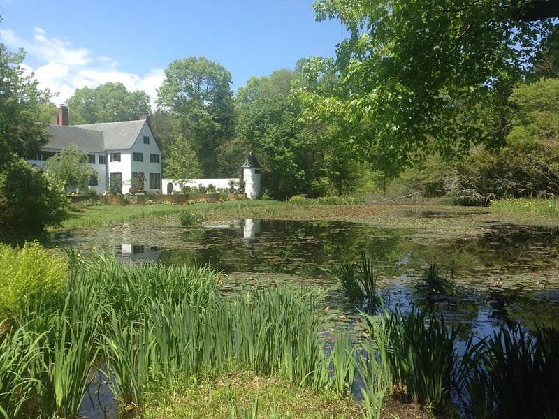
The hiking trails in Nassau County offer some unique local history as well as a chance to explore beautiful flora and fauna like frogs, snakes, turtles, songbirds, and more.
Known as the home of the first monarch of Albania when he fled from Europe, he purchased a mansion on Long Island with rubies and diamonds.
The 2.5-mile Muttontown Preserve Loop Trail wanders through his estate and crumbling but elegant buildings.
As the island’s largest nature preserve at 550 acres, you’ll also find a number of kettle ponds, upland forests, and various woodlands here, which creates a bird-watching paradise as many birds come to breed in the diverse habitat.
In fact, the National Audubon Society considers the park an Important Bird Area.
They note that the park has a unique variety of “characteristic species” like the American woodcock, eastern kingbird, gray catbird, chestnut-sided warbler, indigo bunting, and the Baltimore oriole, to name a few.
Moreover, it is one of the very few sites in Nassau County where both great horned owls and eastern screech-owls nest.
Long Island Hiking Map
Hopefully, this guide to the best hikes on Long Island has given you some inspiration to get outside and spend more time in nature.
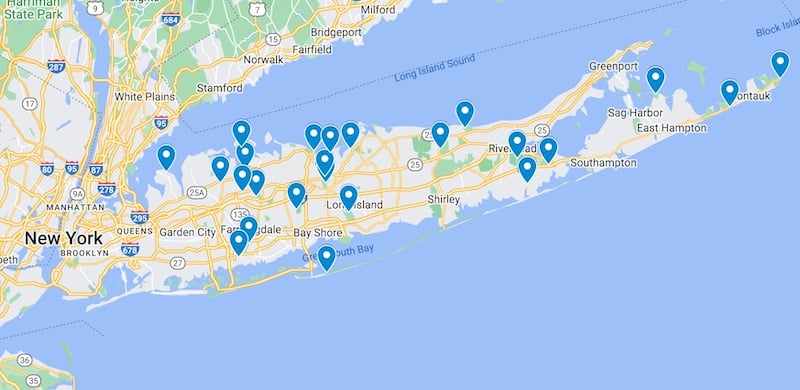
To help you with your planning, here is also a map showcasing all of the above-mentioned best places to hike on Long Island:
Important Tips For Hiking On Long Island NY
Now that we’ve gone over some of the top hiking and walking trails on Long Island, let’s chat about some important tips to help you stay safe and have fun.
Here are my top tips for hiking in Long Island New York:
Drive to the best hikes on Long Island (vs the train)
Most of the best hiking trails and paths on Long Island are easily accessible by car. If you’re coming from NYC and don’t have a car, you can take the Long Island Railroad, but then you will still need to drive from the train station to reach most trailheads.
It can be expensive to use Uber or Lyft, not to mention ridesharing apps might not have much availability in smaller towns on Long Island.
Because of this, it’s best to rent a car for the day if you’re planning to hike on Long Island instead of relying on public transportation and ridesharing apps. You can use Discover Cars to quickly compare your rental options.
Pack plenty of food & water
If you’re heading out on a day hike on Long Island, be sure to pack enough food and water for your journey.
According to REI, the general rule of thumb when it comes to water is about one half-liter of water per hour of moderate activity in moderate temperatures — meaning even on a short hike you should be hydrating as well as packing a few snacks like trail mix, fresh fruit, or granola bars.
For a longer hike, you may want to pack sandwiches and additional snacks.
When stopping to eat, be sure to pack up all of your trash and carry it with you until you find a place to dispose of it properly.
Don’t forget hiking essentials
These include things like sunscreen, bug spray, and a first aid kit.
You might think that you don’t need to worry about these things because you’re on Long Island. After all, the island is hardly the wilderness, and you’re never more than a few miles from civilization, right?
While it’s true that Long Island as a whole is a densely populated suburban area, you should still take basic precautions when hiking. This includes packing a first aid kit, even if you’ll just be going for a short hike.
While you won’t need any heavy-duty hiking protection like bear spray for hiking on Long Island, don’t forget other basic hiking essentials like sunscreen and bug spray. Especially during the spring and summer months, these items are a must.

Wear proper footwear for exploring the best places to hike on Long Island
While you don’t necessarily need a pair of hiking boots for most of the trails on Long Island, a durable pair of sneakers is a better choice than, say, flip-flops.
Pay special attention to what type of trail you’ll be hiking, too. Some Long Island trails are sandy, which can make walking more difficult. You’ll want to make sure you have footwear with a strong grip for walking on sandy trails.
Leave nothing but footprints
One of the most important tips to remember when hiking on Long Island is to respect the landscape. Be sure you don’t leave any trash behind, and you may even decide to pick up trash you find along the trail to discard properly later.
Since most hiking spots on Long Island are in suburban areas, there are plenty of signs of human presence all around. Well-trodden trails may get polluted with trash from plastic water bottles to cigarette butts, so do your part not to contribute to this — or to leave the environment even better than you found it.
Recommended Long Island Hiking Gear
Hiking on Long Island?
Check out these affordable hiking backpacks for under $100.
Moreover, I recommend shopping for hiking gear from sustainable outdoor brands like:
- Cotopaxi
- REI Co-op
- Speakeasy Travel Supply Co
- NOVICA
- Rheos Sunglasses
- EarthHero
- Life Without Plastic
Where To Stay On Long Island
Looking for Long Island accommodation?
➡️ Click here for a list of Long Island hotels!
Prefer self-contained stays?
➡️ Click here to check out unique local rentals!
You can also use this map to search for local stays:
What trails would you add to this list of best places to hike on Long Island?
About the guest author, Alex Schnee
Alex is the founder of the blog Alex on the Map, where she covers hiking, outdoor adventure, and national parks. Originally a mountain girl, she’s now a New York dreamer when she’s not traveling. You can follow her on Instagram and Facebook.

Hi, I’m Jessie on a journey!
I'm a conscious solo traveler on a mission to take you beyond the guidebook to inspire you to live your best life through travel. Come join me!

Want to live your best life through travel?
Subscribe for FREE access to my library of fun blogging worksheets and learn how to get paid to travel more!




These are all great hikes! I didn’t realize Long Island had a lot of outdoor adventure. I definitely have to explore more of Long Island as a New Jersey gal. 🙂
Super detailed information on these hikes. I’m from Mass so it’s possible to do some of these on a trip to the city. I had no idea they were so close to NYC.
Got to love Jersey, too! I was just at Cheesequake–super fun!
Thank you for compiling this list. I’m looking forward to trying them all, and checking off each one as I go.
Thanks a lot for sharing. You have done a brilliant job. Your article is truly relevant to my study at this moment, and I am really happy I discovered your website. However, I would like to see more details about this topic. I’m going to keep coming back here.
thank you so much for sharing this! 🙂 now all I have to do is pick one place to hike! 🙂
Awesome information
Thank you for sharing insights into a beautiful place like a long island. It was detailed and exciting content. I hope I experience hiking there with my husband soon!
Thank you for sharing this travel related information…
Thanks for the valuable information.
I am happy to read your blog again. I really enjoy hiking.
FYI you may want to update… no pets are allowed year round at sunken meadow.
One thing I’m curious about is whether these remedies work for all hair types, not just curly hair. It would be interesting to know if they have benefits beyond enhancing curls.
Your passion for travel and exploration shines through in your writing, and I love how you’ve curated such a diverse selection of hikes for all skill levels.