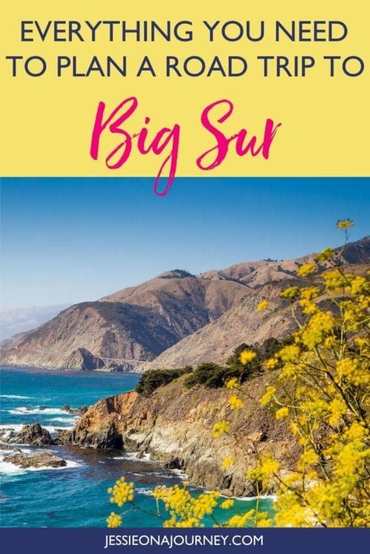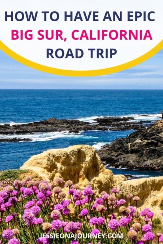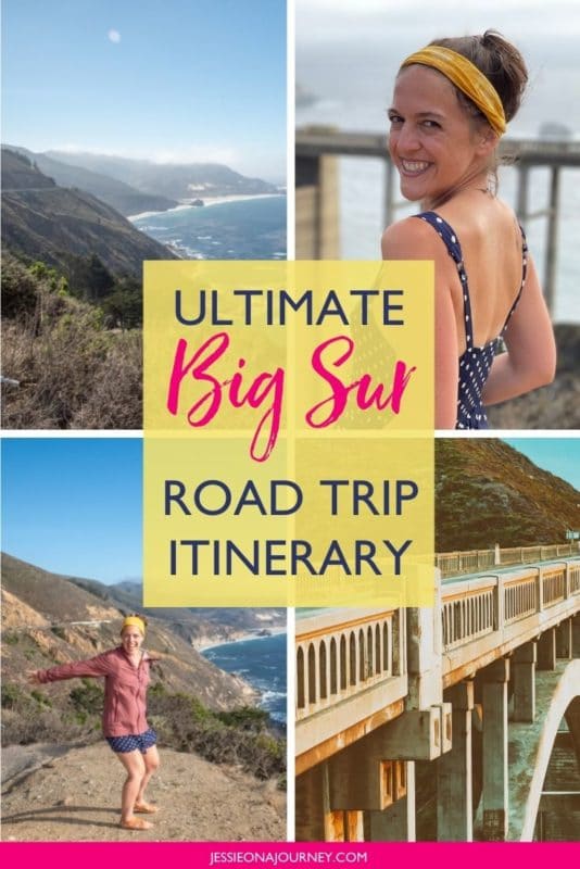
Driving Big Sur: Best Big Sur Road Trip Itinerary (Best Views + Map!)
This post contains affiliate links, including Amazon affiliate links. If you purchase through these links, I may earn a commission at no extra cost to you. As an Amazon Associate, I earn from qualifying purchases. Thank you for your support!
No trip to California would be complete without driving Big Sur!
In my opinion, this is one of the top destinations in the state. Not only is it incredibly scenic with numerous places to pull over and take in stunning views, but there are many parks, beaches, hikes, and towns to stop off in on your journey.
But, here’s the thing:
Without a solid plan, you can easily miss some of the attractions or viewpoints along California State Route 1.
Which is why I created this guide. By the end, you’ll have an epic Big Sur road trip itinerary mapped out — no planning required.
Below, you’ll also find important logistical information, answers to frequently asked questions, and, of course, beautiful photos to get you excited for your trip.
So on that note, sit back, relax, and let’s head out on an adventure to Big Sur.
Free Ultimate Travel Planning Kit
Now, before we dive into the details of your Big Sur scenic drive, I want to invite you to grab my free Ultimate Travel Planning Kit — which also includes a downloadable Google Map of my full Big Sur road trip itinerary.
Add the map to your phone to have it ready to go for your trip!
Bonus: The kit comes with 40+ other travel resources — from printables to quizzes to itineraries — all meant to help you explore the world beyond the guidebook!
What Is Big Sur?
To kick off this road trip planner, let’s go over a little overview of Big Sur.
It’s not a village, town, or city, so what exactly is Big Sur?
It’s actually a scenic region that encompasses the stunning stretch of California’s central coast that goes for about 90 miles between Carmel and San Simeon.
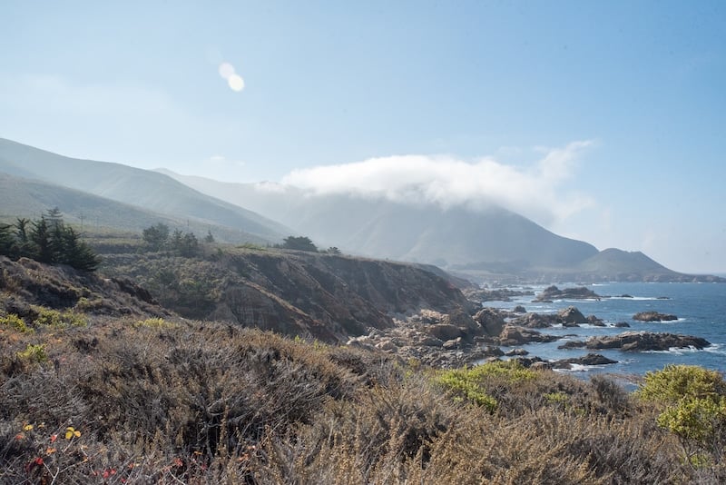
It’s known for its astounding beauty as you witness the Santa Lucia Mountains meet the rocky Pacific Ocean coastline, with the narrow Highway 1 – Pacific Coast Highway winding through it and offering many places to stop off for hiking, photography, swimming, and enjoying a delicious meal with a rugged natural view.
History of Big Sur
According to the Big Sur Chamber of Commerce, historically Big Sur was simply called El Sur Grande or “The Big South” in reference to the fact that it showcased raw and uncharted wilderness.
Originally the land here was inhabited by the Esselen, Salinan, and Ohlone Native Americans, though it was eventually taken from them by Spanish explorers (though luckily in 2020 the Esselen Tribe regained back some of this ancestral land).
In the 1830s, certain parcels of the land were given to Mexico; however, these were never permanently settled.
Around the turn of the century is really when you see homesteaders arriving to create permanent settlements on the land. Many of the Big Sur attractions you see today are named after these settlers — like Pfeiffer Ridge, Post Summit, and Cooper Point.
In 1937, Highway 1 officially opened, bringing California’s first Scenic Highway to life. Driving the Big Sur coast is truly an unforgettable experience, as you’ll see below.
Big Sur Drive Map
Need a Big Sur driving map? Click here!
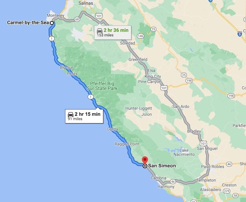
As there isn’t cell service along Highway 1 Big Sur, I recommend plotting out your destination points before leaving your hotel so you can pull them up when offline.
Alternatively, I’ve pre-plotted all of the 21 below destinations into a ready-to-download Big Sur road trip map in Google Map form, which you can grab inside of the my Ultimate Travel Planning Kit here.
How To Get To Big Sur
Now, when it comes to getting to Big Sur, there are a number of options.
Most people drive to Big Sur and stay in Carmel-by-the-Sea, Monterey, or in the heart of Big Sur itself. Since you’ll need a car anyway to do your road trip through Big Sur, this typically makes the most sense.
Note that the closest airport to Big Sur is the Monterey Regional Airport, which is about 31 miles away, and the closest international airport is the Norman Y. Mineta San Jose International Airport in San Jose, which is about 104 miles away.
If you don’t have a car, it’s recommended to book a guided tour — like a Big Sur Monterey California Coast McWay Falls One Day Tour from San Jose.
Alternatively, you can take the Monterey-Salinas Transit Line 22 from Carmel or Monterey, which will take you all the way to Nepenthe Restaurant when heading south. I discuss Nepenthe below as a must-visit stop on your Big Sur itinerary!
Just note that the Monterey-Salinas Transit Lines stop running during certain seasons, holidays, and inclement weather conditions, so your best bet is really to drive yourself.
Renting A Car For Your Big Sur Road Trip
Need a car for your Big Sur road trip? If so, I highly recommend using Discover Cars to quickly compare your rental options.
Their comparison tool does the homework for you, so there’s no need to have up 10+ tabs trying to figure out which company is the most affordable. Actually, you can save up to 70% using their tool!![]()
Best Time To Visit Big Sur
Thanks to its location on the Pacific Ocean, Big Sur has a temperate climate that makes it a year-round destination. That being said, not all seasons are created equal.
Spring. The highlight of visiting in spring is the gorgeous wildflowers along the trails and coast, making the stop-offs mentioned below even more stunning.
Summer. You’ll enjoy beautiful weather and loads of tours and activities; however, this is also the busiest and most expensive time to visit.
Fall. Late September through early November is widely considered to be the best time to visit. Despite cooler temperatures, the crowds disappear and you can enjoy the beauty of Big Sur in solitude.
Winter. Winter is Big Sur’s rainy season, which can also mean mudslides. Still, you might truly have the place all to yourself and hotel prices will likely be lower than during other times of year.
How Long To Make Your Big Sur Road Trip Itinerary
You can absolutely have an amazing time with 1 day in Big Sur. That being said, you won’t be able to hit all of the stops mentioned below, especially as a number of them are big California state parks and hiking trails.
In my opinion, you’ll want to have a minimum of 3 days in Big Sur for the best experience.
Big Sur Road Trip Itinerary Overview
In the next section of this Big Sur trip guide, I’ll list out all of the stops you should make along your Big Sur scenic drive. I recommend taking your time and not trying to pack everything into one day.
Here is a quick overview of how I recommend breaking up the stops into a Big Sur 3 day itinerary. If you have the time, extending the amount of days allows for a slower pace where you can really soak in the beauty of Big Sur.
By the way, Big Sur is one of best places for solo female travel in California for a safe, fun, and scenic trip.

Big Sur Road Trip Day #1: Explore Carmel-by-the-Sea
Carmel-by-the-Sea is a California travel destination in itself, and one can easily spend a few days here. Enjoy the delicious restaurants, see the fairytale cottages, wander the many art galleries, and spend time on the beautiful Carmel Beach.
Moreover, you can visit nearby attractions like Point Lobos State Natural Reserve and/or Garrapata State Park.
Big Sur Road Trip Day #2: Explore Big Sur State Parks, Beaches & Viewpoints
Use today to really drive Highway 1 and explore the many parks, hiking trails, beaches, and viewpoints. End the day with a meal and a view at Nepenthe Restaurant.
Big Sur Road Trip Day #3: Driving Big Sur To San Simeon & Paso Robles
Continue driving Highway 1 to visit the stops beyond Nepenthe, like Julia Pfeiffer State Park, Sand Dollar Beach, and Ragged Point.
Then head to San Simeon to see a beach full of giant elephant seals and then even further to continue your trip exploring wine country and hot springs in Paso Robles. I recommend spending at least 3 days in Paso Robles to really get a feel for the destination.
Big Sur Road Trip Stops (In Order)
On that note, let’s dive into our Big Sur trip itinerary. Again, these are some of the best stops when driving Highway 1 Big Sur, listed in order from north to south:
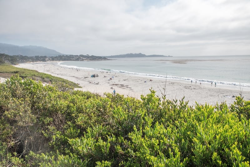
Stop #1: Carmel-by-the-Sea
Carmel-by-the-Sea is a great starting point for your Big Sur road trip itinerary. In fact, you have the option to base here the entire time (I recommend the Carmel River Inn!) or switch hotels your second night and stay at a place like the Big Sur Lodge in Pfeiffer Big Sur State Park, which is a stop on our route.
Carmel-by-the-Sea is a quaint seaside city full of locally-owned shops, delicious restaurants, charming cafes, fairytale cottages, and almost 100 art galleries.
Of course, make sure to do a DIY art gallery crawl while you’re there. Interestingly, Carmel-by-the-Sea is home to the Thomas Kinkade Gallery — his first ever! There is a lovely courtyard with paintings as well as an indoor gallery full of his works.
In terms of tours, one not-to-miss is a self-guided audio tour of Carmel-by-the-Sea’s famous Fairytale Houses. Also known as the Comstock Cottages, the tour takes you to 11 of these whimsical abodes and shares interesting information about each.
You also can’t miss spending time on the gorgeous Carmel Beach, a long white-sand beach popular for sunbathing, swimming, surfing, and dog-walking. You will absolutely see many adorable pups splashing in the waves and rolling in the sand.
Finally, there are loads of mouthwatering restaurants, a few of which include:
–From Scratch. Head here for breakfast and order the From Scratch Skillet, a hearty helping of potatoes, eggs, cheese, and your choice of three additions. They even have vegan sausage! You also get thick slabs of toast or their homemade cheddar biscuit.
–Mulligan’s Public House. It’s not easy to find good budget-friendly places to eat in Carmel, but Mulligans fits that bill with outstanding service, delicious food, and a mean Bloody Mary (get the bacon bloody!). At our waitress’ recommendation, my husband Andy and I ordered the shrimp tacos — substitute fries for onion rings — and it was outstanding. I also ordered a salmon salad for $18 that had a nice big piece of fish!
–Tree House Cafe. This beautiful eatery fuses Mediterranean, Greek, and Thai cuisines in a lovely indoor restaurant that also has a giant elevated outdoor terrace. Andy and I ordered the seafood pasta and baked calamari and both were delicious!
–Basil Seasonal Dining. This delicious Italian eatery serves up a delectable short rib and the bruschetta with burrata is not to be missed!
–La Bicyclete. We were told by multiple tourists and locals that the French-focused Michelin-starred Le Bicyclete is a must — and after eating the food ourselves, it’s easy to see why. Their gnocchi is extra large and pillowy, while the truffle mushroom pizza is rich and delicious.
–Hog’s Breath Inn. Formerly owned by Clint Eastwood — who was once the mayor of Carmel-by-the-Sea — this tasty restaurant and bar has a warm and inviting feeling with fireplaces, indoor/outdoor seating, and even a doggy menu if you bring your pup!

Stop #2: Point Lobos State Natural Reserve
Driving time from Carmel-by-the-Sea to Point Lobos State Natural Reserve = 10 minutes
You can’t visit Big Sur without exploring the outdoors, and hiking is a great way to do this — especially as the area is home to some of the world’s best hiking trails.
If you love hiking, wildlife, and being outdoors but don’t necessarily want to trek up a mountain or be gasping for breath, Point Lobos State Natural Reserve is for you.
This Monterey County state reserve, which is dedicated to protecting the unique natural beauty and ecological significance of the area, showcases 5.36 square miles of land to explore, including numerous easy flat trails offering coastal views and opportunities to spot wildlife like pelicans, sea lions, and sea otters.
One popular hike is the 5-mile Point Lobos Loop Trail, which follows the coast of the reserve.
For something shorter but still very scenic, I really enjoyed our hike down the South Plateau Trail to the Bird Island Trail and along the South Shore Trail to Sea Lion Cove and the Sea Lion Point Trail. From there, we took the Lace Lichen Trail to get back to where we started.
The entry fee is $10 per vehicle and free to walk-ins.
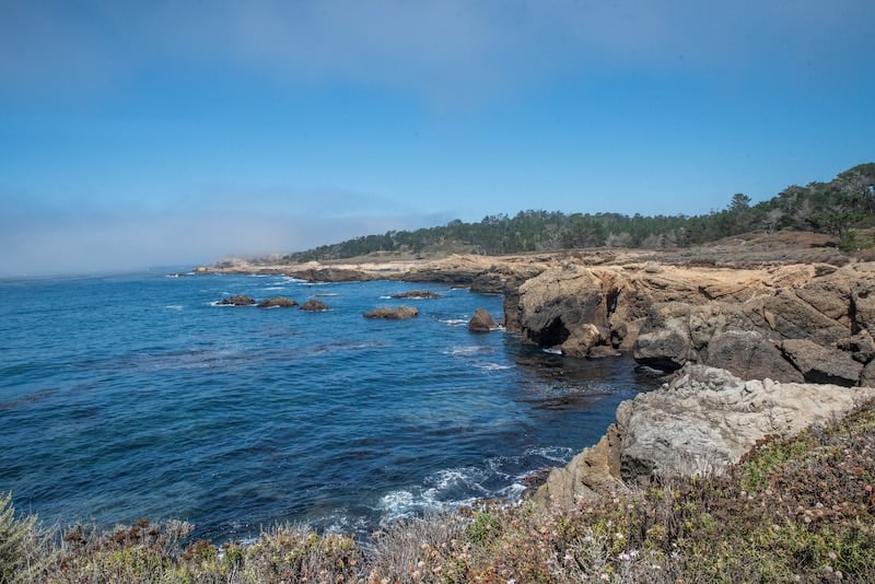
Stop #3: Garrapata State Park & Vista Point
Driving time from Point Lobos State Natural Reserve to Garrapata State Park = 7 minutes
Showcasing 4.6 square miles of coastal trails and beachfront, this is a great place to take in some of the most incredible views along Highway 1. Actually, you won’t find signage for the park and there isn’t an entry fee; instead, you’ll access the various trails and viewpoints right from the highway.
One fun hike is the Soberanes Canyon Trail, a 2.8-mile out-and-back trail that takes you from Highway 1 down toward the coast along Soberanes Creek, through redwoods, and passed a waterfall. Note that this trail is typically a loop trail but is now an out-and-back trail due to hazardous conditions.
You can also follow a 1.8-mile trail from the Soberanes Point Trails Trailhead to Soberanes Point, a beautiful secluded beach with outstanding coastal headlands, and Whale Peak, a hilltop offering an incredible coastal vista.
For something easy, the Garrapata Bluff Trail is a 0.6-mile out-and-back hike known for its amazing coastal views and gorgeous wildflowers in spring. You can access the trail from Gate #7 or #8 in the park.
Stop #4: Kasler Point
Driving time from Garrapata State Park to Kasler Point = 5 minutes
Ready for another view? Located near Garrapata Creek, Kasler Point is a cape offering a spectacular view that blends mountains sloping down toward the sea covered in lush green flora and beautiful flowers with waves lapping up over a rocky coast.
Stop #5: Rocky Creek Bridge
Driving time from Kasler Point to Rocky Creek Bridge = 3 minutes
While you’ve probably heard of Bixby Bridge, Rocky Creek Bridge is another gorgeous bridge worth pulling over for.
Built in 1932, it’s an open-spandrel arch bridge made of concrete and is stunning against the Pacific Ocean and lush vegetation blanketing the sloping hillside around it. Look down to also see the beautiful Rocky Creek Beach.

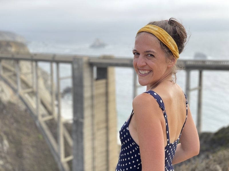
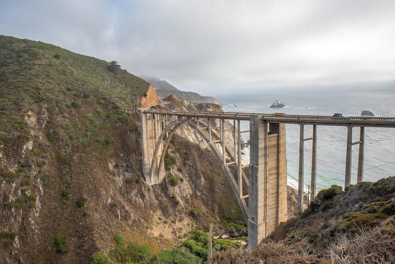
Stop #6: Bixby Creek Bridge
Driving time from Rocky Creek Bridge to Bixby Creek Bridge = 1 minute
Also known as Bixby Canyon Bridge, this iconic Big Sur attraction dates back to November 1932 when it first opened to the public.
Interestingly, it was named after a pioneer from New York named Charles H. Bixby who traveled to the California coast in 1852 and absolutely fell in love with it.
Due to its unique design featuring an open-spandrel arch bridge made of concrete, it’s one of the most photographed bridges in California.
Near to the bridge, you’ll find several scenic overlooks for snapping the perfect photo. Visiting is one of the top things to do in Big Sur!
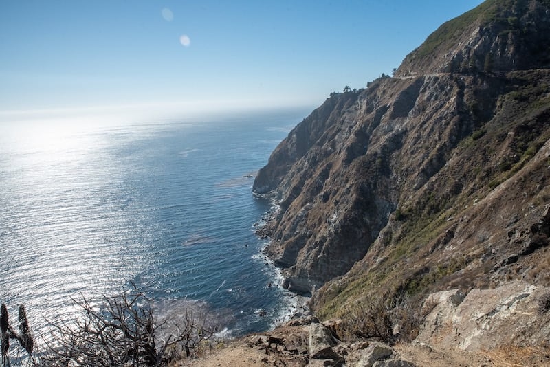
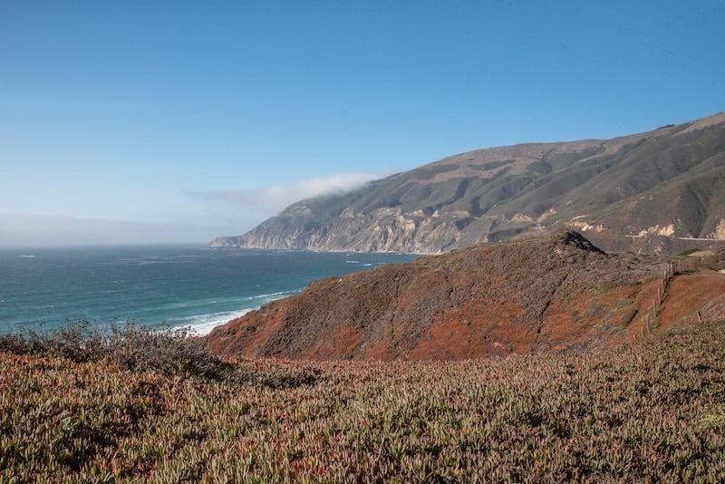
Stop #7: Hurricane Point
Driving time from Bixby Creek Bridge to Hurricane Point = 2 minutes
Hurricane Point is one of the highest points along Highway 1 Big Sur at 560 feet. It’s a great spot for photos — especially as if you look to the north you can get Bixby Bridge in your shot!
Stop #8: Andrew Molera State Park
Driving time from Rocky Creek Bridge to Andrew Molera State Park = 13 minutes
If you love raw landscapes, the 4,766-acre Andrew Molera State Park features mostly undeveloped land. This is because the former owner, Frances Molera, dreamed of keeping the landscape in its natural state.
In the park, you’ll find miles of trails leading you to stunning beaches, through expansive meadows, over sloping hillsides, and along ridges offering scenic Big Sur views.
One major highlight of the park is the 40-foot Highbridge Falls, a year-round waterfall.
Additionally, a few hiking trails worth checking out include:
- Bluffs Trail. This easy trail is 1.7 miles one-way and takes you along the bluffs of Big Sur where you can gaze down at the beach and Pacific Ocean.
- Spring Trail. This short trail connects with the Bluffs Trail to take you down to Molera Beach if you’d to get closer to the water.
- Ridge Trail. For something strenuous but worth the effort, you’ll love the views along this 3.2-mile one-way walk that ascends a ridge.
- Ridge Trail – Panorama Trail – Bluff Trail. Again, strenuous, but this 8.7-mile loop hike offers all of the quintessential Big Sur scenery you could want, including redwoods, beaches, rocky coastline, and hillsides covered in lush vegetation.
The entry fee is $10 per car.
Stop #9: Pfeiffer Big Sur State Park
Driving time from Andrew Molera State Park to Pfeiffer Big Sur State Park = 22 minutes
After paying the $10 fee at the entry booth, you’ll have access to the 1,006-acre Pfeiffer Big Sur State Park, sometimes referred to as “mini Yosemite.”
There are about 8 miles of trails to explore, ranging from flat short paths to challenging treks with ocean vistas.
The moderate 2.6-mile Buzzard’s Roost Loop Trail — which I highly recommend — fits into the latter category, though the effort is worth it for the coastal and mountain views at the end.
When hiking this trail, Andy and I also saw a few California Condors roosting and then spreading their wings to glide over the valley. It was a spectacular sight that should definitely be on your list of Big Sur trip ideas!
Stop #10: Pfeiffer Beach
Driving time from Pfeiffer Big Sur State Park to Pfeiffer Beach = 16 minutes
Right across from the Pfeiffer Big Sur State Park is Pfeiffer Beach, a secluded beach that requires descending down a skinny 2-mile road with many twists and turns toward the shore. It’s worth it though, as the beach features soft sand, a secluded cove, and a very interesting rock arch in the water near the shore.
Oh, and the sand sometimes turns purple, particularly right after it has rained!
Admission to this Big Sur beach is $12.
Stop #11: Nepenthe Restaurant
Driving time from Pfeiffer Beach to Nepenthe Restaurant = 13 minutes
This should absolutely be one of your Big Sur stops, particularly if you love a scenic meal. Not only is the food at Nepenthe super tasty and the service superb, but you’ll have stunning panoramic views to pair.
When visiting, Andy and I started off with some spritzes on the outdoor viewing platform before being seated on their outdoor deck.
Because the view is something to savor, we started with a large cheese platter featuring three huge portions of cheese, dried apricots, grapes, and two chutneys.
From there, I had a house-made veggie burger with green salad while Andy ordered a beef burger with slaw. Both of us loved our meals — and again, the amazing view!
Pro tip: They serve lunch and dinner, though it’s recommended to visit while it’s still light out so you can really see the vista over the Pacific.
Even if you only have room to create a Big Sur one day itinerary, you won’t want to miss this eatery!

Stop #12: Grimes Point Scenic Overlook
Driving time from Nepenthe Restaurant to Grimes Point Scenic Overlook = 5 minutes
Here you can relax and take in one of the best coastal views in Big Sur.
Stop #13: Seal Beach Scenic Overlook
Driving time from Grimes Point Scenic Overlook to Seal Beach Scenic Overlook = 1 minute
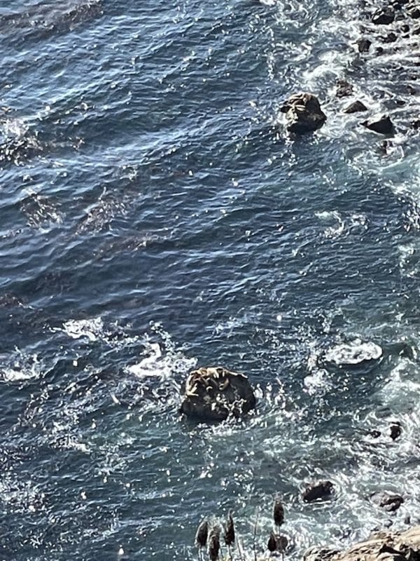
Sometimes called Seal Vista Point, this popular Big Sur road trip stop is where you can look down over the bluffs of Highway 1 to see elephant seals on the beach below.
Note that if the visibility isn’t great when you visit you may not be able to clearly see them; however, you’ll still likely hear them barking!
Stop #14: Julia Pfeiffer State Park – McWay Falls
Driving time from Seal Beach Scenic Overlook to Julia Pfeiffer State Park = 5 minutes
Named after a Big Sur pioneer woman named Julia Pfeiffer Burns, this state park features 5.9 square miles that extend from the Pacific coastline up toward the majestic ridgeline for 3,000 feet.
While there are a number of hikes you can do here, there is one that should absolutely be on your Big Sur road trip itinerary:
McWay Falls.
The hike along the McWay Falls Overlook Trail is more like an easy walk at just 0.5 miles; however, you’ll be rewarded with a front-row view of an 80-foot waterfall pouring down toward the Pacific below.
On a clear day, the colors are extra vibrant as turquoise waters meet green, yellow, and red vegetation. In spring, there are also wildflowers that add to the scene.
Other highlights of the trail include McWay Canyon and McWay Creek.
The entry fee is $10 per card.
Stop #15: Big Creek Cove Vista Point
Driving time from Julia Pfeiffer State Park to Big Creek Cove Vista Point = 12 minutes
This is another epic photo stop that will add to the beauty of your Big Sur scenic drive. Pull over for amazing views of beaches, rugged coastline, and jagged cliffs blending together as the winding Highway 1 appears to slice through the landscape.
Stop #16: Limekiln State Park
Driving time from Big Creek Cove Vista Point to Limekiln State Park = 12 minutes
As you can see, when driving Big Sur you’ll encounter many parks — all of which are worth a visit if you can fit them into your schedule.
There are a few main reasons to spend time at the 711-acre Limekiln State Park. For one, there is an array of experiences, from taking in the lovely views of the Monterey Bay National Marine Sanctuary and the Big Sur coastline to hiking through redwood forests to learning the cultural history of limekilns.
There is also a small beach that sits under a Highway 1 bridge, making for a unique setting and interesting photos.
Then, of course, there are the hiking trails. Specifically, this park is home to three short and moderate hiking trails that are all connected by one longer trail, making it easy to do all of them.
During the hike, you’ll trek up Limekiln Canyon to see redwood groves, lovely creeks, the 100-foot Limekiln Falls, and the historic lime kilns that were used to extract lime to be used in concrete.
Note that there is a day-use fee of $10 to visit Limekiln State Park.

Stop #17: Sand Dollar Beach
Driving time from Limekiln State Park to Sand Dollar Beach = 13 minutes
Known for being the largest unbroken stretch of sand in Big Sur, Sand Dollar Beach is a great spot to photograph the bluffs and interesting rock formations as well as swim, fish, and surf. In fact, it’s known as being one of the top surfing beaches in Big Sur.
Interestingly, Sand Dollar Beach is also a popular spot for beachcombing as it’s not uncommon to find sand dollars, serpentine, and jade.
If you’re in the mood to hike, a short trail takes you out over the bluffs to a lookout point where you can take in beautiful views and, if you’re lucky, migrating whales.
Sand Dollar Beach charges a day-use fee of $10 if you park in the official lot, though it’s free to park on the road and walk down the wooden stairs to the beach.
Stop #18: Ragged Point Scenic View
Driving time from Sand Dollar Beach to Ragged Point Scenic View = 26 minutes
Ragged Point is a rocky headland offering a beautiful view — though it’s important to note that the area of Ragged Point is a destination in itself.
First of all, the Ragged Point Inn is a popular place to stay, as each room offers a stunning view of the California coastline.
Their onsite restaurant also serves delicious seasonal dishes. After eating, you can stroll an onsite paved path down to the water for a beautiful vista.
Another highlight of Ragged Point is the hiking trails — including the short yet challenging Ragged Point Cliffside Trail, which heads downhill for 0.6 miles to a black sand beach. From here, admire the beauty of the 300-foot Black Swift Falls.
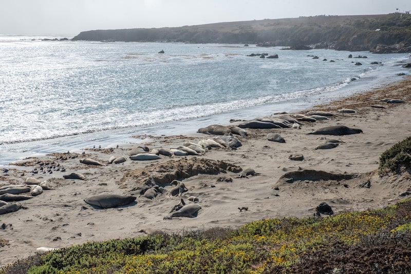
Stop #19: Elephant Seal Vista Point
Driving time from Ragged Point Scenic View to Elephant Seal Vista Point = 15 minutes
This stop takes you to the seaside village of San Simeon, specifically to my personal favorite viewpoint thanks to the wildlife.
In fact, during birthing and breeding seasons, you can see loads of elephant seals — which can weigh more than 8,000 pounds — laying on the beach and rolling around in the sand.
It’s easy to see them, too! Simply park your car and walk along a wooden platform to the beach. You’ll be at a safe distance but still very close to the action.
Stop #20: Hearst Castle
Driving time from Elephant Seal Vista Point to Hearst Castle = 8 minutes
Formerly known as La Cuesta Encantada, Hearst Castle is the former over-the-top residence of newspaper magnate William Randolph Hearst.
Built in 1919, the 90,000-square-foot estate features 165 rooms and 127 acres of extravagant art, gardens, and amenities — not to mention a gorgeous view from its hilltop location.
Soon after Mr. Hearst passed away in 1951, the castle was donated to the state of California and opened to the public for touring.
My personal favorite feature of the tour is seeing the grand onsite pools, particularly the Roman Pool, which is inspired by ancient Roman bathhouses and features statues of Roman gods and goddesses as well as glass tiles fused with gold.
Adult tickets for Heart Castle are $25.
Stop #21: Continue Your Big Sur Road Trip To Paso Robles
Driving time from Hearst Castle to Paso Robles = 47 minutes
As you leave the Big Sur area and its famous Highway 1 stops, it’s time to decide where to go next.
There are many options; however, I highly recommend making your way to Paso Robles, particularly if you want to relax in a beautiful wine country. Along with being home to over 200 wineries, you’ll find hot springs, a hip downtown with a great food scene, and opportunities to meet local makers.
It’s a highly recommended California road trip stop!

Other Stops To Add To Your Big Sur Road Trip Itinerary
While the above itinerary for driving Big Sur mentions the most popular stops, a few lesser-known but still worthwhile places to pull over include:
Big Sur Taphouse. If you like trying local beer and wine when you travel, the Big Sur Taphouse is the perfect spot. You’ll also find the Big Sur Deli next door, which is owned by the same people.
Henry Miller Memorial Library. Henry Miller actually lived in Big Sur from 1944 and 1962, and this library was created in honor of the famed author. Honestly, it’s more of a quirky bookstore than a library, with a broken piano and offbeat sculptures in the yard, strings of foreign currency dangling from the ceiling, and interesting novels, many of which you won’t see in mainstream bookstores.
Rocky Point Restaurant. If you like fine dining with a vista, this upscale cliffside eatery offers panoramic views over the Pacific Ocean through its floor-to-ceiling windows and from its outdoor patio. Keep an eye out for dolphins, deals, whales, and sea otters!
Big Sur Bakery. This adorable bakery resides in a 1930s ranch-style house covered in plants. Along with delicious homemade pastries and baked goods, you can sit for a delicious meal, from woodfire oven-baked pizzas to salads and soups made with local vegetables.
Mother Botanical & Shop. Next door to the Big Sur Bakery is this apothecary shop that also sells local art, interesting books, handmade ceramics, and more. They showcase really beautiful products, like bath time meditation bundles, aromatherapy sprays to support anxiety relief, all-natural beauty products, and more.
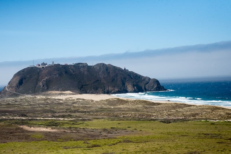
Point Sur State Historic Park. This park is rich in history! First of all, it was the site of many shipwrecks — which led to the creation of the 1889 Point Sur Lighthouse, which today is on the National Register of Historic Places.
Interestingly, the Big Sur attraction is California’s only complete turn-of-the-20th-century lighthouse open to the public.
The lighthouse can be visited with a tour — as can the historic Point Sur Naval Facility, a Cold War relic so secret that even its logo was fake.
The facility is the only remaining complete, standalone Naval Facility from the Cold War on the west coast.
On the tour, you’ll learn about the top secret mission carried out while hearing stories of spies, weapons, and clandestine operations.
You can book tours for both experiences here.
Big Sur Tours
Want to add some tours to your Big Sur itinerary? Check out:
- Big Sur Self-Driving Audio Tour in California (Highway 1, Pacific Coast Highway)
- Carmel Small-Group Food and Wine Walking Tour
- Big Sur Monterey California Pacific Coast One Day Tour
- 2-Hour Monterey and Pacific Grove Sea Car Tour
- Macaron making with a Master Chef in Carmel-by-the-Sea
- Half-Day Whale Watching Tour From Monterey
Click here for a list of fun tours in Big Sur as well as nearby Carmel and Monterey!
Best Places To Stay In Big Sur
The truth is, when doing the above Carmel to Big Sur road trip, it’s possible to stay in one hotel the entire time or switch each night.
Personally, Andy and I stayed at the Carmel River Inn in Carmel-by-the-Sea both nights and absolutely loved it. Rooms feature giant Jacuzzi-style tubs for two (certain rooms), private patios, and super comfortable bedding. They’re set up like a little village with walking paths and gardens as well as a nightly bonfire bringing the “community” together. It felt like staying in a cute apartment.
If you want to stay right in Big Sur, the Big Sur Lodge is a great option — especially as it’s located right in Pfeiffer Big Sur State Park and guests get free admission to this fun nature attraction.
For something more budget-friendly, Deetjen’s Big Sur Inn has a variety of accommodations — including some with shared bathrooms which can help save on costs.
Want more accommodation options?
Click here for a full list of Big Sur hotels!
Prefer self-contained stays?
Click here for a full list of local rentals or check out the map below. It’s currently set to Carmel-by-the-Sea, which has many hotels right near Highway 1, but you can easily change the location as needed:
Tips For Driving Big Sur
Here are some additional tips to help your Big Sur road trip run smoothly:
-You don’t need to stay directly in Big Sur to enjoy it. When planning my Big Sur trip, I nearly lost my mind trying to find budget-friendly accommodation right in Big Sur. What I didn’t realize was that Carmel-by-the-Sea and Monterey are both great destinations that are right off Highway 1.
In fact, both can be memorable parts of your Big Sur road trip! Bonus: Hotels in these places are usually cheaper than in the heart of Big Sur.
-There is no cell service while driving Big Sur Highway 1. For this reason, it’s smart to have your route pre-plotted in Google Maps for offline use.
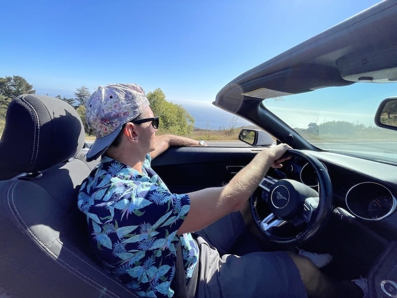
-A convertible can make the drive more fun. Typically, I rent the cheapest car available — but not for Big Sur! Andy and I rented a Ford Mustang Convertible for our trip, which made driving Big Sur a lot more exciting.
-When driving between Big Sur and Carmel-by-the-Sea make sure to leave padding for stopping at the many viewpoints along Highway 1 — like Bixby Bridge and Seal Point Lookout; check out the trails attached, too, which take you along the coast and down to secret beaches.
-Check park websites for any trail closures. Things like landslides are relatively common in Big Sur, so certain trails or even entire parks may be closed sometimes. Additionally, trails may close to protect or heal local landscapes and habitats.
-Do not drive fast. While Highway 1 is well-maintained, there are many sharp curves and you do not want to end up driving into the Pacific Ocean.
-Check your fuel indicator. While you can get gas in Monterey and Carmel, the next gas station when heading south isn’t until you’re near Pfeiffer Big Sur State Park, which is at least a 30-minute drive away.
What To Pack For A Big Sur Road Trip
Now let’s chat about what you’ll want to have with you while driving around Big Sur.
–Clothes to wear on a hike. As you can see above, there are many amazing hiking trails along Highway 1 Big Sur. Make sure you’re prepared with the proper clothing, gear, and hiking shoes.
–Bathing suit. Along with hiking trails, there are numerous Big Sur beaches worth visiting, so make sure to pack a swimsuit.
-Camera. Whether you use a DSLR, mirrorless camera, or your phone, have some type of photo-taking device charged and ready as this is one of the most scenic destinations in California.
-Offline maps. There isn’t cell service along Highway 1 Big Sur, so have your route plotted on a Google Map before you leave your hotel. Again, you can grab a pre-plotted Google Map for Big Sur by grabbing my free Ultimate Travel Planning Kit.
-Snacks and water. While there are places to stop off for food and drink along Highway 1, there are stretches filled with attractions but no deli or eatery in sight. Moreover, you might find yourself loving a particular park or beach and not wanting to leave to grab food. For this reason, it’s smart to pack a cooler so you’re always prepared.
–Sunscreen, sunglasses, and a hat. Protect yourself from the sun with proper gear. Even when it’s cloudy, the sun can shine through, making sunscreen extra important.
-Layers. The weather can change quickly in Big Sur, so be sure to pack layers. Moisture-wicking garments (like these)are the best as they keep you cool and temperate while wicking away moisture. They also help ward off hypothermia, which can happen in any season.
–Rain jacket. Big Sur can get very windy! Having a rain jacket (like these) is great for both unexpected rain and for when it’s gusty out.
-Scarf shawl. I love having a scarf shawl with me at all times. Not only does it work as a scarf, but you can use it as a makeshift picnic blanket if you find a nice spot to sit outside.
Frequently Asked Questions About Driving Big Sur
Here are answers to frequently asked questions about driving through Big Sur:
Q: What is the Big Sur drive time?
Without stopping, it takes about 2 hours and 15 minutes to drive through Big Sur from Carmel-by-the-Sea to San Simeon along Highway 1.
Q: Where should I stop when driving to Big Sur from San Francisco?
The drive from to Big Sur from San Francisco is about 2.5 hours, making it a great day trip option.
That being said, if planning a San Francisco to Big Sur road trip itinerary, a few great places to stop along the way include Daly City, Half Moon Bay, Gilroy, and Santa Cruz.
Q: Is it possible to do a day trip to Big Sur from Los Angeles?
It takes at least 5.5 hours to drive from LA to Big Sur, meaning it wouldn’t be a reasonable day trip. That being said, you can absolutely fly into Los Angeles and use it as the starting point for a larger road trip that includes Big Sur.
Q: Where should I stop when driving to Big Sur from Los Angeles?
If planning an LA to Big Sur road trip itinerary, I recommend:
- Visiting Joshua Tree National Park to hike the Lost Horse Mine Trail, Hidden Valley Nature Trail, and Ryan Mountain
- Spending at least one day in Sequoia National Park to see its famous giant trees and hike the Lakes Trail
- Climbing Mount Whitney, the highest mountain in the contiguous United States and the Sierra Nevada
- Creating an itinerary for Yosemite National Park that includes hiking Columbia Rock, hiking Vernal Falls to Nevada Falls via the Mist Trail, and trekking from Sentinel Dome to Glacier Point
- Looping back around to visit Carmel-by-the-Sea and Big Sur
From there, you can continue the loop back to Los Angeles stopping in places like Paso Robles (there are so many things to do in Paso Robles!), Pismo Beach for hiking, or enjoy a weekend in Solvang along the way. There are also many great LA hikes with waterfalls near the city.
By the way, this is a great itinerary whether you’re in a group or on your own. A solo trip to LA has a lot to offer, as do the national parks and wine country.

Q: Do you recommend a Carmel to Big Sur road trip?
Yes! In fact, you can base in Carmel-by-the-Sea during your entire road trip or you can switch hotels on the second night.
Q: Do you recommend a San Diego to Big Sur road trip?
It takes about 7.5 to 8 hours to drive to Big Sur from San Diego, so making stops along the way is a great idea. A few worthworth stops include Long Beach, Los Angeles, Malibu, and Santa Barbara.
Q: What should I include in a Big Sur itinerary for one day?
If you only have one day in Big Sur, I recommend choosing 1-2 state parks, a beach, Nepenthe Restaurant, and all of the quick vista points like Bixby Bridge and Kasler Point.
Q: Is driving Big Sur in an RV allowed?
Yes! Just make sure to do the speed limit and be courteous of other cars around you, especially at viewpoint pullouts.
Travel Insurance For Your Big Sur Trip
When visiting Big Sur — or anywhere else in the world — it’s wise to get travel insurance.
One of the best travel medical insurance for travelers is SafetyWing as they’ve got a large network and offer both short-term and long-term coverage — including coverage if you’re traveling for months as well as limited coverage in your home country).
Additionally, SafetyWing is budget-friendly and offers $250,000 worth of coverage with just one low overall deductible of $250.
Click here to price out travel insurance for your trip in just a few clicks.
What would you add to this Big Sur road trip itinerary? Any tips for driving Big Sur?
Other California Travel Guides:
An Unforgettable Itinerary For Yosemite National Park (1, 2 & 3 Days)
One Day In Sequoia National Park: The Perfect Itinerary (Epic!)
How To Hike Vernal & Nevada Falls via The Mist Trail in Yosemite National Park
Hiking The Hidden Valley Trail in Joshua Tree National Park
Weekend In Paso Robles: What To Do In Paso Robles With 3 Days (Epic!)
Solvang Itinerary: How To Have The Perfect Weekend In Solvang, California
15 Best Hiking Trails In Pismo Beach, California
Pin for later