
15 Pismo Beach Hiking Trails Not to Miss
This post contains affiliate links, including Amazon affiliate links. If you purchase through these links, I may earn a commission at no extra cost to you. As an Amazon Associate, I earn from qualifying purchases. Thank you for your support!
Hiking in Pismo Beach, but need some help choosing your trail?
Then you’re in the right place!
Pismo Beach, located on the Central Coast of California, is a paradise for outdoor enthusiasts. With its picturesque coastal views and rolling hills, it’s no wonder that exploring the many stunning Pismo Beach hiking paths is a popular thing to do.
Whether you’re a seasoned hiker or just starting out, there are plenty of Pismo Beach trails to explore.
In this article, we’ll cover the best Pismo hiking trails. From easy nature walks to challenging mountain hikes, there’s something for everyone on this list. So grab your hiking boots, pack your backpack, and let’s hit the trails!
Pro tip: Before going hiking in Pismo Beach, make sure to download the AllTrails app to have trail guides, maps, photos, and reviews right at your fingertips. You can also sign up for a free trial of AllTrails+ to download offline maps, get alerts for wrong turns, find trails by distance from you, and more!
What Type Of Hiker Are You? [Free Quiz]
But first, before we dive into our guide to hiking Pismo Beach, I want to share a free personality quiz I think you’ll love:
It’s called “What type of hiker are you?” and it will help you discover your hiking personality.
Bonus: Your results also share trail suggestions based on your responses, helping you to explore some of the best hiking trails in the world.
Once you’ve bookmarked the quiz, keep reading to discover some incredible Pismo Beach trails.
Pismo Beach Hiking Trails Map
To help you navigate the trails, we’ve included a map highlighting the locations of the best hikes in Pismo Beach, California (listed below).
With this map, you’ll be able to plan your hiking itinerary and make the most of your time in Pismo Beach:

Click here for the interactive version of this Pismo Beach hiking map.
Where To Go Hiking In Pismo Beach CA
From leisurely strolls to challenging treks, each hike on the below list has been carefully chosen to showcase the best of Pismo Beach’s natural beauty.
You’ll have the opportunity to explore the picturesque coastline, walk through scenic parks, and hike up wildflower-covered hills. Along the way, you’ll encounter diverse wildlife and plant life, making each hike a unique and memorable experience.
From the Dinosaur Caves Trail to the Shell Beach Bluff Trail, we’ve included all the best Pismo Beach hikes in the area — and possibly the world.
So lace up your hiking boots and get ready for an unforgettable adventure on the Central Coast!
Best Hikes In Pismo Preserve
Pismo Preserve has 11 miles of trails, with options suitable for all hiking levels. Whether you are interested in something the whole family can enjoy or a more strenuous hike with significant elevation gain, Pismo Preserve has an option for you. You can see a map of the entire Pismo Preserve area here.
To enter Pismo Preserve, head to 80 Mattie Road, which is where all the trails begin. Many of the trails are directional, so be sure to follow signage.
Both bicyclists and hikers are allowed on the trails, so pay attention to your surroundings for safety.
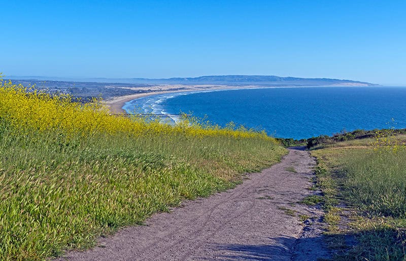
1. Lone Oak to Peekaboo to Discovery to High Road
Length: 5.5-mile trail
Time: About 2.5 hours
Difficulty: Easy
Elevation Gain: 761 feet
Style: Loop
Location: Pismo Preserve
Trailhead: 80 Mattie Road in Pismo Beach; all trails begin across from the parking lot
Parking: Yes
Trail Map: Click here for a Lone Oak to Peekaboo to Discovery to High Road trail map
About the Lone Oak to Peekaboo to Discovery to High Road:
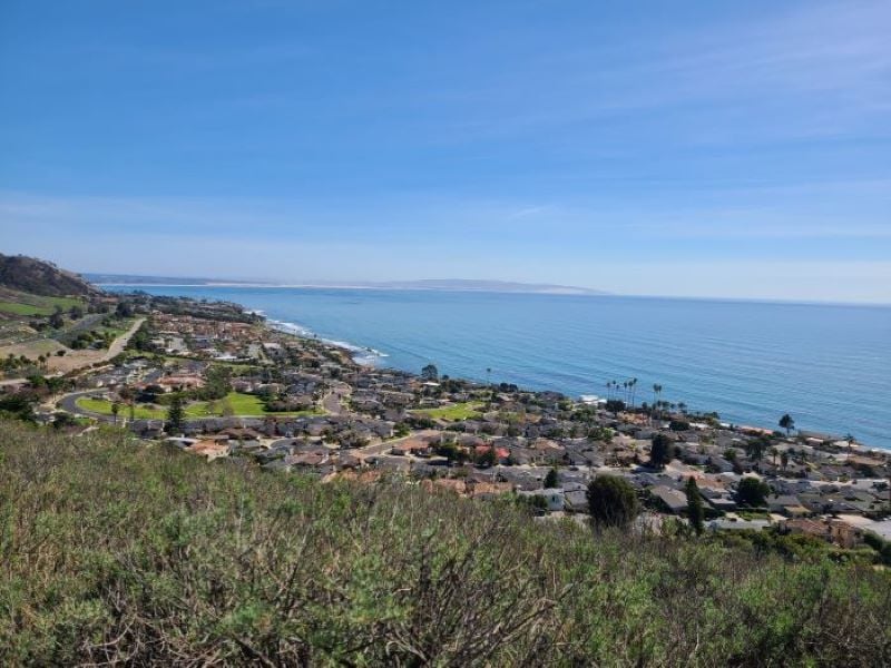
Kickstart your Pismo hiking adventures with this scenic trail. It begins with a few steep stretches before unfolding into a gently rolling middle section.
On a clear day, the views are nothing short of stunning, making every step worth the effort. If you enjoy seeing wildlife, keep your eyes peeled for whales in the ocean below!
While certain spots along the path can be narrow and steep, the trail is well-maintained and clearly signposted. Come spring, the path turns into a showstopper, with wildflowers popping up in a beautiful display of color.
Convenient overflow parking is available, taking the stress out of finding a spot.
As this trail has many exposed sections, make sure to wear sunscreen, sunglasses, and a hat.
2. Discovery Trail
Length: 5.4 miles
Time: About 2 hours and 15 minutes
Difficulty: Moderate
Elevation Gain: 627 feet
Style: Loop
Location: Pismo Preserve
Trailhead: 80 Mattie Road in Pismo Beach; all trails begin across from the parking lot
Parking: Yes
Trail Map: Click here for a Discovery Trail map
About Discovery Trail:
This is an enjoyable hike across gently rolling hills. While these ups and downs might seem challenging, maintaining a steady pace will make your hike enjoyable.
While the trail doesn’t have much shade, the gentle ocean breeze plays a part in keeping you cool and refreshed. Of course, some sunscreen and a hat will also help you stay comfortable.
Remember to stay alert while hiking, as it’s common to see snakes on this trail. Moreover, this trail is well-marked and also a favored route for mountain bikers, so listen for their bells.
Along the way, you’ll find plenty of benches and picnic tables placed for rest stops, allowing you to pause and take in the beauty of your surroundings.
An early start is best not only to avoid the heat but also to secure a parking spot. The lot tends to fill up quickly as the day progresses.
Traveling solo in California? This is a popular option, especially as you’ll very likely encounter other hikers along the way.

3. Spring to Spring Trail
Length: 3.8 miles
Time: Just over 1.5 hours
Difficulty: Easy
Elevation Gain: 488 feet
Style: Loop
Location: Pismo Preserve
Trailhead: 80 Mattie Road in Pismo Beach; all trails begin across from the parking lot
Parking: Yes, and there is an additional parking area conveniently located off Price Street
Trail Map: Click here for Spring to Spring Trail map
About the Spring to Spring Trail:
If you’re looking for Pismo hikes with lots of flora and fauna, this one is for you!
This popular hiking trail unfolds like a carpet of rolling hills, dotted with beautiful wildflowers and diverse plant life. The Spring to Spring Trail is well cared for, providing a pleasant hiking experience accompanied by some of the best views in Pismo Beach.
Setting off early is best if you want to escape the crowds and fully immerse yourself in the quiet ambiance of the area. Given the number of intersecting trails, using the AllTrails app for navigation will be helpful.
As with any outdoor adventure, staying alert is key. It’s not uncommon to come across snakes, including rattlesnakes, on this trail — as well as lizards and birds.

4. Vamonos Canyon to High Road Trail
Length: 1.3 miles
Time: About 35 minutes
Difficulty: Easy
Elevation Gain: 209 feet
Style: Loop
Location: Pismo Preserve
Trailhead: 80 Mattie Road in Pismo Beach; all trails begin across from the parking lot
Parking: Yes
Trail Map: Click here for a Vamonos Canyon Trail map
About the Vamonos Canyon to High Road Trail:
This scenic path winds its way through a verdant landscape — which is even more vibrant after a bout of rain. Along the way, you’ll take in rolling hills peppered with majestic old oak trees.
A handy tip for your hike: try to set off early in the day to avoid the afternoon heat. I find the morning also presents a refreshing, calm environment that’s a great way to kick off your day.
One of the standout features of this Pismo Beach trail — and a big reason it’s one of my favorite hikes — is its tranquility. It’s usually less crowded than other trails in the Pismo Preserve, offering you a peaceful escape into nature.
For those looking for a breather, bench rest areas are conveniently located along the trail. While exploring the trail during the warmer months, be mindful of snakes. As with all wildlife, it’s best to keep your distance.
5. High Road to Panhandle to Discovery Trail
Length: 4.5 mile
Time: Just over 2 hours
Difficulty: Moderate
Elevation Gain: 797 feet
Style: Loop
Location: Pismo Preserve
Trailhead: 80 Mattie Road in Pismo Beach; all trails begin across from the parking lot
Parking: Yes
Trail Map: Click here for a High Road to Panhandle to Discovery Trail map
About High Road to Panhandle to Discovery Trail:
If you want Pismo trails with epic vistas, you won’t want to miss this route — which is famous for its sweeping ocean views, sights of Avila Bay and Pismo Beach, and gorgeous vistas of Edna Valley.
Come spring, the trail comes alive with a riot of wildflowers dotting the landscape.
Beautiful oak trees dot the trail as well, adding to the sense of tranquility and immersion in nature.
The trail offers a blend of shaded and open areas, ensuring you have plenty of moments under the cool canopy. One thing to note is the Panhandle section, which features a moderate gravel incline that’s easier to tread downwards for most.
Though generally less crowded, the High Road section is often chosen by bicyclists, so keep your ears open for the sound of their bells.
An early start is wise not just to avoid the afternoon heat, but also to secure a parking spot, as the lot can quickly fill up by late morning.
Adding to the charm of the hike are picnic tables at the trail’s summit, inviting you to rest and refuel while enjoying the views.
Best Hikes Near Avila Beach
Avila Beach is surrounded by stunning natural landscapes, with local hiking trails offering breathtaking views of the Pacific Ocean, rugged coastline, rolling hills, and verdant valleys. The area boasts a rich biodiversity, with diverse flora and fauna, making it a visual treat for hikers.
There are numerous hiking trails near Avila Beach catering to hikers of all skill levels. Whether you prefer a leisurely stroll along the coastline or a challenging hike up a mountain, you’ll find a trail that suits your preferences. Here are some top picks.
6. Pirates Cove via Cave Landing Road
Length: 0.5 mile
Time: About 15 minutes
Difficulty: Easy
Elevation Gain: 75 feet
Style: Out and back; be aware that it leads to a sheltered clothing-optional beach
Location: Near Avila Beach
Trailhead: From Pirate’s Cove Beach parking lot
Parking: Yes
Trail Map: Click here for a Pirates Cove Trail map
About Pirates Cove via Cave Landing Road:
Venture from Shell Beach onto the Cave Landing Pirates Cove trail, a moderately steep but well-maintained path.
As you hike, enjoy a vista that includes dramatic cliffs, the distant town of Avila, and, if luck is on your side, you might even spot otters or sea lions playing in the ocean waves.
The hike starts on a paved path which then transitions to an older service road, guiding you to a descent to the beach. Something to note: Pirates Cove is a clothing-optional beach, so don’t be surprised by the liberty some visitors might take!
While it’s true that some areas of the cave are marked with graffiti and a gated neighborhood skirts the trail, these human touches do little to mar the sheer beauty of the natural surroundings. In fact, they might add a touch of quirky charm.
And the magic of this trail doesn’t stop there: at low tide, the receding waters reveal a collection of tide pools, transforming the beach into a natural marine science education opportunity. These pools provide a unique peek into the undersea world, making your hike all the more memorable.

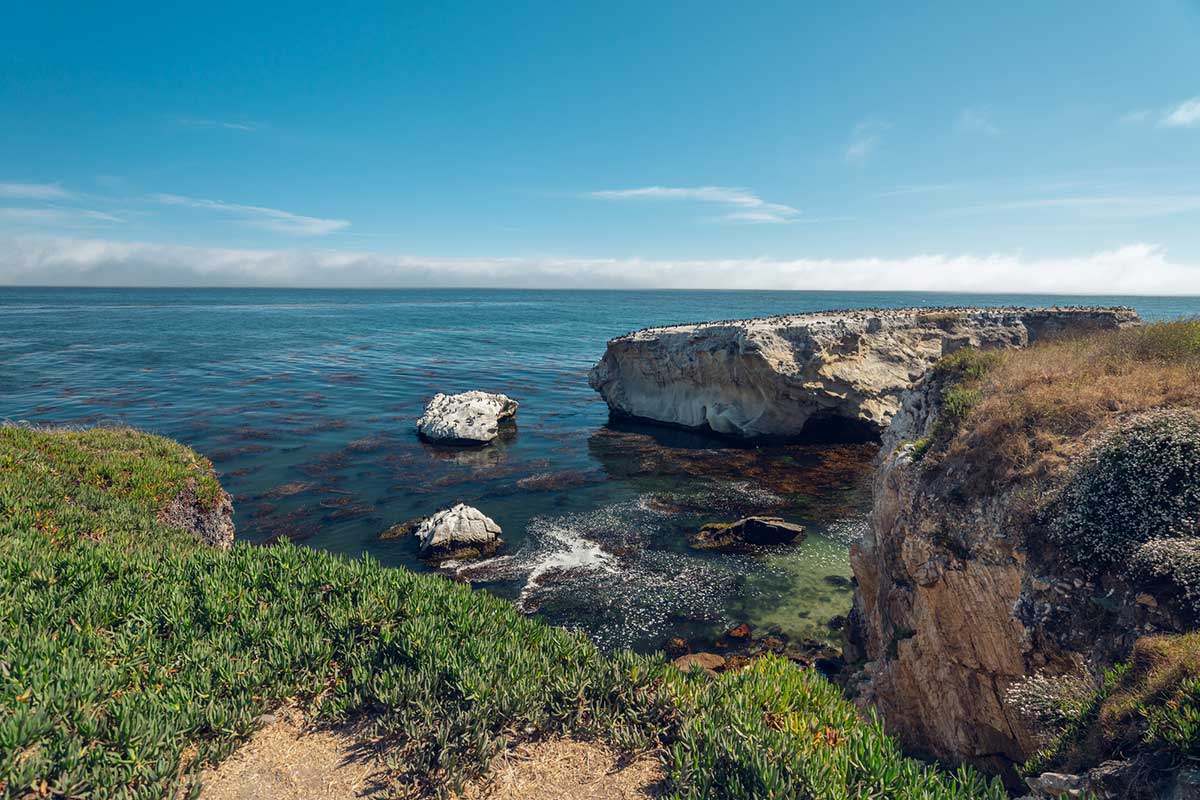
7. Shell Beach Bluff Trail
Length: 0.9 mile
Time: About 20 minutes
Difficulty: Easy
Elevation Gain: 59 feet
Style: Out and back
Location: Between Avila Beach and Pismo Beach
Trailhead: At Cave Landing parking lot, just off Indio Drive
Parking: Yes
Trail Map: Click here for a Shell Beach Bluff Trail map
About Shell Beach Bluff Trail:
The Shell Beach Bluff Trail is a charming coastal path perfect for a short, scenic reprieve after hours on the road. This easy trail takes hikers down a paved path — which is also wheelchair-friendly — that is guaranteed to deliver the tranquil ambiance you crave.
This is one of my favorite trails. I’ve enjoyed it with my family as an after-dinner walk, taking in the beautiful views of the Pacific Ocean that extend as far as the eye can see.
And let’s not forget the wildlife — you may spot otters bobbing in the ocean waves. Or sea lions barking as they lay on the rocks.
Along the trail, take advantage of the overlooks to capture unforgettable shots of a stunning sunset or seascape. And while you’re marveling at the views, take a moment to admire the impressive oceanfront homes that get to enjoy this scene every day.
8. Ontario Ridge to Shell Beach Bluff Trail Loop
Length: 2.8 miles
Time: Just over an hour
Difficulty: Moderate
Elevation Gain: 744 feet
Style: Loop
Location: Near Avila Beach
Trailhead: Pick up the Ontario Ridge trailhead just off Shell Beach Road
Parking: Yes
Trail Map: Click here for an Ontario Ridge to Shell Beach Bluff Trail map
About the Ontario Ridge to Shell Beach Bluff Trail Loop:
The Ontario Ridge to Shell Beach Bluff Trail Loop is more for those who want an exciting adventure laden with stunning views of the Pacific Ocean and bluffs as well as the surrounding hills and vineyards.
This trail is a challenge that will get your heart racing, with a steep climb right at the start and an equally heart-thumping return descent.
Be aware, the trail can be a bit tricky underfoot, with loose shale and rocks adding to the challenge and creating somewhat slippery terrain. To navigate this, hiking poles can help maintain your footing.
But don’t let this deter you; almost every step on this trail is rewarding thanks to the captivating views.
And the surprises don’t stop there — keep an eye out for a fun little secret along the trail: a rope swing at the peak!
9. Johnson Ranch Trail
Length: 3.2 miles
Time: About 1.5 hours
Difficulty: Moderate
Elevation Gain: 423 feet
Style: Loop
Location: Near Avila Beach
Trailhead: Just off Ontario Road
Parking: Yes
Trail Map: Click here for a Johnson Ranch Trail map
About the Johnson Ranch Trail:
Lying snuggly between San Luis Obispo and Pismo Beach, the trailhead is located at the end of the South Higuera Street Extension, with the hike offering stunning views of the surrounding hills and valleys.
One of the unique features of this trail is the oak trees that line it, providing occasional shade and a peaceful atmosphere.
The trail might be narrow, with a few gentle changes in elevation, but it’s in great condition and makes for a family-friendly adventure. Each twist and turn offers a new view of the beautiful scenery.
Remember, the trail can be quite sunny so you’ll want to pack a hat, sunscreen, polarized sunglasses, and plenty of water.
During the warmer months, you might even spot a few snakes. Always remember to give them space and observe from a distance.

10. Bob Jones City to Sea Trail
Length: 5.1 miles
Time: Just over 1.5 hours
Difficulty: Easy
Elevation Gain: 111 feet
Style: Out and back
Location: Near Avila Beach
Trailhead: Across the street from the parking lot at 7009 Ontario Road
Parking: Yes
Trail Map: Click here for a Bob Jones City to Sea Trail map
About the Bob Jones City to Sea Trail:
The Bob Jones Trail is shared with both pedestrians and bicyclists. It follows San Luis Obispo Creek, offering a picturesque view of the surrounding natural beauty. It’s a paved trail that’s perfectly suited for the whole family and is accessible within the mostly gentle (5% or less) grade category.
You’ll encounter gentle inclines along your journey, with the path also benefiting from a generous sprinkling of shade — much appreciated especially during the warmer months.
The trail weaves alongside a peaceful creek, past a local golf course, and you’ll often spot ducks and geese busily going about their day. Springtime on the trail is especially beautiful with an array of wildflowers painting the landscape.
And what’s at the end of this delightful Pismo Beach trail? Nothing less than the magnificent Avila Beach!
It’s a scenic reward for your journey, where you can relax, enjoy the sea breeze, and watch the waves gently roll in. Take some time to walk down the beach and enjoy the tranquility of the zen rock piles.
11. Sycamore Crest Trail
Length: 1.5 miles
Time: Just under an hour
Difficulty: Moderate
Elevation Gain: 498 feet
Style: Out and back
Location: Near Avila Beach
Trailhead: Behind the Sycamore Mineral Springs Resort
Parking: If staying at the Sycamore Mineral Springs Resort or enjoying a spa treatment or hot tub soak, you can use their parking lot. If not, then consider parking at the Bob Jones Trailhead which adds 2 miles to the total hike. Some hikers also park at Avila Valley Barn, which adds about 30 minutes to the hike.
Trail Map: Click here for a Sycamore Crest Trail map
About Sycamore Crest Trail:
Surrounded by lush oak forest, the Sycamore Crest Trail has a well-earned spot on this list of best hikes near Pismo Beach. Despite being a short and somewhat steep trail, the hike is incredibly rewarding, with the shade from the trees providing a pleasant environment.
As you power through the trail, your effort pays off with breathtaking views of Port San Luis and Avila Beach at the crest. It’s truly an exceptional place to soak in the surroundings and catch your breath, giving you a chance to appreciate both your efforts and the natural beauty of the area.
If you’re starting from the Bob Jones Trailhead, be aware that it does add an extra 2 miles to your overall hike. The Avila Valley Barn is an alternative parking option, although it may not be the best choice for those with young children. The barn is located along a winding two-way road, which can be a little tricky to navigate.
For those looking to add a bit of luxury to their hiking experience, you can book a hot tub or spa visit at Sycamore Springs. This comes with the added bonus of a parking spot right in their lot. Imagine ending your hike with a relaxing soak — the perfect combination of exercise and indulgence!
Best Hikes In Price Historical Park
A list of the best hiking trails in Pismo Beach would not be complete without checking out Price Historical Park. Located in the hills directly across from Pismo’s downtown area, this 4-acre coastal country space immerses you in nature with hiking and outdoor activities while also teaching you about the history of the local Indigenous Chumash people, Spanish missionaries, and the founding of the city.
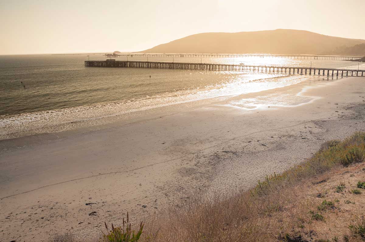
12. Price Historical Park to Pismo Pier Trail
Length: 2.7 miles
Time: About an hour
Difficulty: Easy
Elevation Gain: 147 feet
Style: Out and back
Location: Price Historical Park
Trailhead: Jjust beyond the Price Historical Park parking lot
Parking: Yes
Trail Map: click here for a Price Historical Park to Pismo Pier Trail map
About Price Historical Park to Pismo Pier Trail:
The starting point of this trail takes you on a path along the tranquil Pismo Creek up to Bello Street.
From there, the trail guides you into the heart of town via Pomeroy Avenue — taking you right to the iconic Pismo Beach Pier, a sight that paints a perfect picture of coastal charm.
Along with the pier, this trail also showcases a beautifully constructed bridge and train tracks, all offering fantastic photo opportunities to capture the essence of Pismo Beach.
13. Price Historical Park via Juan Bautista de Anza Trail
Length: 1.4 miles
Time: About 30 minutes
Difficulty: Easy
Elevation Gain: 29 feet
Style: Out and back
Location: Price Historical Park
Trailhead: Starts at the Price Historical Park lot at 100 Rancho Pismo Drive
Parking: Yes
Trail Map: Click here for a Price Historical Park via Juan Bautista de Anza Trail map
About Price Historical Park via Juan Bautista de Anza Trail:
The tranquil Juan Bautista de Anza Trail is found within Price Historical Park, in the hills near Pismo Beach, California. This peaceful trail is a haven for outdoor enthusiasts, perfectly suited for bird watching, hiking, and mountain biking.
Take a step back in time as you gain insights into the Anza expedition group that journeyed up from Mexico and areas that are now part of southern Arizona. These stories of past settlers give visitors to the trail a sense of the history of the area.
With year-round accessibility and a serene atmosphere rarely interrupted by crowds, the Juan Bautista de Anza Trail is a delight to visit at any time. Its unique blend of history and natural beauty provides an enriching experience that transcends the usual hike.
Other Pismo Beach Hiking Trails

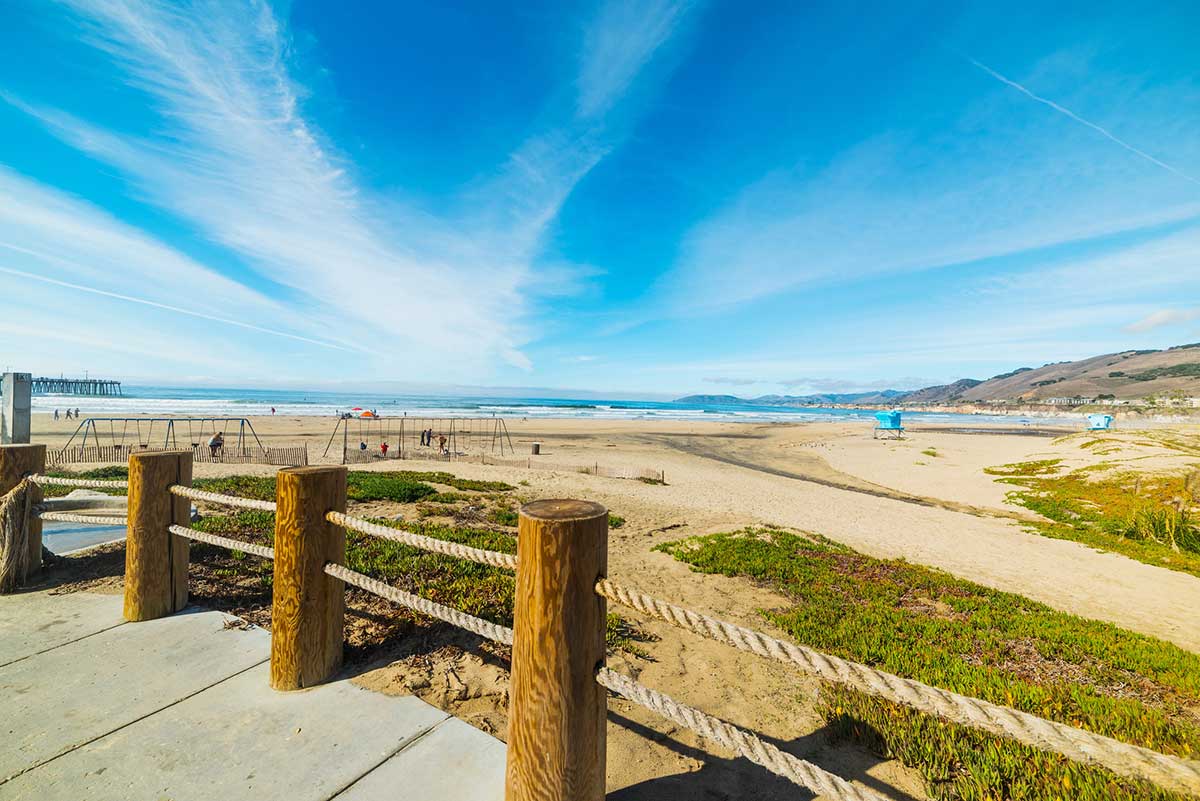
14. Monarch Butterfly Grove and Meadow Creek Trail
Length: 1.5 miles
Time: About 30 minutes
Difficulty: Easy
Elevation Gain: 3 feet
Style: Out and back
Location: Pismo State Beach
Trailhead: Just past the North Beach State Campground
Parking: Yes
Trail Map: Click here for a Monarch Butterfly Grove and Meadow Creek Trail map
About the Monarch Butterfly Grove and Meadow Creek Trail:
The Meadow Creek Trail is a short hike offering a unique experience that nature lovers will enjoy.
Between late October and early February, visitors can witness a fluttering paradise as beautiful butterflies migrate to Monarch Butterfly Grove, which is near the Meadow Creek Trail.
The Meadow Creek Trail is a straightforward coastal path, perfect for a relaxed walk while listening to the gentle rhythm of the waves. If you’re up for a bit more adventure, you can choose to hike the dunes for more of a workout.
Alternatively, consider an easy stroll along the beach back to Pismo, letting the sound of the ocean lull you into a state of calm.
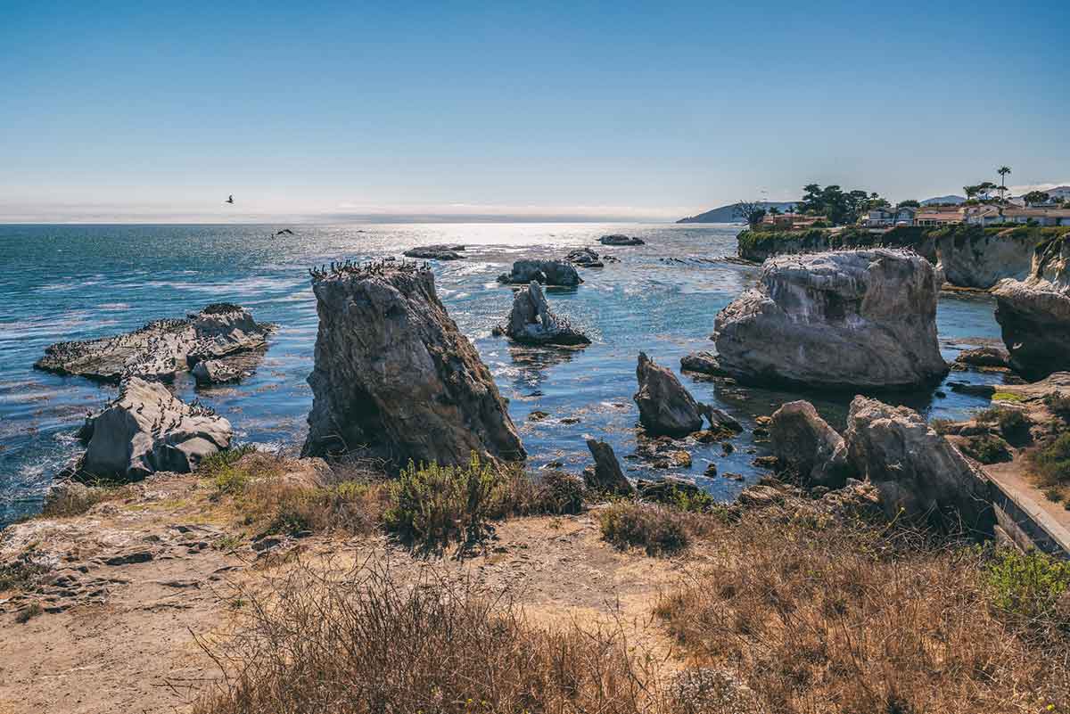
15. Dinosaur Caves Bluff Trail
Length: 1.2 miles
Time: Less than 30 minutes
Difficulty: Easy
Elevation Gain: 78 ft.
Style: Out and back trail
Location: Just 2 miles from Pismo Pier, Dinosaur Caves Park is an 11-acre blufftop park and a popular destination for hiking, walking, or hanging out with your fur babies!
Trailhead: Located at the Dinosaur Park parking lot. Here you’ll find well-maintained bathrooms for your convenience, too.
Parking: Yes
Trail Map: Click here for a Dinosaur Caves Bluff Trail map
About Dinosaur Caves Bluff Trail:
Find your happy place at Dinosaur Caves Bluff Trail, where a leisurely walk along a flat path rewards you with magnificent coastal views and a pet-friendly scene. It’s an excellent trail to shake off the stiffness of a long drive on Highway 101.
The path gets its name from the presence of rock formations along the trail that resemble the shape of dinosaur caves. These unique rock formations, eroded by wind and water over millions of years, have created small caves and crevices that bear a resemblance to the dwellings of prehistoric dinosaurs.
Along the way, you can enjoy Pacific Ocean views, spot various birds and beautiful flowers, or even stop to sit at available benches to take in the natural beauty.
By the end, you’ll be hooked on the California Central Coast lifestyle because of the beauty of the coastal caves and rugged rocky bluffs that punctuate the reach of the Pacific.
Please note that the stairs to beach access may be closed due to dangerous conditions attributed to weather erosion of the cliffs.

Tips For Hiking In Pismo Beach
Hiking is an excellent way to experience the natural beauty of Pismo Beach, but it’s important to be prepared before hitting the trails. Here are some tips to keep in mind when exploring the hiking trails near Pismo Beach:
Wear proper hiking attire. Make sure you wear shoes that provide good traction and support and dress appropriately for the weather conditions.
Bring sun protection, water, and snacks. Pismo Beach walking trails can get pretty warm, so it’s important to protect yourself from the sun with sunscreen as well as UV-blocking and polarized sunglasses — like Rheos floating sunglasses.
Stay hydrated. Bring along plenty of water and some snacks to keep your energy up on the trails. In terms of how much water, REI recommends one half-liter per hour of moderate activity in moderate temperatures. Keep in mind, you may need to increase this amount as temperatures and trail intensities rise.
Respect wildlife and stay on designated trails. It’s important to stay on designated trails to protect the local ecosystem and wildlife. Be respectful of any animals you may encounter and give them plenty of space. Never try to touch wildlife.
Check weather conditions before heading out. Weather can change quickly on the Central Coast, so it’s important to check the forecast before you head out on your hike. Bring along a jacket or extra layers in case the weather turns. A general rule of thumb is to pack a thermal base layer, a mid-layer like a fleece, and a jacket on top. Something that is waterproof and windproof is a good idea — like these jacket options from REI.
Packing Essentials For Hiking In Pismo Beach
To ensure a comfortable and safe hike in Pismo Beach, be sure to bring along these packing essentials:
Water bottle or hydration system. Staying hydrated is crucial while hiking, so bring along a water bottle, hydration pack, or bladder system. You can browse water hydration systems here — though the 3L Platypus Big Zip EVO Reservoir is a personal favorite.
Sunscreen. Protect your skin from the strong California sun with a high-SPF sunscreen that is a minimum of 30 SPF.
Hat. A hat can provide additional sun protection and keep you cool. Consider a hat with a cape to protect your neck too.
Sunglasses. Protect your eyes from the sun’s glare and prevent any damage — like Rheos polarized sunglasses.
Trail map or GPS device. Don’t get lost on the trails. Bring a map or use a GPS device to stay on track. For offline trail maps, the AllTrails+ app has you covered.
Where To Stay In Pismo Beach
Looking for Pismo Beach accommodation?
Click here for a list of top-rated Pismo Beach hotels!
Prefer self-contained stays?
Click here to check out unique local rentals!
You can also use the map below to search for local stays:
Pismo Beach Travel Insurance
When visiting Pismo Beach — or anywhere else in the world — it’s wise to get travel insurance.
One of the best travel medical insurance for travelers is SafetyWing as they’ve got a large network and offer both short-term and long-term coverage — including coverage if you’re traveling for months as well as limited coverage in your home country.
Additionally, SafetyWing is budget-friendly and offers $250,000 worth of coverage with just one low overall deductible of $250.
Click here to price out travel insurance for your trip in just a few clicks.
Final Thoughts On Pismo Beach Hiking
Pismo Beach is a hiker’s paradise, with a diverse range of trails to explore. From easy nature walks to challenging mountain hikes, there’s something for every level of hiker.
Get out and explore Pismo Beach’s hiking trails, but be sure to come prepared with comfortable shoes, sunscreen, and plenty of water.
And while you’re in the area, why not check out some of the other activities and attractions? There are so many things to do in Pismo Beach and the surrounding Central Coast area.
From relaxing on the beach in Carmel or Monterey to wine tasting in nearby Paso Robles or checking out Hearst Castle near Cambria, there’s no shortage of things to do on the Central Coast.
Consider creating a California road trip that includes these unforgettable attractions as well as some of the Pismo Beach trails mentioned above!
What are your favorite trails for hiking in Pismo Beach?
Enjoyed this guide to Pismo Beach hiking? Pin it for later!