
How To Hike The Lost Horse Mine Trail In Joshua Tree (Epic!)
This post contains affiliate links, including Amazon affiliate links. If you purchase through these links, I may earn a commission at no extra cost to you. As an Amazon Associate, I earn from qualifying purchases. Thank you for your support!
By Jessie Festa. This guide to hiking Lost Horse Mine Joshua Tree contains affiliate links to trusted partners!
Looking to hike the Lost Horse Mine Trail in Joshua Tree National Park?
Then you’re in the right place!
Lost Horse Mine is one of the best trails in Joshua tree, as it blends stunning natural beauty with history as you trek through expansive desert to an over-100-year-old mine.
Not only that, but you have a few options in terms of how you can do this trail, adding a choose your own adventure element to the hike.
And while not difficult, this is a moderate hike suited for those looking for a slight challenge but not necessarily to be gasping to catch their breath.
Actually, in regards to energy spent vs reward, this hike is well worth the effort as you’ll be immersed in some of the park’s most beautiful landscapes without needing to summit a mountain.
Bonus:
My husband Andy and I only saw only a handful of other hikers, so you’ll likely have the trail mostly to yourself!
Quick tip: Need help planning your national park trip? Fellow blogger and outdoor adventure expert Alex on the Map offers custom national park trip itinerary planning. Click here to learn more about her services!
What Type Of Hiker Are You? [Free Quiz]
Now, before we dive into how to hike one of the best Joshua Tree trails, I want to share a free personality quiz I think you’ll love:
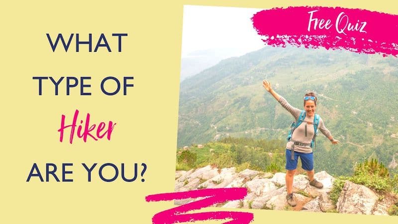
Discover your hiking personality in this fun and short hiker personality quiz, which also shares trail suggestions based on your results.
Once you’ve grabbed the quiz, let’s discuss how to hike the Lost Horse Mine Trail, one of my favorite California travel experiences!
Lost Horse Mine Trail Map
Before hiking to the Lost Horse Mine, it’s recommended to print out a map of Joshua Tree National Park. You can click here to do that. You can also get a Lost Horse Mine Trail map specifically here.
Additionally, you’ll get a paper map when entering the park and there are maps posted everywhere for you to easily take a photo of with your phone.
Prefer a Google Map? Click here!
Note that there are many abandoned mines in Joshua Tree National Park. Many you can’t visit, though some you can. If you’re looking to explore others, like the Desert Queen Mine, you can find Joshua Tree mines maps here.
Lost Horse Mine Trail: Quick Facts
Trailhead: You can do this trail a few different ways:
- Ryan Campground to the Big Trees Trail to the Lost Mine Trail or Loop.
- Take the small dirt road off the road to Keys View (called Keys View Road) to the trailhead for the Lost Horse Mine out-and-back trail or the Lost Horse Mine Loop around Lost Horse Mountain.
Trail Level: Moderate (if you do this as an out-and-back hike) or challenging (if you do this as a loop)
Trail Length:
- 4 miles (6.4 km) if done as an out-and-back hike from the Lost Horse Mine trailhead; about 2-3 hours
- 6.5 miles (10.5 km) if you add on the Lost Horse Mine Loop; about 3-4 hours
- 6.2 miles (10 km) if you do start at Ryan Campground and get to the Lost Horse Mine via the Big Trees Trail; about 3-4 hours
Elevation Change: About 550 feet
When To Hike The Lost Mine Trail: There is no shade on this hike, so if you can avoid summer — especially if doing the 6.5-mile Lost Horse Mine Trail Loop — that is best. If you are visiting in summer, try to go earlier or later in the day to avoid the intense sun.
Trail Highlights:
- Beautiful desert scenery
- Gorgeous views over the Lost Horse Valley
- Wildlife like lizards, ravens, white-tailed antelope squirrels, and giant caterpillars
- Seeing the remnants of a successful Gold Rush-era mine
Joshua Tree National Park Entrance: There are a number of different entrances for Joshua Tree National Park. When hiking to the Lost Horse Mine, it’s recommended to to come in through the West Entrance if possible.
A Note On Lost Horse Mine Trail Directions
Funny story:
We attemped this trail twice!
The first time, we started at Ryan Campground and tried to connect to the Lost Horse Mine Trail via the Big Trees Trail; however, we couldn’t find where the trail connected.
The second time we hiked from the Lost Horse Mine Trailhead and were successful in reaching the mine. On this attempt, we also saw where the Big Trees Trail and Lost Horse Mine Trail connect.
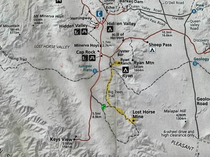
Moreover, you can see on this annotated map that both options are possible. The yellow highlighter shows the Ryan Campground – California Riding & Hiking Trail – Big Trees Trail – Lost Horse Mine option while the green highlighter shows where the Lost Horse Mine Trailhead is:
So, what went wrong?
We’re not sure if the trail junction got washed out or we gave up too soon.
This being said, the Big Trees Trail is gorgeous and if you can connect the two it is a stunning hike and a truly memorable adventure travel experience.
When visiting for yourself, I would:
- Ask at the Joshua Tree National Park entrance or visitor center what the condition of the trails is and if it’s possible to connect them on that day.
- Use the AllTrails app to keep track of where you are and where you’re going. Just make sure to pull up the Lost Horse Mine hike in the app before getting to the park, as you won’t have cell service. This way you’ll be able to just click “Start Hike” even when offline.
If you’d prefer to skip the Big Trees Trail and just do the Lost Horse Mine out-and-back trail or the loop, you shouldn’t have any trouble as this section is well-marked. Again, you can access the trailhead off Keys View Road.
How To Hike The Lost Horse Mine Trail In Joshua Tree National Park
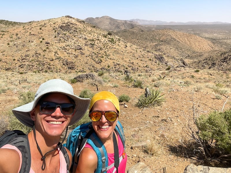
As stated above, for our first attempt at the Lost Horse Mine Trail Andy and I park at Ryan Campground.
From here, we hike the California Riding & Hiking Trail for a few minutes to get to the 2.2-mile Big Trees Trail — a flat trail full of otherworldly-looking Joshua Trees twisting and intertwining that connects to Lost Horse Mine Trail.
The scenery looks like something from a Dr. Seuss book, and I can almost picture the author’s fantastical Barb-a-loots popping up from the tree bristles.
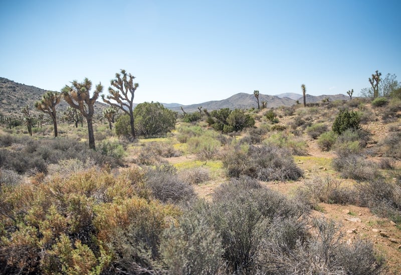
We walk the dirt path, stopping every two minutes to photograph the desert landscape that looks so different from anything we have in New York.
Just take a look for yourself:
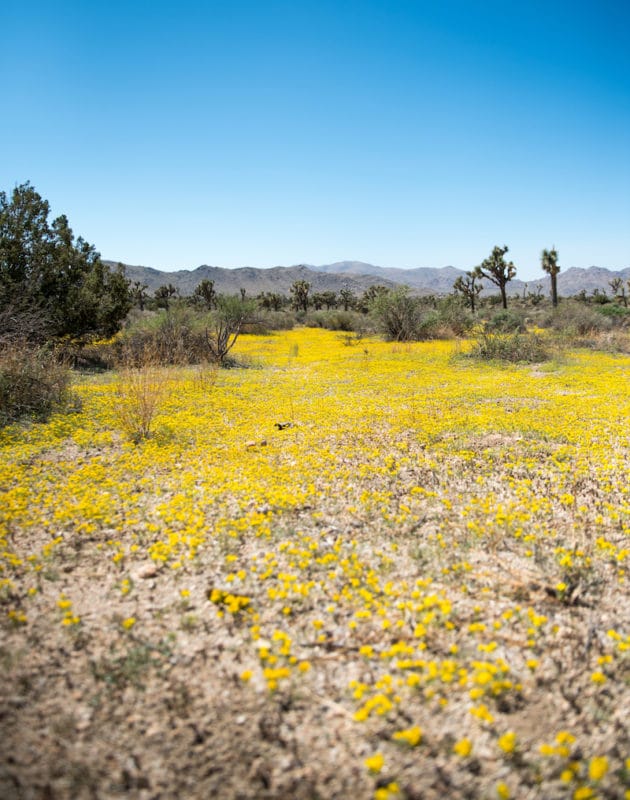
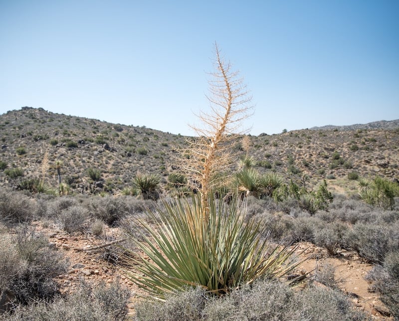
Rock formations, Mojave yucca, scrub brush, cacti, and the park’s namesake Joshua Trees add to the desert beauty, as do the mountains up ahead.
It’s over these mountains where we’ll connect with the Lost Horse Mine Trail, which rewards hikers with an up-close look at the ruins of a historic gold mine.
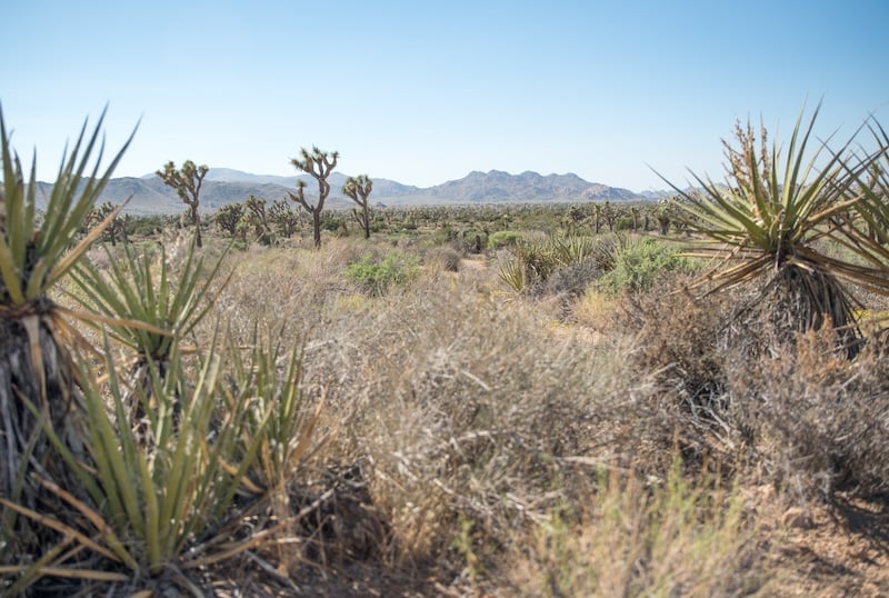
Eventually, the Big Trees Trail goes from flat to wavy, taking you up and over numerous hills to connect with the Lost Horse Mine Trail, which can be done as an out-and-back trail or a longer loop.
As stated above, it’s during this section that we have trouble finding where the Big Trees Trail connects with the Lost Horse Mine Trail — but it is possible. Scroll up to my “A Note On Lost Horse Mine Trail Directions” section for more information.
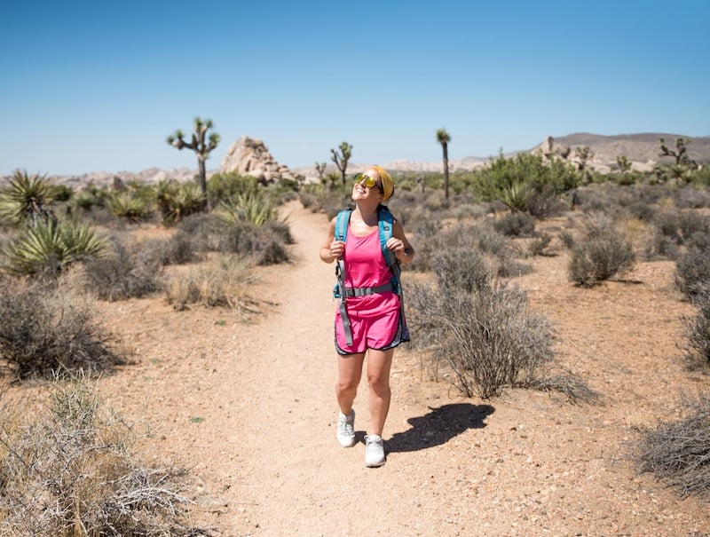
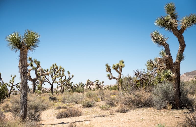
Once on the actual Lost Horse Mine Trail, we choose the shorter out-and-back option. The scenery is much different here than on the Big Trees Trail, with less trees and more low-to-the-ground desert plants as well as lizards and large colorful caterpillars.
And views. Beautiful, beautiful views:
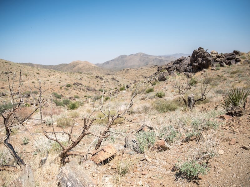
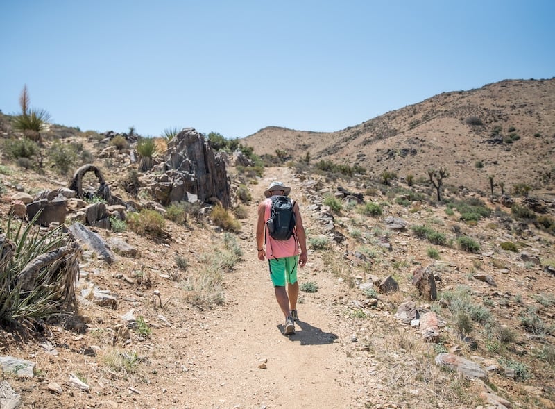
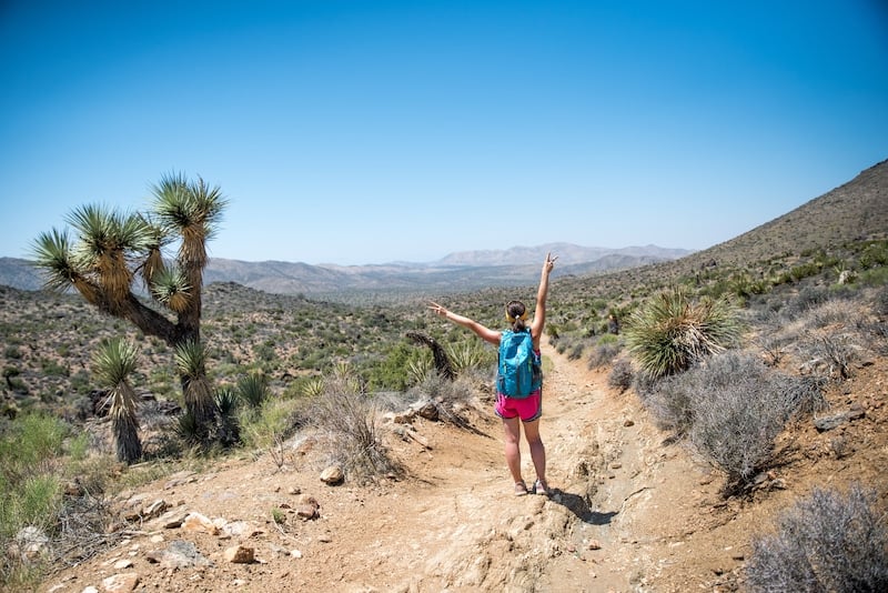
My favorite section is when we begin hiking up and down along a rolling ridge overlooking the Lost Horse Valley, which awards us with layered mountain vistas.
The views keep us energized as we make our way to the mine — which appears on our left seemingly out of nowhere.
Pro tip:
It’s recommended to climb the 0.3 miles to the top of the ridge where the mine is located for amazing views over Queen Valley, Lost Horse Valley, and Pleasant Valley.
This is also where we take a break for lunch with a vista!
By the way, it’s interesting that we started our journey at Ryan Campground, as it’s named after JD Ryan, who actually operated the Lost Horse Mine. In fact, nearby to the campground you can view the ruins of Ryan’s Ranch, which was his residence.
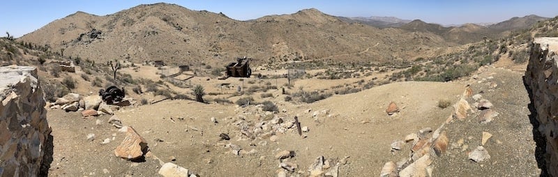
The mine now sits as a relic of the California Gold Rush era, though between 1894 and 1931 it produced more than 10,000 ounces of gold and 16,000 of silver.
When Joshua Tree National Monument was created in 1936, the old mine came under the protection of the National Park Service.
The mine is fenced off as it’s not safe to touch or get close to, but you can walk around the fence to see pieces of machinery that once operated to produce what would equate to about $5 million today.
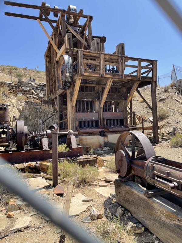
One of the most impressive ruins is Lost Horse Mine’s 10-stamp mill — which is considered to be one of the best preserved mills in California!
Ultimately, what I love about this trail is the mix of natural beauty, incredible views, and fascinating history.
It’s long, though if you’d like to visit the mine in the shortest way possible simply park at the trailhead for the Lost Mine Trail and Loop — but skip the loop and do the out-and-back option.
What is great about the out-and-back hike is the views on the way there look very different on the way back.
Either way, don’t miss this incredible California hiking trail!
Lost Horse Mine Trail Hiking Video
Want a first-hand perspective of the Lost Horse Mine hike? Check out our video from the trail:
Tips For Hiking In Joshua Tree National Park
-Know that you’re on Indigenous land. The Serrano, the Cahuilla, the Mojave, and the Chemehuevi were the original inhabitants of the land that Joshua Tree National Park resides on. These Indigenous peoples were displaced and/or forced to relocate.
Along with educating yourself on the history and culture of these tribes, consider making a donation to causes and charities that directly support them. Moreover, where possible hire Indigenous guides and purchase from Indigenous-owned businesses.
-There is no cell service in Joshua Tree National Park, so make sure to have a park map on hand. You can also use the AllTrails app to stay on track. The paid version works offline — though you can also use the free version offline as long as you pull up your hike in the app when you actually have cell service.
From there, hit “Navigate” and then “Hiking” and get it on the page where you’ll hit “Start” when you’re ready to begin your hike.
To be honest, we didn’t have much cell service on our entire Southern California road trip!
-Many Joshua Tree trails have little to no cover. This means that it can get incredibly hot. If possible, hike outside of summer and/or mid-day when the sun is at its strongest.
–Know what to wear hiking. Having extra water as well as the proper hiking attire like moisture-wicking clothing, sunglasses, sunscreen, and a hat that covers your head and neck will help keep you temperate and safe.
-Don’t touch those fuzzy-looking cholla cacti! Known as the “jumping cactus,” it looks furry but is actually very prickly. If you get their thorns in you they can be incredibly painful and difficult to remove.
-When choosing your accommodation, consider your desired entrance. While Joshua Tree National Park isn’t nearly as large as other California national parks like Yosemite (where you can hike Sentinel Dome to Glacier Point, Vernal and Nevada Falls, and the Columbia Rock Hike) and Sequoia (where you can hike the Lakes Trail or enjoy an unforgettable one day Sequoia itinerary), the drive from one end of the park to the other can be quite long.
If you know what hikes you’d like to do, try to choose accommodation near to the entrance that makes the most sense.
-Keep wildlife wild. Do not feed or touch wildlife. This is for your protection as well as for the protection of the animal.
For instance, in Joshua Tree National Park feeding coyotes can lead to them becoming more aggressive toward humans. You’ll see signs about this put up by the National Park Service all over.
Other Not-To-Miss Joshua Tree National Park Hikes
Joshua Tree is home to some of the best hikes in the world! If you’re looking to explore some of the other incredible hikes beyond Lost Horse Mine CA, don’t miss:
Easy Joshua Tree Hikes
Barker Dam Nature Trail
Cholla Cactus Garden
Keys View
Skull Rock
Moderate Joshua Tree Hikes
Hi-View
Mastodon Peak
Pine City
Split Rock Loop
West Side Loop
Challenging Joshua Tree Hikes
Boy Scout Trail
California Riding and Hiking Trail
Lost Palms Oasis
Fortynine Palms Oasis
Warren Peak
Hotels Near Joshua Tree National Park
Click here for a full list of hotels near Joshua Tree!
Prefer self-contained stays?
Click here to view unique local rentals!
You can also peruse the map below:
Joshua Tree National Park Tours
Looking to explore Joshua Tree and its surroundings with a guide? Here are a few highly-rated experiences:
- Joshua Tree National Park Offroad Tour
- Half-Day Guided Hike in Joshua Tree National Park
- Joshua Tree National Park Self-Driving Audio Tour
- Rappelling Adventure in Joshua Tree National Park (4 Hours)
- Secrets of Joshua Tree Hidden Valley Scavenger Hunt
- Palm Springs Indian Canyons Bike and Hike from Palm Springs
Click here for a full list of tours near Joshua Tree.
Renting A Car For Joshua Tree National Park
Joshua Tree National Park is huge, and you’ll definitely want a car to explore the many trails and sites.
If you need to rent a car, I highly recommend using Discover Cars to quickly compare your rental options.
Their comparison tool does the homework for you, so there’s no need to have up 10+ tabs trying to figure out which company is the most affordable. Actually, you can save up to 70% using their tool!![]()
California Travel Insurance
When visiting California, it’s wise to get travel insurance to protect yourself and your trip.
If you’re looking for something straightforward, comprehensive, and budget-friendly, SafetyWing is an excellent choice. They offer two plan options:
🟡 Essential, for mid-to-short-term travelers
- Covers emergency medical care, trip delays, and evacuations
- Flexible 28-day subscription or fixed-date coverage for specific trips
- Add-ons available for adventure sports, electronics theft, and U.S. coverage
🔵 Complete, for long-term travelers and digital nomads
- Includes most Essential benefits, plus routine care, mental health support, and maternity coverage
- Covers you both abroad and in your home country
- Comes with adventure sports coverage, cancer screenings, outpatient services, and therapies like chiropractic care
➡️ Click here to compare plans and protect your trip.
Other California Hikes
Looking to explore other California hiking trails? A few not-to-miss trails include:
- Hidden Valley Nature Trail in Joshua Tree National Park
- Mount Whitney in the Sierra Nevadas
- The Lakes Trail in Sequoia National Park
- The Moro Rock Trail in Sequoia National Park
- Sentinel Dome to Glacier Point in Yosemite National Park
- The Columbia Rock Trail in Yosemite National Park
- Vernal And Nevada Falls in Yosemite National Park (Mist Trail)
- James Irvine Trail to Fern Canyon in the Prairie Creek Redwoods State Park