12 Stunning Waterfall Hikes In Los Angeles Not To Miss
By Olivia Blodgett & Joanna Kalafatis. This guide to hiking trails with waterfalls in Los Angeles contains affiliate links to trusted partners!
Looking for stunning waterfall hikes in Los Angeles, California?
Then you’re in the right place!
Los Angeles is known for having beautiful hikes that wind up into the iconic Hollywood Hills and down into shady canyons, but many don’t know this city is also home to many hiking trails with waterfalls.
Take a short trip from the big city and you’ll find hidden oases with rushing streams and shady sitting areas from which to take it all in.
While the water is best viewed in the fall, spring, or after heavy rain, these hikes provide a lovely escape into nature year-round.
Keep reading to discover some of the most scenic waterfall hikes in LA, listed from easy to hard so you can find your perfect trail. All trails are within approximately an hour of Los Angeles.
Bonus: This guide also contains tips for enjoying the various trails safely and confidently.
Pro tip: Before going hiking, make sure to download the AllTrails app to have trail guides, maps, photos, and reviews right at your fingertips. You can also sign up for a free trial of AllTrails+ to download offline maps, get alerts for wrong turns, find trails by distance from you, and more!
What Type Of Hiker Are You? [Free Quiz]
But first, before we dive into the various Los Angeles waterfall hikes, I want to share a free personality quiz I think you’ll love:
Discover your hiking persona in this fun and short hiker personality quiz, which also shares trail suggestions based on your results.
Once you’ve grabbed the quiz, let’s go over some of the top hiking trails in Los Angeles with waterfalls. Get excited, as hiking is one of the top things to do in California!
10 Stunning Waterfall Hikes In Los Angeles
Below, find epic waterfall hikes near Los Angeles. We’ll begin with some easy yet scenic trails before moving into moderate and then difficult hiking paths.
Easy Waterfall Hikes In Los Angeles
1. Escondido Falls
Trail Length: 3.5 miles out-and-back
Trailhead: Escondido Canyon Trail, Malibu, CA 90265
Trail Map: Click here for an Escondido Canyon Trail map
Distance from Los Angeles: About an hour and 10 minutes
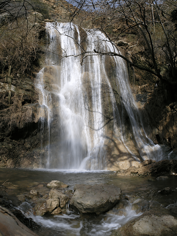
Escondido Falls is one of the most notorious hiking trails with waterfalls in Los Angeles. If you follow any of the popular Los Angeles Instagram accounts, you’ve likely seen this beauty before.
This easy-paced trail takes hikers to see a 50-foot lush and cascading waterfall – and, for the more daring, up further to see a second waterfall towering at 150 feet high.
If planning to venture up to the second waterfall, be prepared for more strenuous conditions including boulder hopping and steep climbing with a rope. If you’ve hiked the more challenging Death Valley canyon trails, like Mosaic Canyon, this trail is similar in the scrambling and boulder climbing required.
There is parking at the start of the trail, which first takes you through a residential area of the Malibu Hills; but, if you keep going, you will reach the trailhead sign and the start of the lush green nature trail.
Note that this is a shady hike, and, depending on the time of year, you may cross streams of water flowing across the pathways. Because of this, you’ll want to pack some water shoes!
2. Solstice Canyon
Trail Length: 3-mile loop
Trailhead: 3455 Solstice Canyon Rd, Malibu, CA 90265
Trail Map: Click here for a Solstice Canyon Loop map
Distance from Los Angeles: About an hour
If you’re looking for a Malibu hiking trail with a waterfall, Solstice Canyon rewards hikers with a picturesque waterfall and scenic views. Not only that, but it also has some fascinating historical sights to explore along the way.
This is an easy loop trail, but it’s the kind with which you’ll want to take your time and explore.
There are opportunities to view the ruins of some old historical buildings and mansions along the way that have been abandoned and are being taken back by nature.
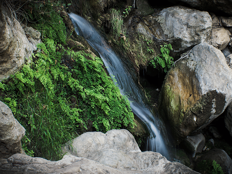
Following the trail further will bring hikers to the 30-foot-high Solstice Canyon Waterfall. It’s a lovely shady area, especially when the waterfall is full after it has rained. During periods of drought, the waterfall can diminish to a trickle.
After reaching the waterfall, turn around and head back the way you came, or take the Rising Sun Trail for a moderately-paced finish to the loop of the trail, which also provides some scenic ocean views.
Pro tip: there is a relatively small parking lot at the trailhead, so be sure to do this scenic hike early in the morning to beat any crowds.
3. Santa Ynez Canyon Waterfall Trail
Trail Length: 2.2 miles out-and-back
Trailhead: Santa Ynez Canyon Trail, Pacific Palisades, CA 90272
Trail Map: Click here for a Santa Ynez Canyon Waterfall Trail map
Distance from Los Angeles: About an hour
Santa Ynez Canyon is home to one of the best easy yet adventurous hiking trails with waterfalls in Los Angeles.
A 2.2-mile out-and-back trail, Santa Ynez Canyon starts off by following a clearly marked path among tall sycamore and oak trees.
The trailhead begins in Topanga State Park in the Pacific Palisades, a neighborhood located between the Pacific Ocean and the Santa Monica Mountains.
At a certain point along the trail, it becomes a bit more difficult to follow due to other trails intersecting with the path.
Since the goal of this hike is to get to the waterfall, be sure to follow the creek. As hikers get closer to the waterfall, there are some boulders and rocks to navigate through, so proceed with caution. You’ll also have a number of creeks to cross over, adding some fun to the hike.
Once the waterfall is reached, however, hikers are rewarded with an 18-foot waterfall hugged by verdant moss in a narrow canyon. The waterfall is lovely, though note it isn’t huge so it’s best viewed during the rainy season.
The trail continues past the waterfall but becomes moderately strenuous with rope climbing involved, so the waterfall is a great point to rest and turn back when ready unless you’re up for a challenge.
4. Eaton Canyon Trail
Trail Length: 3.5 miles out-and-back
Trailhead: 1999 Veranada Ave, Pasadena, CA 91107
Trail Map: Click here for an Eaton Canyon Falls Trail map
Distance from Los Angeles: About 30-45 minutes
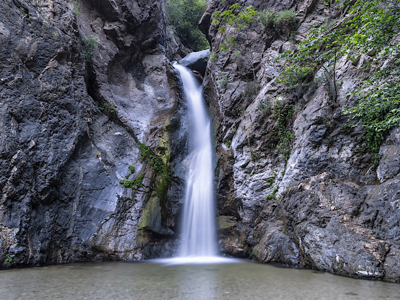
Located at the base of the San Gabriel Mountains, the Eaton Canyon Trail takes you to Eaton Canyon Falls, a beautiful 40-foot waterfall. This easy trail is one of my favorite hikes in the world.
This Los Angeles waterfall hike begins on a wide dirt path hugged by low plants and grasses, with a view of the surrounding hillside in front of you.
After about a mile, you’ll cross under a footbridge – which is when the hike starts to really get exciting. From this point, you’ll be inside the canyon crossing numerous streams and seeing little waterfalls.
At times, the canyon walls showcase various shapes and colors, and it’s interesting to look up and feel like you’ve been swallowed by mother nature.
The highlight, of course, is reaching Eaton Canyon Falls, where you can watch as the water cascades down into a refreshing pool at the bottom. This is the perfect place to rest or swim before turning back.
Pro tip: near the parking lot, you’ll find Eaton Canyon Nature Center, which features free exhibits for those interested in learning more about the area. Also, you may want to bring water shoes for the stream crossings.
5. Lewis Falls
Trail Length: 0.8 miles out-and-back
Trailhead: Soldier Creek, Azusa, CA 91702
Trail Map: Click here for a Lewis Falls Trail map
Distance from Los Angeles: About an hour
At just about a mile, Lewis Falls is one of the shortest hiking trails with waterfalls in Los Angeles but is very scenic.
There is no parking lot on site, but hikers can park close by on the main road. Most of the trail is shaded, and it is easy to follow to find Lewis Falls.
There is a small amount of rock scrambling required as you get closer to the falls, and, depending on the conditions during your visit, the rocks may be slippery; however, the view of the 50-foot Lewis Falls sitting high in the San Gabriel Mountains makes the effort worth it.
This is truly one of the best LA hikes with waterfalls!
6. Heart Rock Trail
Trail Length: 1.3-mile loop
Trailhead: 250 CA-138, Crestline, CA 92325, United States; look for marker 4W07 to locate the trailhead.
Trail Map: Click here for a Heart Rock Trail Map
Distance from Los Angeles: About 1 hour 20 minutes
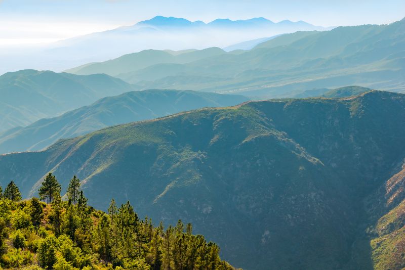
Though the Heart Rock Trail is located a little bit further from LA, couples and families generally love this relatively easy hike. There are also beautiful rock formations at the end, making it one of the more unique LA hiking trails with waterfalls.
The loop trail is well-trafficked but never too busy, so you will rarely find yourself completely alone on it – which can be comforting for solo hikers.
Most of the hike is a nature walk, except for the very last section that leads down to the waterfalls.
Next to the 25-foot waterfall, you will see a heart-shaped opening in the rock formation, which lends the trail its name and also creates a great background for pictures. In fact, you will see hearts painted on rocks on the way to the waterfall, so the chances of getting lost on the trail are pretty slim.
When you park, you will need to have a National Forest Adventure Pass on display on your dashboard.
Moderate Hiking Trails With Waterfalls In Los Angeles
7. Temescal Canyon Trail
Trail Length: 3.4-mile loop
Trailhead: 15601 Sunset Blvd, Pacific Palisades, CA 90272
Trail Map: Click here for a Temescal Canyon Trail map
Distance from Los Angeles: 40 minutes
Temescal Canyon Trail is a typical Los Angeles hike in that it explores a shady canyon while also providing views of the ocean.
A moderately-paced loop trail, this hike begins in Temescal Gateway Park in the Pacific Palisades. Prepare for a parking fee for the on-site lot as you begin your journey.
It is recommended to follow the loop trail counter-clockwise for the easiest routing. Enjoy shady canyon settings before being faced with the open ocean views and colorful seasonal wildflowers.
Hikers will reach a footbridge next to a small waterfall in a serene setting. To see the bigger part of the waterfall, hikers may go a bit off-trail and follow the water. Continue along the regular trail, however, to complete the loop back out to the exit.
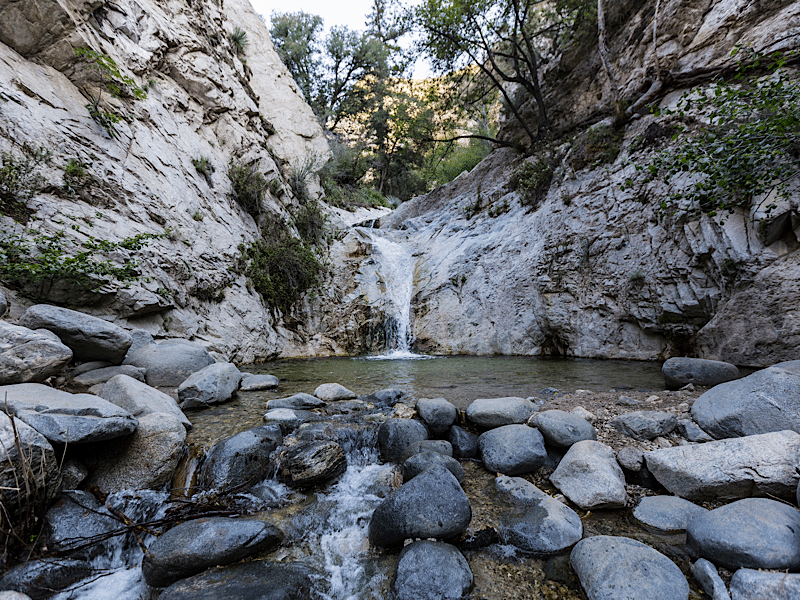
8. Switzer Falls
Trail Length: 3.7-mile out-and-back; 5 miles if you go to the upper falls
Trailhead: 701 Angeles Crest Hwy, Tujunga, CA 91042
Trail Map: Click here for a Switzer Falls Trail map
Distance from Los Angeles: About 40 minutes
The trail to Switzer Falls in the San Gabriel Mountains is one of the most popular waterfall hikes in Los Angeles. There is parking at the trailhead, and a National Forest Adventure Pass is required to be displayed on your car windshield.
Except for one part of the trail that takes you into the open, the rest of the trail is shaded.
This trail is unique in that the first view of Switzer Falls is from the top. Hikers can descend down to the waterfall, creek, and pools by following Bear Canyon Trail.
During the right time of year when the water levels are high, this can be a great spot to jump into the water to cool off.
9. Cooper Canyon Falls (Burkhart Trail)
Trail Length: 6.2-mile loop
Trailhead: Pacific Crest Trail, Pearblossom, CA 93553
Trail Map: Click here for a Cooper Canyon Falls Trail map
Distance from Los Angeles: About an hour and 15 minutes
This loop trail in the San Gabriel Mountains contains plenty of lush forest greenery and peaks with a waterfall.
One of the more popular Los Angeles hikes with waterfalls, this trail attracts visitors all year long. The majority of the trail is shaded and easy to follow.
Towards the end, there is a steep decline to get to Cooper Canyon Falls, and, therefore, a steep incline coming back up.
There is a rope right near the falls to help hikers keep steady. Once at the falls, enjoy a peaceful and shaded 30-foot waterfall in the heart of the mountains.
10. Millard Canyon Falls

Trail Length: Short hike is 1.2 miles out-and-back; long hike is 2.8 miles out-and-back
Trailhead: Short hike – Millard Trail Camp, 4041 Chaney Trail, Altadena, CA 91001; long hike – Brown Mountain Truck Trail, Altadena, CA 91001
Trail Map: Click here for a Millard Canyon Falls Trail map
Distance from Los Angeles: About 35 minutes
Another shady beautiful Los Angeles hike with a waterfall is the Millard Canyon Falls Trail.
Located in the San Gabriel Mountains near Altadena, the trail is shared with mountain bikers, so be aware of your surroundings and leave enough room for the bikers to pass by.
This trail is fairly easy to follow as long as you keep going down in the direction of the canyon. Once Millard Falls is reached the view is picturesque, with boulders precariously sitting at the top of the 50-foot falls while water effortlessly steams down into the pools below.
There is a parking lot near the trailhead where you can leave your car before starting your hike to the falls. The main difference between the short and long hike is that you park further up on the trail in order to do the short hike, so you have less distance to traverse to reach the waterfalls.
However, if you’re up for it and have the energy, the longer hike is highly recommended so you can view more of the green surroundings on the way to the falls.
11. Paradise Falls (via Mesa, Teepee, and Moonridge Trail)

Trail Length: 2.8-mile loop trail
Trailhead: 928 West Avenida De Los Arboles, Wildwood Regional Park, Thousand Oaks, CA 91360
Trail Map: Click here for a Paradise Falls Trail map
Distance from Los Angeles: About 50 minutes
This 2.8-mile moderately paced loop trail in Conejo Valley is a local favorite for hikers in the Thousand Oaks area.
To reach the beautiful 30-foot-tall Paradise Falls, follow the Mesa Trail to Teepee, and then to the Moonridge Trail.
Along the way, you’ll encounter plenty of people hiking and running, as well as walking their dogs, as pets are allowed as long as they are on a leash.
If you wish to take some small detours, you can make your way to Indian Cave and Indian Creek, both about 10 minutes off the main trail. You will see signs pointing to the cave while walking along the route. You can park for free near the trailhead at Wildwood Regional Park.
Pro trip:
On the way to Paradise Falls, you will experience a descent of around 300 feet, so make sure you don’t get too tired, as the way back to the car will involve the same ascent.
12. The Grotto
Trail Length: 2.7 miles out-and-back
Trailhead: Circle X Ranch – 12896 Yerba Buena Rd, Malibu, CA 90265
Trail Map: Click here for a map of The Grotto
Distance from Los Angeles: About 1 hour 10 minutes
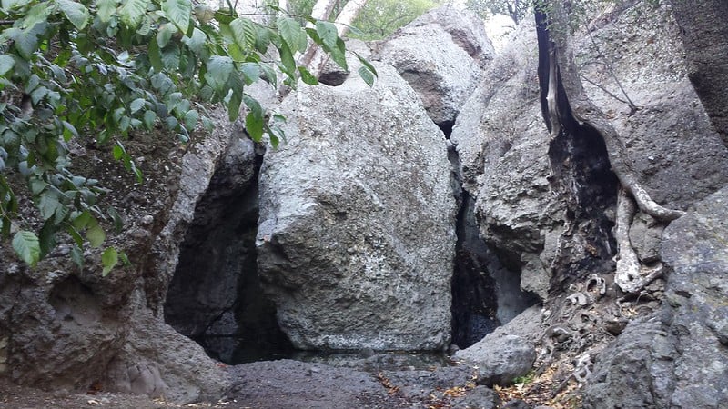
Located near Malibu, the Grotto is one of the most unique natural formations in the LA area.
Follow the route from the trailhead down to the canyon and along the creek until you encounter the boulder-filled canyon where the creek ends. Here you will encounter a 12-foot waterfall tumbling off the rocks, and a tubular cave-like structure formed by the rocks.
You can admire the view from above, or if you’re up for an adventure, scramble down to the Grotto; but, only if you feel confident in your ability to scramble back up the rocks to get out. Tired and inexperienced hikers have had trouble with this in the past.
It’s generally recommended you save your energy for the way back to the car, which involves a 475-foot ascent.
While dogs on a leash are welcome, they are not allowed to descend the last part of the hike into the Grotto itself.
Tips For Hiking In Los Angeles
Now that we’ve gone over some of the best waterfall hikes in Los Angeles, let’s chat about some important tips to keep in mind before hitting the trails:
Start early. As most days in Los Angeles are sunny, it tends to get very hot mid-day. This is also when trails can be at their most crowded, so it’s smart to get an early start.
Bring proper footwear. There will be lots of steep declines and inclines, as well as some occasional rock scrambling across slippery boulders. Reduce your risk of injury by wearing proper footwear. Many of these trails also involve river crossings, so bring water shoes and wear proper hiking attire.
Know how to stay safe on the trail. This means bringing enough water – at least one half-liter of water per hour in moderate temperatures, more if it’s hot out – as well as sun protection. It’s also smart to bring a small first-aid kit as well as some Moleskine bandages in case you start to get a blister. Finally, consider hiking with a personal locator beacon like the Garmin InReach Mini.
Share your location. Especially if hiking solo, it‘s always smart to share your plans with someone and let them know where you’ll be.
Check weather conditions and trail closures. The dry fall season in Los Angeles is also known as wildfire season. Be sure to check for any local trail closures due to fires and safety.
Prepare your permits. If a National Forest Adventure Pass is needed to park at the trailhead, be sure to purchase one ahead of time. For tips on where to purchase one, click here.
I hope you’ve enjoyed this list sharing some of my favorite waterfall hikes. There are so many beautiful Los Angeles waterfalls to explore!
What waterfall hikes in Los Angeles would you add to this list?
Enjoyed this waterfall hikes LA guide? Pin it for later!
About The Authors
Olivia’s travel blog, Girl With Blue Sails, focuses on adventure travel and exploring the beauty of this earth. She creates destination guides based off her travels with hopes to inspire her readers to set sail on a journey of their own. You can also follow her on Instagram.
Joanna Kalafatis is an actress living and working in Los Angeles as well as the travel blogger and photographer behind Lose the Map. She also has published two photo books on “Abandoned California” with Arcadia Publishing.


Hi, I’m Jessie on a journey!
I'm a conscious solo traveler on a mission to take you beyond the guidebook to inspire you to live your best life through travel. Come join me!
Want to live your best life through travel?
Subscribe for FREE access to my library of fun blogging worksheets and learn how to get paid to travel more!
Turn Your Travel Blog Into A Profitable Business
Subscribe to my email list to snag instant access to my library of workbooks, checklists, tutorials and other resources to help you earn more money -- and have more fun -- blogging. Oh, and it's totally FREE! :) // Privacy Policy.