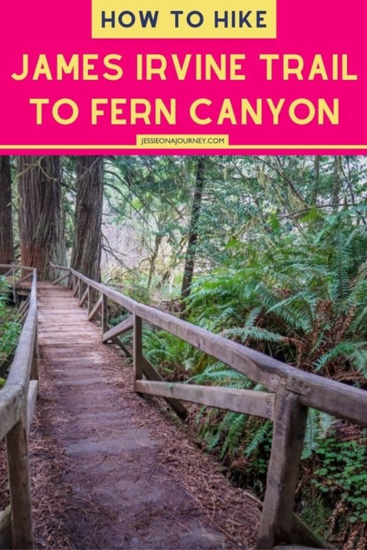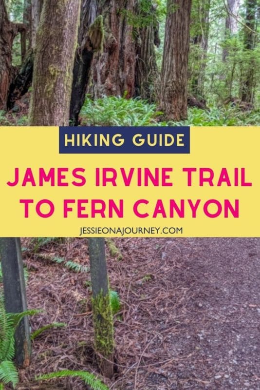
How To Hike The James Irvine Trail To Fern Canyon For Amazing Scenery
This post contains affiliate links, including Amazon affiliate links. If you purchase through these links, I may earn a commission at no extra cost to you. As an Amazon Associate, I earn from qualifying purchases. Thank you for your support!
Avoid the crowds and explore magical Fern Canyon via the James Irvine Trail in Northern California.
A gentle rolling path through a forest of towering redwood trees, the James Irvine Trail is a lovely trek to a sandy beach on the Pacific Ocean.
The highlight of this trip is Fern Canyon — a stunning fern-lined canyon dripping with water and moss.
The 50-foot (15-meter) walls of Fern Canyon are so impressive that they were famously used as a filming location for Jurassic Park 2: The Lost World and BBC’s Walking with Dinosaurs.
Given the incredible natural beauty on offer at Fern Canyon, it is no wonder that it is also incredibly popular.
For a better viewing experience, hike into the canyon on the James Irvine Trail when the road to the Gold Bluffs parking area is closed. This will ensure you have the canyon almost to yourself.
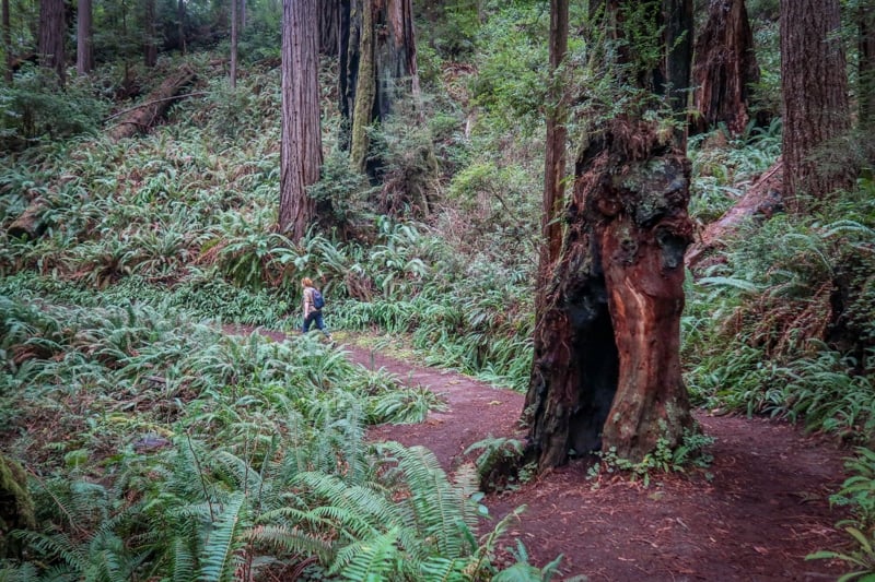
Hiking along the James Irvine Trail is delightful in its own right, however. The old-growth trees lining the trail are magnificent specimens of coastal redwoods -– the tallest trees in the world!
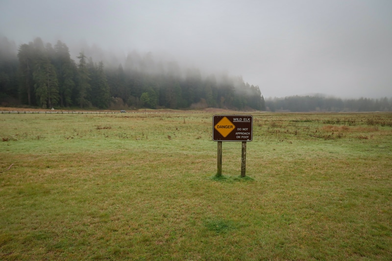
Majestic Roosevelt elk also commonly roam the woods, along with the occasional black bear.
Keep reading to learn everything you need to hike the James Irvine Trail and how to make the most of your visit to Fern Canyon!
What Type Of Hiker Are You? [Free Quiz]
But first, before we get into our James Irvine Trail hiking guide, I want to share a free personality quiz I think you’ll love.
It’s called “What type of hiker are you?” and it will help you discover your hiking personality. Bonus: Your results also share trail suggestions based on your quiz responses!

On that note, let’s dive into how to enjoy one of the best hikes in the world!
James Irvine Trail – Essential Information
The James Irvine Trail is advertised as a 4.5-mile (7.2-kilometer) trail one-way – but in my experience the hike was closer to 5 miles (8 kilometers). This brings the roundtrip total to about 10 miles (16 kilometers).
Distance: 10 miles (16 kilometers) roundtrip; 11 miles (17.7 kilometers) if you go all the way to the beach
Elevation Gain: 1,400 feet (427 m)
Difficulty: Moderate to Strenuous
Season: Year-round
Duration: 4-8 hours
Type of Hike: Out-and-back to the Fern Canyon Loop
James Irvine Trail Hiking Surface: Primarily a dirt path with some tree roots, bridges and stairs
Fern Canyon Hiking Surface: A creek bed with water and some blowdowns to navigate
James Irvine Trail Map & Navigation
Even though the James Irvine Trail is fairly straight-forward and well-signed, you should always bring a map when hiking in the backcountry. You can pick up a paper map at the Prairie Creek Visitor Center or download one online before hitting the trail.
Or better yet, do both!
While cell reception is available throughout some of Prairie Creek Redwoods State Park, most of the areas along the James Irvine Trail have no connectivity. Be sure to download maps to your phone in advance.
If you are using a phone for navigation, bring a portable battery such as the Anker portable battery charger and protect it from the rain and elements.
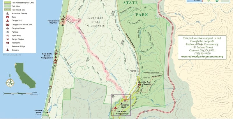
AllTrails is a good resource for online hiking maps, too, and you can also search on Google Maps here.
Preparing To Hike The James Irvine Trail To Fern Canyon
Before embarking on this or any hike in the backcountry, remember that you are entering a rugged outdoors environment and prepare accordingly.
Pack a lunch, bring plenty of water and snacks, and wear sturdy hiking shoes. Check the weather forecast and make sure you’re prepared for the weather conditions with plenty of layers as appropriate.
Familiarize yourself with proper hiking bathroom etiquette before hitting the trail and be sure to leave no trace of your visit behind.
Once the James Irvine Trail reaches Fern Canyon, be forewarned that the path follows a creek bed for the rest of the hike. You may have to scramble over or around some blowdowns and your feet will probably get wet.
Some hikers like to bring along a pair of hiking sandals for this portion of the trek.
Recommended Hiking Gear For The James Irvine Trail
Wondering what to wear going hiking or what essentials to bring? This list includes some of my favorite gear for day hikes in the woods.
- Hiking Shoes – Sturdy hiking shoes are important. I’m a big fan of Altra Lone Pe43ak Trail Running Shoes and pair them with hiking gaiters to keep rocks from getting into my shoes.
- Socks – Good thick socks are key. I usually wear a pair of double-walled Wrightsock Coolmesh II socks with my Altras. For longer hikes, I switch to Injinji Outdoor Midweight toe socks to prevent toe blisters.
- Backpack – I love Osprey backpacks and use the Osprey Manta pack — which is technically a men’s pack because I have a longer torso than most women. The women’s equivalent is the Osprey Mira pack.
- Hiking Poles – Hiking poles reduce pressure on your joints and help maintain your balance if you trip. My current favorites are the LEKI Micro Vario Carbon Trekking Poles because they are super lightweight and portable.
- Raingear – Raingear is essential when hiking in a rainforest. My favorite rain jacket is the Outdoor Research Helium II jacket since it is very lightweight.
- Camera – I love taking photos and always bring a camera along on my hiking trips. I use the Canon PowerShot G7X Mark III because it is super portable yet has many advanced features.
When To Hike The James Irvine Trail To Fern Canyon
The James Irvine Trail is available year-round. The trail’s location near the California coast means that it typically doesn’t see snow and the path is usually easy to access during all seasons.
In the summer months, footbridges are installed over the creek to make it easier to navigate. While the weather is driest in the summer months, it is also the most crowded at that time.
Avoid the crowds and hike during spring, autumn or winter. If hiking in the off-season, be sure to check the forecast ahead of time and be prepared for rain and mud.
Before heading out during winter months, be sure to check on trail and road conditions first.
Sometimes hikes into the canyon are limited after heavy rainfalls. Stop by one of the visitor centers or check the Redwood National and State Parks website for current conditions.
James Irvine Trail Parking & Trailhead
The James Irvine Trailhead is located directly behind the Prairie Creek Redwoods Visitor Center in Prairie Creek Redwoods State Park, which should definitely be on your list if you’re planning a trip to California!
While full-day parking is available at the Visitor Center, it is somewhat limited. There is plenty of parking for any-sized vehicle along the Newton B. Drury Scenic Parkway, however.
No fee or parking pass is required to park at the Visitor Center.
The Visitor Center is located one hour’s drive north of Eureka, California along Highway 101 on Newton B. Drury Scenic Parkway.
Prairie Creek Redwoods State Park is unique in that it is managed cooperatively by the National Park Service and the California Department of Parks and Recreation. It is part of the Redwoods National and State Parks unit, along with Del Norte Coast Redwoods State Park, Jedediah Smith Redwoods State Park, and Redwood National Park.
To complete your California redwood experience, be sure to drive the Avenue of the Giants auto tour through Humboldt Redwoods State Park. Avenue of the Giants is located about 40 minutes south of Eureka along Highway 101.
James Irvine Trail Alternative: Fern Canyon Loop via Gold Bluffs Beach
If you can’t hike the James Irvine Trail, you can still access Fern Canyon by driving to Gold Bluffs Beach and parking at the day-use area. From here, hiking through Fern Canyon is an easy 1-mile loop hike.
This is the most popular way to access the beach, however, so be prepared for crowds. Arrive in the early morning or late in the day if possible.
Be aware that driving to Gold Bluffs Beach requires navigating dirt roads that are narrow and bumpy. The road is often closed during winter months.
The road crosses a creek in a few spots and may be difficult to access for low-clearance vehicles. RVs and vehicles towing trailers are prohibited.
A fee applies when parking at the Gold Bluffs day-use area, though National Park Service and California State Park passes are accepted.
What Hiking The James Irvine Trail To Fern Canyon Is Really Like
Now that I have gotten all of the essential details out of the way, it’s time to dive into the good stuff. Read on for a detailed account of how to hike the James Irvine Trail.
The Beginning Of The James Irvine Trail
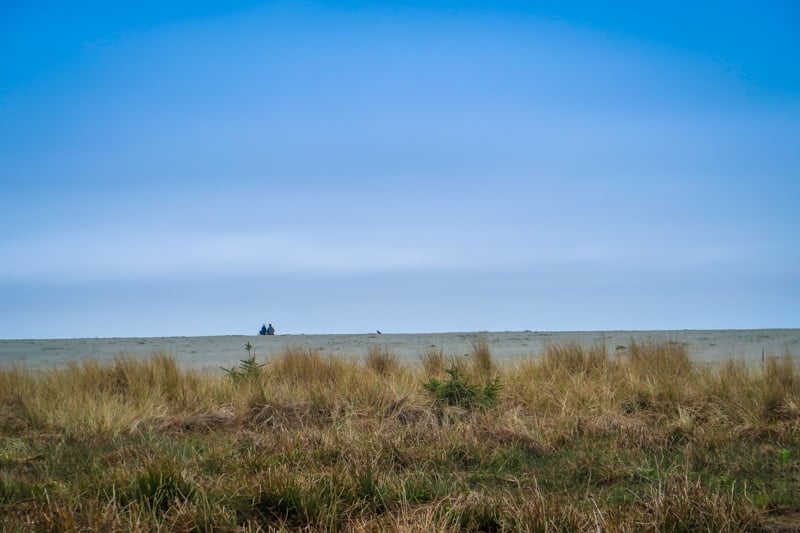
The trail begins at the Prairie Creek Visitor Center. Keep an eye out for elk in the nearby field as they like to graze in this area.
Walk behind the visitor center to locate the official trailhead. There is a great network of nature trails here that are fun to explore if you have the time.
After crossing a picturesque wooden bridge over Prairie Creek, the trail loops in an arc behind the visitor center.
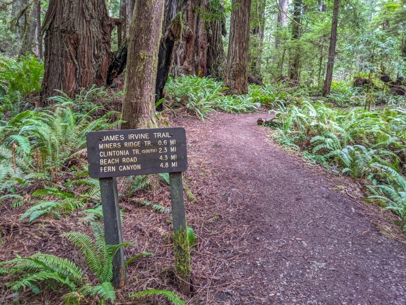
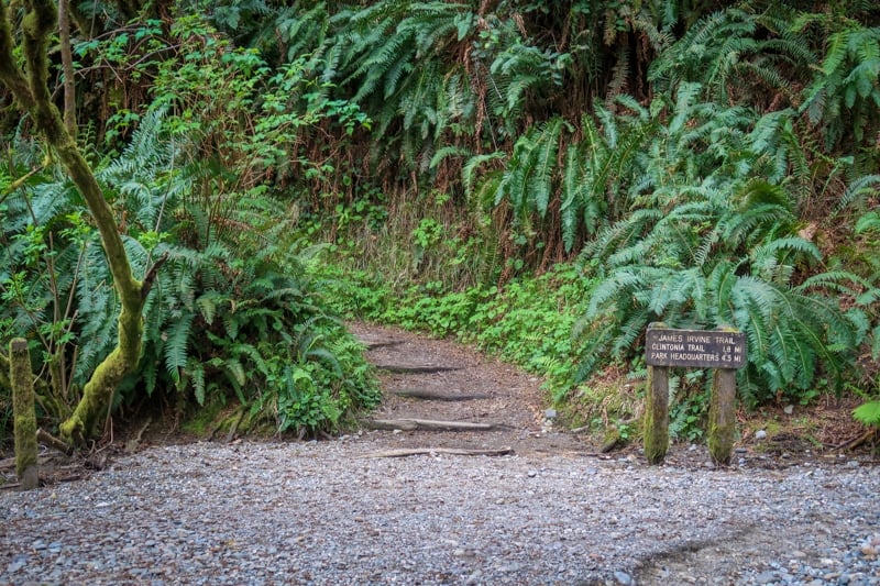
At .2 miles (320 m), the James Irvine Trail begins. Here, the path tees off from the interpretive trail and heads northwest towards Fern Canyon.
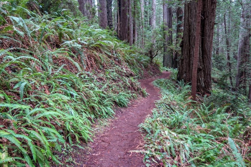
Hiking Among Giant Trees In Prairie Creek Redwoods State Park
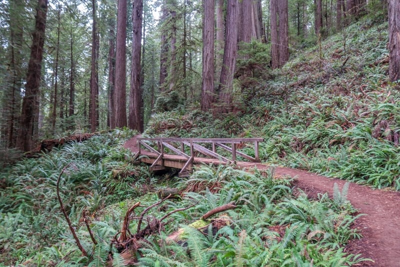
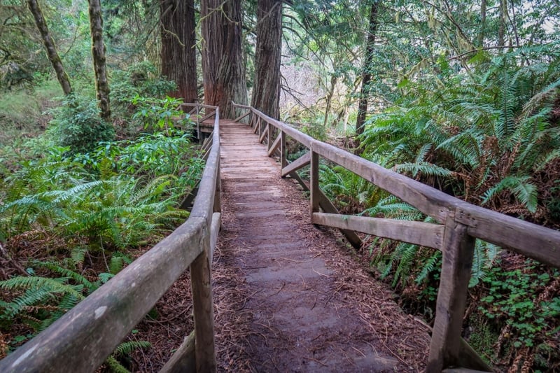
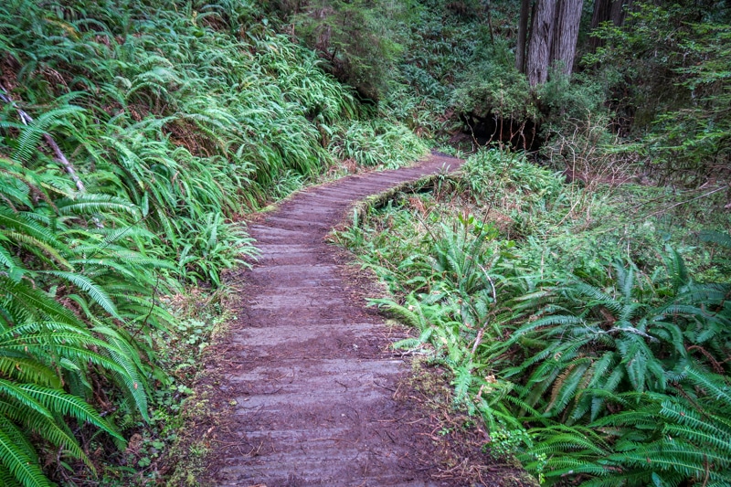
The James Irvine Trail follows the gentle drainage of Godwood Creek through a lush forest of towering redwood trees.
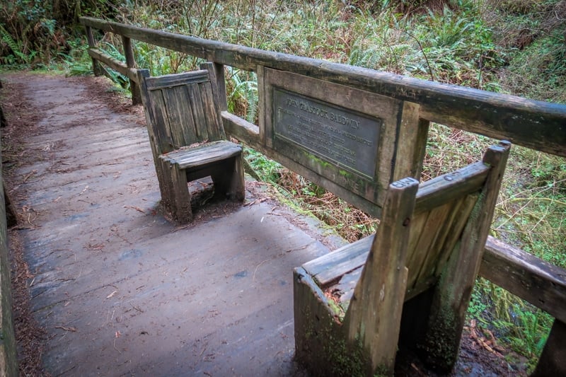
The hike winds through the ancient forest on a dirt path that is lined with brilliant green ferns while crossing the occasional footbridge.
Watch your step after it rains as sections of the trail can become muddy.
The trail slopes gently uphill for the first 1.5 miles (2.4 kilometers) or so before eventually cresting a ridge. After this point, it is mostly downhill until you reach Fern Canyon.
While the trek is well-signed and easy to follow, be on the lookout for junctions to the Miner’s Ridge and Clintonia Trails. These are great alternate routes on the return trip if you want a change of scenery.
As the James Irvine Trail nears the ocean, the old-growth redwood trees give way to a forest of coastal spruce trees.
A boardwalk crosses a marshy area here where you can find sword and deer ferns along with skunk cabbage, saxifrage, and salal.
After 4.6 miles (7.4 kilometers), the trail intersects the upper portion of the Fern Canyon Trail.
You can either descend the steps to Fern Canyon along the upper trail, or continue along the James Irvine Trail to its terminus. Then you can loop back through Fern Canyon on the return hike.
This hiking guide describes the former option.
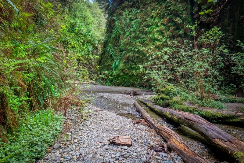
The Magic Of Fern Canyon
After descending the steep path and losing 150 feet (45 m) of elevation, you will finally arrive in Fern Canyon!
Here, the trail ends at the stream bed and the fun really begins. Simply follow the creek as it flows west towards the Pacific Ocean.
While there are some paths along sand bars and the canyon’s edge, this isn’t always the case. It will be difficult to keep your feet dry unless seasonal bridges are installed.
Watch out for fallen logs and other debris that block the canyon’s path. Sometimes you can walk along logs to keep your feet dry, but it may involve some scrambling.
After following the creek for a short while, the creek turns a corner and the scenery changes.
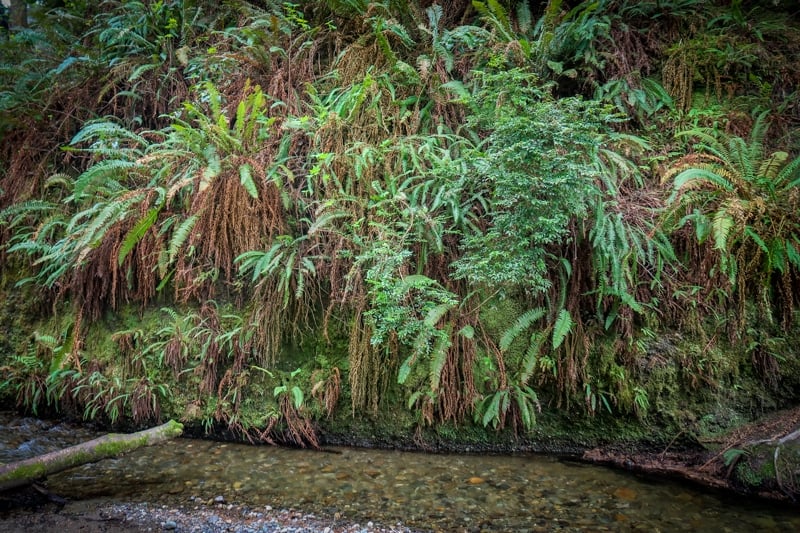
Suddenly you are standing in a narrow canyon with 50-foot (15-meter) walls covered in ferns and moss. During the rainy season, water oozes and drips down the walls.
The breathtaking scenery reminds me of hiking the Pacific Crest Trail, where I was constantly in awe of the natural beauty surrounding me.
Take your time to admire the fern species here — some of which have an ancestry that is 325 million years old.
Eventually, the path leads to the opening of the canyon and the western trailhead for the James Irvine Trail. If you wish to turn back here, take a right.
However, I recommend continuing on to the beach!

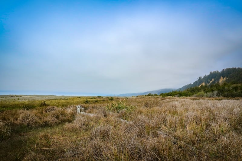
Relaxing On Gold Bluffs Beach
To access the beach, simply take the left-hand path at the end of Fern Canyon. I had a hard time finding it during my visit, but it is right across from the James Irvine Trailhead.
The trail to the parking area is broad and easy to follow. After about a half-mile (.8 kilometers), you’ll reach the parking lot.
There are outhouses here as well as some picnic tables and access to Gold Bluffs Beach, where you can walk along the sand and rest your weary feet in the Pacific Ocean.
For a fun camping experience, continue on to the Gold Bluffs Beach campground.
A backcountry site is available for the exclusive use of hikers and bikers. Be sure to register for a backcountry permit first to enjoy this unforgettable adventure travel experience!
The Return Hike
While you can simply return the way you came, there are several other options.
The first is to arrange for a car to pick you up at Gold Bluffs Beach. Or, if you do the hike with a buddy, you can drop one car off at the beach first so that it is waiting for you when you arrive.
The second option is to return to Prairie Creek via the Miner’s Ridge Trail Loop.
To follow this route, hike south for 1.5 miles (2.4 kilometers) until you reach the campground and access the Miner’s Ridge Trailhead. This will add an extra 3 miles (4.8 kilometers) onto your hike.
A third option is to return via the James Irvine Trail but to hike up the ridge on the Clintonia Trail. This eventually leads to the Miner’s Ridge Trail and adds 2 extra miles (3.2 kilometers) to your overall hike.
Accommodation Near Prairie Creek Redwoods State Park
Now that we’ve talked about how to hike the James Irvine Trail to Fern Canyon, let’s discuss where to stay.
Click here for a list of hotels near Prairie Creek Redwoods State Park!
Prefer self-contained stays?
Click here to check out unique local rentals!
You can also use this map to search for local stays:
Renting A Car For California Hiking Trip
The best way to explore all that California has to offer is by car, as this will allow you to experience numerous hiking trails, parks, and attractions.
My recommendation: Use Discover Cars to quickly compare your car rental options.
Their comparison tool does the homework for you, so there’s no need to have up 10+ tabs trying to figure out which company is the most affordable. Actually, you can save up to 70% using their tool!![]()
Using a platform like this makes it easy to bring your group and solo road trip ideas to life on a budget! I also used this platform when planning a California road trip.
California Travel Insurance
When visiting California, it’s wise to get travel insurance to protect yourself and your trip.
If you’re looking for something straightforward, comprehensive, and budget-friendly, SafetyWing is an excellent choice. They offer two plan options:
🟡 Essential, for mid-to-short-term travelers
- Covers emergency medical care, trip delays, and evacuations
- Flexible 28-day subscription or fixed-date coverage for specific trips
- Add-ons available for adventure sports, electronics theft, and U.S. coverage
🔵 Complete, for long-term travelers and digital nomads
- Includes most Essential benefits, plus routine care, mental health support, and maternity coverage
- Covers you both abroad and in your home country
- Comes with adventure sports coverage, cancer screenings, outpatient services, and therapies like chiropractic care
➡️ Click here to compare plans and protect your trip.
Other California Hikes
Looking to explore other California hiking trails? A few not-to-miss trails include:
- Lost Horse Mine in Joshua Tree National Park
- Hidden Valley Nature Trail in Joshua Tree National Park
- Mount Whitney in the Sierra Nevadas
- The Lakes Trail in Sequoia National Park
- The Moro Rock Trail In Sequoia National Park
- Sentinel Dome to Glacier Point in Yosemite National Park
- The Columbia Rock Trail in Yosemite National Park
- Vernal And Nevada Falls In Yosemite National Park (Mist Trail)

Have you hiked the James Irvine Trail to Fern Canyon?
Enjoyed this guide to hiking the James Irvine Trail? Pin it for later!