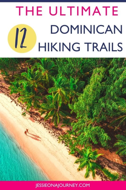
Dominican Republic Hiking: 12 Amazing Trails Not To Miss
This post contains affiliate links, including Amazon affiliate links. If you purchase through these links, I may earn a commission at no extra cost to you. As an Amazon Associate, I earn from qualifying purchases. Thank you for your support!
Curious about Dominican Republic hiking?
Then you’re in the right place!
The Dominican Republic is famous for its all-inclusive resorts and endless beaches, but what many people don’t realize is that there are spectacular sights, unique things to see and unbelievable natural treasures you can reach through hiking.
Roaring waterfalls, gorgeous panoramic viewpoints, and pristine beaches are just some of the highlights awaiting you.
To give you a better overview of what is possible, the following list includes the 12 best hiking trails in the Dominican Republic, including some of the most spectacular trails you can find when visiting the Caribbean.
I’m a local of the Dominican Republic, and I can’t wait to share some of my favorite hiking spots with you!
Quick tip: Whether you’re hiking solo or in a group, it’s smart to keep safety in mind. One piece of advice is to carry a She’s Birdie Personal Safety Alarm, which features a 130db alarm and flashing strobe light designed to deter an attack. It’s a top safety essential whether hiking, at home, or traveling.
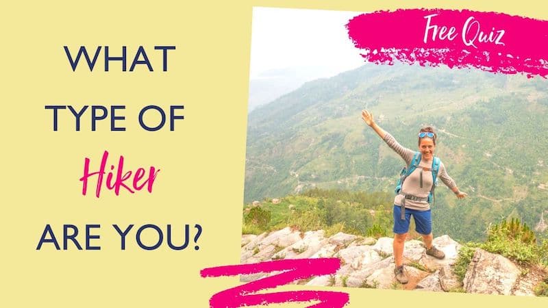
What Type Of Hiker Are You? [Free Quiz]
But first, before we dive into our guide to hiking in the Dominican Republic, I want to share a free personality quiz I think you’ll love.
It’s called “What type of hiker are you?” and it will help you discover your hiking personality. Bonus: Your results also share trail suggestions based on your quiz responses!
On that note, let’s dive into how to enjoy one of the best hikes in the world!
A Map Of The Dominican Republic
The Dominican Republic is located on the island of Hispaniola in the Caribbean. It sits between the Caribbean Sea and the Atlantic Ocean and shares a border with Haiti to the west.
When it comes to exploring the hiking trails of the Dominican Republic, having a map and understanding where you are is smart. This map offers a good starting point for getting a lay of the land:
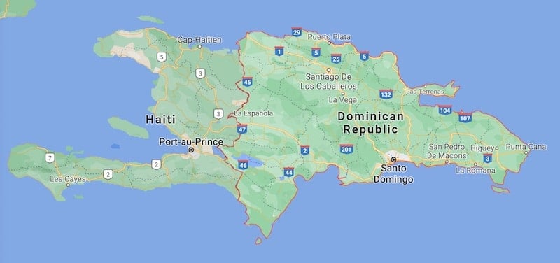
Additionally, you can click here for an interactive Dominican Republic map that allows you to plug in your destination and even the trails you’ll be hiking.
Moreover, you can use this map to plan an adventurous Dominican Republic road trip and explore numerous hikes from the below list!
Dominican Republic Hiking: What To Expect
Hiking in the Dominican Republic can’t be compared with hiking in your home country, especially in =North America, Europa, or Australia.
While you might be used to marked trails, proper signage, and in-depth hiking maps, the Dominican Republic usually has none of these. That’s why it is important to either go with a high-tech GPS or a local hiking guide who can take you to all the destinations mentioned below. This is true whether you’re in a group or on a solo Caribbean vacation.
The price of a guide varies widely depending on the area as well as the difficulty and the length of the trail, but a good ballpark figure is a price of either 1000 Dominican pesos per person or 2500 Dominican pesos per group for a four-to-six-hour hike.
It is also important to always head off with plenty of water — three liters minimum, as the Caribbean heat can be brutal — and some snacks in case you need a quick energy boost. Moreover, you should understand what to wear when going hiking to stay safe and temperate.
In terms of cost, most hiking trails in the Dominican Republic are free. This makes it more economic to explore the country on foot and shows that this area of tourism is still not properly developed and very authentic.
But which destinations can you reach hiking?
Let’s have a look at the best hiking trails in the Dominican Republic. Below, hikes are grouped by difficulty level so that you can find the trails best suited to you.
The Best Easy Hiking Trails In The Dominican Republic
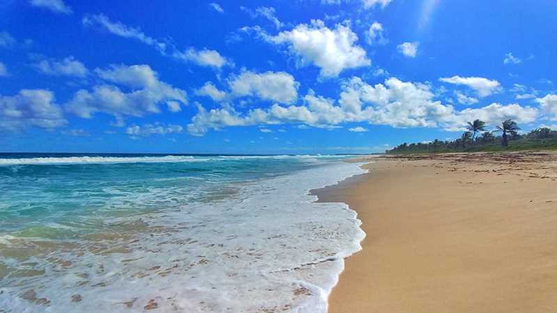
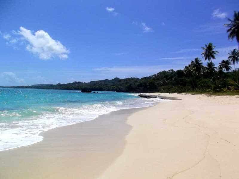
1. Punta Cana Beach Walk (Punta Cana)
Highlights: Multiple marvelous beaches and ocean views
Length: Adjustable; up to 12 miles one-way
Elevation profile: Totally flat
Signposting: Not necessary
How to get there: Just exit your hotel in the Bávaro beach resort area of Punta Cana and walk in either direction of the beach
Trail map: Click here for a Punta Cana Beach Walk trail map
About This Dominican Republic Hiking Trail:
If you’re looking to go hiking in Punta Cana, this is a scenic and easy option that is also safe for those hiking alone.
In fact, this trail doesn’t involve any trips into remote areas, and it’s even possible for visitors staying in the all-inclusive resorts in Punta Cana: a walk along the endless beaches of Punta Cana.
While this may not sound like much of an adventure travel option at first, this scenic walk can easily be extended to a day hike thanks to the endless beaches in this area. In fact, you can walk 12 miles along the beach with your feet never leaving the sand! It’s by far the best of the hiking trails in Punta Cana for those with any mobility issues.
Depending on what you’re looking for, a beach hike in Punta Cana can be an exciting activity — especially considering the numerous gorgeous views you’ll see during this day.
In short, make sure to add walking the coastline to your Punta Cana itinerary!
2. Montaña Redonda (Punta Cana)
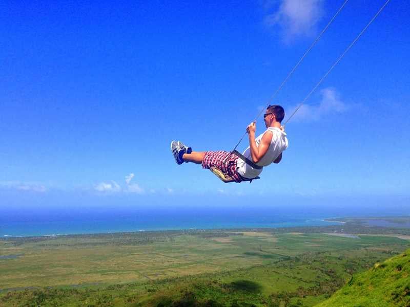
Highlights: Unique photo opportunities with the swings on the edge
Length: A bit more than a mile one-way
Elevation profile: A tough climb of about 800 feet
Signposting: Not available, but from the parking lot you can follow the only trail leading up the mountain
How to get there: The trail starts at the parking lot of Montaña Redonda, which is about 1 hour away from Punta Cana
Trail map: Click here for a trail map for Montaña Redonda
About This Dominican Republic Hiking Trail:
Here is another great and easy option if you want to explore the outdoors in Punta Cana. It’s one of the most popular Punta Cana hikes.
This Dominican Republic hiking trail — which is about an hour away from Punta Cana — leads to a unique mountain, which offers a spectacular 360-degree panorama of the surrounding Cordillera Oriental (part of the Colombian Andes), the ocean, and lush vegetation.
Furthermore, Montaña Redonda features giant swings and hammocks on the edge of the mountain which allow for unique photo opportunities.
The hike is easy to find and not particularly long — though it’s pretty steep, so prepare for a good sweat.
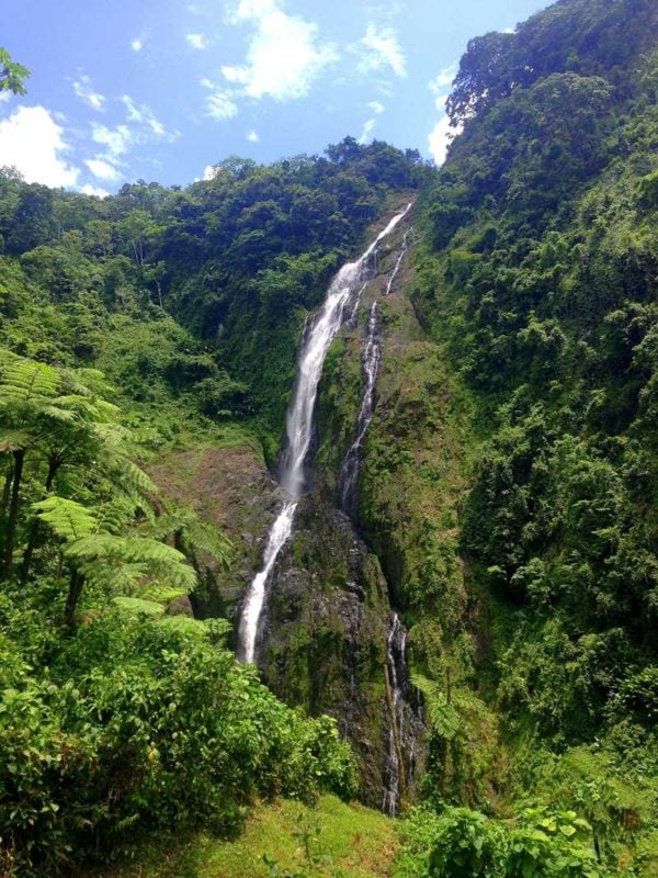
3. Salto Jimenoa (Jarabacoa)
Highlights: Beautiful nature and a waterfall to refresh
Length: Less than a mile one-way
Elevation profile: About 600 feet each way — first down then back up
Signposting: The parking lot of Salto Jimenoa can be easily found on Google Maps, and the walk down to the waterfall is obvious and hard to miss
How to get there: The trail starts at the parking lot of Salto Jimenoa, about 15 minutes away from Jarabacoa
Trail map: Click here for a trail map for Salto Jimenoa
About This Dominican Republic Hiking Trail:
If you’re looking for Dominican Republic waterfalls, this hike is for you!
Salto Jimenoa is close to Jarabacoa and is one of the best waterfalls if you are looking for a moderate hike in the Dominican Republic with beautiful nature and a few twists.
The path follows an easy-to-follow trail down into a canyon where the Salto Jimenoa Waterfall creates a wonderful natural swimming pool you can dip into.
However, it is recommended to keep a bit of energy for the way back, as going up will be much more exhausting than the way down. It is still a beautiful hike for everyone in moderate shape.
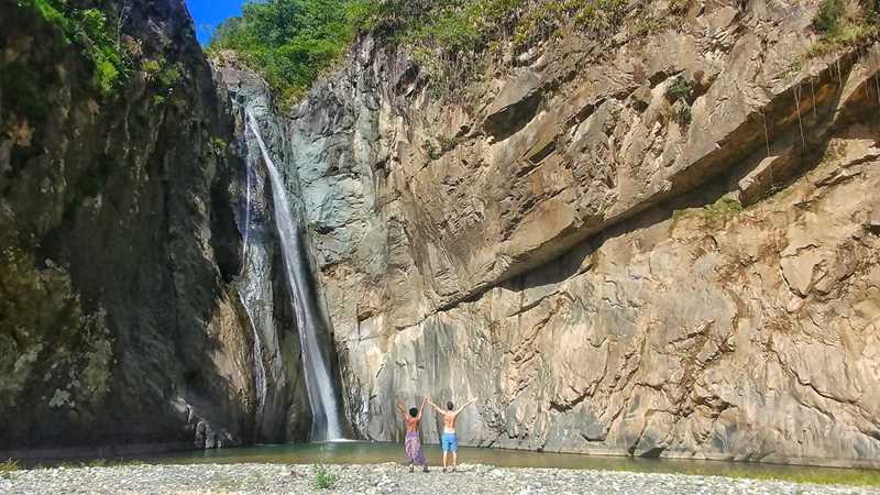
4. Salto El Limon (Samaná)
Highlight: The waterfall is simply beautiful and makes for stunning photos
Length: Between 1 and 3 miles each way depending on the trail you choose
Elevation profile: It does have some short ups and downs, but it is not a steady climb compared to other Dominican Republic hikes
Signposting: There is a map at the beginning of each hike and signs on the trails, but not all junctions are signposted
How to get there: There are 5 different trailheads along the road from El Limón to Santa Barbara de Samaná
Trail map: Click here for a trail map for Salto El Limon
About This Dominican Republic Hiking Trail:
Salto Jimenoa is pretty, but Salto El Limón is one of the most gorgeous Dominican Republic waterfalls you can find in the country.
Particularly when you go early and arrive before 9am, you usually have the entire waterfall to yourself. This means you can enjoy some of the most spectacular scenery in the Dominican Republic, especially as Salto El Limón is incredibly picturesque.
The trail to Salto El Limón is interesting and is characterized by everything that makes hiking in the Dominican Republic unique: beautiful vegetation, lush mountains, muddy paths, and exciting river crossings.
There are five different hiking trails to Salto El Limón, ranging from 30 to 75 minutes each way.
The Best Hikes In The Dominican Republic With Medium Difficulty
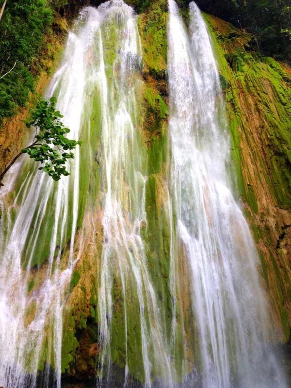
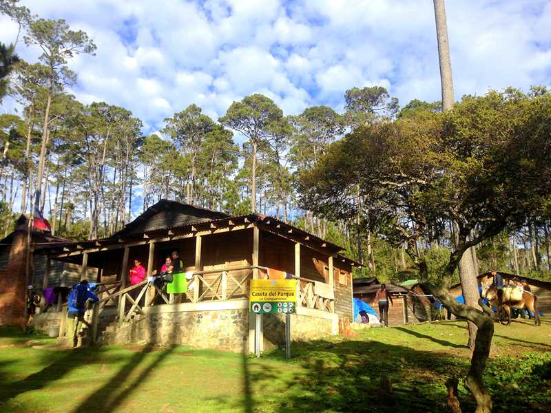
5. La Rejolla (North Coast, Puerto Plata)
Highlight: If one waterfall is not enough, you’ll be happy to know this hike showcases four spectacular Dominican Republic waterfalls
Length: approx. 2 miles one-way
Elevation profile: Hilly with just a few up and downs
Signposting: None
How to get there: The trailhead is located in Camú, about 20 minutes away from Puerto Plata
Trail map: Click here for a trail map for La Rejolla
About This Dominican Republic Hiking Trail:
As you’re probably starting to see, planning a trip to the Dominican Republic should absolutely include visiting a few waterfalls.
In fact, let’s start this section with another gorgeous waterfall — or even better, four of them!
La Rejolla is a series of beautiful waterfalls fed by a turquoise river in the Cordillera Septentrional, a mountain range running parallel to the DR’s North Coast. This is close to Puerto Plata, which is similar to Punta Cana in terms of its focus on all-inclusive resorts.
La Rejolla is one of my favorite hikes in the Dominican Republic because it is not well-known, isn’t too difficult, and comes with truly spectacular scenery.
The four waterfalls you encounter on this hike are all connected by one trail that continuously follows a river, resulting in a particularly beautiful hike.
There are a few little twists along the trail — such as a six-foot-high wall you have to climb. But with indentations and rocks to pull yourself up, it is doable if you are in average shape.
Furthermore, the trail is sometimes a bit hard to find so it is recommended to go with a local guide.
Your reward will be four completely different waterfalls, which all come with natural swimming pools and plenty of photo opportunities.
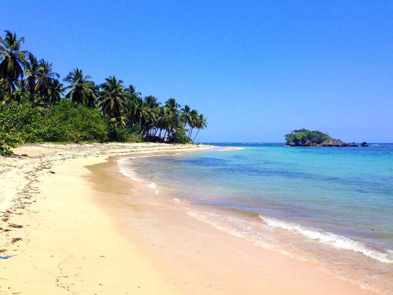
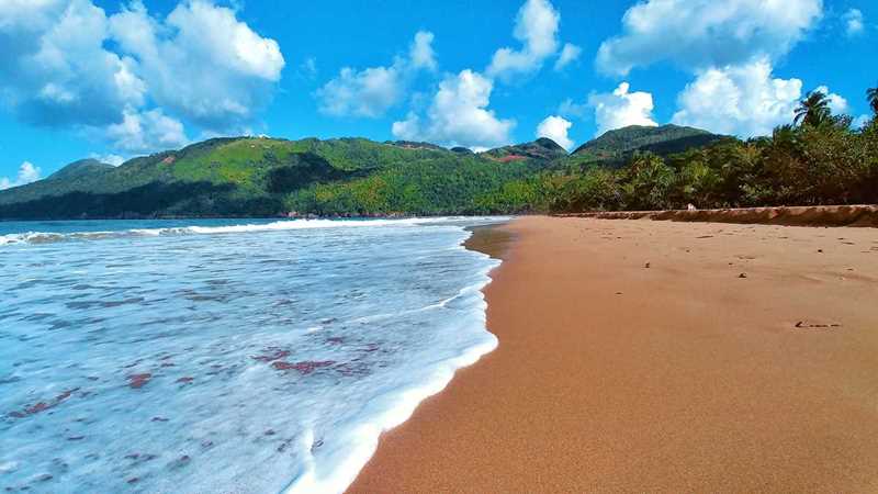
6. 7 Beaches Hike (Samaná)
Highlight: Hiking along seven gorgeous Caribbean beaches
Length: 4-5 miles one-way; return is not necessary if you take a boat or a taxi back
Elevation profile: Mostly flat with a few hills
Signposting: None
How to get there: You can hike this trail either way, starting from Las Galeras or Playa Rincón
Trail map: Click here for a trail map for 7 Beaches Hike
About This Dominican Republic Hiking Trail:
If you prefer shoreline over waterfalls, the Samaná Peninsula has you covered with some amazing beach hikes.
One of them –- and probably the most beautiful -– is a hike along seven different gorgeous beaches from Las Galeras to Playa Rincón. Most of these beaches are completely pristine and the destination of the hike, Playa Rincón, is one of the most beautiful beaches in the Caribbean.
This hiking trail continuously takes you along the ocean — sometimes directly on the beach, sometimes in a coconut grove behind it, and sometimes a little bit up a hill.
You’ll likely have most of the beaches along the trail completely to yourself, too.
At the end, it’s recommended to relax at one of the local beachfront shacks on Playa Rincón with a meal of fresh fish and a cold drink.
7. Playa Ermitaño (Samaná)
Highlight: Having a Robinson Crusoe beach all for yourself
Length: About 1 mile one-way
Elevation profile: A steady up and down hike
Signposting: None
How to get there: From El Limón — which is 30 minutes away from Las Terrenas — head towards Agua Sabroso and from there continue to Playa Las Canas
Trail map: Click here for a Playa Ermitaño trail map
About This Dominican Republic Hiking Trail:
Another fantastic beach hike in the Dominican Republic is the one to Playa Ermitaño, which is also located on the Samaná Peninsula.
Playa Ermitaño is one of the most remote beaches on the peninsula, as it is only reachable by a 1.5-hour walk or by boat.
The beach is divided into two parts that are connected by another 20-minute hiking trail.
Playa Ermitaño is what comes closest to most people’s imagination of a perfect Robinson Crusoe beach all to yourself — likely without any people at all.
The hike to Playa Ermitaño is pretty interesting as it starts right at another two-mile pristine beach, Playa Las Cañas. From here, you scramble over cliffs, traverse tropical fruit and vegetable plantations, and climb up to a lovely viewpoint.
8. Salto de la Jalda (Miches)
Highlight: Seeing the highest waterfall in the Dominican Republic
Length: 5-6 miles one-way
Elevation profile: Mostly flat, except for some short inclinations at the end
Signposting: None
How to get there: The trailhead is located in Magua, halfway between Miches and Sabana de la Mar
Trail map: Click here for a Salto de la Jalda trail map
About This Dominican Republic Hiking Trail:
Salto de la Jalda is one of the longest hikes on this list of the best hiking trails in the Dominican Republic, but it is absolutely worth it.
It only makes it into the “moderate” section of our Dominican Republic hiking guide because it is mostly flat, passing tons of cocoa plantations.
That being said, you should be prepared to walk a lot, as it is a five-mile walk one-way if you are arriving with an SUV. Add one or two miles to that if you’re coming with a regular Sedan car since you’ll need to park farther away from the trailhead.
But the reward of this long hike is completely worth it, as you will get to see the highest waterfall in the Dominican Republic and probably also in the Caribbean (the latter stat is often disputed).
Furthermore, you will have this stunning beauty all for yourself, as on most days less than a dozen people are visiting Salto de la Jalda.
The Best Difficult Hikes In The Dominican Republic
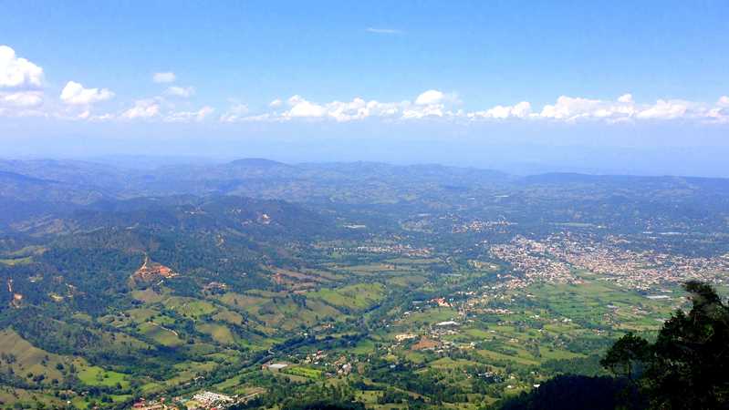
9. El Mogote (Jarabacoa)
Highlight: A fantastic view from the top
Length: 3 miles each way
Elevation profile: A steep mountain climb with a total elevation gain of 3,000 feet
Signposting: The trailhead is marked; later there is a junction where you should take the left fork
How to get there: The trailhead is located just a few kilometers out of Jarabacoa
Trail map: Click here for an El Mogote trail map
About This Dominican Republic Hiking Trail:
El Mogote is a prominent mountain close to Jarabacoa offering spectacular 360-degree views of the Jarabacoa valley and the surrounding majestic mountains.
It is a quick hike that needs a maximum of half a day, but it is very steep and gets a bit technical — especially when it’s wet and muddy. This Dominican Republic hike is not recommended when it is raining.
Your reward for this steep and sweaty climb is fantastic panorama views.
Furthermore, the trailhead is easily accessible with a motoconcho (a Dominican motorcycle taxi) or even by public transport.
10. Pico Duarte (Cordillera Central)
Highlight: Reaching the highest point in the Caribbean
Length: 28 miles return is the shortest approach to reach the peak
Elevation profile: A long and steady climb with more than 7,500 feet of elevation change each way
Signposting: Occasional maps along the way, but it is mandatory to go with a guide anyway
How to get there: There are five different entry points for the Pico Duarte and you need to hire a local park ranger or book a guided tour to do this hike
Trail map: Click here for a Pico Duarte trail map
About This Dominican Republic Hiking Trail:
Once you have successfully tackled El Mogote, you can head to the top of the Caribbean, the Pico Duarte.
At over 10,000 feet, it is the highest mountain in the entire Caribbean and allows views of the awe-inspiring Central Mountain Range.
Hiking Pico Duarte requires a two-to-three day excursion with a certified national park guide.
For peace of mind, it is easiest to book an organized tour with one of the specialized mountain tour operators, who provide you with all the equipment — including sleeping bag, mats, food, and more.
Note that while the hike is not very technical, it is very long. The shortest approach is around 14 miles one-way and it is a very long and steady climb with a total elevation change of around 6,000 feet.
If you prefer a more varied itinerary, you can also start at one trailhead and end at another, as there is a total of five different ways to reach Pico Duarte.
Be prepared for some pretty low temperatures even though you are still in the Caribbean. Especially during the high season from December to March, temperatures can drop to freezing.
11. From Playa Rincón To Playa El Valle (Samaná)
Highlight: Exploring nature at its wildest
Length: 9-10 miles one-way; it’s recommendable to take public transport or a taxi for the way back
Elevation profile: About 1,500 feet of uphill hiking
Signposting: None
How to get there: The trail can be done either way, from Playa Rincón or Playa El Valle
Trail map: Click here for a Playa Rincón to Playa El Valle trail map
About This Dominican Republic Hiking Trail:
Do you remember the 7 Beaches Walk from Las Galeras to Playa Rincón mentioned above? Well, there is a more challenging “second stage” starting at Playa Rincón that takes you to the next beach, Playa El Valle, which another one of Samanás wonderful beaches.
This trail leads you up to one of the highest points of the Samaná Peninsula at around 1,200 feet, offering breathtaking views before you descend through banana plantations and wild tropical jungle to the serene beach of El Valle.
While the description of this hike doesn’t sound very difficult, parts of the trail are often covered in knee-deep mud, which makes it particularly challenging to tackle.
That being said, once you arrive to the beautiful El Valle Beach and enjoy a fresh coconut with an ocean view, you’ll know why you have done it.
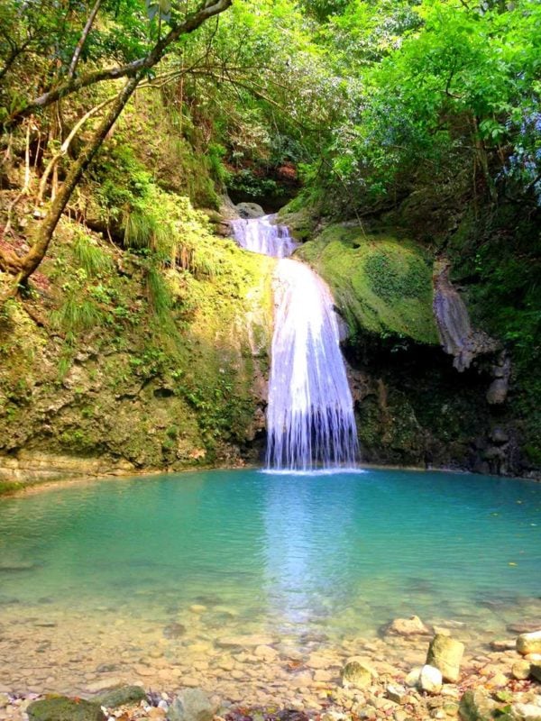
12. Canon de Arroyo Frio (North Coast, Jamao Al Norte)
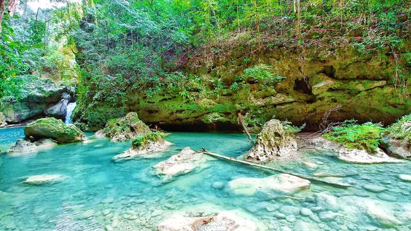
Highlight: Exploring a river and more than 50 natural swimming pools, cascades, and waterfalls
Length: 4-5 miles
Elevation profile: You’re following a river so it is mostly flat and downhill
Signposting: None
How to get there: The trailhead is located close to Jamao al Norte — about 30 minutes away from Cabarete — and you need a guided tour for this hike
Trail map: Click here for a Canon de Arroyo Frio trail map
About This Dominican Republic Hiking Trail:
By now you’ve done a lot of Dominican Republic hiking, so why not combine your trekking experience with some serious water fun while challenging your fitness skills?
Cañon de Arroyo Frio is a canyon with a clear and turqouise river in the Cordillera Septentrional Mountain Range close to Cabarete. With a guide, you can hike along this canyon — most of the time in the water, including many sections where you have to wade, swim, and jump
Traversing Canon de Arroyo Frio is endless fun as you are passing more than 50 natural swimming pools, cascades, and waterfalls.
The highest waterfalls are over 20 meters (66 feet) high, and the tour includes optional jumps from 10 meters (33 feet) and higher into the water.
While the distance of the canyon is not the biggest challenge, spending an entire day walking in the river on slippery stones and in fresh mountain water can really test your physical fitness.
That being said, you won’t regret it considering the untouched nature you will be surrounded by the entire day.
Dominican Republic Hiking Tours
Prefer to explore the local Dominican Republic hiking trails with a guide? The following local tours are great options:
- Hiking Tabernacle Thundering Waterfall in Dominican Republic (Santo Domingo)
- National Park of the East Private Hiking Tour with Swimming (Santo Domingo)
- Hike and Kayak Tour in the Los Haitises National Park (Villa Riva)
- The 27 Waterfalls of Damajagua Private Adventure (Puerto Plata)
- Admission to Scape Park for the Full Day (Punta Cana)
Click here for a full list of Dominican Republic tours.
Dominican Republic Hotels
Click here for a full list of Dominican Republic hotels!
Prefer self-contained stays?
Click here to check out unique local rentals!
You can also use this map to search for local stays. The above link and below map are currently set to Punta Cana, but you can easily change the destination to your own:
Renting A Car In The Dominican Republic
Many visitors to the Dominican Republic like to rent a car, as it allows them to explore the country’s many hiking trails and attractions on their own time.
Recommendation:Use Discover Cars to quickly compare your car rental options.
Their comparison tool does the homework for you, so there’s no need to have up 10+ tabs trying to figure out which company is the most affordable. Actually, you can save up to 70% using their tool!![]()
Just note that if you do decide rent a car in the DR you should be extremely comfortable with driving in other countries and in chaotic situations, as locals tend to make up their own rules of the road.
Dominican Republic Travel Insurance
When visiting the Dominican Republic — or anywhere else in the world — make sure to get travel insurance.
One of the best travel medical insurance for travelers is SafetyWing as they’ve got a large network and offer both short-term and long-term coverage — including coverage if you’re traveling for months as well as limited coverage in your home country.
Additionally, SafetyWing is budget-friendly and offers $250,000 worth of coverage with just one low overall deductible of $250.
Click here to price out travel insurance for your trip in just a few clicks.
Hiking in Dominican Republic FAQs
Here are the answers to some popular questions about hiking Punta Cana and beyond.
Q) Does Punta Cana have hiking?
Yes, there are many different Punta Cana hiking options, from a 12 mile beach stroll to Montana Redonda with the famous swings.
Q) Are there any waterfall hikes in Punta Cana?
The popular Salto de la Jalda is not in Punta Cana but you can take a day trip there. Be prepared for about 2 hours in the car each way.
Q) Is it safe to hike in the Dominican Republic?
Yes, hiking in the Dominican Republic is very safe. Most of these hikes are quite popular and well-maintained. Note that you should be aware of your own limitations when attempting the more challenging hikes and always follow general hiking safety precautions.
Q) Are there mountains in Punta Cana?
There aren’t any Punta Cana mountains, per say, but there are mountains nearby. For some great hiking near Punta Cana, Montana Redonda is a popular option.
Have you explored Dominican Republic hiking?
Enjoyed this post on hiking in the Dominican Republic? Pin it for later!