
16 Best South Island New Zealand Hiking Trails
This post contains affiliate links, including Amazon affiliate links. If you purchase through these links, I may earn a commission at no extra cost to you. As an Amazon Associate, I earn from qualifying purchases. Thank you for your support!
By Delilah Hart. This guide to hiking on New Zealand’s South Island contains affiliate links to trusted partners!
Looking for the best South Island New Zealand hiking trails?
Then you’re in the right place!
With raw, untouched landscapes and a vast, natural beauty, New Zealand has earned a reputation as one of the most picturesque and scenic places to visit in the world.
There are many ways to explore the country, but I reckon hiking is arguably the best. You’ll find heaps of amazing walks and hiking trails across the South Island of New Zealand — which can make it tricky to choose which ones to embark on.
Luckily, I’ve been exploring New Zealand my entire life.
To help you decide which track to choose, here are a few of my the best hikes in New Zealand’s South Island, at least in my opinion.
They all offer incredible views and vistas relative to the effort required to complete them.
What Type Of Hiker Are You? [Free Quiz]
But first, before we dive into some of the best hikes in New Zealand, I want to share a free personality quiz I think you’ll love:

It’s called “What type of hiker are you?” and it will help you discover your hiking personality.
Bonus: Your results also share trail suggestions based on your responses, helping you to explore some of the best hiking trails in the world.
South Island New Zealand Hiking Map
To help give you a lay of the land so you can better understand where the below South Island New Zealand hiking trails are located, here is a map with each one plotted:
You can also click here for the interactive version of the map to easily save these recommended New Zealand walks in South Island right to your phone.
Getting Around New Zealand’s South Island
While there are public buses in the South Island, it’ll be tricky to reach your intended trailhead without a car. Having your own vehicle ensures you can get to all of the South Island hikes on your itinerary, and on your own schedule.
Need to rent a car for your South Island hiking trip? Check out Discover Cars to quickly compare your rental options.
Their comparison tool does the homework for you, so there’s no need to have up 10+ tabs trying to figure out which company is the most affordable. Actually, you can save up to 70% using their tool!![]()
Best Time To Go Hiking In New Zealand’s South Island
While you can visit any time of year, the best time to go hiking in the South Island is generally during the summer — which for New Zealand is December to March.
This is when you’ll experience sunny and warm weather that also isn’t too hot at about 61°F to 75°F.
While you can go hiking in the South Island in winter, certain trails can become more dangerous due to snow and ice.
What To Pack For A South Island New Zealand Hiking Trip
When it comes to what to wear when hiking in the South Island, a few staples you’ll definitely want to pack include:
- Sun protection like a hat, sunglasses, sunscreen & lip balm with SPF
- Insect repellent
- Snacks & water (at least one half-liter of water per hour for a moderate hike)
- Waterproof hiking backpack
- Portable charger
- Moisture-wicking base layer
- Additional layers depending on the weather
- Moisture-wicking socks
- Waterproof hiking sneakers or boots
One important tip when doing NZ walks in the South Island is that dressing in layers is key, as the weather can change as the day goes on and as you change elevation during your hike.
Additionally, wearing moisture-wicking clothing helps to repel sweat from your skin to keep you dry, comfortable, and temperate. This step is really important for preventing hypothermia, too. You can check out REI’s collection of moisture-wicking shirts, pants, and socks.
Keep in mind, different seasons may require additional items, such as crampons if hiking an icy trail in the winter.
16 Best South Island New Zealand Hiking Trails
On that note, let’s dive into our list of unforgettable South Island New Zealand hiking trails.
The treks have been separated by difficulty to make it easier for you to choose the perfect hike for your abilities.
No matter which South Island hiking trail you pick, you’ll be rewarded with epic New Zealand scenery.
Best Easy Hikes In New Zealand’s South Island
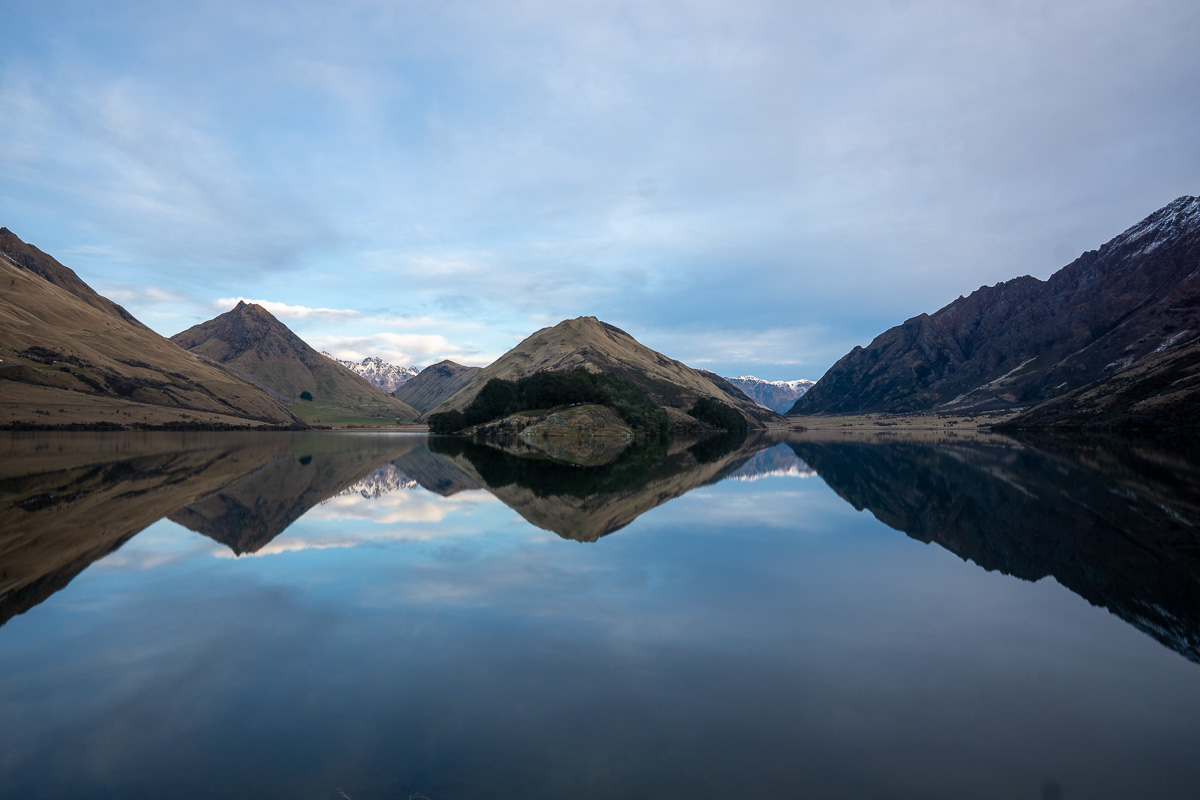
1. Moke Lake Track
Length: 4.3 miles / 6.9 km
Time: 2 – 3 hours
Difficulty: Easy
Ascent: 597 ft / 182 m
Style: Loop
Location: Central Otago
Trailhead: It’s a short drive from Queenstown to the trailhead, which is located at the end of a 20-30-minute drive down a gravel road.
Parking: There is a Department of Conservation (DOC) campsite at the end of the road with plenty of free parking.
Trail map: Click here for a Moke Lake Track map.
About This New Zealand South Island Trail:
Moke Lake is a horseshoe-shaped lake located just outside of Queenstown’s city center. It offers two of the best hikes in the South Island NZ.
The first hike is the main Moke Lake Loop Track that circumvents the lake, starting at the carpark. This hike takes two-to-three hours and offers a great vantage point to absorb the mirror reflections of the mountains on the lake’s surface.
The second hike is less known and requires getting off the main track. This “secret” viewpoint involves scaling one of the nearby mountains where you’ll experience incredible birds-eye views over the lake.
Note that while this is my favorite view of the lake, the track is barely visible and can be treacherous in winter.
Accommodation: Click here for a list of hotels near the Moke Lake Track.
2. Hooker Valley Track
Length: 6.2 miles / 10 km
Time: 2 – 3 hours
Difficulty: Easy
Ascent: 626 ft / 191 m
Style: Out and back
Location: Aoraki Mount Cook National Park
Trailhead: The Hooker Valley Walk is accessed from Mount Cook National Park village.
Parking: Parking is available either in the village by Aoraki Mount Cook National Park Visitor Centre or at White Horse Hill Car Park at the end of Hooker Valley Road.
Trail map: Click here for a Hooker Valley Track map.
About This New Zealand South Island Trail:
If you’re looking to find the best ratio of views to effort of any of these hiking trails in the South Island of New Zealand, then the Hooker Valley Track is for you.
Located in the heart of Mount Cook National Park and right next to the Mount Cook Village, the Hooker Valley Track is one of New Zealand’s most popular short walks. It’s also a top pick for those on a solo trip in New Zealand, as there is minimal risk of getting injured while alone.
The track is easy and well maintained, making it suitable for almost anyone.
Over just two to three hours you’ll cover 10 kilometers (6.2 miles); however, the track is so flat and the views are so surreal that this time will fly by.
Along the way, you get to cross three suspension bridges as you weave your way through the Hooker Valley. The trail ends at an incredible lake where you will see Mount Cook reflected on the water and the Hooker Glacier in the distance.
It truly is a bucket list South Island New Zealand trail!
Accommodation: Click here for a list of hotels near Hooker Valley Track.
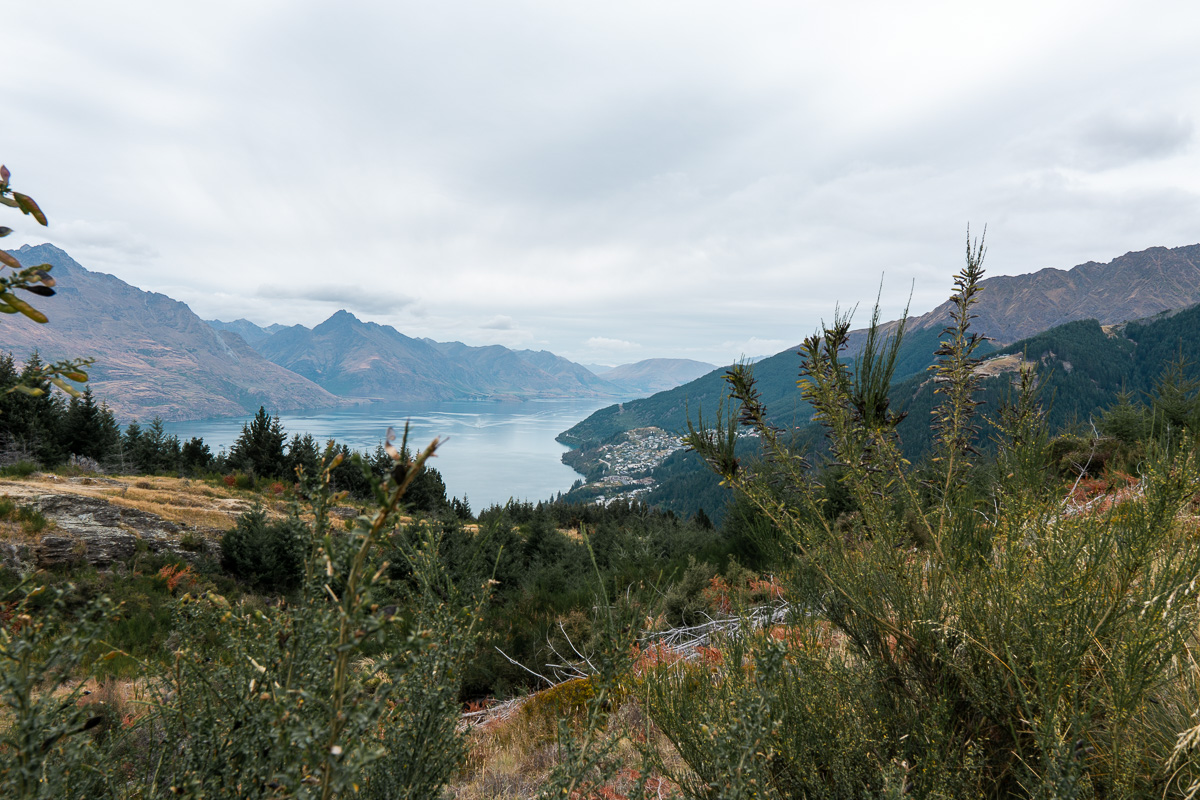
3. Queenstown Hill
Length: 3 miles / 4.8 km
Time: 2 – 3 hours
Difficulty: Easy
Ascent: 1312 ft / 400 m
Style: Out and back
Location: Central Otago
Trailhead: Access Queenstown Hill from the heart of Queenstown. It’s a short drive up part of the hill to the clearly signposted trailhead.
Parking: You can park on the street next to the trailhead.
Trail map: Click here for a Queenstown Hill Walking Track trail map.
About This New Zealand South Island Trail:
Queenstown is the adventure capital of New Zealand, but I reckon it’s the hikes surrounding this beautiful resort town that makes it so spectacular.
Queenstown Hill is one of the best day hikes in Queenstown and is conveniently located right within the town itself.
The first section of the hike takes you along a decent trail through a pine forest. This abruptly ends once you break the treeline, where the views over Queenstown begin to improve as you get closer to the summit.
At the top, you’ll have 360-degree views over the surrounding landscapes.
Overall, Queenstown Hill isn’t too challenging and is safe to hike year-round.
With 400 meters (1312 feet) of elevation gain it is a bit of a climb, so you can expect to break a sweat.
Accommodation: Click here for a list of hotels in Queenstown.
4. Bob’s Cove Track & Nature Walk
Length: 1.2 miles / 2 km
Time: 30 minutes
Difficulty: Easy
Ascent: 165 ft / 50 m
Style: Out and back
Location: Central Otago
Trailhead: It’s a short 15-minute drive to the start of the track.
Parking: There is plenty of free parking at the beginning of this South Island walk.
Trail map: Click here for a Bob’s Cove trail map.
About This New Zealand South Island Trail:
Bob’s Cove Track is a bit of a hidden gem just outside the resort town of Queenstown. The track is well-maintained and takes just 30 minutes to complete.
It’s one of the best day hikes in the South Island thanks to two beautiful viewpoints along the way!
Your first stop is a cute little jetty offering fantastic photo opportunities overlooking the vibrant blue water of Lake Wakatipu.
After this, you’ll climb a very short hill where you’ll find an amazing view overlooking the lake. It’s then an easy walk back to your car.
Accommodation: Click here for a list of hotels in Queenstown.
5. Franz Josef Glacier Walk
Length: 1 mile / 1.7 km
Time: 30 minutes
Difficulty: Very easy
Ascent: 85 ft / 26 m
Style: Out and back
Location: West Coast
Trailhead: It’s a short 5-minute drive from Franz Josef Township to the start of the track.
Parking: There is free street parking at the start of the track.
Trail map: Click here for a Franz Josef Glacier Walk map.
About This New Zealand South Island Trail:
The Franz Josef Glacier Walk is a very short walk that offers the easiest and quickest way to view the impressive Franz Josef Glacier on New Zealand’s West Coast.
You’ll walk for around 10 to 15 minutes until you arrive at a viewpoint overlooking the glacier from a distance.
This is a great option for anyone looking for an easy way to view the glacier — though if you’re keen to get up close, I’d recommend checking out some of the more significant hikes in the area or opting for a heli hike tour where you can actually walk on the glacier itself!
Accommodation: Click here for a list of hotels near the Franz Josef Glacier Walk.
Best Intermediate Hikes In New Zealand’s South Island
6. Abel Tasman Coast Track
Length: 37 miles / 60 km
Time: 3 – 5 days
Difficulty: Moderate
Ascent: 7473 ft / 2278 m
Style: One way
Location: Tasman
Trailhead: The hike starts in Marahau, but you will need to arrange transport back from the end of the hike (usually via a water taxi). You can also take a water taxi to and from Kaiteriteri or book a tour from Nelson, like this one.
Parking: Free Department of Conservation (DOC) parking available in Marahau.
Trail map: Click here for an Abel Tasman Coast Track map.
About This New Zealand South Island Trail:
The Abel Tasman Coast Track is one of the best things to do in Nelson and is officially considered a “Great Walk.”
It is among the country’s most popular multi-day hikes — which means you’ll want to ensure you book your huts well in advance.
The Abel Tasman Coast Track outlines New Zealand’s beautiful coastline along the top of the South Island. You won’t find epic viewpoints or summit any mountains on this walk; instead, you’ll explore endless golden sand beaches and impressive emerald-blue bays.
The track is maintained to a high quality and is mostly flat with gentle undulations along the entirety of the journey.
As it is a three to five day hike, you’ll want to stay in the huts or campgrounds along the way.
Another option for the Abel Tasman Coast Track is to head out on a water taxi and complete a one-day section of the track. If you’re short on time or just don’t love staying in huts then this is a great option.
Accommodation:
- Click here to book your huts along the Abel Tasman Coast Track.
- Click here for a list of hotels near the Abel Tasman Coast Track.
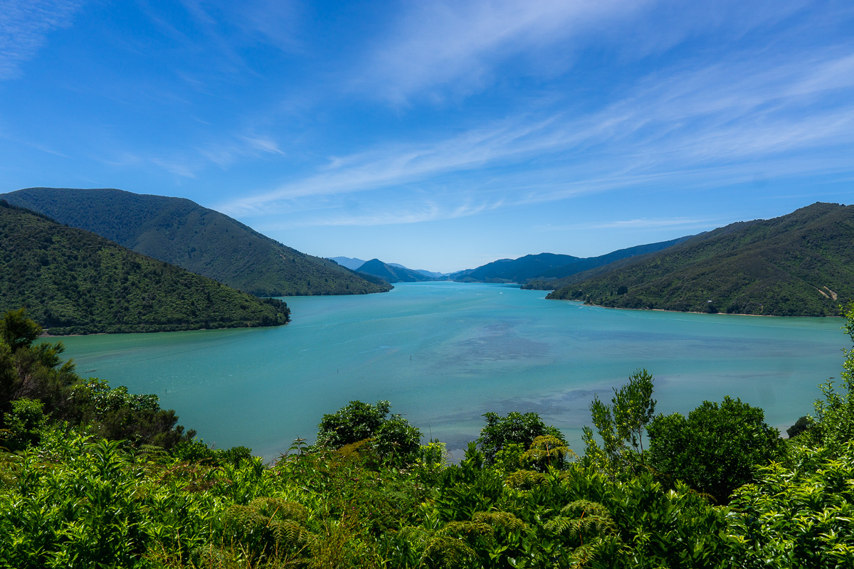
7. Queen Charlotte Track
Length: 46 miles / 74 km
Time: 3 – 5 days
Difficulty: Moderate
Ascent: 9255 ft / 2821 m
Style: One way
Location: Marlborough Sounds
Trailhead: You can reach this South Island hiking trailhead via water taxi from Picton. The water taxi is easily accessible in town, drops you off anywhere along the hike, and will pick you up again anywhere once you’re finished.
Parking: Parking is more challenging in Picton, so your best option is the paid car park near the main town wharf.
Trail map: Click here for a Queen Charlotte Track map.
About This New Zealand South Island Trail:
Part of the Te Araroa Trail South Island, the Queen Charlotte Track offers a very similar experience to the Abel Tasman Coast Track, with beaches and bays lining the entire trail; however, the locals have been unsuccessful in their attempts to add this track to the Great Walk list.
You’ll want to set up a base in Picton for this South Island hike, as the track extends out from town along the coast of the Queen Charlotte Sound.
It’s also a great opportunity to explore all the other great things to do in Picton, from stunning wineries to gorgeous lookouts.
Note that while the Queen Charlotte Track is stunning and one of the best hikes the country has to offer, I personally still prefer the Abel Tasman Track if you’re debating between the two.
Accommodation:
- Click here to view private lodging options along the Queen Charlotte Track
- Click here for a list of hotels in Picton
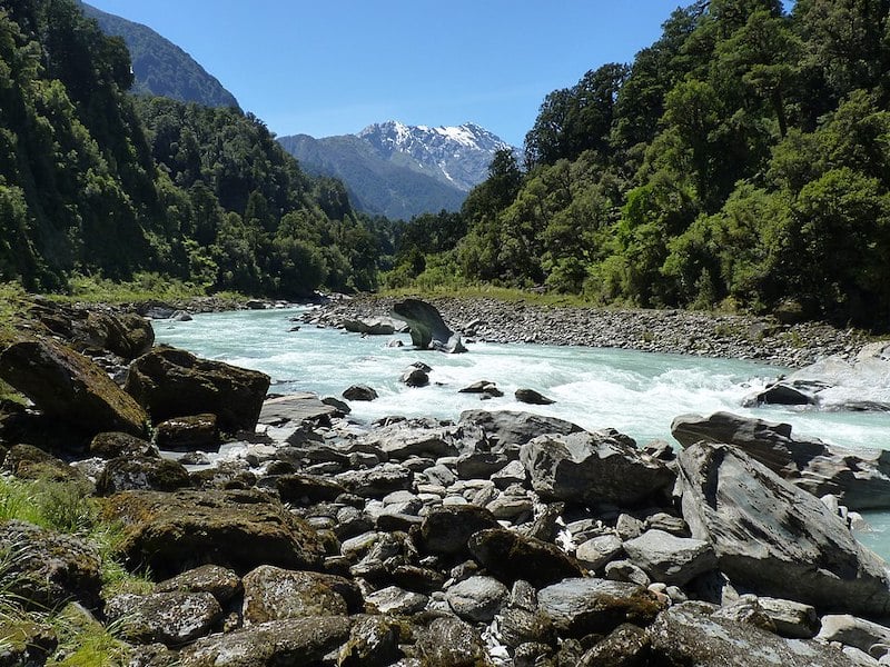
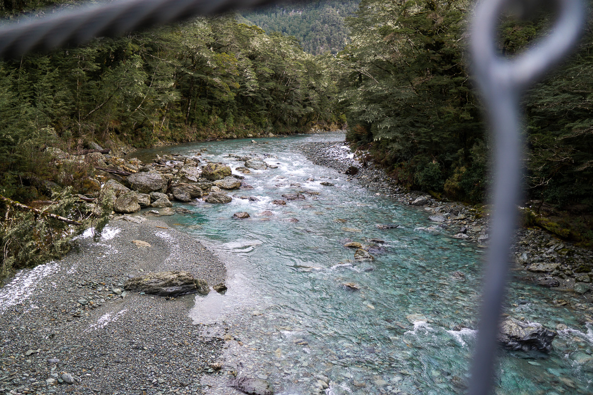
8. Copland Track To Welcome Flat Hut
Length: 11 miles / 18 km each way
Time: 2 days
Difficulty: Intermediate, though closer to Challenging than Easy
Ascent: Roughly 680 meters (2,230 feet)
Style: Out and back
Location: South Island, 26 kilometers (16 miles) south of Fox Glacier
Trailhead: You can access this South Island walk via State Highway 6, just north of the Karangarua Bridge.
Parking: The turn-off to the parking lot is on the northern side of the Karangarua Bridge. It is well marked.
Trail map: Click here for a Copland Track to Welcome Flat Hut trail map.
About This New Zealand South Island Trail:
The Copland Track is one of the best overnight hikes in the South Island. It’s a stunning trek located within Westland Tai Poutini National Park in NZ’s West Coast region.
Over the course of two days, the vistas get better and better as you take in mountains, glacial rivers, grassy plains, and lush forest.
Along with taking in the beauty of the Copland Valley, another highlight of this South Island hike is all of the bridges you’ll cross — particularly two long swing bridges suspended high above the ground. If you’re afraid of heights, don’t look down!
Pro tip:
If you plan to hike the Copland Track over two days, you’ll need to book a bunk bed at the Welcome Flat Hut. As this hike is popular, it’s essential to book in advance.
Accommodation:
- Click here to book your Welcome Flat Hut accommodation.
- Click here for a list of hotels near Westland Tai Poutini National Park.
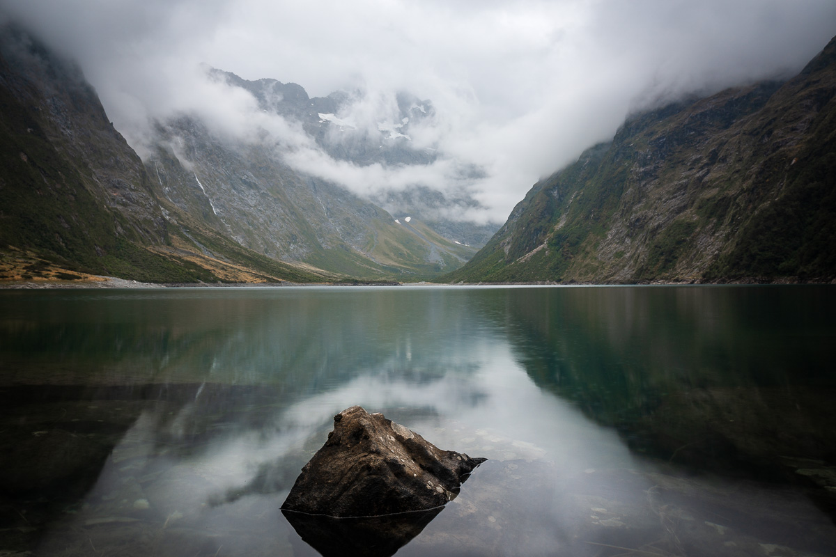
9. Lake Marian
Length: 1.9 miles / 3.1 km (one way)
Time: 2.5 – 3 hours
Difficulty: Moderate
Ascent: 1351 ft / 412 m
Style: Out and back
Location: Fiordland National Park
Trailhead: You’ll need to drive here from the main route out to Milford Sound.
Parking: Parking is free at the start and end of the track.
Trail map: Click here for a Lake Marian trail map.
About This New Zealand South Island Trail:
To preface this, Lake Marian is magical. It’s undoubtedly one of the most scenic hikes in New Zealand’s South Island, ascending through forest and past a lovely waterfall before opening up to rocky, mountainous conditions.
Eventually, after about 1.5 hours of steep climbing, you’ll suddenly step out of the bush and find yourself staring at an alpine lake. It really comes out of nowhere.
Make sure you wear decent footwear and come prepared as the track can be a little tricky in places with loose rocks.
While hiking this trail, I met a few other hikers who had gotten lost. Remember to follow the orange markers, especially as the track can be hard to see at times.
Accommodation: Click here for a list of hotels near Lake Marian.
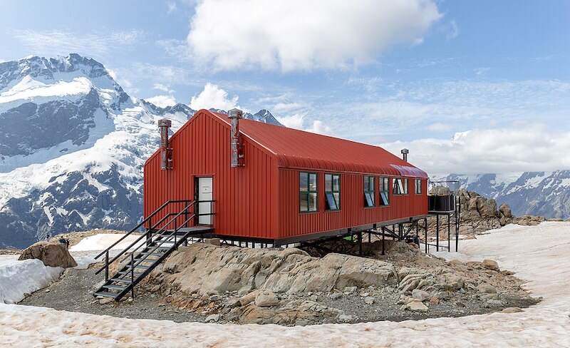
10. Sealy Tarns Track to Mueller Hut
Length: 6.5 miles / 10.4 km
Time: 6 – 8 hours
Difficulty: Moderate
Ascent: 3405 ft / 1038 m
Style: Out and back
Location: Aoraki Mount Cook National Park
Trailhead: The Mueller Hut track is accessed from Mount Cook National Park village.
Parking: Parking is available either in the village by Aoraki Mount Cook National Park Visitor Centre or at White Horse Hill Car Park at the end of Hooker Valley Road.
Trail map: Click here for a Sealy Tarns Track map.
About This New Zealand South Island Trail
Sealy Tarns up to Mueller Hut is a grueling climb with over 1000 meters of elevation gain and 2,200 steps over just 5 kilometers (3.1 miles).
It’s steep and hard work the entire way — though luckily it’s relatively short. Plus, the challenge pays off in the end with impressive views out over Aoraki National Park from the hut.
You can opt to spend a night in the hut, as well. Despite the hike being doable in a day, there’s nothing like waking up for sunrise at this magical spot.
Near the hut there is a lookout with 360-degree, panoramic views overlooking Mount Cook National Park’s majestic glaciers and New Zealand’s highest mountains.
Accommodation:
- Click here to book accommodation at Mueller Hut.
- Click here for a list of hotels near Aoraki Mount Cook National Park.
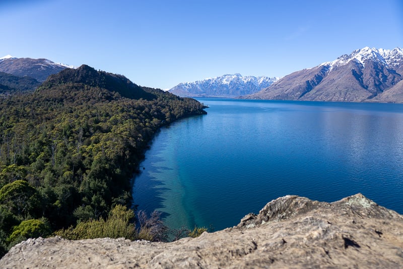
11. Key Summit Hike
Length: 4.2 miles / 6.8 km
Time: 3 hours
Difficulty: Moderate
Ascent: 1375 ft / 419 m
Style: Out and back
Location: Fiordland National Park
Trailhead: This South Island NZ trail begins at The Divide, about 85km along Milford Road from Te Anau.
Parking: Free parking is available near the trailhead.
Trail map: Click here for a Key Summit trail map.
About This New Zealand South Island Trail:
Key Summit, which is part of the longer Routeburn Track, is yet another of the more popular day walks in the South Island.
Located deep within Fiordland National Park near Lake Marian, it comes as no surprise that the reason people complete the hike is for the views.
From the top, you’ll gain a commanding perspective of the Fiordland National Park and Lake Marian — plus there is a small tarn that can give you mirror reflections of the surrounding mountains when the conditions are good.
At just 6.8 kilometers (4.2 miles), the trail isn’t too long — but it is fairly challenging as you climb 400 meters of elevation over just 3.4 kilometers (2.1 miles).
Most visitors to Milford Sound find they have just enough time to complete either this hike or Lake Marian.
Honestly, you really can’t go wrong with either of these South Island New Zealand hiking trails. While Lake Marian provides a unique opportunity to visit an alpine lake, Key Summit offers breathtaking views over Fiordland National Park.
This being said, if it isn’t a clear day you’ll likely want to pick Lake Marian over Key Summit.
Accommodation: Click here for a list of hotels near the Key Summit trail.
Best Difficult Hikes In New Zealand’s South Island
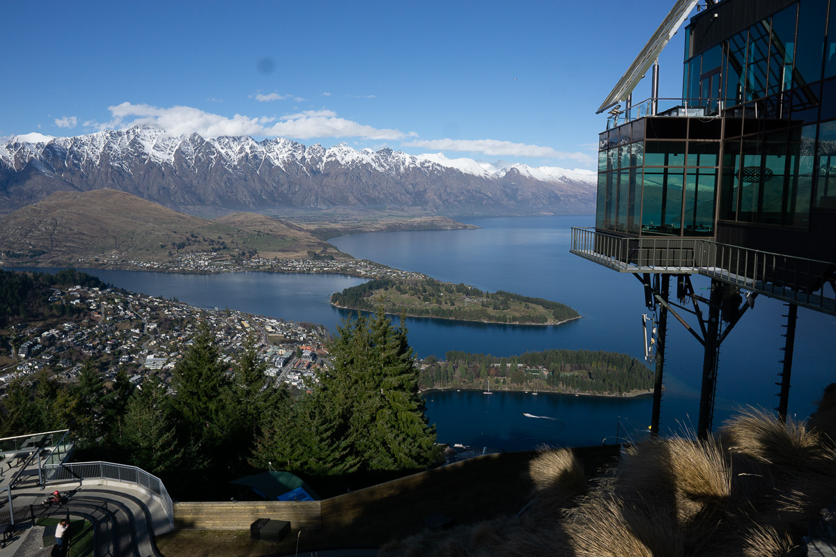
12. Ben Lomond Track
Length: 8.7 miles / 14 km
Time: 6 – 8 hours
Difficulty: Hard
Ascent: 4,593 ft / 1,400 m
Style: Out and back
Location: Central Otago
Trailhead: The base of this South Island hike begins right in the heart of Queenstown. You can save a couple hours and a few hundred meters of elevation by taking the Skyline Gondola up part of the way.
Parking: Street parking is located at the base of the trail. Some free parking is available, but it can be challenging to find. You’ll likely want to pick a paid carpark in town.
Trail map: Click here for a Ben Lomond Track map.
About This New Zealand South Island Trail:
One of the best hikes in Queenstown and probably the most famous, the Ben Lomond Track winds its way up from the heart of town at the base of the Skyline Queenstown gondola to the summit of Ben Lomond.
You can choose to either take the gondola up the first section to skip about 300 meters of elevation gain, or walk from the Tiki Trail at the very bottom.
The views from the summit as well as along the saddle are among the best in New Zealand, and definitely make tackling one of the most challenging day hikes in the South Island very much worth it.
Once you breach the tree line and walk along the saddle you’ll get to enjoy breathtaking views out over the Southern Alps and Lake Wakatipu.
An hour’s further climb will take you to the summit where there are panoramic views in all directions.
Accommodation: Click here for a list of hotels near the Ben Lomond Track.
13. Kepler Track
Length: 37.3 miles / 60 km
Time: 3 – 4 days
Difficulty: Moderate — but Advanced in winter from May through October due to this South Island trail’s challenging and complex avalanche terrain; here is more information to help you prepare
Ascent: 7168 ft / 2185 m
Style: Loop
Location: Fiordland National Park
Trailhead: Accessing the Kepler Track is easy with the nearest town being Te Anau. Take a turn off the main highway to find parking at the start of the trail.
Parking: There is a car park at the start of this South Island NZ track.
Trail map: Click here for a Kepler Track map.
About This New Zealand South Island Trail:
The Kepler Track is typically considered the most spectacular of New Zealand’s South Island Great Walks.
Incredible views from Luxmore Hut and along the ridgeline are worth every breath, while the hike through the valley is equally stunning.
The hut and the ridgeline offer epic sights extending over deep fiords and gigantic mountains — which is what you are really here for.
This beautiful hike in South Island contains such a wide array of unique views and landscapes. You’ll definitely want your camera for this trail!
Accommodation:
- Click here to book your accommodation at Luxmore Hut.
- Click here for a list of hotels near the Kepler Track.
14. Routeburn Track
Length: 20.5 miles / 33 km
Time: 2 – 4 days
Difficulty: Moderate – Difficult
Ascent: 5324 ft / 1623 m
Style: One way
Location: Central Otago
Trailhead: Access is near Glenorchy, a short drive from Queenstown, with the end of the trail in Fiordland National Park near Te Anau and Milford Sound. It is a 325 kilometer drive from one end of the track to the other as no roads cross the mountain range. Arrange bus or tour pick up at the end.
Parking: There is a carpark at the start of the track at Routeburn Shelter. I recommend starting here, as collecting your car on the other side is a lot more challenging.
Trail map: Click here for a Routeburn Track map.
About This New Zealand South Island Trail:
While the Kepler Track offers variety, the Routeburn Track is one of the most popular Great Walks in the South Island and in New Zealand as a whole.
This track is a fairly challenging multi-day hike located just outside Glenorchy and Queenstown.
Similar to the Kepler Track, this trail takes you past a wide variety of incredible landscapes. From rivers and valleys to mountain peaks and alpine lakes, the Kepler captures the essence of New Zealand’s raw, natural beauty.
There are huts also along the way (which you’ll need to book in advance), as well as some separate tracks which you can take to extend the duration of the overall hike.
Accommodation: Click here for a list of hotels near the Routeburn Track.
15. Milford Track

Length: 33.5 miles / 54 km
Time: 3 – 4 days
Difficulty: Moderate
Ascent: 9409 ft / 2868 m
Style: One way
Location: Fiordland National Park
Trailhead: The Milford Track is accessed via boat from Te Anau.
Parking: It’s preferable to leave your car at your accommodation in Te Anau. Alternatively, you can park at the free Department of Conservation (DOC) carpark in Te Anau.
Trail map: Click here for a Milford Track map.
About This New Zealand South Island Trail:
Looking for epic multi-day hikes in the South Island? Then you’ll love this one.
The Milford Track is unquestionably the most popular of New Zealand’s Great Walks and one of the most beautiful South Island walking tracks.
This stunning three to four day hike weaves through native New Zealand forests in Fiordland National Park.
The trail starts after a boat ride across Lake Te Anau, followed by tramping through majestic fiords and native forests until you arrive at Sandfly Point in Milford Sound.
The track itself will have you spending most of your time walking through the densely forested valley as opposed to through the Milford Sound, but you will get to see the sound at the end as the track finishes there.
If you want to get out and explore Milford Sound then I highly recommend booking a cruise.
It’s a good idea to book this hike well in advance. It’s not uncommon for popular dates to fill up a year in advance when the slots open, as this is one of the best multi day hikes in New Zealand’s South Island.
Pro tip:
You’ll also want to remember to bring a good rain coat and plenty of insect repellant. It will almost certainly rain at some point — if not the entire way — and sandflies are prevalent in the area.
Accommodation:
- Click here to book your hut accommodation along this South Island walk.
- Click here for a list of hotels in Te Anau.
16. Roy’s Peak Track
Length: 10.1 miles / 16.3 km
Time: 3 – 4 hours
Difficulty: Moderate – Difficult
Ascent: 4265 ft / 1300 m
Style: Out and back
Location: Central Otago
Trailhead: This South Island hike is easy to access as it is just a short drive from either Wanaka or Queenstown.
Parking: Free parking is available at the base of this South Island New Zealand hiking trail.
Trail map: Click here for a Roy’s Peak Track map.
About This New Zealand South Island Trail:
Roy’s Peak is possibly the most popular day hike in New Zealand’s South Island. The views from the summit are so breathtaking that they’re plastered all over Instagram.
Despite the popularity, it’s not an easy hike. Over just 8 kilometers (5 miles), you’ll be expected to climb 1300 meters in order to reach the summit.
The walk is relentless every step of the way and requires a pretty high level of fitness to make it to the top.
Regardless, a lot of people do survive the climb, just with a few aches and pains the next day.
Once you make it to the top, you’ll forget the journey it took to get there as you soak in the views out over Mount Aspiring National Park and Lake Wanaka.
Accommodation: Click here for a list of hotels near Roy’s Peak.
Tips For Hiking New Zealand’s South Island
1) For safety reasons, always tell someone where you’re going before heading out on any hike — especially multi-day South Island walks.
2) Hiking solo or in a remote area? Consider packing a personal locator beacon (PLB) or satellite messenger, like the popular Garmin inReach Mini. These devices can help you send SOS messages when in danger. Before purchasing one, just check that your South Island hiking trail is within the coverage area of the device. You can check this guide for additional help with choosing a PLB or satellite messenger.
3) Prepare by visiting the Department of Conservation (DOC) website and reading information about your hike before venturing out so you know what to expect. You should also make sure your South Island NZ trail is open when you plan to go.
4) Wear the appropriate clothes for hiking. Good hiking boots are necessary for most of the intermediate and difficult hikes on this list, while sneakers will be fine for the easy ones. Hiking poles can be a good idea, too. Bring a raincoat and layers if there is a chance of rain.
5) Book hut passes well in advance to avoid disappointment. The South Island New Zealand hiking trails on this list are the best for a reason, and this makes them popular. If it’s a hut that requires booking, please don’t turn up and take a bed if you didn’t book.
6) Be tidy and respectful. Take your litter back with you and leave nature as it was when you arrived.
7) Double check that you locked your car and turned off your headlights. I’ve made this mistake before, though was lucky enough to find someone with jumpstart cables to help; however, most rental cars won’t have them.
8) Bring enough water for the hike. Again, at least one half-liter of water per hour for a moderate hike is recommended. Some multi-day hikes will have drinkable water along the way as well; but, it’s usually safest to have some sort of water sanitation system just in case. Boiling water is fine, or you can check out hydration products like the Sawyer Mini, LifeStraw, and Grayl Bottle.
Travel Insurance For Hiking New Zealand’s South Island
When visiting New Zealand — or anywhere else in the world — it’s wise to get travel insurance.
One of the best travel medical insurance for travelers is SafetyWing as they’ve got a large network and offer both short-term and long-term coverage — including coverage if you’re traveling for months as well as limited coverage in your home country.
Additionally, SafetyWing is budget-friendly and offers $250,000 worth of coverage with just one low overall deductible of $250.
Click here to price out travel insurance for your trip in just a few clicks.