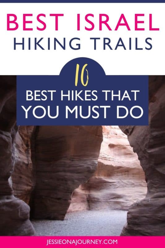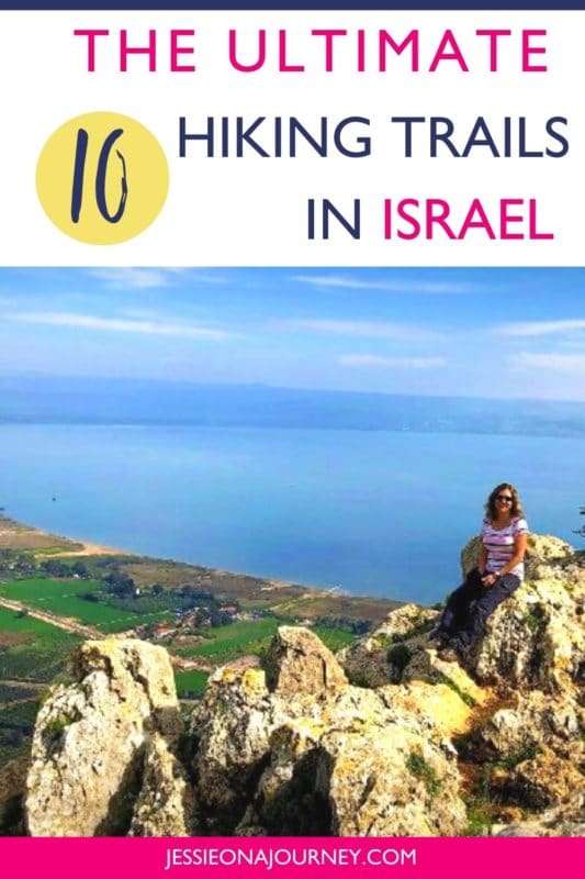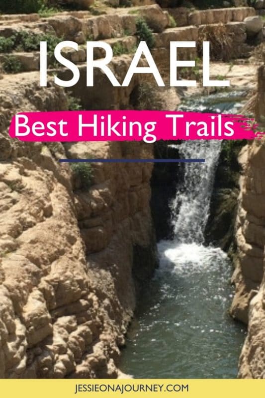
10 Best Hikes In Israel You Shouldn’t Miss (Epic!)
This post contains affiliate links, including Amazon affiliate links. If you purchase through these links, I may earn a commission at no extra cost to you. As an Amazon Associate, I earn from qualifying purchases. Thank you for your support!
By Erez Speiser. This post on hiking trails in Israel contains affiliate links to trusted partners!
Are you looking for the best hikes in Israel?
Then you’re in the right place!
Israel is blessed with a variety of fantastic trails, whether you’re seeking easy day hikes to epic multi-day treks.
From the green forest of the Galilee Mountains in the north to the rugged Negev Desert in the south, you can experience a variety of landscapes — all within an area smaller than the state of New Jersey.
But, that’s not all.
What makes hiking in Israel incredibly unique, besides for the fantastic views, is that you pass through ancient and biblical sites that reveal 3000 years of history!
And if you need some help choosing your perfect trek, I’ve got you covered with a detailed list of incredible Israel trails for people of all ages and abilities.
Quick tip: Whether you’re hiking solo or in a group, it’s smart to keep safety in mind. One piece of advice is to carry a She’s Birdie Personal Safety Alarm, which features a 130db alarm and flashing strobe light designed to deter an attack. It’s a top safety essential whether hiking, at home, or traveling.
What Type Of Hiker Are You? [Free Quiz]
But first, before we go over the best places for hiking in the holy land, I want to share a free personality quiz I think you’ll love.
It’s called “What type of hiker are you?” and it will help you discover your hiking personality. Bonus: Your results also share trail suggestions based on your quiz responses!
Map Of Israel
To help give you a lay of the land so you can better understand where each of the below Israel hiking trails are located, here is a map of the country:
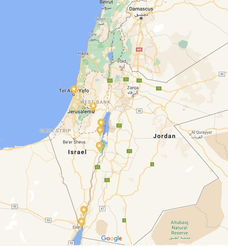
Click here for an interactive version of the above map. You can use it as your Israel hiking map.
On that note, let’s dive into our guide to hiking Israel! Soon, you’ll see why no trip to Israel would be complete without getting in at least one trek.
Best Hikes In Israel
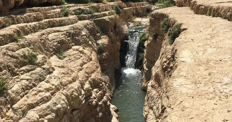
1. Wadi Qelt Hike
Trail Difficulty: Moderate — though note it involves a few exposed sections equipped with metal handles
Length: 9 kilometers (6 miles)
Location: Wadi Qelt is a stream that connects Jerusalem and Jericho and marks the northern boundary of the Judean Desert.
Trailhead: The trail starts at the Ein Prat Nature Reserve entrance — about 2 miles from the small village of Almon and a 20-minute drive from Jerusalem. Put “Ein Prat Nature Reserve” into Google Maps.
Trail Map: Click here for a Wadi Qelt Hike trail map.
About This Hiking Trail In Israel:
If you’re looking for the best water hikes in Israel, this trail should be on your list!
The hike in Wadi Qelt can range anywhere from a two-day journey from Jericho to Jerusalem down to a family stroll of a couple of miles near the national park’s entrance.
The “classic” and most attractive section is between Ein Prat and Ein Maboa. In this relatively small area, you will pass ancient aqueducts, old monasteries, and a deep canyon full of springs, pools, and cascades. It’s a real oasis!
Pro Tip:
Don’t miss a detour (by car) to the viewpoint above St. George Monastery hanging on the cliff above the stream.
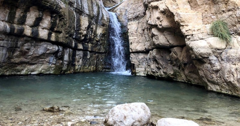
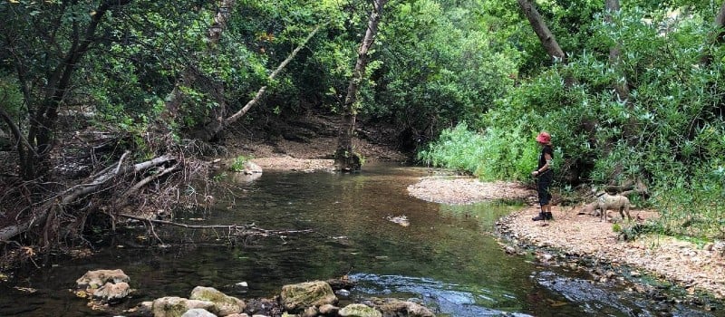
2. Arugot Stream Hike
Trail Difficulty: Easy
Length: 6 kilometers (3.5 miles)
Location: Ein Gedi Nature Reserve, Israel. Ein Gedi is a beautiful nature reserve located in the Judean Desert near the shore of Israel’s Dead Sea — a highlight of a trip to the Middle East!
Trailhead: The trail entrance is located near the southern parking lot of the Ein Gedi Reserve. Put “Ein Gedi Reserve” in Google Maps and continue driving until the south parking lot.
Trail Map: Click here for an Arugot Stream Hike trail map.
About This Hiking Trail In Israel:
Two main streams are flowing in the Ein Gedi Reserve; David Stream and Arugot Stream.
The David Stream hike is shorter and much more crowded. Therefore, my recommendation is to head one mile further south to the magical Arugot Stream.
The attractive desert path passes by the gushing stream and sometimes inside it. In some sections, you will have to wade in shallow water — so be careful hopping from stone to stone if you insist on keeping your feet dry.
Don’t miss the “Secret Waterfall” — which isn’t really secret as it’s right on the path. The 10-meter (33-foot) waterfall drops into a beautiful deep pool where you can swim or even take a shower under the cascades.
For those who prefer to stay dry, there is plenty of shade to relax beside the natural pool.
In my opinion, this is one of the best easy hikes in Israel — though the Nahal David hike, also in the Ein Gedi Reserve, is also spectacular!
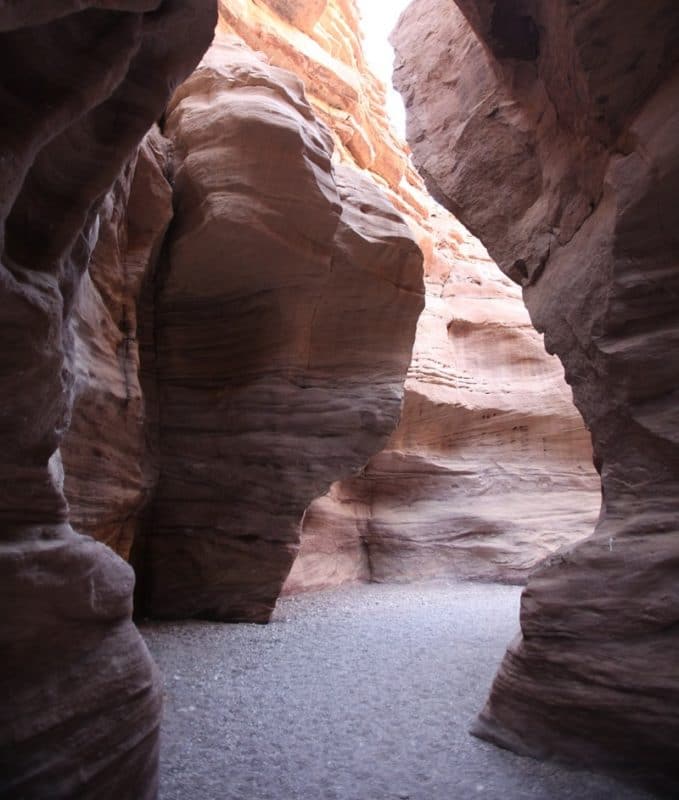
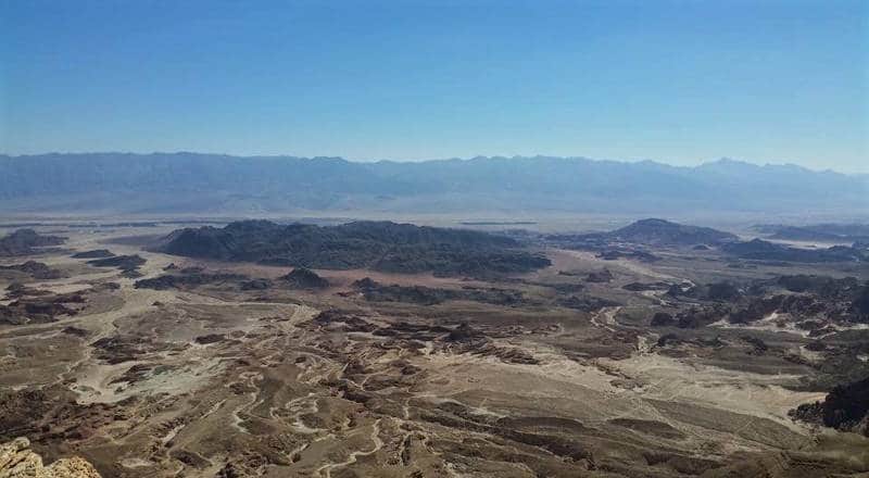
3. Red Canyon Hike
Trail Difficulty: Easy
Length: 2-5 kilometers (1.5-3 miles)
Location: Eilat Mountains, Israel. Eilat is a small touristic town on the northern edge of the Red Sea; however, it is also home to some of the best hikes in the world! The surrounding Eilat Mountains offer fantastic desert hiking options within a short drive from the city.
Trailhead: The track entrance is located on a dirt road that branches from road #12 about 20 kilometers (12.4 miles) northwest of Eilat. Put “Red Canyon Parking” into Google Maps.
Trail Map: Click here for a Red Canyon Hike trail map.
About This Hiking Trail In Israel:
The Red Canyon is the most famous hike in the area because it’s not far from Eilat, it’s easy, and it’s stunning.
Although it is just a 5-kilometer (3.1-mile) circuit, it involves exciting sections that pass through a deep and narrow gorge with the aid of metal handrails and ladders.
The canyon makes its way deep through the red sandstone. At some sections, the width is just a few feet. Moreover, the colors change between different shades of red and black.
It’s truly an expereince you shouldn’t miss when exploring adventure travel in Israel!
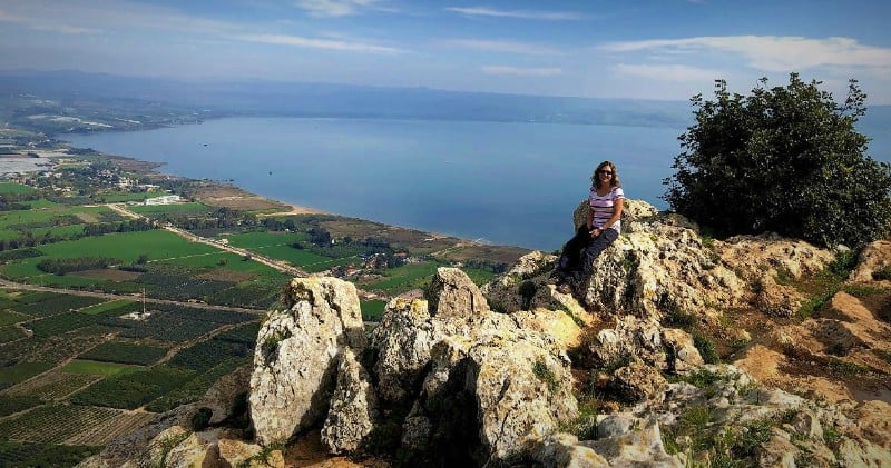
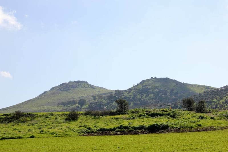
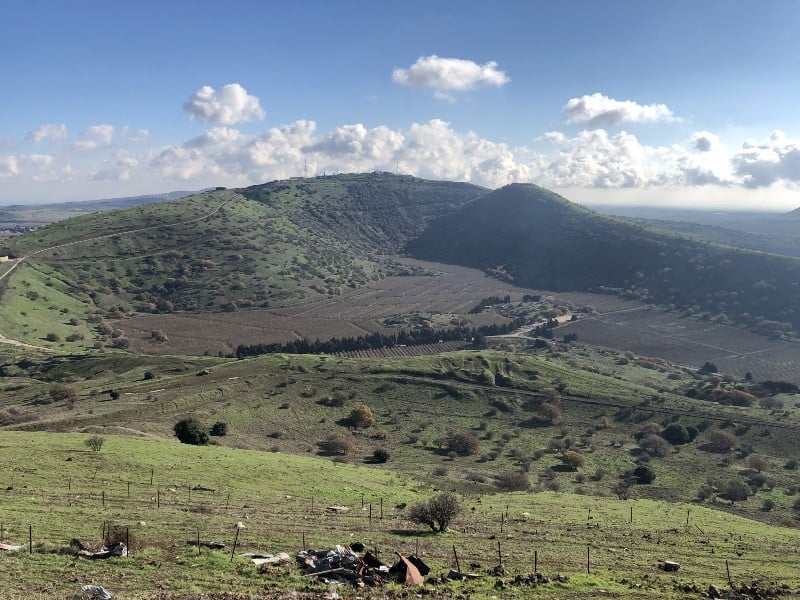
4. Mount Arbel Hike
Trail Difficulty: Moderate — though it involves an exposed section equipped with metal handles
Length: 8 kilometers (5 miles)
Location: Mount Arbel is located in the Lower Galilee region, directly above the western shore of the Sea of Galilee and 10 kilometers (6.2 miles) north of Tiberias. Also, if you’re looking for the best hikes near Tel Aviv this trail is only about 90 minutes away.
Trailhead: The trail starts near a small town called Migdal on the road leading to a tiny village called Wadi Hamam. Put “Wadi Hamam” into Google Maps and park your car on the parking lot just before the road enters the village.
Trail Map: Click here for a Mount Arbol Hike trail map.
About This Hiking Trail In Israel:
One of the classic hikes in northern Israel is to climb from the shore of the Sea of Galilee to the summit of Mount Arbel within the Arbel National Park and Nature Reserve.
Mount Arbel’s height is only 180 meters (590 feet) but it rises very steeply, 380 meters (1245 feet) from the Sea of Galilee, which sits 200 meters (656 feet) below sea level.
Besides the great view from the summit looking out toward the Golan Heights and Mount Hermon, this loop trail brings you to an ancient fortress, a cave village, and the ruins of a 4th-century synagogue.
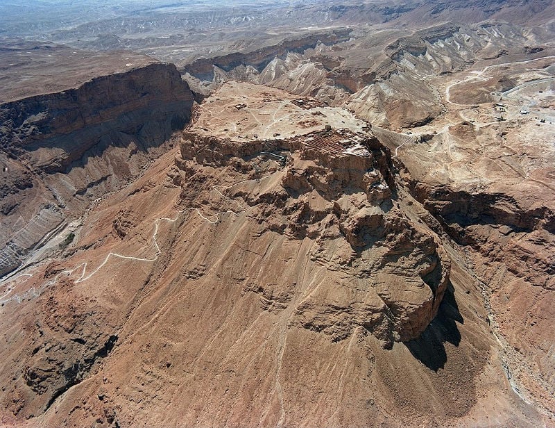
5. Masada Hike
Trail Difficulty: Moderate
Length: 3-9 kilometers (2-6 miles)
Location: Dead Sea, Israel. Masada is located in the Judean Desert near the shore of the Dead Sea, 20 kilometers (6.2 miles) south of Ein Gedi.
Trailhead: The trail starts at the main parking lot of Masada National Park. Put “Masada Eastern Parking” into Google Maps.
Trail Map: Click here for a Masada trail map.
About This Hiking Trail In Israel:
The Masada Mountain desert fortress erected by Herod the Great in 30 BCE is on the shortlist of any tourist wanting an unforgettable Israel adventure, and rightly so.
This unique site has it all: history going back 2000 years, a dramatic story with a tragic ending, spectacular desert scenery, and it is located at the lowest place on earth at 400 meters (1,312 feet) below sea level.
For a bit of history:
When Roman troops invaded Masada at the end of the First Jewish–Roman War, almost 1,000 Sicarii rebels and Jewish freedom fighters — those who had been trying to get rid of the Romans from Judea — killed themselves, as they would have rather committed suicide and be with God than be killed or enslaved by their enemy.
This important site sits on an enormous rock plateau overlooking the Dead Sea that you can hike up.
That being said, most people visit Masada via cable car without hiking; however, reaching the site on foot will make your visit much more rewarding.
The classic hike is along the “Snake Path” (3 kilometers; 1.9 miles), which is one of the best day hikes in Israel.
If you want to avoid the crowds and prefer a more significant effort, the more rewarding trails are the “Runner Path” that climbs from the north side and the “Elaazar Path” that ascends from the south side. The best option is to go up with one of them and down from the other.
If you’re embarking on solo female travel in Israel, Masada is a good option since it’s touristy so there will likely be people around if you’d like to meet others or in case of emergencies.
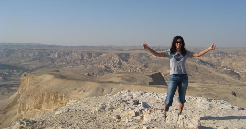
6. Ein Akev Hike
Trail Difficulty: Difficult
Length: 17 kilometers (11 miles)
Location: Ein Akev is located in the Negev Desert, about 5 kilometers (3 miles) east of Midreshet Ben Gurion.
Trailhead: The trail starts 1.5 Kilometers (1 mile) before the entrance to Ein Avdat National Park. Put “Ein Avdat National Park” into Google Maps and park 1.5 kilometers (1 mile) before the park just as the road finishes its descent to the valley.
Trail Map: Click here for an Ein Akev Hike trail map.
About This Hiking Trail In Israel:
This is a tough and rewarding desert adventure that has it all! The hike includes an exciting ascent to the stunning “Hod Akev” viewpoint.
Note that the climb is exposed at some parts and can be vertiginous for some.
From the summit, take in views that stretch over vast desert landscape. You feel like you can see for miles and you’ll realize just how small you are on this big earth.
From there, the trail continues to “Ein Akev” (Ein means “spring” in Hebrew), a lovely desert spring with a beautiful deep pool you can swim in.
7. Yam le Yam (Sea to Sea Trail)
Trail Difficulty: Difficult
Length: 70 kilometers (44 miles)
Location: The trail is located in the Galilee Mountains in northern Israel.
Trailhead: The trail starts on the shore of the Mediterranean Sea, 5 kilometers (3.1 miles) north of Naharia. Put “Gesher Haziv” into Google Maps.
Trail Map: Click here for a Yam le Yam trail map.
About This Hiking Trail In Israel:
Yam le Yam (Sea to Sea) is the top classic multi-day trek of the Galilee region.
Starting on the shore of the Mediterranean Sea on the west and ending at the shores of the Sea of Galilee in the east gives a sense of achievement.
The trek also passes and stays overnight at the Old City in Safed, the Druze village of Hurfeish, and the Melkite Christian village of Fausta — all of which are interesting locations for additional exploration and cultural immersion.
It typically takes four-to-five days to complete the journey. Overnights can be spent at local guesthouses or camping along the trail.
8. Jesus Trail
Trail Difficulty: Moderate
Length: 60 kilometers (38 miles)
Location: The trail is located in the Lower Galilee Mountains between Nazareth and Capernaum and is one of the best hikes in northern Israel, especially if you’re interested in exploring spirituality.
Trailhead: The trail starts at the center of Nazareth near the Church of the Annunciation.
Trail Map: Click here for a Jesus Trail map.
About This Hiking Trail In Israel:
The Jesus Trail is a 60-kilometer (38-mile) hiking trail in the Lower Galilee region that connects important sites from the life of Jesus and other historical and religious sites.
Some of the historical sites along the trails are Cana, Zipori, Horns of Hattin, Arbel, Tabgha, and Capernaum.
This important Israel hiking trail offers an alternative for travelers and pilgrims who want to walk in the steps of Jesus in a unique and adventurous way by trekking through the beautiful landscape of the Lower Galilee region.
Overnights are spent at inns and small hotels along the route.
9. The Golan Trail
Trail Difficulty: Moderate
Length: 120 Kilometers (75 miles)
Location: The Golan Trail is located on the eastern side of The Golan Heights.
Trailhead: The trail starts at the lower parking lot of Mount Hermon. Put “Hermon Site Lower Parking” into Google Maps.
Trail Map: Click here for a Golan Trail map.
About This Hiking Trail In Israel:
Stretching from the Israeli settlement and kibbutz of Mevo Hama in the south to Mount Hermon in the north, the Golan Trail is a long distance thru-hike that crosses the ridge of the rocky Golan Heights plateau in northern Israel from north to south.
Along the way, you’ll pass through many natural gems, historical sites, and various communities.
Most of the path is easy, traversing between the rolling hills of the Golan plateau.
Depending on your fitness and desires, it takes between between five and 10 days to complete the journey.
Besides the fantastic views and historical sites, the trail passes near a variety of small and diverse settlements, including Druze villages, kibbutz communes, and moshav agricultural settlements. These provide perfect lodging locations and an opportunity to visit different communities.
10. Israel National Trail
Trail Difficulty: Very difficult; this trail is one of the hardest hikes in Israel!
Length: 1,025 kilometers (640 miles)
Location: The Israel National trail crosses the country of Israel from north to south.
Trailhead: The trail can be walked from north to south or from south to north. The northern trailhead is at Kibbutz Dan (put “Kibbutz Dan” into Google Maps) and the southern trailhead is near Eilat (put “Eilat Field School” into Google Maps).
Trail Map: Click here for an Israel National Trail map.
About This Hiking Trail In Israel:
The Israel National Trail — usually referred to as INT — is considered by many as one of the world’s best long-distance hiking trails.
In fact, National Geographic once chose the INT as one of their picks for 20 best hikes in the world!
It takes most hikers 45-60 days to finish the route, depending on their hiking style and fitness level.
Long stretches of the trail pass through remote desert areas without any settlements and infrastructure and can only be done by backpacking and camping along the path.
Over a relatively short distance the trail passes through the lush green Galilee Mountains, traverses along the Mediterranean coastline, and crosses rugged desert landscape.
That being said, if you only have time to do part of the INT, the desert section between Eilat and Arad is the best in terms of scenery and atmosphere.
Tips For Hiking In Israel
There are many reasons to visit Israel, though as you hopefully see, hiking is a big one. As you lace up your boots, here are a few general tips to keep in mind:
-Familiarize yourself with your route before heading out. If possible, bring a map with you in case you get lost. You can also download Google Maps for offline use.
-Even if you’re wanting to immerse yourself in nature and detach from social media, bring a working and fully-charged phone in case of emergencies. You might also bring a portable phone charger, like this one.
-Bring plenty of water! Generally, you’ll want a half-liter for every hour of moderate hiking, though this goes up as the difficulty and temperatures do. For instance, if you’re doing a hard hike on a hot day you’ll want to bring at least 1 liter of water per hour.
-Sunscreen and a hat are a must! The sun in Israel can be very strong, especially in desert areas.
–Make sure you understand what to wear when going hiking to stay safe and temperate.
-Especially during the warmer months, start early to avoid the heat and the crowds.
Adventure & Hiking Tours Is Israel
After enjoying some of the best places to hike in Israel, continue exploring through adventurous tours like:
- The Beauty of Tel Aviv by Bike: Private Tour
- Star Watching Experience in the Arava Desert from Be’er Sheva
- Rope Park Eilat
- Rappelling Down the Ramon Crater Cliff from Mitzpe Ramon
- Masada Sunrise Ein Gedi and Dead Sea Tour from Jerusalem (including a hiking tour portion!)
Click here for a full list of Israel tours!
Israel Hotels
Click here for a full list of Israel hotels!
Prefer self-contained stays?
Click here to check out unique local rentals!
You can also use this map to search for local stays and experiences:
Renting A Car In Israel
Many hikers in Israel like to rent a car, as it allows them to explore the city’s many hiking trails and attractions on their own time.
And if you need to rent a car, I highly recommend using Discover Cars to quickly compare your rental options.
Their comparison tool does the homework for you, so there’s no need to have up 10+ tabs trying to figure out which company is the most affordable. Actually, you can save up to 70% using their tool!![]()
Israel Travel Insurance
When visiting Israel — or anywhere else in the world — it’s wise to get travel insurance.
One of the best travel medical insurance for travelers is SafetyWing as they’ve got a large network and offer both short-term and long-term coverage — including coverage if you’re traveling for months as well as limited coverage in your home country).
Additionally, SafetyWing is budget-friendly and offers $250,000 worth of coverage with just one low overall deductible of $250.
Click here to price out travel insurance for your trip in just a few clicks.
What would you add to this list of best hikes in Israel?
Enjoyed this guide to Israel hiking trails? Pin it for later!