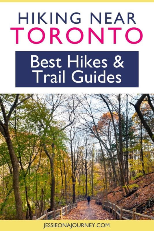
12 Best Places To Hike Near Toronto For Amazing Scenery
This post contains affiliate links, including Amazon affiliate links. If you purchase through these links, I may earn a commission at no extra cost to you. As an Amazon Associate, I earn from qualifying purchases. Thank you for your support!
Are you looking for the best places to hike near Toronto? Then this is the guide for you!
Many people think Toronto is just the CN Tower, but there’s so much more to the city than concrete buildings. In fact, Toronto is near some amazing hiking trails that are perfect for beginners to experts!
You’ll find easy local walks with stunning views, like the Scarborough Bluffs, and bucket list hikes, like the Bruce Trail. No matter what type of hike you’re looking for, you’ll find an ideal trail near Toronto.
If you need help choosing between the best hikes near Toronto, this guide will help you decide. With detailed guides of all the best trails, you’ll find a hike that’s perfect for your ability.
Toronto is my home city, and hiking near Toronto is one of my favorite things to do so I’m excited to share some of the best trails near Toronto here with you!
🥾 Pro tip: Before going hiking in Toronto, make sure to download the AllTrails app to have trail guides, maps, photos, and reviews right at your fingertips. You can also sign up for a free trial of AllTrails+ to download offline maps, get alerts for wrong turns, find trails by distance from you, and more!
💪 Safety: Additionally, whether you’re hiking solo or in a group, it’s smart to keep safety in mind. One piece of advice is to carry a She’s Birdie Personal Safety Alarm, which features a 130db alarm and flashing strobe light designed to deter an attack. I also love the Garmin inReach Mini, a compact satellite communicator with SOS capabilities that can truly save your life in an emergency.
What Type Of Hiker Are You? [Free Quiz]
But first, before we go over the best hiking spots near Toronto, I want to share a free personality quiz I think you’ll love.
It’s called “What type of hiker are you?” and it will help you discover your hiking personality. Bonus: Your results also share trail suggestions based on your quiz responses!
Map Of Toronto
To help give you a lay of the land so you can better understand where each of the below Toronto hiking trails are located, here is a map of the city:
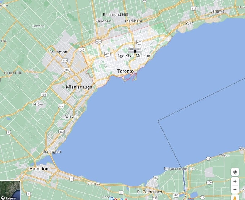
Click here for an interactive version of the above map with the best hikes around Toronto.
On that note, let’s dive into where to hike in Toronto and how to enjoy some of the best hikes in the world!
Best Places To Hike Near Toronto (By Destination)
Best Hikes In The Greater Toronto Area
1. Scarborough Bluffs
Trail Difficulty: Easy
Length: 6.8 kilometers (4.2 miles)
Trail Type: Out and back
Location: Scarborough, a district of Toronto located in the East End of the city. The area is best known for the Scarborough Bluffs and the Toronto Zoo.
Trailhead: The trail technically begins in the middle of the Scarborough Bluffs path. Put “Scarborough Bluffs Parking Lot” into your GPS to be taken to the lots by the marina. Start by heading west towards Bluffer’s Park, then loop back to go right towards Bluffer’s Beach.
Trail Map: Click here for a Scarborough Bluffs trail map
About This Toronto Trail:
The Scarborough Bluffs are the best hiking destination in Toronto. Located near Downtown Toronto, they’re very accessible by car or public transportation — and are even great for those hiking alone.
When you arrive at the Bluffs parking lot, you’ll have the option to turn right, which will take you along the Bluffers Hiking Trail to get the best view of the white sandstone cliffs. This easy path is very flat but can be challenging when you have to dodge all the visitors around midday.
If you turn left from the parking lot, you’ll reach Bluffer’s Beach. Go behind the beach to follow the Cathedral Cliffs trail, where you can walk beneath the towering sandstone cliffs. The walls of leaves and trees make you feel like you’re in a jungle rather than 20 minutes from the CN Tower.
For views over the Bluffs, you’ll need to walk up the road from the parking lot. It’s a steep incline with no footpath, so be careful of oncoming traffic. You cannot climb up the mud paths that you’ll see down the side of the cliffs. These are illegal paths that can result in fines of over $500 CAD.
Instead, wait until you hit the schoolyard, where you can turn onto a legal dirt path that will let you walk along the top of the Scarborough Bluffs safely.
You can do all three trails in one day and still have time for the beach.
Arrive before 10am to have the trails mostly to yourself. It makes these popular treks feel more magical when you’re not dodging mountain bikes and large groups of hikers.
2. High Park Area Trails
Trail Difficulty: Easy
Length: 5.1 kilometers (3.2 miles)
Trail Type: Loop
Location: High Park, the largest park in Toronto. The park is known for its greenery, small zoo, and stunning lake. It is best accessible from the High Park subway station or by driving and parking in the free lots.
Trailhead: The trail begins on Spring Road at Colbourne Lodge, although there are many access points throughout the trail.
Trail Map: Click here for a High Park Area Trails map
About This Toronto Trail:
High Park is the biggest park in Toronto. It encompasses two lakes, a mini zoo with local animals (and capybaras), a small cafe, numerous tennis courts, a pool, and 5.1 kilometers of amazing hiking trails.
Located in Etobicoke, a popular suburb in Toronto, High Park offers some of the best hiking trails in the city.
Families may prefer to walk the paved sidewalk trails that run the length of High Park and that don’t have as high of a risk for muddy shoes.
Dog parents will love the off-leash dog trails that are located at various points along the High Park trails. These areas are fenced in and have clearly marked signs so you can be sure you’re in the right place.
The best High Park trails are the outer paths that wind through the forests that surround the park. To access them, when you arrive at the main entrance of the park, turn left and follow the dirt path right beside the gate. It will lead you into the myriad of trails that loop around the park.
You can opt for flatter terrain by following the paths closer to the sidewalks; however, some trails do have a significant incline when they wind up toward the side roads.
When you reach the southern limits of the park, you will need to exit the trail and walk below the High Park river on the sidewalk. Then you will find the entrance to the other side of the trails.
This area is a haven for hikers, with less brush underfoot and massive Canadian maple trees that seem to stretch up for miles. Even in the heat of summer, this path is pleasantly cool thanks to the shade.
The trails are easy to find, easy to follow, and great for all manner of hikers. If you want a more advanced workout, jog along the paths — but watch out for tree roots!
Overall, High Park is one of my favorite places for hiking in Toronto Canada!
3. Humber River Recreation Trail
Trail Difficulty: Easy
Length: 10 kilometers (6.3 miles)
Trail Type: Out and back
Location: Humber River in Western Toronto, beside Bloor West Village. The area is known for its Eastern European bakeries, cute houses, and the salmon swimming upstream.
Trailhead: Across the bridge from the Old Mill Inn & Spa you will see a clear path to follow along the West side of the river.
Trail Map: Click here for a Humber River Recreational Trail map
About This Toronto Trail:
One of the best hikes in Toronto is rarely called by its actual name. People refer to it as anything from “the ravine” to “the Old Mill Trail”, depending on where they enter this hike.
The best way to access the Humber River Recreation Trail is from the entrance behind the Old Mill, where you can find a paid public parking lot to leave your car.
This trail has two paths: one for pedestrians and one for cyclists. The pedestrian path runs directly beside the paved cyclist path but is a mix of hard-packed dirt and gravel.
Take this hike to experience the incredible nature that is lurking around every corner when you visit Canada.
In the autumn, you can visit this trail to see the large Canadian salmon jumping upstream to get to their spawning ground. Every year, starting in September, the salmon make their way to jump up the waterfalls in the Humber River.
In the summer, you can see a variety of small Canadian animals and birds frolicking around the river. Among those wild animals, you’ll find dogs trying to chase some ducks on the shore and Canadian geese keeping people at bay.
This easy trail has year-round access due to its flat terrain. Moreover, this is considered one of the best winter hikes near Toronto as you’ll be able to see the frozen waterfalls suspended in mid-air.
The Humber River Recreation Trail follows the Humber River from Old Mill up to James Gardens. This walk will take you through a Canadian forest, past one of the longest rivers in the city, and into the most beautiful gardens you’ll find in Toronto.
James Gardens is a public park that features large natural ponds and flowing rivers, tiered gardens with seasonal blooms, and stunning backdrops for photos.
4. Glen Stewart Ravine
Trail Difficulty: Intermediate
Length: 1.3 kilometers (0.8 miles)
Trail type: Out and back
Location: The Beaches, an area East of Toronto known for the stunning white sand beaches and indie cafes. Visit to feel like you’re in Florida without leaving Toronto.
Trailhead: The trail begins at the intersection of Glen Manor Drive and Glen Manor Drive W. It does not begin in Glen Stewart Park, as this is a separate area.
Trail Map: Click here for a Glen Stewart Ravine trail map
About This Toronto Trail:
One of the undiscovered hiking trails in Toronto is in the Beaches neighborhood. This area located East of Downtown Toronto is a summer paradise that feels like going abroad without leaving the city.
The Glen Stewart Ravine Trail is a short walk from the main street of the Beaches. Grab a snack from Tori’s Bakeshop or a fresh-pressed juice to enjoy during this hike — or stop by afterward for a sweet treat when you’re heading home.
This trail may seem short at first, but you’ll quickly find yourself spending hours exploring this forested area in the middle of the suburbs.
The trail is made up of a boardwalk path that hovers over the ravine itself. You’ll avoid wet shoes if you stay on the path that stretches from one end of the ravine to the other.
The highlight of this trail — and the feature that lands it on this list of the best hikes near Toronto — is the stairways. These giant metal staircases help you climb to the height of the trees where you can get a serious workout and enjoy a view above the treetops of the smaller maples and pines.
Be sure to pause as you hike this trail to listen for the native bird song that’s especially rich on weekend mornings in the summer.
To make the most of this trail, walk in one direction then turn back so you leave from where you started. Be sure to climb at least two staircases to side paths so you can experience the beauty high above the ravine.
It’s definitely one of the best Toronto hikes with a view.
5. Lower Don River Trail
Trail Difficulty: Easy
Length: 6.8 kilometers (4.2 miles)
Trail Type: Out and back
Location: Don River Valley Park, East of Downtown Toronto. This park winds through the community, blending Toronto’s famous skyline with Canada’s natural beauty.
Trailhead: The trail begins by the Loblaws on Redway Road.
Trail Map: Click here for a Lower Don River Trail map
About This Toronto Trail:
One of the best hiking places near Toronto is the Lower Don River.
It is a hike and an art walk all in one. This trail will take you along the Don River to get stunning views of the CN Tower through the trees, and to see some of the unique sculptures that line the trail.
While this hiking trail isn’t the typical nature experience — as you may hear some noise coming from the Don Valley Parkway nearby — it offers a unique blend of city and nature-scapes.
The hike will take you past several different parks and side hikes along the way. If you do them all your hike can be extended to over 13 kilometers (8.1 miles).
This paved trail is smooth and easy to walk, going over bridges and old railway lines so you can see some different sides of the city.
It’s a very relaxing hiking destination at any time of the year — though the best time to visit is in autumn when the sumac trees bloom a colorful red and make a great backdrop for hiking selfies.
If you don’t have seasonal allergies, you’ll love the wildflowers that bloom in summer. The bright patches of goldenrods seem to turn the whole trail into the yellow brick road from the Wizard of Oz.
Hike past replica gargoyles that hang around Downtown Toronto, past scattered sculptures along the Viaduct, and take in the views of the fast-flowing Don River.
This is the perfect trail for a natural hike that still feels like it’s in Toronto.
6. Brickworks Trail
Trail Difficulty: Intermediate
Length: 1.9 kilometers (1.2 miles)
Trail Type: Loop
Location: Don River Valley Park, East of Downtown Toronto. This park winds through the community, blending Toronto’s famous skyline with Canada’s natural beauty.
Trailhead: Search for “Welcome to the Don Valley Brickworks” and follow the path.
Trail Map: Click here for a Brickworks Trail map
About This Toronto Trail:
The Brickworks Trail is one of the side trails that you can take off the Lower Don River Trail; however, you can also do it by itself.
This heavily wooded trail offers a short, but more challenging hike for people in the city of Toronto. You’ll walk around the river on a dirt path that allows for some of the best birdwatching in the city. It is filled with wildlife, from large squirrels crossing your path to frogs croaking in the distance.
Visit this trail mid-week to find it almost bare of people. You’ll feel like you’re in your own world, with only the sound of crackling leaves and chirping birds around you.
For the wanderers, climb the east Brickworks Park hill. From the top, you’ll get a great view over the park with a hint of the Toronto skyline in the distance.
This trail ends at the Evergreen Brickworks, a collection of old industrial buildings with the charm of Toronto’s Distillery District. The buildings now hold gardens that showcase sustainable development. On Saturdays, they host a lovely farmers market.
Best Hikes Near Toronto
7. Elora Gorge
Trail Difficulty: Intermediate
Length: 5.5 kilometers (3.4 miles)
Trail Type: Loop
Location: The Elora Gorge Conservation Area is located outside of the town of Elora, in a provincial park. The park is home to white water rapids, a deep gorge, and amazing picnic spots. If you’re looking for trails north of Toronto, this one is about 90 minutes north of the city.
Trailhead: Hole in the Rock Scenic Lookout, at the entrance from the furthest parking lot in the Elora Gorge Conservation Area. Follow signs for the Elora Gorge hiking trails.
Trail Map: Click here for an Elora Gorge trail map
About This Toronto Trail:
Elora Gorge is one of the best hiking trails outside Toronto City.
This hiking trail is also in one of the most beautiful provincial parks near Toronto. You’ll find a deep gorge with a crystal blue river running quickly over rapids. Towering above the gorge are the large trees Canada is famous for, with peekaboo views of the running water below.
Many people visit Elora to picnic or go tubing along the fast-flowing river below the rapids. They stop for a lookout, then continue home without exploring the beautiful wooded trails that run alongside the gorge.
Pack a lunch and prepare for a half-day hike, where you can follow the Elora River down the gorge, even meeting it at the bottom to go for a brisk swim on a pebbled beach.
To extend the hike, cross the bridge halfway where people begin their tubing adventure. You can continue on another trail on the other side of the gorge for more spectacular lookouts.
Be sure to stop to admire the views regularly! They’re all remarkably different, with some bearing the telltale rust-red color of the Canadian shield along the gorge and others bearing a limestone resemblance to the Scarborough Bluffs.
The trail is mostly free of debris, but once you pass the bridge the dirt trail does become thinner with more roots and small declines. Watch your footing here, especially on a wet day.
8. Rattlesnake Point Conservation Area: Nassagaweya and Bruce Trail Loop
Trail Difficulty: Easy
Length: 8.6 kilometers (5.3 miles)
Trail Type: Loop
Location: Milton, a small town in Southern Ontario that is 45 minutes west of Toronto.
Trailhead: Rattlesnake Point Gatehouse, which is searchable on your GPS.
Trail Map: Click here for a Nassagaweya and Bruce Trail Loop map
About This Toronto Trail:
Looking for the best hike near Toronto and a cultural experience? Head to Rattlesnake Point Conservation Area where you can cross the Nassagaweya Canyon and explore a reconstructed Iroquoian Village.
Budget four-to-five hours to complete this trail so you can stop at the five lookout points, where you’ll be able to admire sheer cliffs, caves, talus slopes, and glacial deposits. You’ll also see Crawford Lake, a meromictic lake where the waters from the top and bottom do not mix.
If you’d like a full-day hike at Rattlesnake Point, take one of the extra trails that extend along the edge of the cliffs. You can add 12 kilometers (7.5 miles) to your hike if you do them all!
The cliffs at Nassagaweya Canyon rival the beautiful vistas in Algonquin Park, much further north of Toronto. You’ll get the sense that you’re hundreds of miles from civilization without having to drive very far.
Visit in early autumn to experience the changing of the leaves while the lake is still a stunning blue. The bright colors look like a kaleidoscope that you won’t be able to turn away from.
Warning: This trail gets dangerous when it’s wet, as the cliffs don’t have any rope barriers. Stay well away from the edge and wear proper hiking boots and hiking clothing.
9. Mount Nemo Loop
Trail Difficulty: Moderate
Length: 8.7 kilometers (5.4 miles)
Trail Type: Loop
Location: Milton, a small town in Southern Ontario that is 45 minutes west of Toronto.
Trailhead: The trail starts on Colling Road off of Guelph Line 1.
Trail Map: Click here for a Mount Namo Loop trail map
About This Toronto Trail:
Mount Nemo, located near Rattlesnake Point, is the quieter alternative to the popular Rattlesnake Point. Hikers love this trail that offers a peaceful sanctuary with a mildly challenging hike.
There are several ways to experience Mount Nemo. If you’re a rock climber, you should scale the unique cliff edge system for a fun adventure.
Bird watchers should bring binoculars to watch the turkey vultures float on the thermals. If you’re not afraid of the dark, try caving at Mount Nemo to see what lies beneath the earth in Toronto.
Hike to the top of Mount Nemo for panoramic views of the escarpment. On a clear day, you can see all the way to the CN Tower!
One of the things that makes Mount Nemo the best hike near Toronto is the wildlife. In spring and summer, you’ll be hiking alongside butterflies who drift toward the wildflowers.
Alternatively, hike Mount Nemo in the winter to see a frozen forest paradise. The soft flurries of snow look picture-perfect with the frozen branches of the forest, making it one of the best winter hikes near Toronto.
10. 99 Steps Trail
Trail Difficulty: Intermediate
Length: 1.1 kilometers (0.7 miles)
Trail Type: Loop
Location: Thornton Bales Conservation Area, Newmarket, about one hour north of Toronto.
Trailhead: 19th Sideroad, King, ON. Follow the signs into the parking lot.
Trail Map: Click here for a 99 Steps Trail map; note that it is also called the Thornton Bales Conservation Area Lower Loop
About This Toronto Trail:
Outdoor workouts are just better, right?
If you think so, you’ll love the 99 Steps Trail near Toronto!
Located in the Thornton Bales Conservation Area, the 99 Steps Trail gained temporary fame in 2020 when people needed an outdoor area for a workout. Now, it’s quieted down so you can climb the stairs without worrying about hoards of people seeing you huffing and puffing.
The rugged trails of Thornton Bales Conservation Area make it a great, challenging workout. You’ll feel like you’re scaling a mountain in some far-off forest, rather than being a short drive from the city.
The 99 Steps Trail is the start of the conservation area. It is well maintained with thick wooden steps that are easy to walk or jog up and down. But you’ll still need good hiking shoes.
The vertical elevation will make you sweat; you’ll be climbing higher than the drop of Niagara Falls!
You can visit this trail — which is one of the best hiking trails outside of Toronto — year-round to enjoy the heart-racing climb.
Once you’ve reached the top, explore some of the conservation area. It is so fun to hike in the fall when you can crunch multicolored leaves beneath your feet as you enjoy a crisp breeze.
11. Bruce Trail: Toronto Section
Trail Difficulty: Intermediate
Length: 50.5 kilometers (31.4 miles)
Trail Type: Point to point
Location: Milton, 90 minutes west of Toronto.
Trailhead: Campbellville Road and Appleby Line intersection.
Trail Map: Click here for a map of the Toronto section of the Bruce Trail
About This Toronto Trail:
The Bruce Trail is undoubtedly the best hike near Toronto and one of the best hikes in Ontario overall.
It’s also the most challenging hike. Technically, the whole hike spans Toronto to Tobermory, a distance of nearly 500 kilometers (311 miles). The record holder took nine days to traverse it, but many people take months.
This section of the trail starts closer to Toronto and can be done in a day or two, depending on your speed.
The trail winds through Hilton Falls and Limehouse Conservation Areas where you’ll have a chance to spot some local Canadian wildlife.
You’ll end near the Cheltenham Badlands, a unique geographical location that offers incredible landscape views. It feels a bit like walking on Mars due to the red sandy surface of the area.
In my opinion, it’s more fun to hike the Bruce Trail as a group. Luckily, The Toronto Club offers free group hikes where you only have to contribute to the carpool for gas. Then you’ll have an expert guide who can help point out the unique views and what side trails are worth exploring.
12. Dundas Peak Trail
Trail Difficulty: Intermediate
Length: 2.9 kilometers (1.8 miles)
Trail Type: Loop
Location: Hamilton, 45 minutes west of Toronto.
Trailhead: Tew Falls Conservation Area parking lot.
Trail Map: Click here for a Dundas Peak Trail map
About This Toronto Trail:
If you’re looking for some of the best waterfall hikes near Toronto, the Dundas Peak Trail is a local favorite.
This beautiful forest path costs $10 for parking and has a $5 entrance fee per person. This allows you two hours to enjoy the area, which is more than enough time to see the highlights and stop at vistas.
Start the hike at Tew Falls, a 41-meter (135-foot) high waterfall that is nearly the size of Niagara Falls. You can get a better view by standing on one of the two viewing platforms so you can look down into the gorge below.
Then follow the stairs to the upper lookout to begin the hike.
The hike takes about one hour and is a complete loop. You’ll want to stop halfway up the trail to check out the viewing platform of the gorge and to take some stunning photos. In autumn, the leaves are alight with colors that make the perfect Instagram backdrop.
The top of Dundas Peak is the real reason for the hike. At the top, you’ll get an incomparable view of Hamilton Harbour, Dundas, and Ancaster.
Visit in summer or fall to see the fluffy foliage that covers the hillside. You may even spot some rabbits if you visit in early summer!
What To Bring When Hiking In Toronto
To help you enjoy your Toronto hiking experience to fullest, here is a packing list:
- Rain jacket, even if the weather doesn’t call for rain
- Good hiking shoes or boots
- Minimum 1L of water
- High protein snacks or meals that you can easily carry
- A hiking backpack, preferably with straps so you can buckle it for ergonomic support
- Your phone
- A camera to take awesome hiking pictures
- A tripod to take solo hiking pictures
- Sunblock, a hat, and sunglasses to protect yourself from Toronto’s intense solar rays
- Bug spray
- A map — either digital or physical
- Moisture wicking layers
- Long pants are a good idea in more wild trails, where there is a risk of ticks
Toronto Hiking Tips
Hiking around Toronto is truly a unique experience, but it can be even better when you know the following tips:
-Always bring water. People underestimate how hot it gets in Canada, but Toronto regularly gets to 30°C (86°F) in the summer.
-Have extra sunscreen and sun protective layers ready for summer and autumn hiking.
-Stay on designated trails. The hiking trails often have wildlife, erosion, and poisonous plants that can be harmful to you.
-Check the weather before you head for the trail to ensure you are dressed appropriately. You will likely need layers, a rain jacket, and extra socks for any Toronto hiking trail.
-Plan your route ahead of time and tell someone where you’re going, especially if you’re hiking or traveling solo in Toronto. Cell service can be limited on the trail, but sharing a pin location can help your family or friends determine where you are.
-Have a battery pack for your phone and/or camera. You don’t want to lose connection to people or be frustrated that you can’t take photos of the stunning scenery.
-Always wear closed-toe shoes that have good traction and support. Even beginner trails can lead to injury if you’re wearing the wrong footwear.
-Never feed wild animals on trails. Even squirrels can cause issues if you start to feed them.
-Pack plenty of snacks and/or a meal to have during your trek. You’ll work up a big appetite on the best hikes near Toronto.
Adventure & Hiking Tours Around Toronto
After enjoying some of the best places to hike near Toronto, continue exploring through adventurous tours like:
- Bruce Peninsula Day Trip from Toronto
- Algonquin Provincial Park Day Tour from Toronto
- Exhilarating 120km Aerial Tour of Toronto with iflyTOTO
- Niagara Falls Day Trip from Toronto with Niagara Boat
- Guided Bicycle Tour – Toronto Waterfront, Island and Distillery
Click here for a full list of Toronto tours!
Toronto Hotels
Looking for a place to stay on your Toronto hiking trip?
➡️ Click here for a full list of Toronto hotels!
Prefer self-contained stays?
➡️ Click here to check out unique local rentals!
You can also use this map to search for local stays and experiences:
Renting A Car In Toronto
Many hikers to Toronto like to rent a car, as it allows them to explore the city’s many hiking trails and attractions on their own time.
And if you need to rent a car, I highly recommend using Discover Cars to quickly compare your rental options.
Their comparison tool does the homework for you, so there’s no need to have up 10+ tabs trying to figure out which company is the most affordable. Actually, you can save up to 70% using their tool!![]()
Travel Insurance For Your Toronto Hiking Trip
When visiting Toronto — or anywhere else in the world — it’s wise to get travel insurance.
One of the best travel medical insurance for travelers is SafetyWing as they’ve got a large network and offer both short-term and long-term coverage — including coverage if you’re traveling for months as well as limited coverage in your home country.
Additionally, SafetyWing is budget-friendly and offers $250,000 worth of coverage with just one low overall deductible of $250.
➡️ Click here to price out travel insurance for your trip in just a few clicks.

Frequently Asked Questions About Hiking in Toronto
Q) Is Toronto good for hiking?
Yes, Toronto is good for hiking. It has some of the best hiking trails in the world.
Q) What are the best hiking trails in Toronto?
Some of the best hiking trails in Toronto are Scarborough Bluffs, Humber River Recreation Trail and Glen Stewart Ravine.
Q) What is the best season to hike in Canada?
The hiking season in Canada is from May to October.
What best places to hike near Toronto would you add to this list?
Enjoyed this guide to the best hiking trails near Toronto? Pin these Toronto hikes for later!