15 Best Hikes In Utah Not To Be Missed (With Maps!)
By Stephanie Rytting. This guide to the best trails in Utah contains affiliate links to trusted partners!
Looking for the best hikes in Utah? Then you’re in the right place!
Hiking in Utah is special, particularly thanks to its unique landscapes. From dramatic red-orange rocks, hoodoos, goblins, and arches to stunning snow capped mountains and cascading waterfalls, it all comes together to make some of the most epic hiking trails I’ve ever had the privilege of experiencing.
Utah offers some of the greatest variety of landscapes found anywhere in the country — or even around the globe!
In fact, National Geographic recently identified Utah as one of the 25 “most inspiring” places to hike in the whole world.
Now, to help make it easy for you to find your ideal trek, I’ve seperate the below list of best hikes in Utah into northern Utah and southern Utah. While reading, you’re sure to find an amazing hike that peaks your interest. Pun intended!
What Type Of Hiker Are You? [Free Quiz]
But first, before we dive into our guide to fun hikes in Utah, I want to share a free personality quiz I think you’ll love:
It’s called “What type of hiker are you?” and it will help you discover your hiking personality.
Bonus: Your results also share trail suggestions based on your responses, helping you to explore some of the best hiking trails in the world.
Utah Hiking Trails Map [Interactive]
To help give you a lay of the land so you can better understand where the below cool hikes in Utah are located, here is a map with each one plotted:
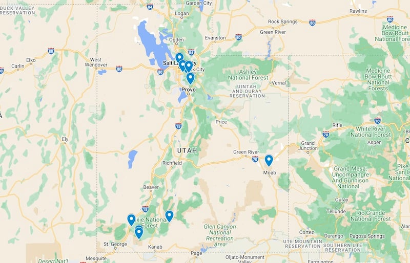
You can also click here for the interactive version of the map to easily save these recommended Utah hikes right to your phone.
Best Hikes In Northern Utah
Okay, let’s kick off our guide to the best hikes in Utah with some unforgettable northern Utah trails, including:
1. Mount Timpanogos
- Difficulty: Hard
- Length: 14.3 miles
- Location: Utah Valley
- Trailhead: There are two primary trailheads for Mount Timpanogos, but the most popular is the Aspen Grove Trailhead off of Highway 92, on the back of Mount Timpanogos
- Trail map: Click here for a Mount Timpanogos trail map
- Accommodation: Click here for hotels near Mount Timpanogos
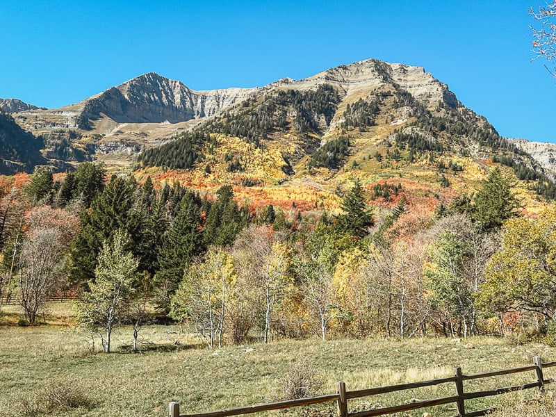
Mount Timpanogos is the second tallest peak in the Wasatch Range in northern Utah and offers a popular — albeit long and challenging — out and back hike to the summit. This is one of the best peaks to hike in Utah, though you’ll definitely want your sturdy hiking boots and possibly trekking poles for it.
You’ll experience a variety of terrains and views as you hike Timp. It’s a long hike, and you’ll trek through forests and wildflowers, pass by a few waterfalls, and see the scenic Emerald Lake.
After Emerald Lake, you’ll hike on an eternal snow pack — it never melts, even in summer — before hiking rocky slopes to the finish.
A really steep hike will get you to the saddle, where you’ll have views over the valley before continuing your beautiful hike along the rim until you reach the summit.
The views overlooking Utah Valley and Utah Lake are truly incredible and help to make this one of the best hikes in Utah County.
Beyond the stunning views, it is notable for its unique lightning shelter — a little hut at the summit in case a storm blows through while hikers are up there. None of the hikes or mountains in the area have anything like it, and it’s a neat experience to sit in this cabin-like structure at the top of a very tall mountain and take in the vista.
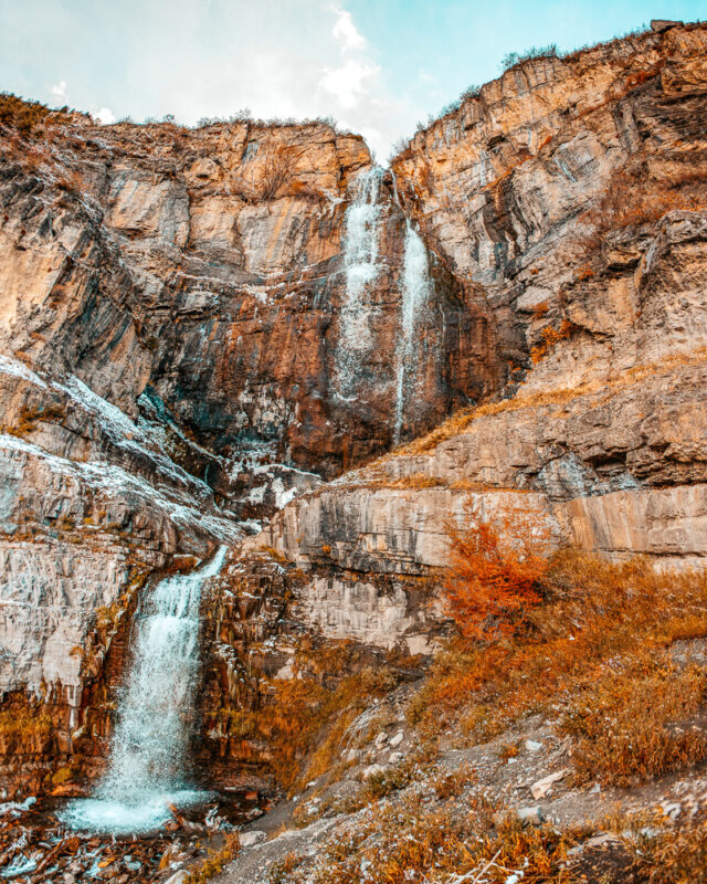
2. Stewart Falls
- Difficulty: Intermediate
- Length: 3.2 miles
- Location: The backside of Mount Timpanogos near Provo, Utah
- Trailhead: You can access the trailhead from the same place as Mount Timpanogos — Aspen Grove.
- Trail map: Click here for the trail map of Stewart Falls
- Accommodation: Click here for hotels in Provo
Stewart Falls is one of the best hiking trails in Utah, particularly if you love waterfalls.
This trail is a lovely hike on the backside of Mount Timpanogos. You’ll hike on mostly flat ground through a rich pine forest until you start descending to the waterfall.
This descent — and the subsequent hike back out — is fairly steep, but the rest of the trail is mild and pleasant.
Stewart Falls itself is a beautiful mountain waterfall, and while you can’t swim, you can cross the rocks in the stream and explore the different vantage points around the falls.
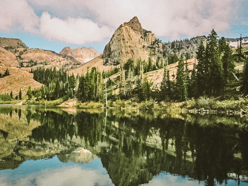
3. Lake Blanche
- Difficulty: Hard
- Length: 6.8 miles
- Location: Big Cottonwood Canyon
- Trailhead: Mill B South Trailhead Area
- Trail map: Click here for a trail map to Lake Blanche
- Accommodation: Click here for hotels near Big Cottonwood Canyon
Lake Blanche is one of the best hikes in Utah near Salt Lake City.
You’ll gain 2,800 feet of elevation in just 3 miles on this difficult hike; however, the payoff at the end makes it all worth it. Lake Blanche is a beautiful lake nestled among pine trees and mountain peaks.
You also get some views of Salt Lake Valley on the climb, and if you want to continue there is another set of lakes a little further on.
Swimming is not allowed, but you can relax and enjoy the scenery.
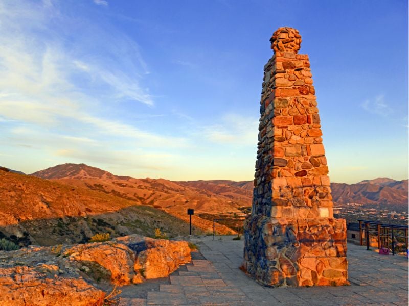
4. Ensign Peak
- Difficulty: Easy-moderate
- Length: 0.8 miles
- Location: Salt Lake City
- Trailhead: Ensign Peak Trailhead in Ensign Peak Memorial Park, about 10 minutes north of downtown Salt Lake City
- Trail map: Click here for a trail map of Ensign Peak
- Accommodation: Click here for hotels in Salt Lake City
This moderately steep but short hike takes you to an overlook with a fantastic view of Salt Lake City and the Salt Lake Valley.
This is a very popular spot for families, for picnics, and especially for sunsets!
This is also a top pick for dog-friendly hikes in Utah. Just note that dogs must be kept on a leash at all times.
5. Mount Olympus
- Difficulty: Very Hard
- Length: 6.6 miles round trip
- Location: Salt Lake Valley
- Trailhead: 5789 Wasatch Blvd, Holladay, on the east side of the Salt Lake valley
- Trail map: Click here for a trail map of Mount Olympus
- Accommodation: Click here for hotels in Holladay
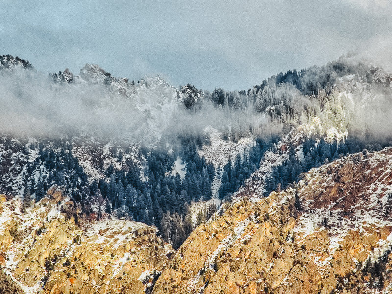
Mount Olympus is no joke. If you are looking for one of the hardest hikes in Utah, this is the one for you.
While Timpanogos (mentioned above) is a solid hike, this one will push you even more. The reward is a commanding view of the Salt Lake Valley from one of the most prominent peaks of the Wasatch Front.
With an elevation gain of 4200 feet, you start steep and stay that way, with a few restful flat sections interspersed.
Tackle stairs, enjoy streams, scramble across narrow ridges, and take in amazing views on this classic Utah hike.
6. Donut Falls
- Difficulty: Easy
- Length: 3.3 miles round trip
- Location: Big Cottonwood Canyon
- Trailhead: The trailhead starts about 9 miles up Big Cottonwood Canyon
- Trail map: Click here for a trail map of Donut Falls
- Accommodation: Click here for hotels in Big Cottonwood Canyon
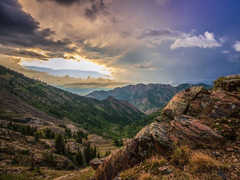
Donut Falls is one of the best waterfall hikes in Utah, as the easy trail takes you on a very scenic path through the forest to a unique waterfall.
These falls actually go through a hole in the rock that resembles a donut, and you can admire the falls from outside or inside the rocky area.
Best Hikes In Southern Utah
While there are great hikes in northern Utah, southern Utah has some of the best hiking spots and most beautiful hikes in Utah. Here are some of my favorites:
7. Fiery Furnace
- Difficulty: Intermediate
- Length: 2-4 miles
- Location: In Arches National Park
- Trailhead: The trailhead is located 14 miles into Arches National Park, and is just off of the main Arches National Park Road
- Trail map: Click here for a trail map of Fiery Furnace
- Accommodation: Click here for hotels near Arches National Park
To hike the Fiery Furnace, you’ll need to obtain a permit ahead of time from recreation.gov.
Note that permits open at 8am one week in advance and are very limited. In fact, they’re typically gone within less than a minute of becoming available, so plan ahead for this popular Utah day hike.
If you’re able to grab a permit, though, this is one of the best Utah hikes you will ever do.
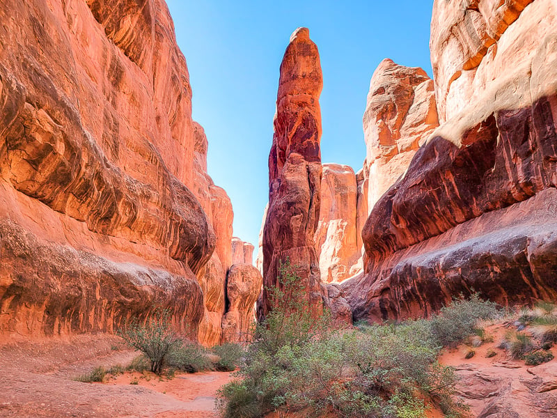
Fiery Furnace is a “backcountry” area of Arches filled with long rows of alternating fins and canyons.
The amazing rock formations create a maze-like area, with sheer walls, narrow passageways, cool rock features, a few arches, and plenty of opportunities to scramble over rocks.
Although there is a general pathway through the Fiery Furnace, there’s no actual trail, and you’re encouraged to go “off trail” and explore all the little nooks, crannies, and side shoots in the Furnace.
Between the limited number of people, the unique and epic landscape, and the chance to just wander and explore, this is a hike in Arches National Park you won’t ever forget.
8. The Narrows
- Difficulty: Hard
- Length: Anywhere from 2 miles to 10 miles
- Location: In Zion National Park
- Trailhead: The trailhead for the Narrows starts at the Temple of Sinawava. The first mile is a paved trail (The Riverside Walk) next to the river, before you reach the river itself. During the spring, summer, and fall, you must take the shuttle bus to the trailhead. In winter, you can drive yourself and park at the trailhead.
- Trail map: Click here for a trail map of The Narrows
- Accommodation: Click here for hotels near Zion National Park
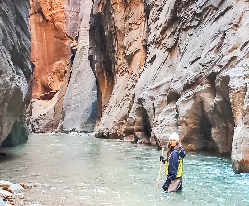
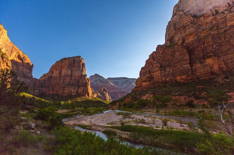
The Narrows is a unique hike in Utah in that you are hiking in a slot canyon — in a river! The towering canyon walls stretch 1500 feet above you as you hike, with the canyon narrowing the farther up you get.
The narrowest part of the river hike is the Wall Street section, where the canyon is only 22 feet wide. While that is wide for a Utah “slot canyon,” it still feels very narrow.
The end point for the Narrows Trail is at Big Springs, which would be a 10-mile round trip hike; however, very few people go that far. Actually, many people turn around when they are tired, and a lot just go to Wall Street (6 miles round trip) and end there.
While you don’t gain a ton of elevation on this trail, hiking upstream against the current on a rocky riverbed does require a lot of effort. The water height varies quite a bit, and can be anywhere from ankle deep to waist deep — and even more in some sections past Wall Street!
9. Angel’s Landing Trail
- Difficulty: Hard
- Length: 4.4 miles
- Location: Zion National Park
- Trailhead: The Angel’s Landing Trailhead is 5 miles from the entrance to the park. During the spring, summer, and fall, you must take the shuttle bus to the trailhead. In winter, you can drive yourself and park at the trailhead. To hike the Angel’s Landing Trail, you must have a permit, which you can apply for early in the Seasonal Lottery, or in the Day Before Lottery.
- Trail map: Click here for a map of Angel’s Landing
- Accommodation: Click here for hotels near Zion National Park
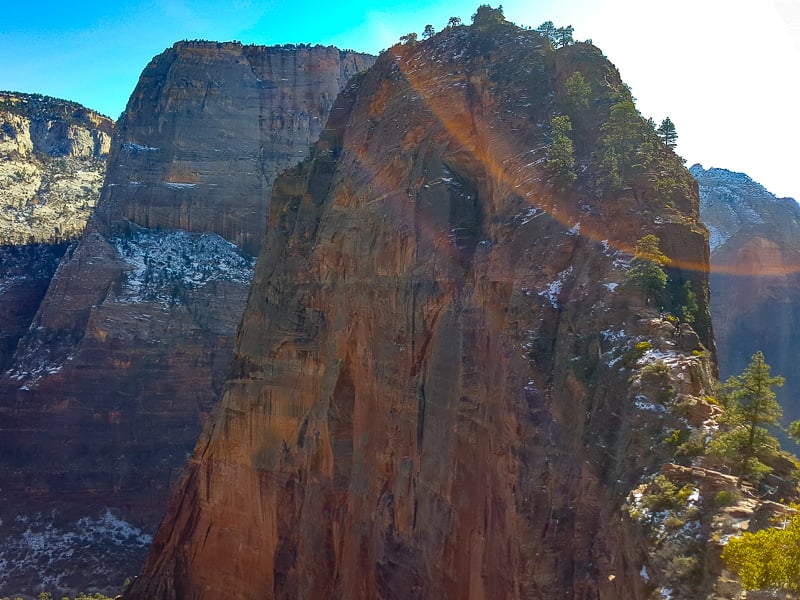
Angel’s Landing is one of the best places to hike in Utah, especially if you love truly shocking trails.
The first part of the trail is pretty normal and straightforward; you’re hiking up a mountain via switchbacks with beautiful views.
However, it’s in the last half of the trail — from Scout Lookout to the summit — where things get really epic. Here, you’ll hike along a super narrow and skinny piece of land connecting two mountains, and holding onto chains so that you don’t slip or fall off.
Definitely hang on tight and watch your step, as people have fallen before and lost their lives. If you have a fear of heights this section of the hike may not be for you.
Once you reach the summit, you’re rewarded with 360-degree views over the entire valley.
While the spectacular views from the summit are a highlight, it’s the final part of the hike up that makes Angel’s Landing such a bucket list experience. If you’re looking for the coolest hike in Utah, Angel’s Landing is your trail!
10. Navajo Loop and Queen’s Garden Trail
- Difficulty: Intermediate
- Length: 3.1 miles/ 5 km
- Location: Bryce Canyon National Park
- Trailhead: You can either start at Sunrise Point with the Queen’s Garden Trail or at Sunset Point with the Navajo Loop. You’ll end at the other location. You can drive to the trailhead or take the free shuttle.
- Trail map: Click here for a map to this scenic trail
- Accommodation: Click here for hotels near Bryce Canyon National Park
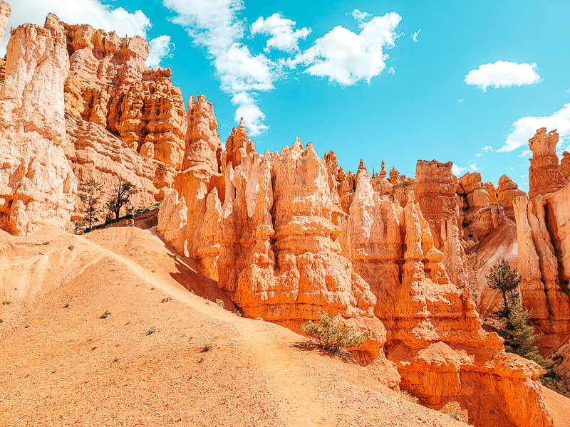
Bryce Canyon National Park is famous for the dramatic hoodoos that fill the park. These hoodoos are tall, skinny, knobby spires of rock, and are mostly orange.
This Utah trail takes you down into the Bryce Amphitheater — the main area of Bryce Canyon where there is a very large concentration of hoodoos. Here you’ll weave in and out of the hoodoos as you descend into the canyon and then climb back out.
The most Instagram-famous section of this amazing hike is known as “Wall Street” and is at the beginning of the Navajo Loop Trail. This section features tight, short switchbacks lined by a tall wall of hoodoos.
This hike takes you through some of the most otherworldly landscapes you will ever experience, and is one of the prettiest hikes in Utah!
11. Kanarra Falls
- Difficulty: Intermediate
- Length: 3.7 miles
- Location: Kanarraville
- Trailhead: At the Kanarra Creek Trailhead Parking Lot. This hike costs $12 per person to do and you must reserve your time online ahead of time. There are a limited number of reservations daily, and they sell out days to weeks ahead of time in the summer, so plan ahead.
- Trail map: Click here for a trail map of Kanarra Falls
- Accommodation: Click here for hotels in Kanarraville
If you want a lesser known and less intense version of the Narrows hike, Kanarra is an excellent option.
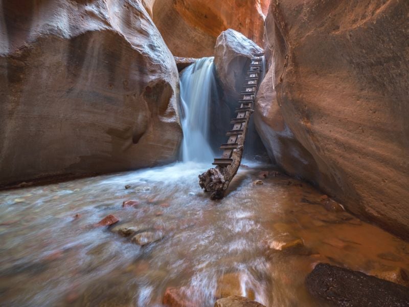
On this hike, you’ll alternate between hiking on dry ground and hiking through the creek, with sections of the trail being in a narrow slot canyon with undulating red-orange walls.
Your end objective is the waterfall, with a picturesque ladder against the side where you can climb to the top! This is one of the best slot canyon hikes in Utah.
12. Peekaboo and Spooky Canyon
- Difficulty: Intermediate-difficult
- Length: 5 miles
- Location: Escalante, Utah
- Trailhead: Lower Dry Fork Trailhead is where you’ll park and start the trail. To get here, you’ll drive about 28 miles on Hole in the Rock Road, an unpaved and very bumpy and washboard-y road. There are frequent potholes and bumpy areas, which means you’ll need to drive slowly. We did this one fine in a “regular” car; just drive carefully.
- Trail map: Click here for a trail map of Peekaboo and Spooky Gulch canyons
- Accommodation: Click here for hotels in Escalante
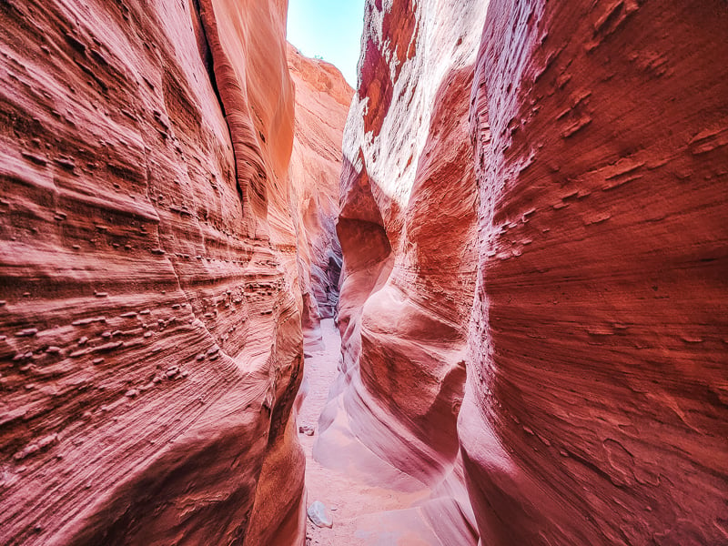
Peekaboo and Spooky Gulch Canyons is a really fun and adventurous hike through two of the best slot canyons in Utah.
While they are two separate canyons, they are right next to each other and it’s easy to combine both into a single hike.
This scenic trail actually starts with a 1.5-mile one-way hike from the trailhead to the start of the canyons, with the slot canyons themselves being approximately 0.5 to 1 mile long.
These slot canyons are incredibly narrow and they weave their way through the crevice in the rock.
At some points, you’ll actually need to turn sideways to fit through; I had to take off my backpack and hold it behind me for this.
There is a set of metal poles at the trailhead indicating how narrow it gets. Don’t ignore these — because if you can’t fit through, you will get stuck in the canyons!
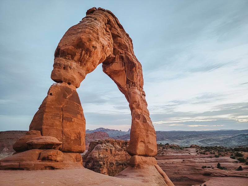
13. Delicate Arch
- Difficulty: Intermediate
- Length: 3.2 miles
- Location: Arches National Park
- Trailhead: The trailhead starts from the Delicate Arch Parking Lot, 12 miles from the Arches National Park Visitor Center
- Trail map: Click here for a trail map of Delicate Arch
- Accommodation: Click here for hotels near Arches National Park
Delicate Arch is the most famous arch in the world and definitely deserves its spot on this list of best hikes in Utah.
The trail starts on a dirt path, but then switches to hiking on smooth rock the rest of the way. You don’t see the arch until you’re literally at the summit, and then there is it, standing tall and independently in front of you.
This is one of the more popular hikes so there are lots of other people, but you can spread out along the bowl in front of the arch and get some space to yourself.
This is one of the top hikes in Utah and one of the best hikes in Utah National Parks.
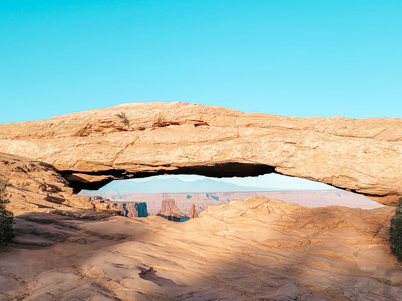
14. Mesa Arch
- Difficulty: Easy
- Length: 0.7 miles
- Location: Canyonlands National Park, Island in the Sky section
- Trailhead: The trailhead is at the Mesa Arch Trailhead, a 10 minute drive from the Island in the Sky Visitor’s Center
- Trail map: Click here for a trail map to Mesa Arch
- Accommodation: Click here for hotels near Canyonlands National Park
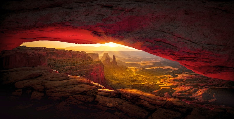
This easy yet spectacular hike delivers one of the best views in the Island of the Sky section of Canyonlands National Park.
After a relatively level, short hike, you’ll reach Mesa Arch — a wide and relatively flat arch.
What’s extremely cool about this arch is that it sits right on the edge of the mesa, so you get an amazing view through the arch as you look out over the river, buttes, and canyon below.
Sunrise is an very popular time to visit Mesa Arch, as the rising sun gets framed beautifully through the low arch.
Mesa Arch is one of the best easy hikes in Utah!
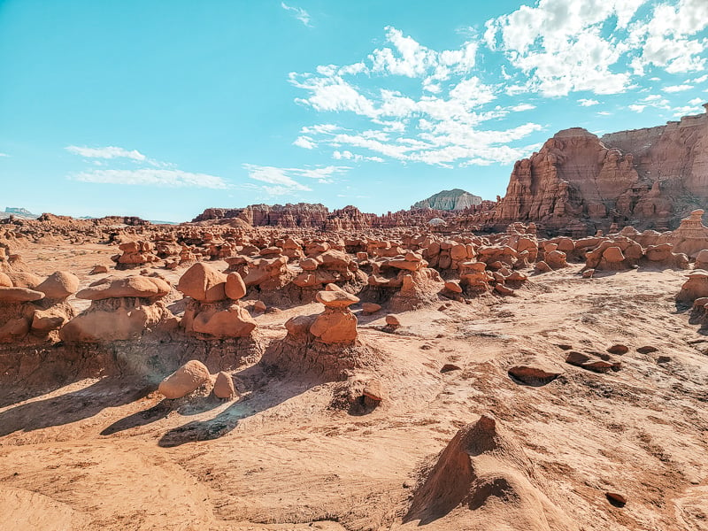
15. Goblin Valley
- Difficulty: Easy
- Length: As long or as short as you want it to be
- Location: Goblin Valley State Park
- Trailhead: The trailhead is at Goblin Overlook, which is at the end of Goblin Valley Road
- Trail map: N/A – no set trail in the main part of Goblin Valley
- Accommodation: Click here for hotels near Goblin Valley State Park
Goblin Valley is a fun state park in Utah offering some amazing sights. While there are a couple of dedicated trails along or outside the rim, the best hike really entails just wandering around the valley and exploring all the goblins.
The goblins are short, squat rock formations and the valley is full of them! Sometimes they are squished together or on a mound of dirt and you can climb up, in, and around them.
There’s no path so you just get to walk through and explore. This is an exceptionally fun area for kids to play and explore — but is really cool for adults too!
Important Tips For Enjoying The Best Hikes In Utah
1. Start your Utah hiking early in warm weather. In the summer, start early to avoid the worst heat. The weather is actually pretty nice between 6am-10am, making this a great time to enjoy the best Utah hikes mentioned above.
2. Bring enough water. According to REI, the general rule is about one half-liter of water per hour of moderate activity in moderate temperatures; but if you’re opting for a strenuous Utah hiking trail or are trekking in hot weather, bring more!
3. Properly prepare for colder temperatures. In winter, Utah can get snowy and slick, so if you’re hiking in the colder months, consider crampons to avoid slipping on ice, snow or snow.
4. Prepare for no cell service. I’d highly recommend downloading offline Google Maps so you can consult a map and get driving directions when you’re out of service areas. Note that most of the above-mentioned Utah hikes will take you out of cell service.
Alternatively, you can install the AllTrails App on your phone. While the paid version comes with offline maps, if you find and begin your hike by hitting “Navigate” when you have service it typically still works offline with the free version.
5. Hiking solo? Consider a packing a Personal locator beacon (PLB) or satellite messenger. Like the popular Garmin inReach Mini. Having one of these is key if you’ll be solo hiking or trekking in a remote area, as both of these tools can help you send SOS messages when in danger. Just make sure to check the coverage map for the device(s) you’re considering to make sure your specific trail is covered. You can check this guide for additional help with choosing a PLB or satellite messenger.
6. Save money on multiple Utah national parks. You’ll find many hikes within Utah national parks. In fact, Utah is home to five of them:
- Zion National Park
- Bryce Canyon National Park
- Arches National Park
- Canyonlands National Park
- Capitol Reef National Park
If visiting multiple of these parks, consider purchasing an America The Beautiful Pass, which gives you unlimited national park access across the country for a year for one flat fee!
Renting A Car For Your Utah Hiking Trip
The best way to get around Utah is with a car. This will allow you to reach all of the trailheads easily and on your own time.
Need to rent a car for your Utah hiking trip? Check out Discover Cars to quickly compare your rental options.
Their comparison tool does the homework for you, so there’s no need to have up 10+ tabs trying to figure out which company is the most affordable. Actually, you can save up to 70% using their tool!
Packing Essentials For Hiking In Utah
I always bring a good backpack and water bottle (like my favorite Hydro Flask), or a camel pack when hiking.
Make sure you bring a hat and sunscreen. The high altitude in Utah can quickly cause sunburns.
Many of the rocks that you’ll be hiking on in Utah — especially in southern Utah — are grippy sandstone, but I’d still highly recommend good trekking sneakers or hiking boots with tread when hitting the trails. In northern Utah, you’re more likely to run into looser shale.
In terms of what to wear when hiking, it’s smart to wear moisture-wicking clothing as your base layer to help keep yourself dry and temperate so you can comfortably enjoy these most spectacular trails.
Of course, check the weather forecast to see if you’ll also need a rain jacket, dry bag, etc.
Final Thoughts On The Best Hiking In Utah
Utah’s desert landscape, mountains, and unique geological history make for some of the best hiking in the entire country — if not the world!
Truly, the hikes in Utah are some of my favorite I’ve ever done. If you’re planning on hitting these top hikes and trails in Utah, you are in for a great time.
Where To Get Utah Travel Insurance
When visiting Utah — or anywhere else in the world — it’s wise to get travel insurance.
One of the best travel medical insurance for travelers is SafetyWing as they’ve got a large network and offer both short-term and long-term coverage — including coverage if you’re traveling for months as well as limited coverage in your home country.
Additionally, SafetyWing is budget-friendly and offers $250,000 worth of coverage with just one low overall deductible of $250.
Click here to price out travel insurance for your trip in just a few clicks.
What trails would you add to this list of best hikes in Utah?
About The Author:
Stephanie is the author of the travel blog TheUnknownEnthusiast.com, where she blogs about visiting epic travel destinations throughout the world on a budget. You can find her on Pinterest, Instagram, or Facebook.
*Featured Utah hiking image via dennis George for Pexels


Hi, I’m Jessie on a journey!
I'm a conscious solo traveler on a mission to take you beyond the guidebook to inspire you to live your best life through travel. Come join me!
Want to live your best life through travel?
Subscribe for FREE access to my library of fun blogging worksheets and learn how to get paid to travel more!
Turn Your Travel Blog Into A Profitable Business
Subscribe to my email list to snag instant access to my library of workbooks, checklists, tutorials and other resources to help you earn more money -- and have more fun -- blogging. Oh, and it's totally FREE! :) // Privacy Policy.