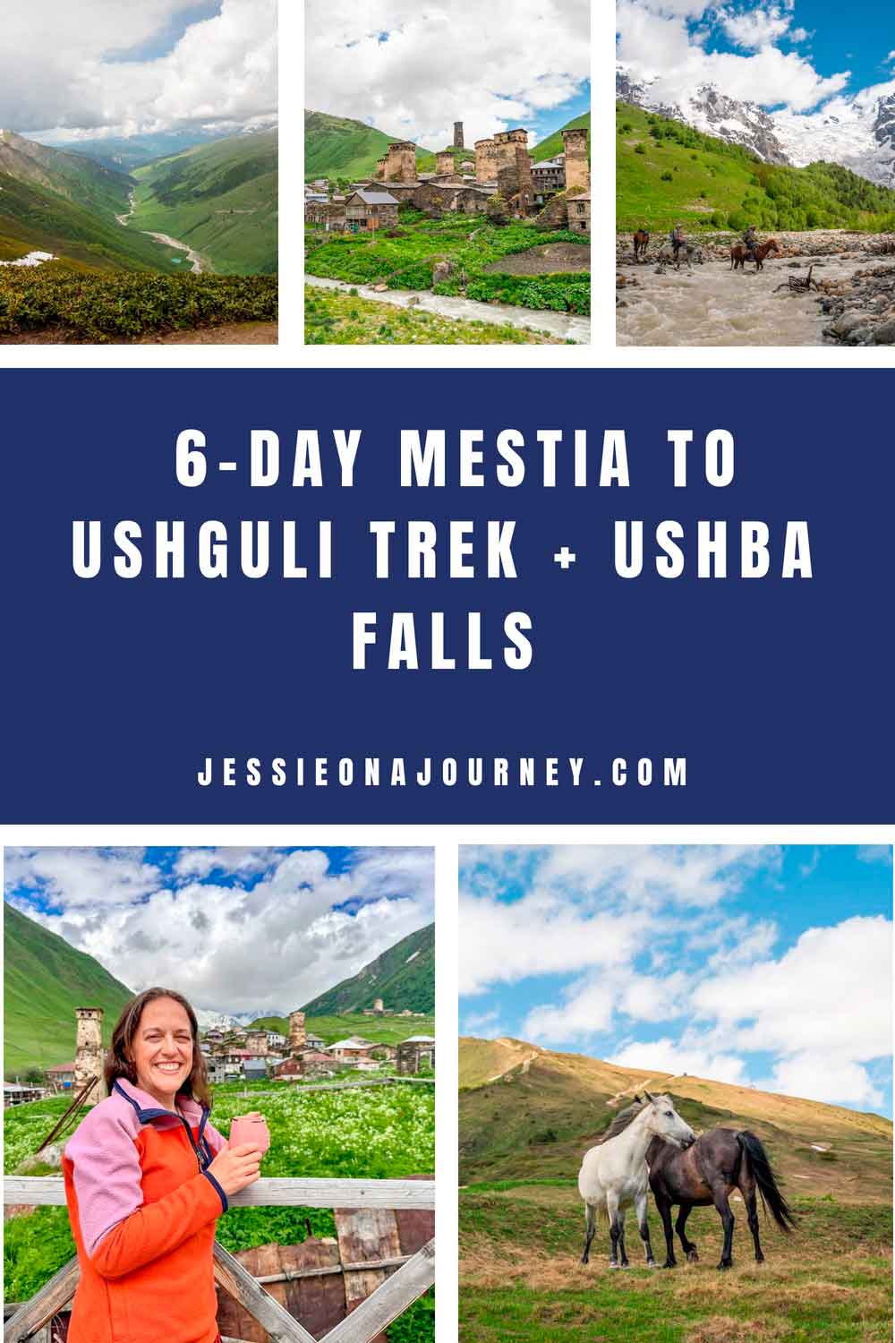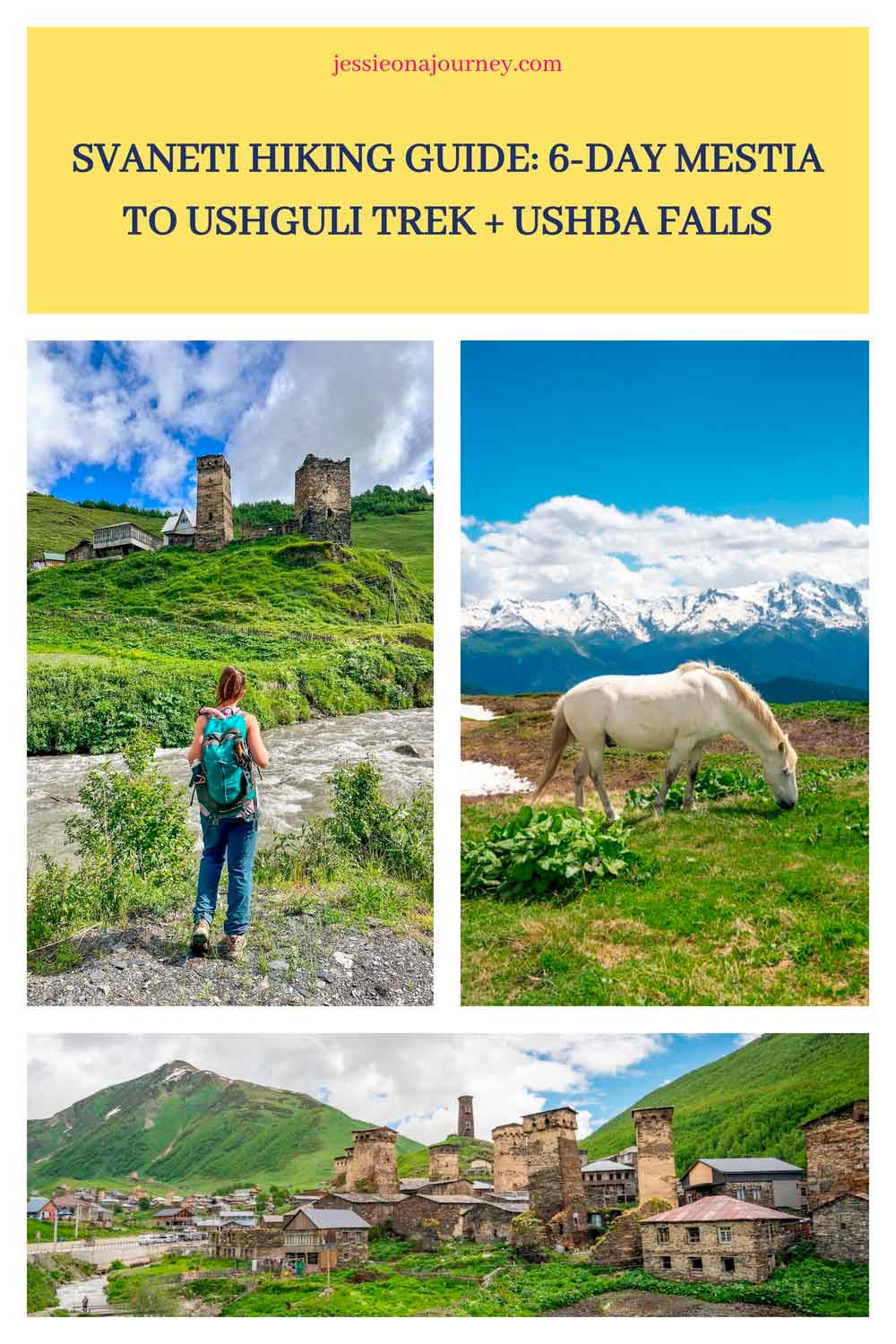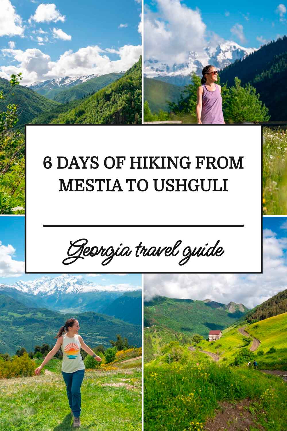
Svaneti Hiking Guide: 6-Day Mestia to Ushguli Trek + Ushba Falls
This post contains affiliate links, including Amazon affiliate links. If you purchase through these links, I may earn a commission at no extra cost to you. As an Amazon Associate, I earn from qualifying purchases. Thank you for your support!
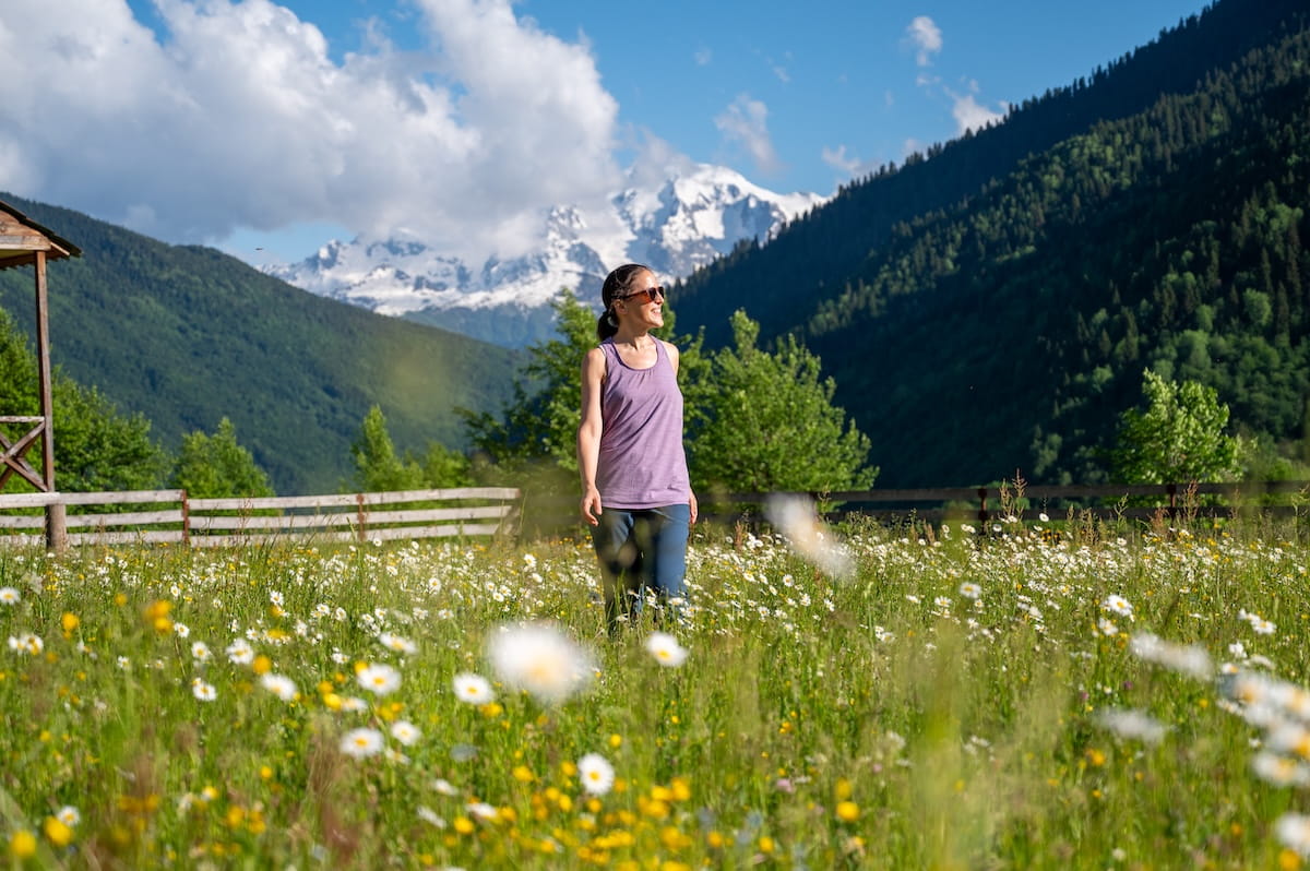
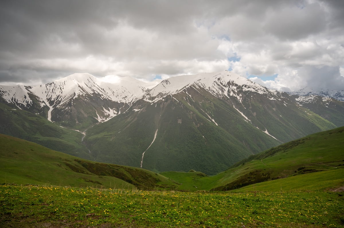
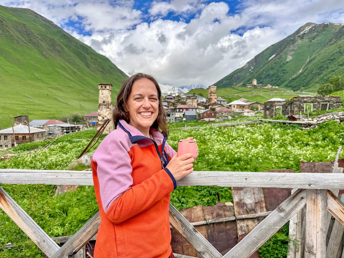
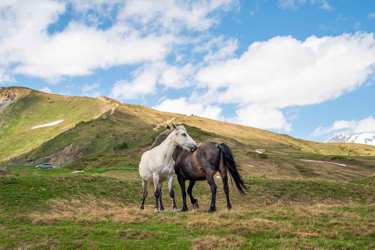
Imagine hiking through a lush alpine meadow surrounded by grazing horses and fields of wildflowers, while medieval stone defense towers rise against a backdrop of towering snow-capped peaks.
Welcome to Svaneti, Georgia — a stunning corner of the Caucasus Mountains that looks like a fairytale come to life. It’s one of the most beautiful trekking destinations I’ve ever visited.
The most popular route here is a 4-day trail from Mestia to Ushguli, home to the UNESCO-protected village of Chazhashi.
That said, I’ve created an extended 6-day trekking route (8 days with travel) that adds acclimatization hikes to Ushba (Shdugra) Waterfall — Georgia’s largest waterfall — and the sky-high Koruldi Lakes.
This way, you can choose your own adventure! If you’re short on time, you can easily stick with the classic 4-day path. But if you have the flexibility, the full 6 days offers a much more complete experience.
Whether you’re going self-guided or booking a Svaneti trekking tour, here is a complete guide with day-by-day breakdown, maps, guesthouse recommendations, and packing essentials!
🥾 Quick facts:
Length: 83.1 km (51.6 mi), 6 days of trekking (8 days with travel)
Difficulty: Moderate to hard
Best time: June–September
eSIM: My Saily eSIM worked perfectly along the trail. 3 GB was enough for me, as guesthouses also typically had Wi-Fi.
Travel Insurance: SafetyWing. Note that it’s mandatory to have travel insurance to enter Georgia, so you’ll want a printout of your policy and purchase receipt.
Recommended operator: TrekGeorgia (shoutout to my amazing guides Eka and Gogi!)
An Introduction To Georgia’s Svaneti Region
Where Is Svaneti Located?
Located in northwestern Georgia in Europe, Upper Svaneti is a high-altitude region entirely enclosed by the Greater Caucasus Mountains.
It sits directly below some of the country’s highest peaks, including the twin-peaked Mount Ushba (4,710 meters) and Mount Shkhara (5,203 meters), Georgia’s highest point.
A Brief History Of Svaneti
Due to rugged mountain passes blocked by heavy winter snow, Svaneti was historically cut off from the rest of Georgia, which allowed the local Svan people to preserve their own unwritten language and unique traditions.
Svaneti’s history stretches from the ancient Kingdom of Colchis and Roman rule to a cultural boom during Georgia’s 12th-century golden age. By the 15th century, the region operated under its own local autonomy — a period known as “Free Svaneti” that lasted until Russian rule in the 19th century.
Today, the focus has shifted to welcoming adventure tourism while preserving that same deep-rooted mountain lifestyle.
Svaneti Trekking Overview + Trail Map
Get ready for one of the world’s best hikes! The classic trail from Mestia to Ushguli is actually a prominent section of the Transcaucasian Trail (TCT) — a network of long-distance routes currently in development to connect Georgia, Armenia, and Azerbaijan across the Caucasus Mountains.
Because this is a point-to-point route with added day-hike loops, your basecamp will shift as you move deeper into the valleys.
My Svaneti itinerary at a glance was:
Pre- & Post-Trek:
- Tbilisi, Georgia
Trekking Itinerary:
- Day 1 (Travel Day): Tbilisi to Mazeri (via Enguri Dam)
- Day 2: Mazeri to Ushba Waterfall Loop Hike
- Day 3: Drive 1 hour to Mestia to hike the Koruldi Lakes Loop
- Day 4: Hike from Mestia to Chvabiani Village
- Day 5: Hike from Chvabiani Village to Adishi Village
- Day 6: Hiking from Adishi Village to Iprali Village
- Day 7: Hiking from Iprali Village to Ushguli
- Day 8 (Travel Day): Ushguli to Tbilisi (via Kutaisi)
As for maps, you can combine the following AllTrails maps and also grab my pre-plotted Google Map:
➡️ Click here for a Mazeri to Usha (Shdugra) Waterfall trail map.
➡️ Click here for a Mestia to Ushguli trail map.
🎁 Grab access to my free Travel Planning Toolkit for a Google Map with the stops in this guide pre-plotted.
Svaneti Trekking Logistics
Getting to Mazeri & Mestia from Tbilisi
It’s a 440-kilometer (273-mile) drive from Tbilisi to Mazeri, which typically takes about 10 hours — including a lunch stop. If you book with a company like TrekGeorgia they’ll handle this for you, or you can hire a private driver through a company like Georgian Transfer or Camp Caucasus.
If you’d prefer to do public transportation, you can take a train to Zugdidi and then switch to the marshrutka (minibus) to Mestia, but ask to be dropped off at the turning point toward Mazeri. From here, you’ll need to walk the remaining 5-6 kilometers or work out transport with your guesthouse.
If you prefer to start in Mestia and do the traditional 4-day Mestia to Ushguli trek, the public tranport will be easier, as you’d simply take the marshrutka to Mestia.
Trail Length
Approximately 83.1 km (51.6 mi) of active hiking across 6 trekking days, bookended by 2 travel days.
Trail Difficulty
Moderate to Hard. The village-to-village transits are highly manageable for anyone reasonably fit, but specific sections — like the steep trek to Koruldi Lakes or the Guli Pass (2,961 meters) — require significant effort and steep climbing.
Hiking Safety & Flexible Planning
You must stay adaptable. Lingering snow can easily block high mountain passes well into late June. If a key route like the Guli Pass is impassable due to deep snow, you need to be prepared to pivot your route.
Best Time To Trek Svaneti
June through September. July and August offer peak summer weather, while June and September bring fewer crowds but carry a higher risk of un-melted trail snow and rain.
Guesthouse Infrastructure
One of the best things about hiking in Svaneti is that no camping is required. You can stay in local village guesthouses with simple, clean rooms where bedding and towels are provided alongside hot showers (often via shared facilities). Most locations even offer Wi-Fi, though it can be quite weak.
Food Along The Trail
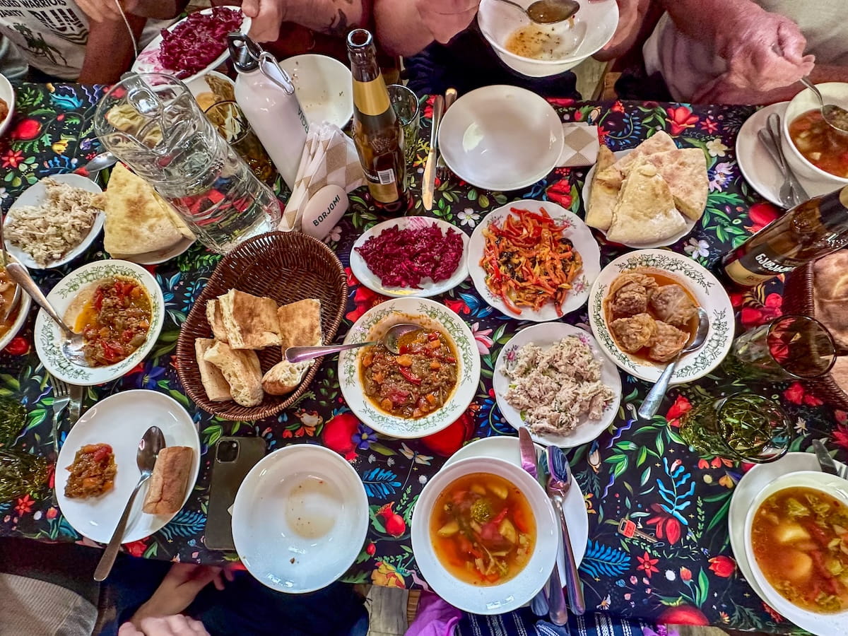
Guesthouses serve massive, family-style meals featuring traditional Georgian and Svan dishes like vegetable soups, stewed eggplant, potato salads, and khachapuri (cheese bread).
Additionally, your stay typically includes breakfast and a spread of foods like bread, boiled eggs, tomatoes, cucumbers, and cheese for a packed lunch.
On most days, you’ll also pass family-run trailside cafes selling water, soft drinks, beer, wine, and chacha (Georgian brandy) as well as homemade foods like soups, bread, yogurt, and foraged fruit jams.
Drinking Water
While Svaneti’s tap water is safe to drink, its high mineral can upset your stomach if you’re not used to it. The people in my trekking group who drank the tap water didn’t have an issue, though I personally like to use my LifeStraw Go Filtering Bottle to be safe.
Luggage Transfers
If you want to walk light, booking with a local operator like TrekGeorgia means they’ll transport your main luggage by car from village to village. This also gives you the flexibility to catch a ride if you want to skip a trekking day.
Trail Highlights & Notable Views
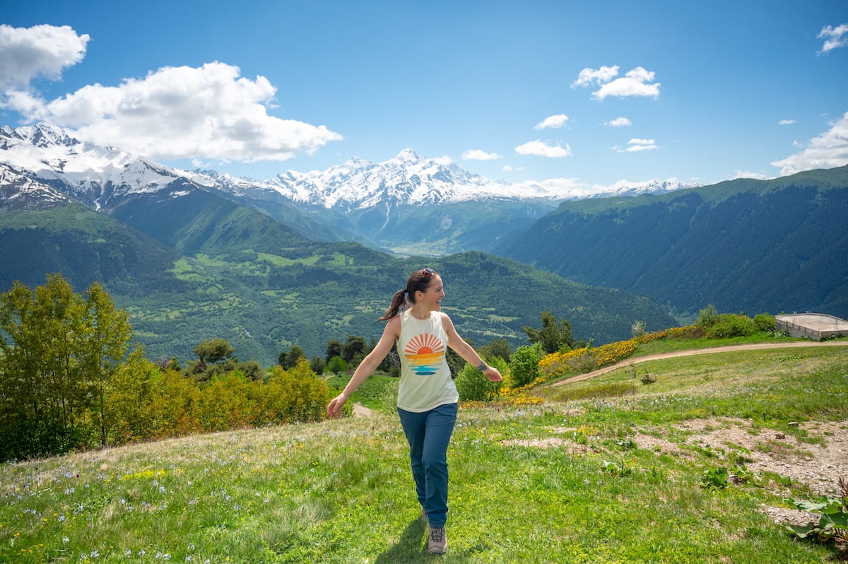
This route offers an incredibly idyllic mountain experience. You’ll stand on a large bridge over the rushing Dolra River, walk through expansive meadows filled with grazing horses and fields of vibrant yellow and purple wildflowers, and explore medieval stone defense towers. You’ll also take in epic views of Caucasus giants over 15,000 feet — like Mount Ushba, Tetnuldi, Gistola, and West Shkhara.
Hardest Day
Mestia to Koruldi Lakes is typically considered the hardest section, especially if you include the Guli Pass; however, Adishi to Iprali is also pretty strenuous with uphill sections and a long 19-kilometer (11.8-mile) route.
Guided vs Self-Guided Trekking
You can hike around Svaneti on your own or with a guide. Personally, I went with TrekGeorgia, which allowed me to focus on the hike while they handled logistics, luggage transfers, and accommodation booking.
The total tour cost of their 8-Day Guided Trekking Tour in Svaneti (Group Tour) was $1,240 USD, with the option to pay an optional $320 USD for your own room, which I thought was worth it.
This price included all accommodation, food, filtered water, luggage transfers — basically everything besides drinks (outside of water), souvenirs, and tips.
That being said, I saw many solo hikers and groups of friends doing this trek fully self-guided and enjoying the experience. You can use AllTrails Peak or Plus for this, as these plans include offline map usage, or go through a company like Camp Caucasus, who will provide maps and also handle accommodations and luggage transfers.
Svaneti Trekking Itinerary (In-Depth)
Now that we’ve gone over the important logistics of this Svaneti trek, let’s go over an in-depth itinerary so you can truly see what the hike is like.
To recap, the itinerary includes 6 days of trekking plus 2 days of travel for a total of 8 days.
📍Day 1 (Travel Day): Tbilisi to Mazeri (via Enguri Dam)
Hiking Distance: 0 kilometers
Highlights: Stopping at the massive concrete arch Enguri Dam and viewing its lovely turquoise reservoir.
The 440-kilometer (273-mile) drive from Tbilisi to Mazeri is a full 10-hour travel day (including lunch break), but it offers a beautiful look at Georgia’s changing landscapes as you leave the capital city behind and wind deeper into the mountains.
To break up the journey, stop at the Enguri Dam — the world’s second-highest concrete arch dam at 271.5 meters (891 feet) in height. It restrains the glacial meltwater of the Enguri River, creating a bright turquoise reservoir that is fun to photograph.
Onsite, there is also an art gallery with very interesting modern art.
🏨 Hotel Ushba Hill. This guesthouse is surrounded on all sides by the dramatic Caucasus Mountains, offering gorgeous views right from the property. Expect clean rooms, private bathrooms with hot showers, and reliable Wi-Fi. The hosts are also very kind and serve a delicious family-style spread of traditional Svan and Georgian cooking for dinner — including the best potato salad of the trip. They also supplied the heartiest lunch box offerings of any guesthouse I stayed at.
📍Day 2: Mazeri to Ushba (Shdugra) Waterfall
Hiking Distance: 12 kilometers (7.4 miles)
Elevation Gain: 682 meters (2,519 feet)
Highest Point: 2,342 meters (7,683 feet)
Map: Click here for a trail map
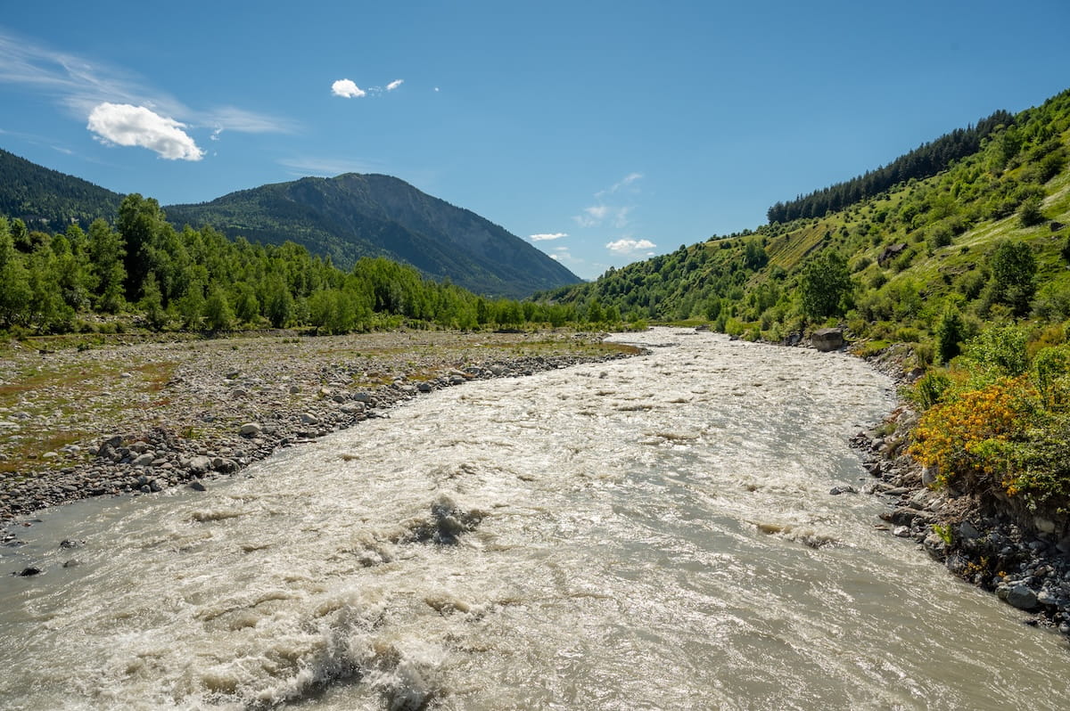
Highlights: Standing on the large Dolra River bridge, walking through flower-filled meadows with grazing horses, and standing at the base of Georgia’s largest waterfall.
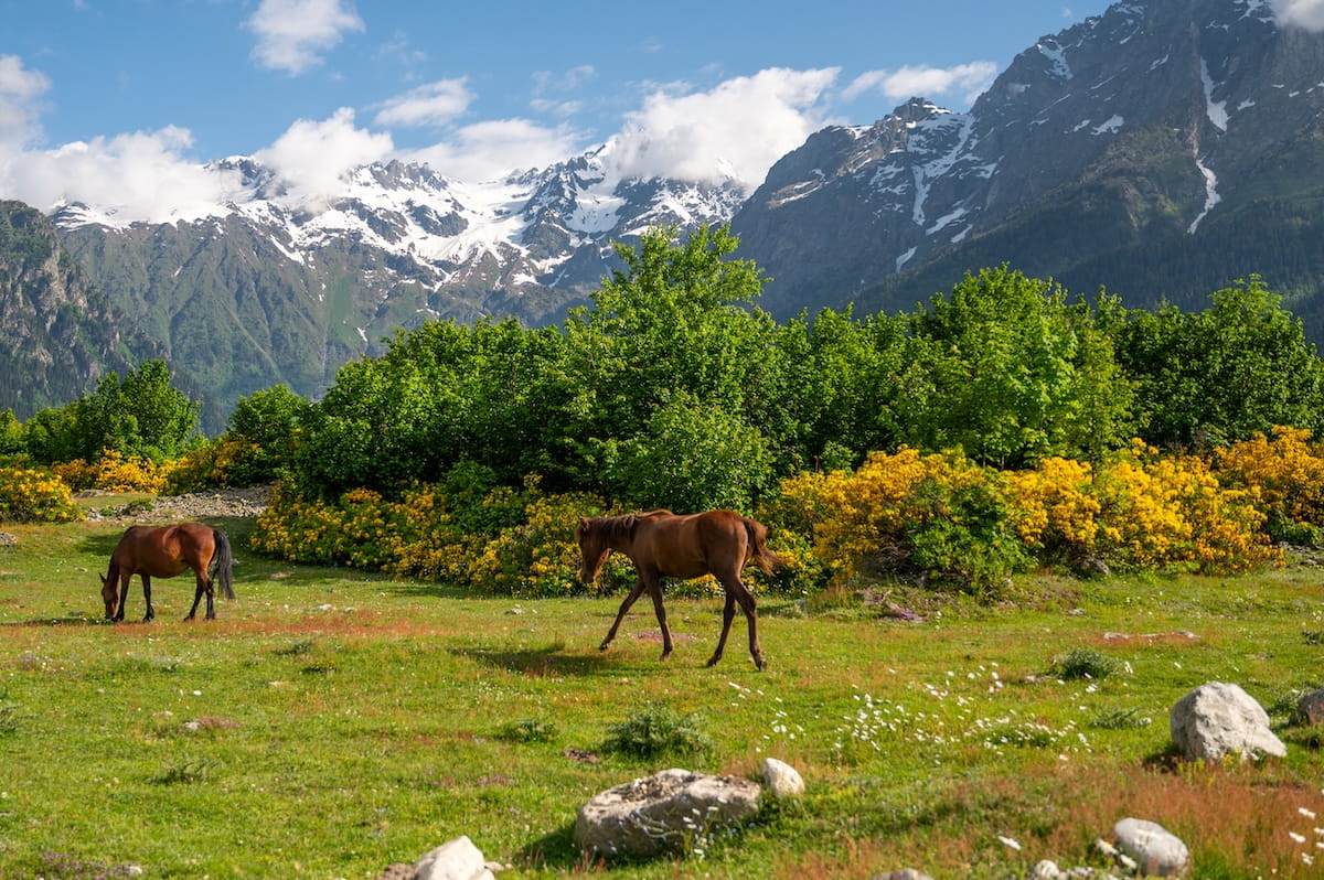
Today is the first official hiking day, starting directly from our guesthouse. The trek begins on a flat road through the valley floor past grazing horses and fields of yellow wildflowers.
Along the path, we pass an ancient stone church. Our guide, Eka, shares that these medieval churches double as sacred vaults, originally used to hide Georgia’s royal treasures from foreign invaders. Today, they belong directly to local family clans who keep them locked to protect these centuries-old heirlooms.
Next, we cross a large wooden bridge over the roaring Dolra River before reaching the Hiker’s Inn, a lakeside cafe with restroom in the forest that is a great refreshment stop on the way back. Tip: Try their baked trout in dough, a traditional Svan dish!
Leaving the inn, the trail winds through dense patches of yellow azaleas — which Eka and Gogi warn can cause minor headaches if you breathe near them too closely.
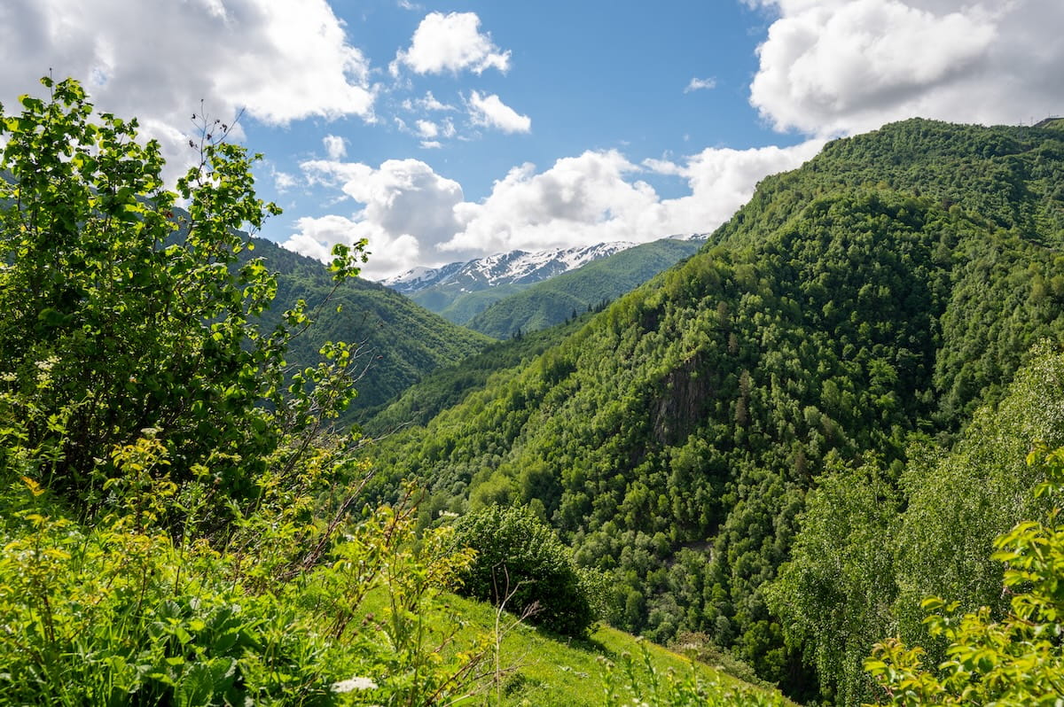
From here, the trail enters a pine forest and turns into a steep climb. The trees eventually clear to reveal far-off views of the waterfall cascading down the cliffs as well as a panoramic view of high Caucasus peaks like Gvadarashi (3,750 meters) and Chkeeru (3,587 meters).
Near the top, the trail emerges onto an alpine snowfield. The terrain gets slippery, making trekking poles an absolute lifesaver. Once you hit the base, you are standing in front of Ushba (Shdugra) Waterfall, the tallest and most voluminous waterfall in Georgia.
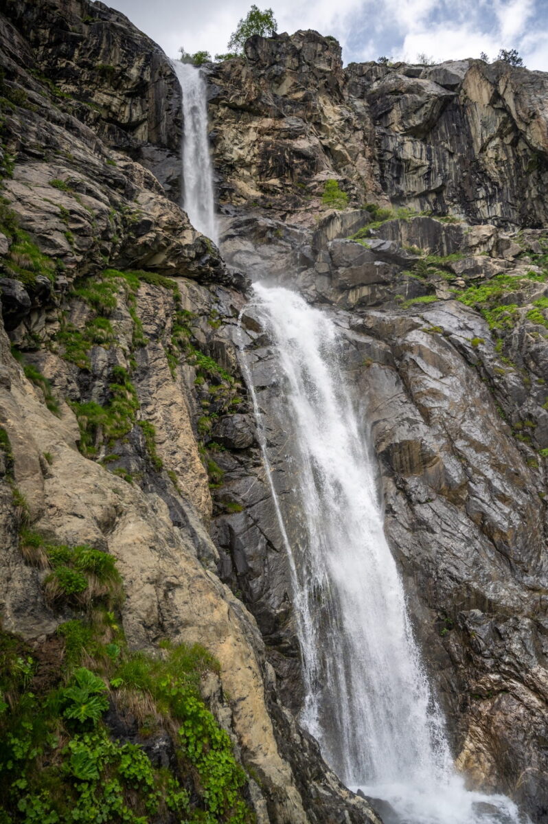
The cool mist hits you from hundreds of meters away, making it a great place to eat your lunch before hiking back down the same way you came.
🏨 Hotel Ushba Hill (the same as last night).
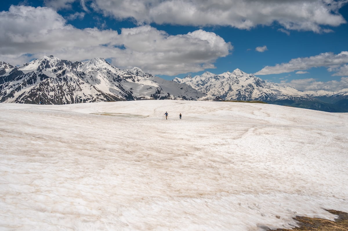
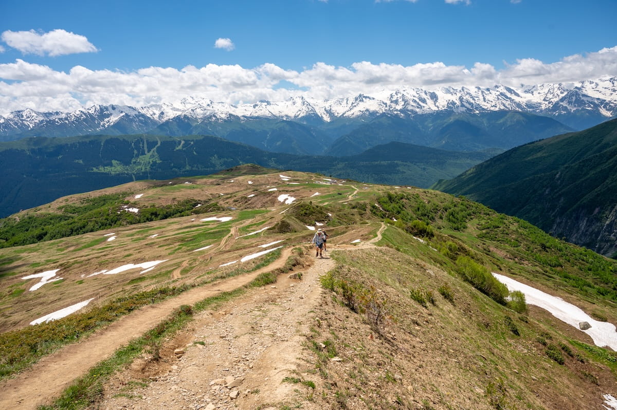
📍Day 3: Mestia to the Koruldi Lakes
Hiking Distance: 11.1 kilometers (6.9 miles)
Elevation Gain: 882 meters (2,894 feet)
Highest Point: 3,000 meters (9,843 feet) — you can also stay lower or hike higher if you’d like
Map: Click here for a trail map
Highlights: Taking a 4×4 ride to the Cross Over Mestia viewpoint, non-stop 360-degree high peak panoramas, and a mountain cafe party with shots of chacha.
This day of our Svaneti trekking itinerary normally takes you over the high Guli Pass (2,960 meters) to walk directly from Mazeri into Mestia.
However, because the pass is blocked with deep snow that has lingered into late June, we drive one hour down pastoral roads to Mestia, converting this stretch into an epic loop.
Once in Mestia, we switch from a bus to a 4×4 for a rugged 20-minute ride up to the Cross Over Mestia, where you can take in 360-degree views of the surrounding peaks from 2,171 meters (about 7,122 feet). Even if you just drive here and don’t hike you’ll enjoy incredible scenery.
But, this is a hiking trip, so we continue up! The trail wastes zero time turning into a strenuous, non-stop uphill grind that keeps our calves burning the entire time, though luckily we’re continuously surrounded on all sides by glacial-carved granite massifs and deep green valleys.
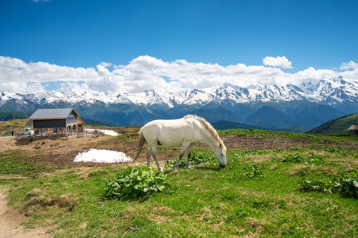
Even in late June, we hit patches of snow near the Koruldi Lakes (2850 meters), which have frozen over. For an even higher vantage point, my group keeps hiking to 3,000 meters, which truly makes me feel on top of the world.
Of course, what goes up must come down, and the descent requires heavy concentration to maneuver over loose rock and slick snow patches.
Near the bottom, we run into a herd of local horses grazing against the mountain backdrop. It looks so idyllic, Taylor Swift’s “Today Was a Fairytale” begins playing in my head.
However, the ballad is soon overtaken as we reach a tiny mountain cafe blasting party music from Akon and Lady Gaga, where we celebrate the day’s trek by toasting shots of chacha (Georgian brandy).
🏨 Hotel Shgedi Mestia. While the other Svaneti accommodations in this guide are guesthouses, this is a typical hotel with spacious rooms, private bathrooms with hot showers, and fast Wi-Fi. They also served my favorite dinner buffet of the trip, as along with heavy Georgian dishes it included lighter salads, hot meat dishes, vegetable soup, fresh fruits, and even desserts (which was rare!).
In terms of location, you’ll be within walking distance of Mestia’s restaurants, bars, grocery stores, and pharmacies. A few recommendations include Coffee Kor for java drinks, KRK for cocktails and live music, Cafe Panorama for elevated terrace views, or Cafe Bar Puba for authentic Svan food.
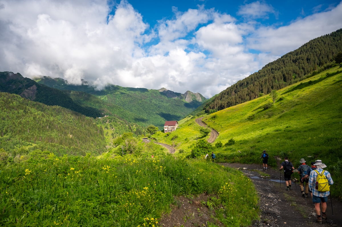
📍Day 4: Mestia to Chvabiani Village
Hiking Distance: 17 kilometers (10.6 miles)
Elevation Gain: 768 meters (2,519 feet)
Highest Point: 1,905 meters (6,250 feet)
Map: Click here for a trail map
Highlights: Trekking through massive fields of yellow and purple wildflowers, exploring the 14 historic towers of Lakhiri village, and climbing a real 12th-century Svan defense tower.
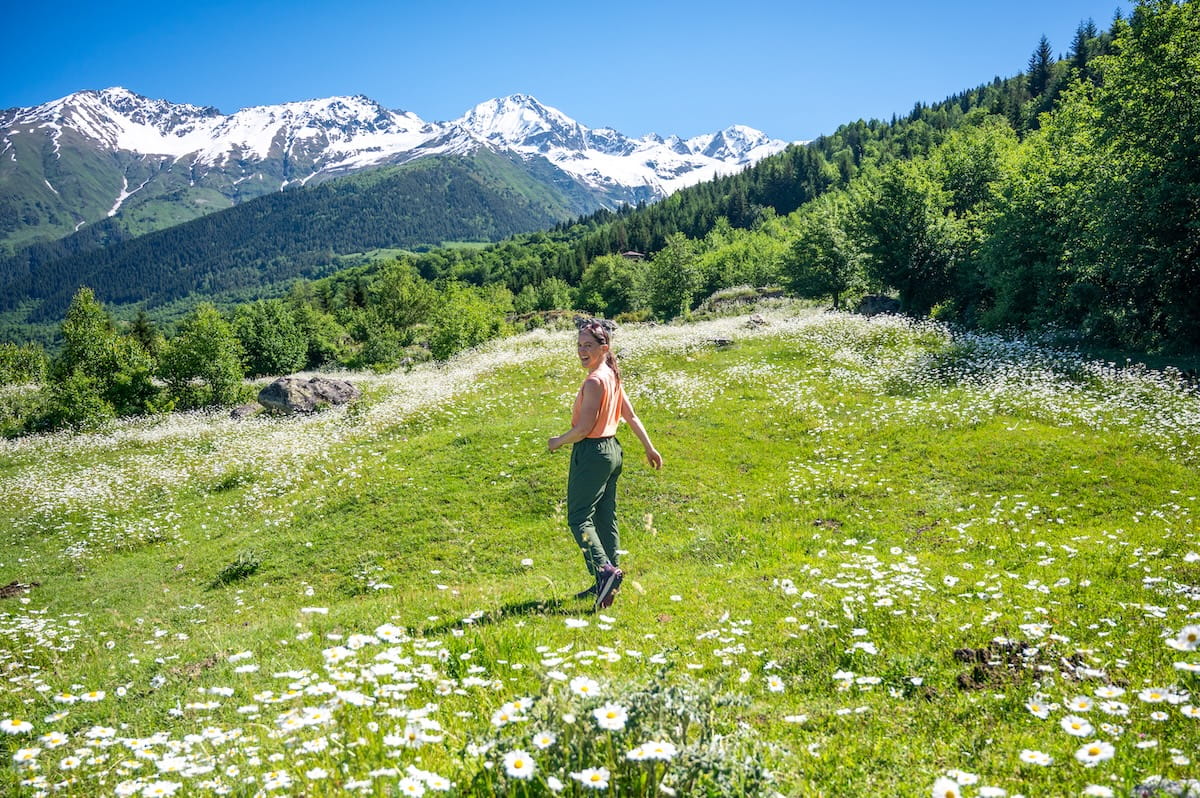
Today begins the classic trek from Mestia to Ushguli. Almost immediately, the song in my head is “The Sound of Music,” because almost the entire trek treats us to fields of yellow and purple flowers backed by towering Caucasian peaks.
After trekking through Mestia townlet, we become immersed in flowers backed by snow-capped mountains.
You will work for these views, as there is a lot of uphill during the first half — including a very steep, 25-minute stretch through the forest that eventually emerges back into floral and high peak beauty.
We stop at an open-air cafe at 1,905 meters to eat, pairing our lunch boxes with wine, beer, homemade lemonade, and cups of fruit salad.
From here, it’s about 3 hours to the village of Chvabiani, traversing a mainly even and downhill path through the villages of Lakhiri and Cholashi.
Right before reaching Lakhiri, we hit an incredibly idyllic scene: expansive fields of white and yellow flowers backed by Mount Tetnuldi and Svaneti’s famous stone towers.
Lakhiri itself is fascinating and home to roughly 14 historic stone towers, a high density for the small village.
You’ll find thousands of these towers all over Svaneti. Built primarily between the 9th and 13th centuries, they helped protect family clans from invasions and multi-generational blood feuds. Today, they’re often used for storage and tourism purposes.
Closer to Chvabiani, we stop at Guesthouse Tetnuldi for homemade refreshments like juices, yogurt, jam, and bread. Here, Gogi grabs a sickle to help the guesthouse family cut their grass — a beautiful example of how Svan neighbors help each other out.
Feeling refreshed, we cross the rushing Mulkhra River into Chvabiani.
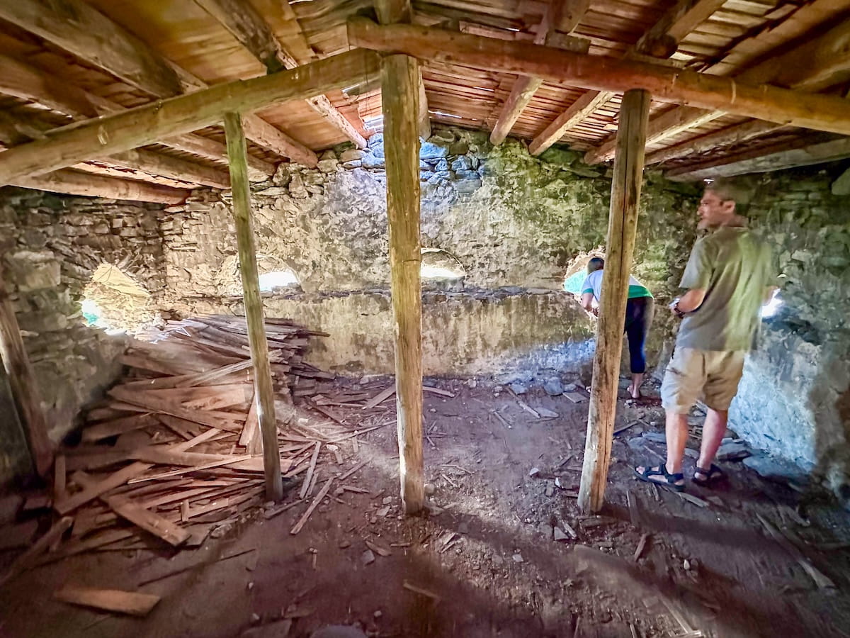
🏨 Maia’s Guesthouse. This Chvabiani accommodation features private rooms with shared bathrooms, delicious homemade food, and strong Wi-Fi in the outdoor common areas. Interestingly, it’s home to a 12th-century tower that has been in the owner’s family the entire time. He let our group go inside and climb to the top floor up skinny ladders — a palm-sweating adventure with incredible views.
For breakfast, they served a massive spread of porridge, homemade jam, bread, egg bake, noodle casserole, sausages, cornmeal cakes, and molasses nut bread with instant coffee, milk, and tea.
📍Day 5: Chvabiani Village to Adishi Village
Hiking Distance: 11 kilometers (6.8 miles)
Elevation Gain: 850 meters (2,789 feet)
Highest Point: 2,445 meters (8,022 feet)
Map: Click here for a trail map (Chvabiani and Zhabeshi are less than 1 mile apart)
Highlights: Idyllic alpine meadows, panoramic high peak views, and a unique small village dance club.
Today you’ll work for your panoramic views, with steep ascents and descents to Adishi, a small 20-family village known for its medieval towers.
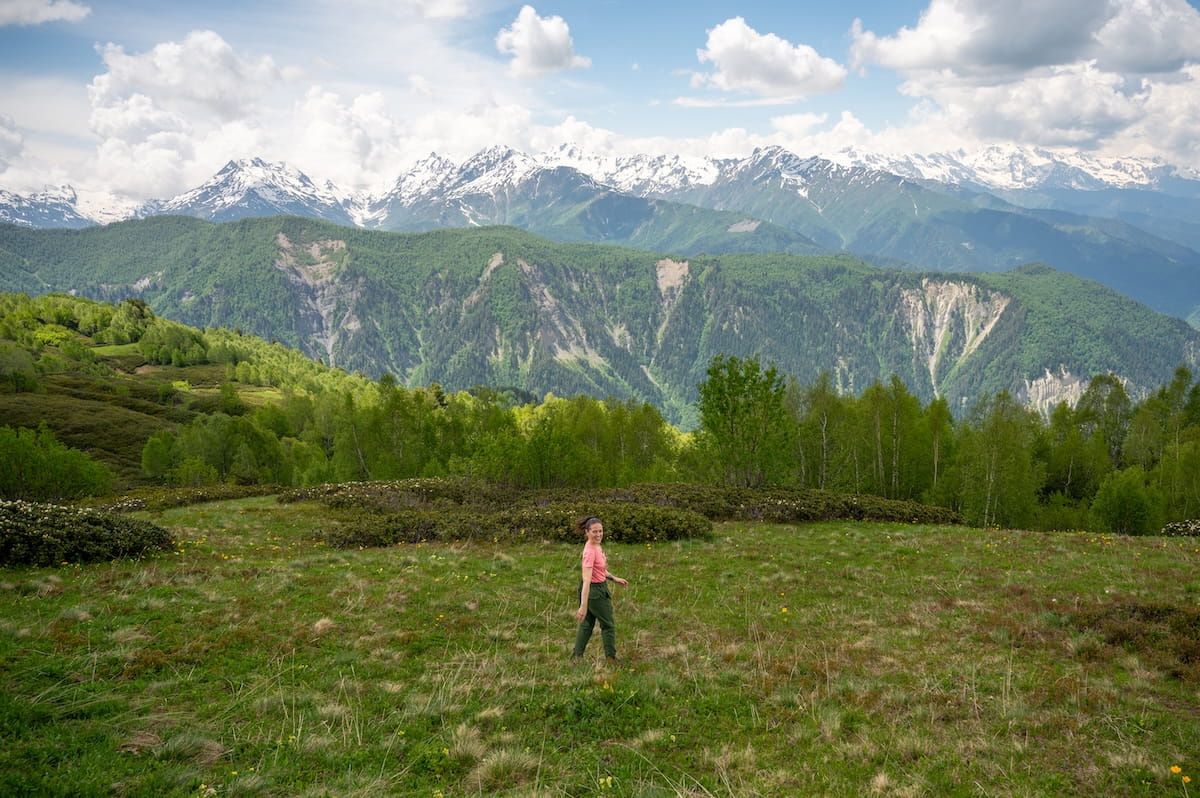
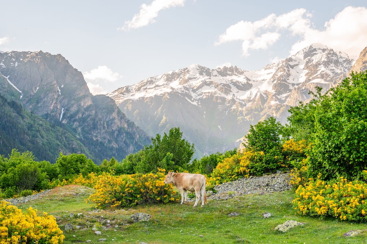
Leaving Chvabiani, we trek up rolling alpine meadows as massive snow-capped peaks tower over lush green hills behind us. The scenery looks like a living postcard, with cows grazing and thick bushes of yellow flowers framing the landscape.
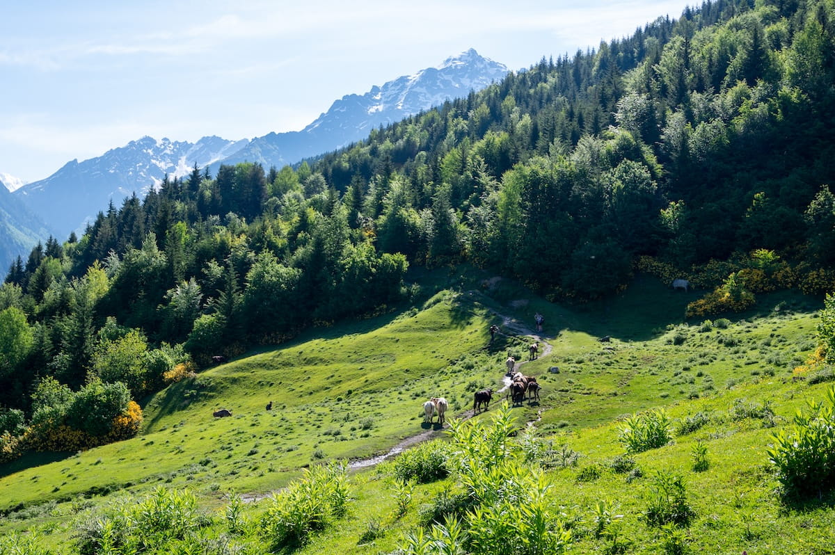
Zig-zagging our way up, the peaks switch from behind to the side of us, keeping the calf-killing trek enjoyable. While we start in the hot sun, the trail occasionally takes us through shady forest for a welcome reprieve.
It takes a little over 2 hours to reach the Market/Bar at Tetnuldi Ski Resort, a cafe sitting at 2,445 meters (8,022 feet) — the highest point today — selling refreshments and homemade carrot cake along the ski lift line.
Twenty minutes later, we reach a scenic picnic table area to eat our lunch boxes while taking in a wide-angle view of Caucasian high peaks like Laila (4,009 meters), Gvadarashi (3,750 meters), and Nekpashi (3,577 meters) standing side by side.
Fueled on cheese, bread, and boiled egg, the remaining three hours to Adishi are luckily downhill through forest trail lined with yellow buttercups, blue forget-me-nots, and white windflowers.
While my legs enjoy the downhill, there is some rough terrain to maneuver — narrow paths with overgrown branches, thick roots, and river crossings. But overall, the path is lovely and relaxed. When it begins to rain, I throw on my rain jacket and pants and zone out to the sound of the droplets hitting leaf and rock.
About an hour from Adishi, we come to a very deep river crossing. Tip: You do not need to wade through this! It’s a bit hidden, but head upstream until you see some planks of wood set up as a bridge.
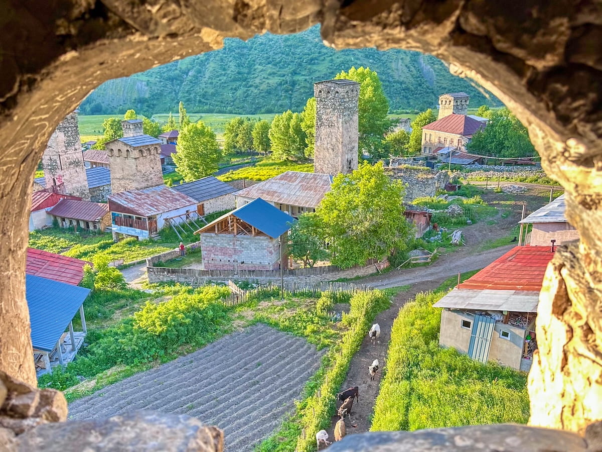
Once you hear the sounds of Georgian pop music playing from Lakhva Cafe Bar, shown here, you know you’re getting close:
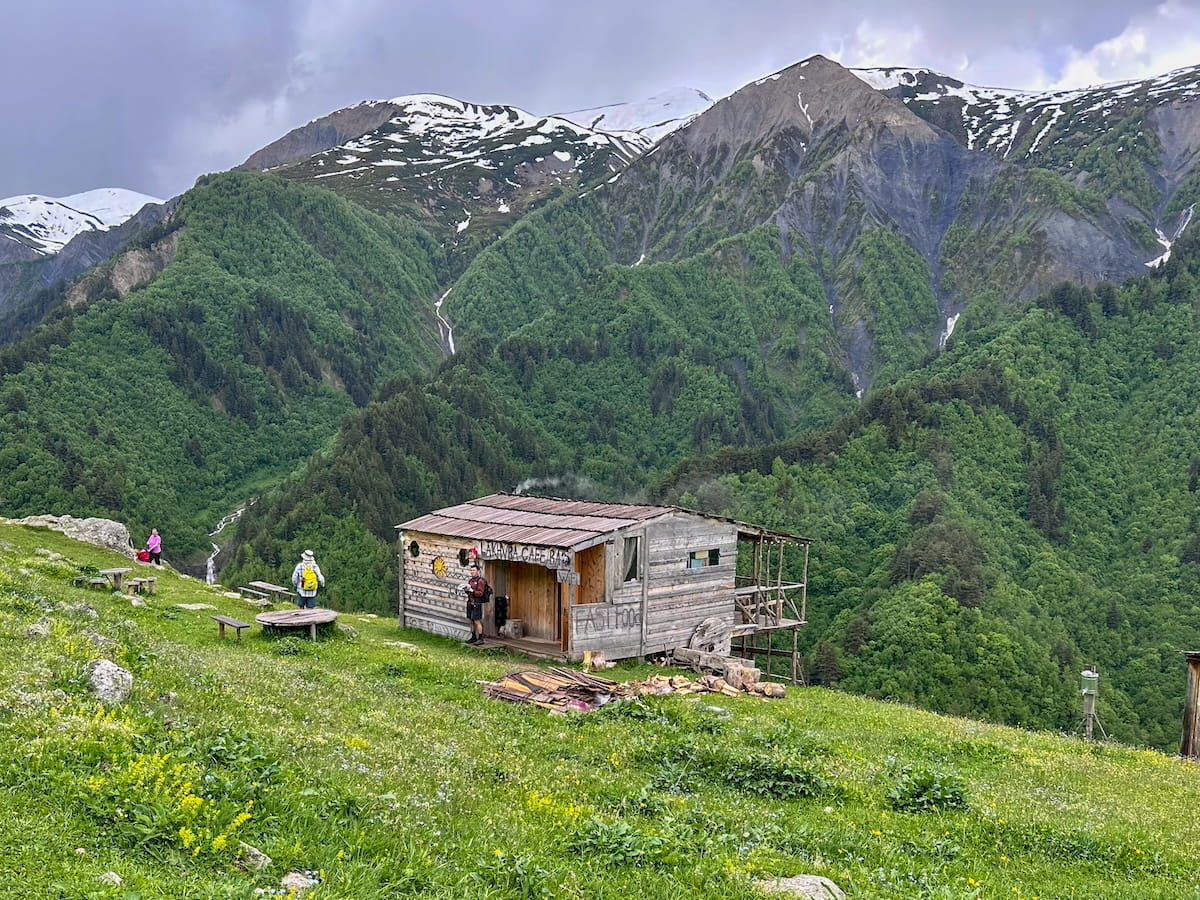
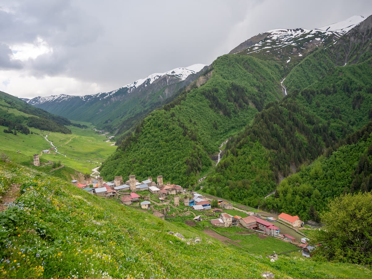
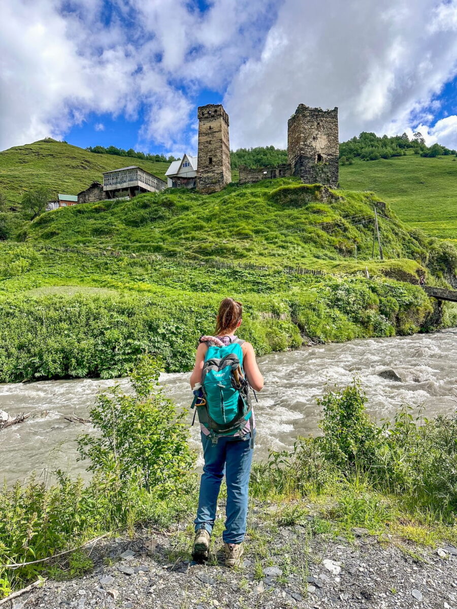
I highly recommend stopping here for some tea, beer, or homemade soup while relaxing in a hammock and taking in a bird’s-eye view of Adishi Village (shown above) and its medieval architecture, waterfalls, and Adishchala River.
From here, it’s about a 10-minute walk down to the village.
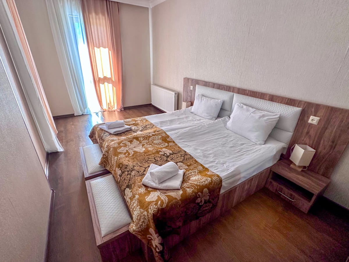
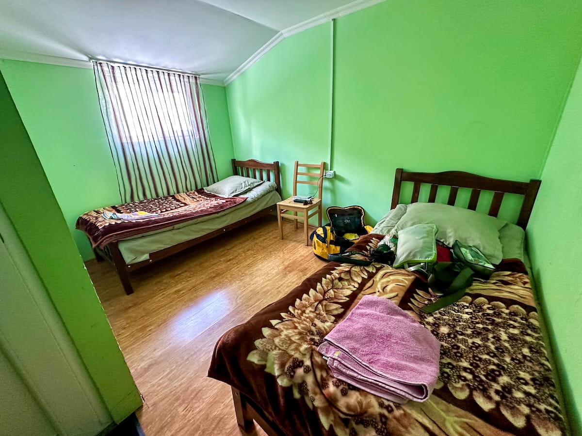
🏨 Guesthouse Caucasioni. This clean and comfortable accommodation features shared bathrooms with hot showers as well as strong Wi-Fi and a balcony with beautiful views over the Adishchala River.
You’ll also be within a short walk of Cafe Tetnuldi as well as nightlife at Bar Tetnuldi — a tiny wooden house turned into a lively dance club playing everything from Georgian pop to J-Lo and the Macarena!
📍Day 6: Adishi Village to Iprali Village
Hiking Distance: 19 kilometers (11.8 miles)
Elevation Gain: 895 meters (2,936 feet)
Highest Point: 2,800 meters (9,186 feet)
Map: Click here for a trail map
Highlights: Horseback river crossing, front-row views of Mount Tetnuldi, and exploring the ruins of Khalde village.
Today’s trek features a little bit of everything: relaxing alpine hiking, steep inclines, mountain passes, village visits, and our daily cafe stop — and even a little bit of horseback riding!
Leaving Adishi, we get a beautiful view of the entire village and its medieval landmarks before moving toward our destination: Iprali, Svaneti’s smallest village run by only three families.
The first two hours are flat and scenic as we follow the Adishi River while cresting the ridgeline, surrounded by lush scenery, crystal waterfalls, streams, and green mountains.
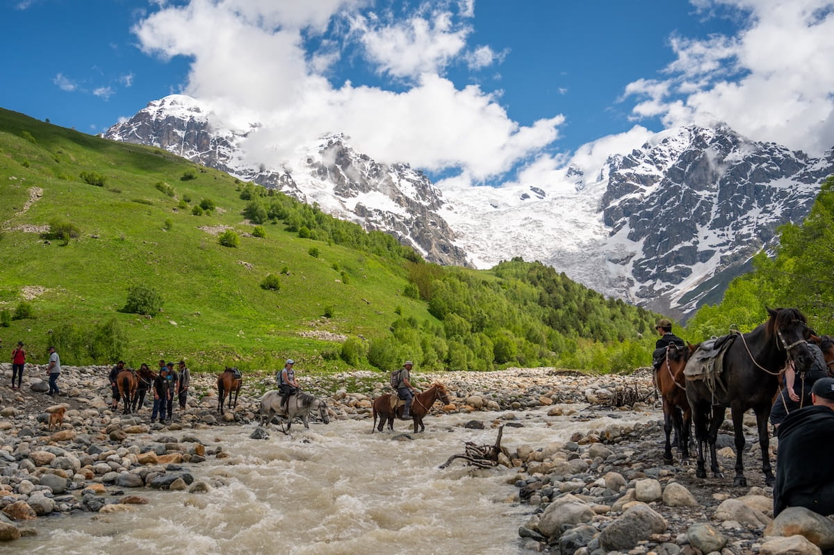
Eventually, we need to cross this roaring river. Luckily, horses are stationed at the quick crossing to make the journey possible.
Once on the other side, we begin our steep ascent toward Chkhunderi Pass (2,800 meters).
Within 20 minutes of the uphill hike, we’re blessed with a front-row view of the towering Mount Tetnuldi (4,858 meters) right next to the Adishi Glacier. It’s one of the most gorgeous views of the trip — that is, until we reach the pass itself.
Here the view changes depending on which way you face, with snow-capped peaks one way and verdant green mountainscape the other, as you can see here:
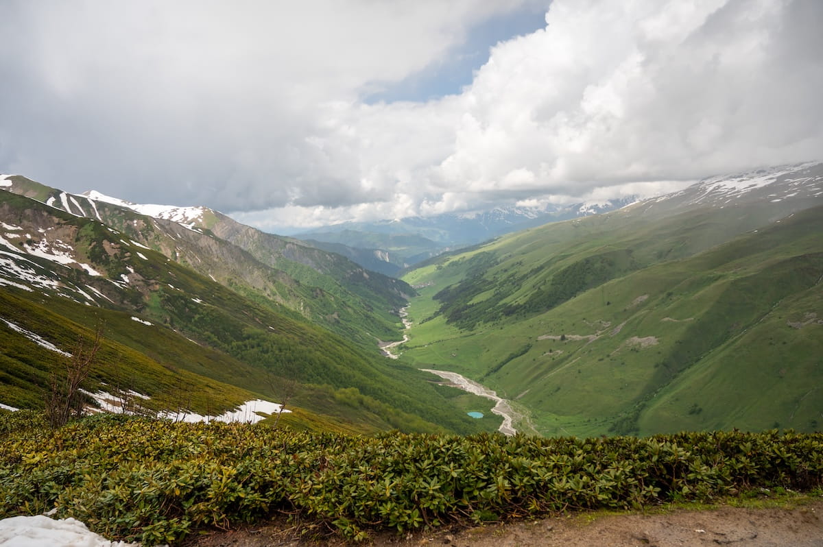
When the weather changes quickly and pelts us with rain, we descend into the Khaldechala Valley, taking cover in a simple shepherd’s hut to eat lunch.
An hour later, we reach Khalde village, which has a very rich albeit sad history. In 1876, Khalde was the epicenter of a massive anti-tax rebellion against the Russian Empire, resulting in a brutal siege that completely destroyed the village and exiled its surviving residents to Siberia.
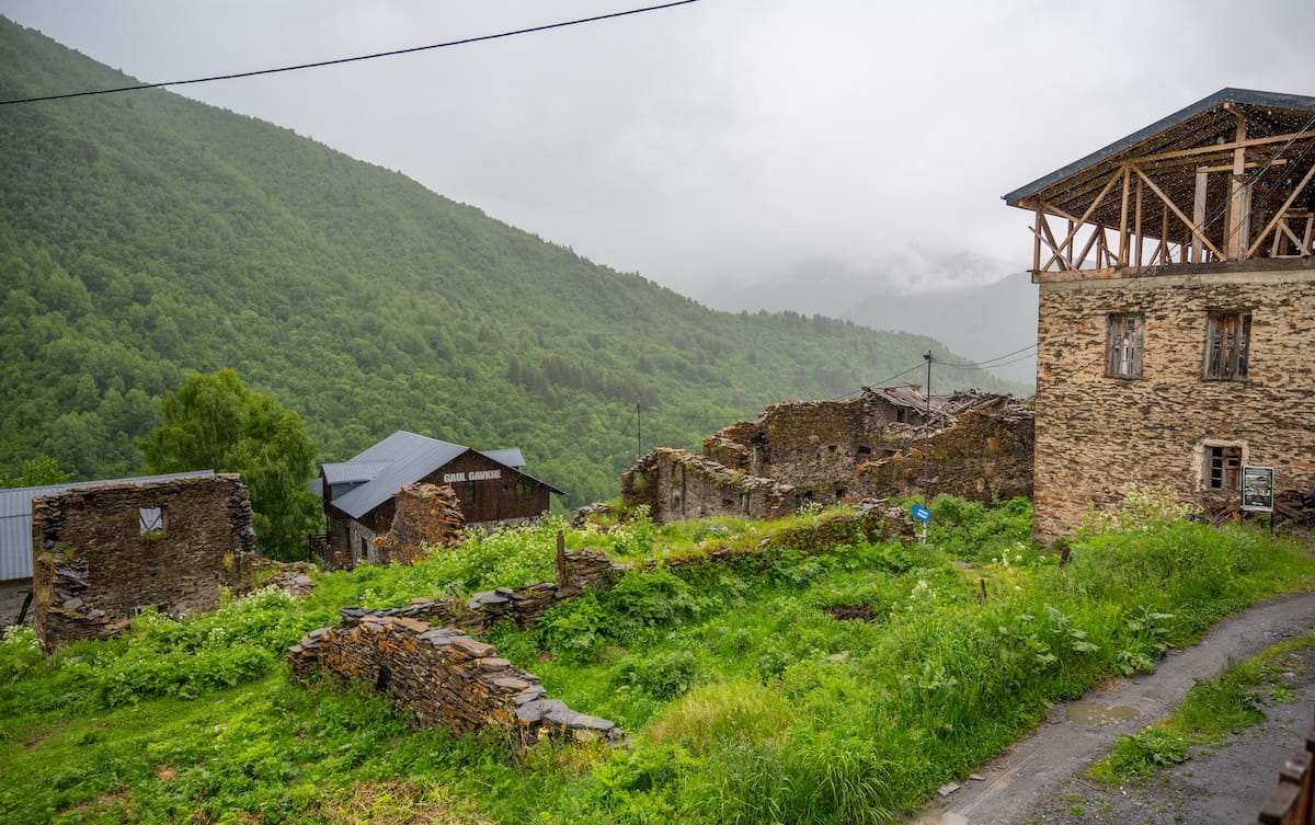
Today, Khalde descendants are working to restore the village. They’re also building a tourism infrastructure with many campsites, hostels, and al fresco cafes. We stop at Century House of Larisa to warm up with coffee and tea, though they also serve food and alcoholic beverages too.
From here, it’s another scenic hour to Iprali.
🏨 Family Hotel Ucha. This is an adorable guesthouse with a ton of character that looks like an elf house from the outside. Inside, it features beautifully decorated hallways and rooms with mountain views. Dinner was a family-style spread of vegetable and rice soup, fresh bread, Russian salad, red beetroot salad, stewed chicken, beans, chicken salad, tea, cake, and fresh melon.
That said, one major downside is the bathroom situation: the second floor (where I stayed) only had 2 shared bathrooms to accommodate 10+ people. Set your expectations accordingly, as there aren’t many hotel options in Iprali.

📍Day 7: Iprali Village to Ushguli
Hiking Distance: 13 kilometers (8 miles)
Elevation Gain: 510 meters (1,673 feet)
Highest Point: 2,200 meters (7,218 feet)
Map: Click here for a trail map
Highlights: Traditional Svani villages, shady forest hiking, and exploring the medieval towers of a UNESCO World Heritage Site.
While there are some steep sections, today’s hike is leisurely compared to the previous days.
Leaving Iprali, the trail winds down into a lush green valley lined with bright yellow wildflowers and framed by pine-forested ridges.
We pass through the traditional Svani villages of Kala and Davberi, surrounded by pastoral beauty and medieval structures.
That said, much of today’s trek is actually inside the forest, mixing steep uphill climbs with leisurely walks under the shade of trees, which occasionally open up to views of snow-capped peaks.
Along the way, Eka points out local plants like thyme and wormwood and pulls out wild chive and garlic bulbs, explaining how villagers forage for food and prepare jams for the harsh winters.
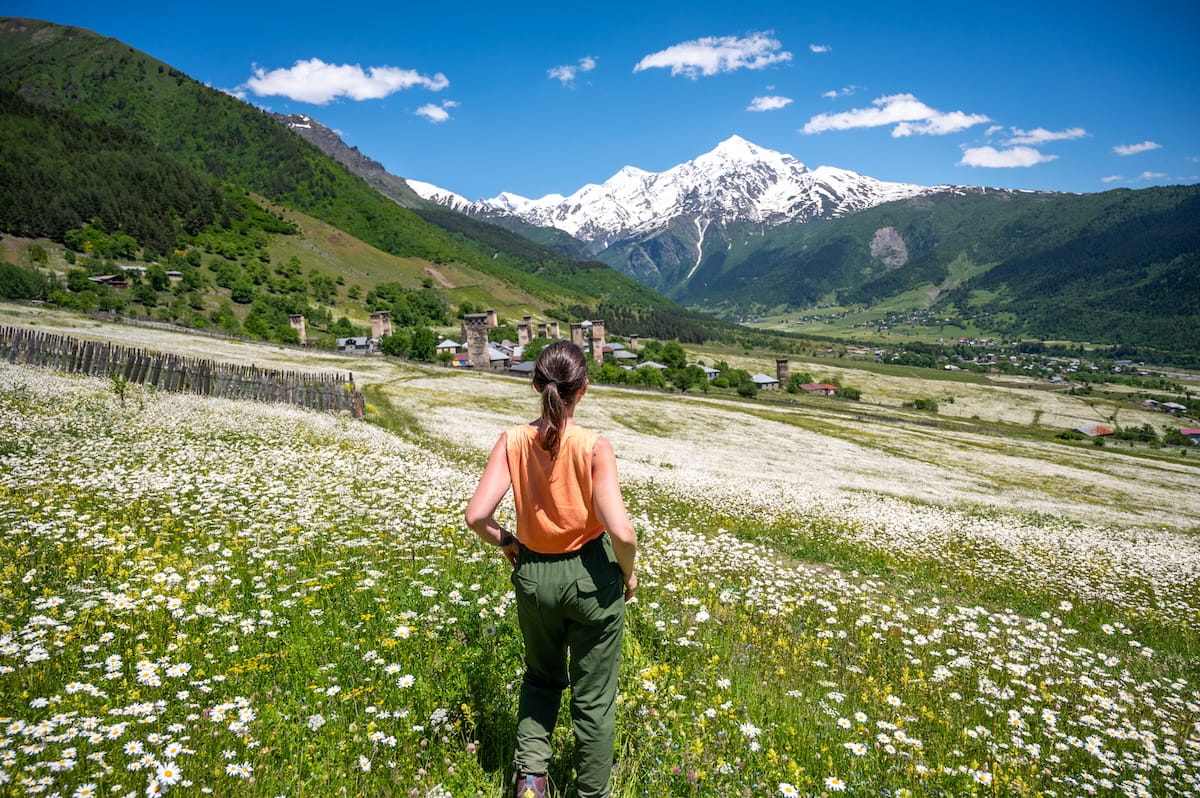
Along the way, we unpack our lunch at a cafe with tables about 30 minutes before reaching Ushguli — one of Europe’s highest permanently inhabited settlements. This community is made of four medieval villages, including the UNESCO-listed Chazhashi with over 200 medieval tower houses, churches, and castles.
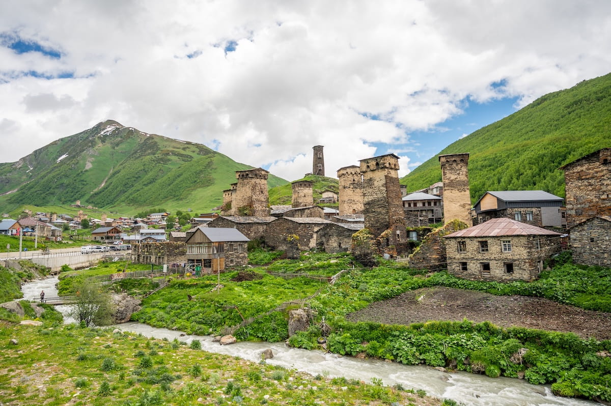
Historically, Ushguli served as the symbol of “Free Svaneti,” using its stone defensive towers to guard the valley at the base of Mount Shkhara.
Today, the village stands as an open-air medieval museum and serves as the most attraction-filled spot of the entire Svaneti trek. Just be prepared for a calf burn while sightseeing, as Ushguli is extremely hilly!
Top things to do in Ushguli include:
- Enjoying a front-row view of Mount Shkhara, Georgia’s highest peak at 5,203 meters (17,070 feet).
- Exploring the legendary historic ruins of Queen Tamar Castle.
- Browsing preserved Svan artifacts and traditional house interiors at the Ushguli Ethnographic Museum.
- Stepping inside the famous 9th-century Lamaria Church to view its ancient frescoes.
- Visiting the rustic Cinema Dede to see Dede, an acclaimed film about Svaneti’s harsh historic traditions that was filmed right in town.
- Going cafe hopping and relaxing at Terrace Best View Cafe for an epic mountain view over food, coffee, beer, or wine.
🏨 Hotel Tekla. Located up the hill, you’ll find simple, clean rooms — some with private bathrooms — and the most comfortable beds of the entire trek. Rooms can get chilly, but they offer thick blankets to keep you warm.
While the Wi-Fi didn’t work everywhere, it was very fast in their onsite restaurant, which also features a terrace with a view and serves up delicious local dishes like khachapuri, potato salad, and tomato cucumber salad.
📍Day 8 (Travel Day): Ushguli to Tbilisi (via Kutaisi)
Driving Time: 9 hours (including bathroom and lunch stops)
Highlights: A scenic journey across Georgia, a garden oasis lunch in Kutaisi, and arriving at a trendy boutique hotel in Tbilisi.
Today we leave Svaneti’s mountain peaks and alpine meadows and drive back to Georgia’s capital city of Tbilisi.
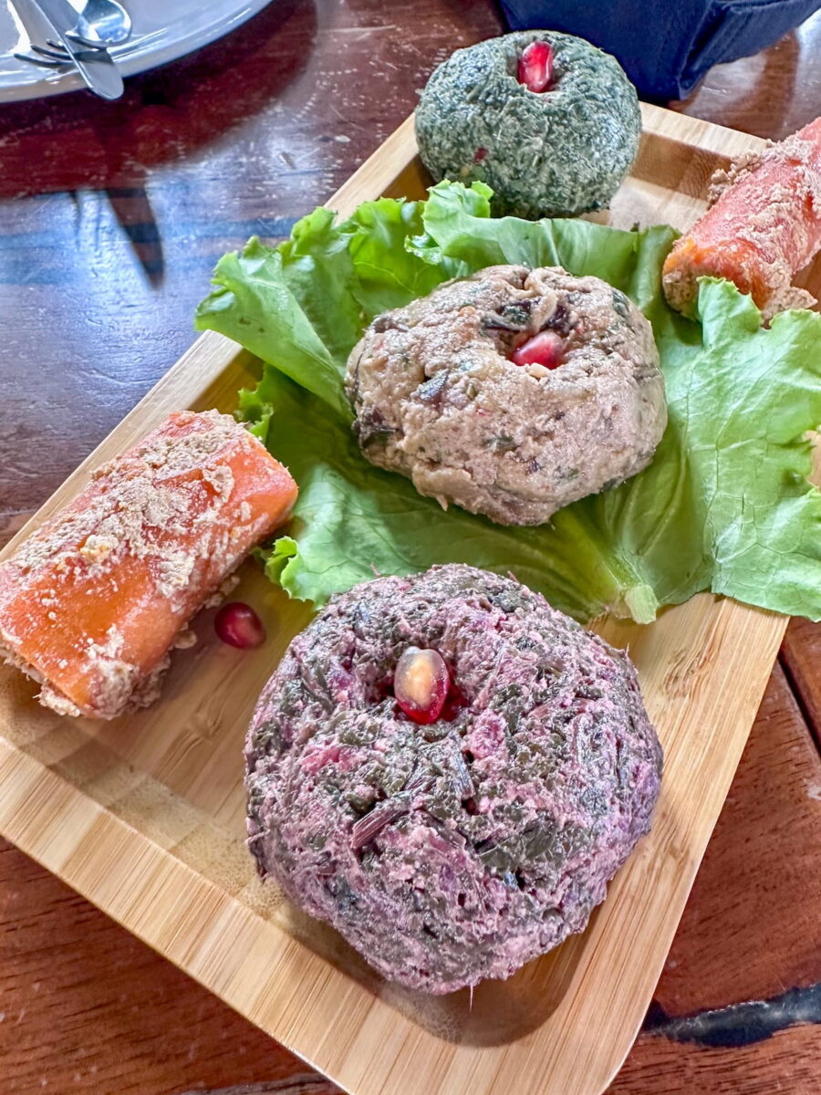
The drive is long, though we break it up with bathroom stops and a memorable lunch in Kutaisi at Restaurant Kvamli. This indoor-outdoor eatery features a garden oasis with lush plants and delicious food — like fresh Greek salad, giant khinkali, and a variety of tasty walnut pkhali spreads in flavors like eggplant and spinach. End with dessert and a cappuccino!
Once back in Tbilisi, there is loads to do. Along with exploring parks, museums, and the scenic cable cars, I recommend doing a fun walking tour with 15+ tastings and learning to make traditional Georgian dishes during a Khinkali & Khachapuri Cooking Class.
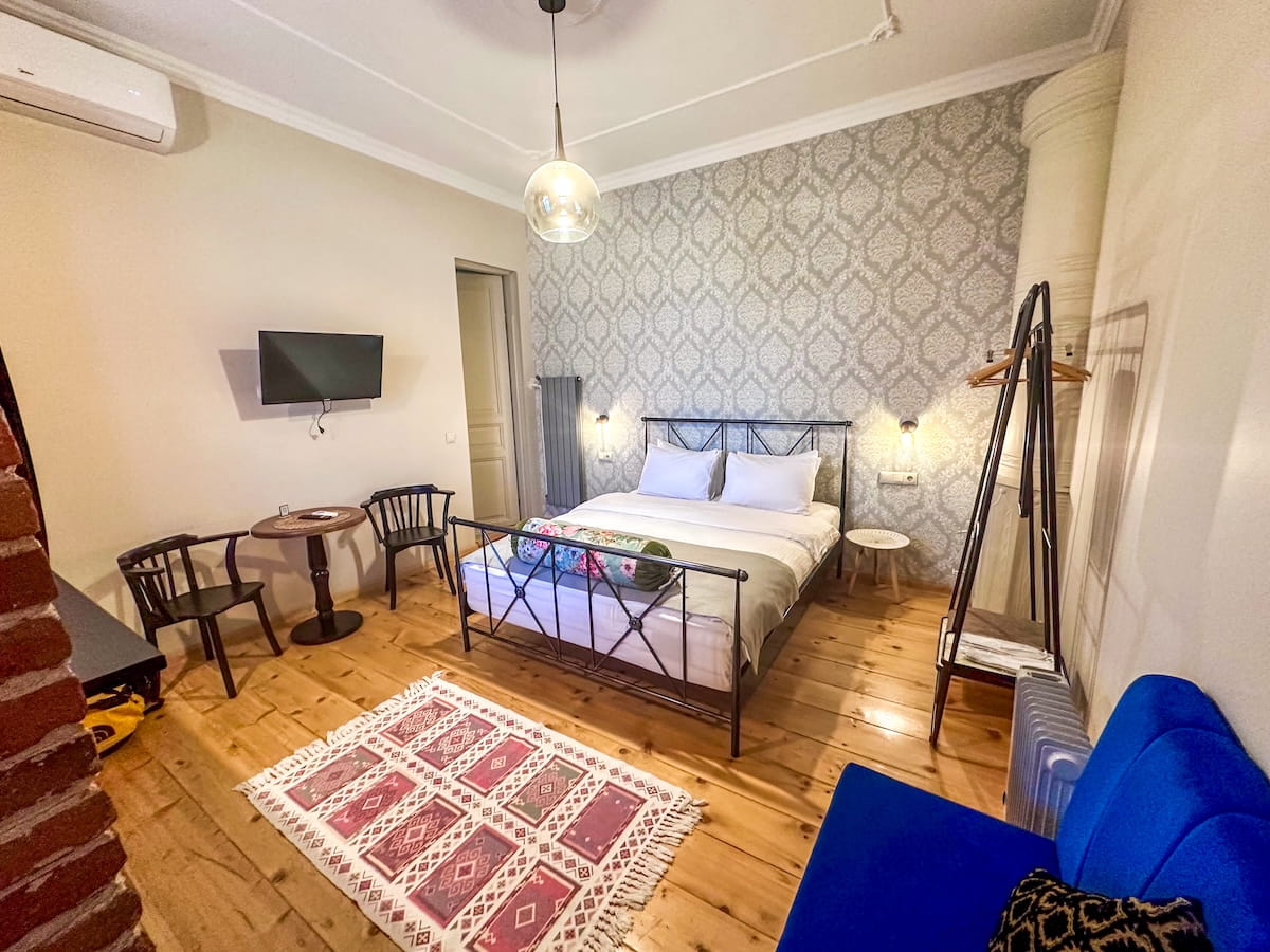
🏨 Arts Hotel Tbilisi. This boutique property features spacious, high-ceilinged rooms styled like trendy apartments with modern furniture and gem-toned futons. Each room is centered around a remarkably comfortable bed with bedside outlets and reading lamps on both sides, complemented by air conditioning, a strong rain shower, and an open-concept kitchenette. Downstairs, the common spaces include an art-filled cafe, a shop with locally made goods, and a garden area filled with adorable cats.
Svaneti Hiking Tips
Now that you have a detailed Svaneti trekking itinerary, let’s go over some important tips to make the experience as smooth as possible.
1) Bring a hard-sided lunchbox and a travel knife. Guesthouses provide a plastic bag to pack your trail lunch, which can lead to food getting squished in your backpack. Bringing your own plastic container keeps it intact, and a small travel knife is incredibly helpful since they often pack whole tomatoes and cucumbers.
2) Pack plenty of extra trail snacks. The provided lunchboxes are pretty simple — usually consisting of bread, a hard-boiled egg, a piece of cheese, a tomato, a cucumber, and a piece of fruit. For an extra energy boost, snatch a piece of raisin cake from the breakfast table to pack for the day and bring snacks like trail mix, granola bars, and Cheez-Its (my personal favorite!).
3) Dramamine is a lifesaver for the transit days. The mountain roads in Svaneti are bumpy, winding, and rough. If you are even slightly prone to motion sickness, pack some Dramamine for the long drives.
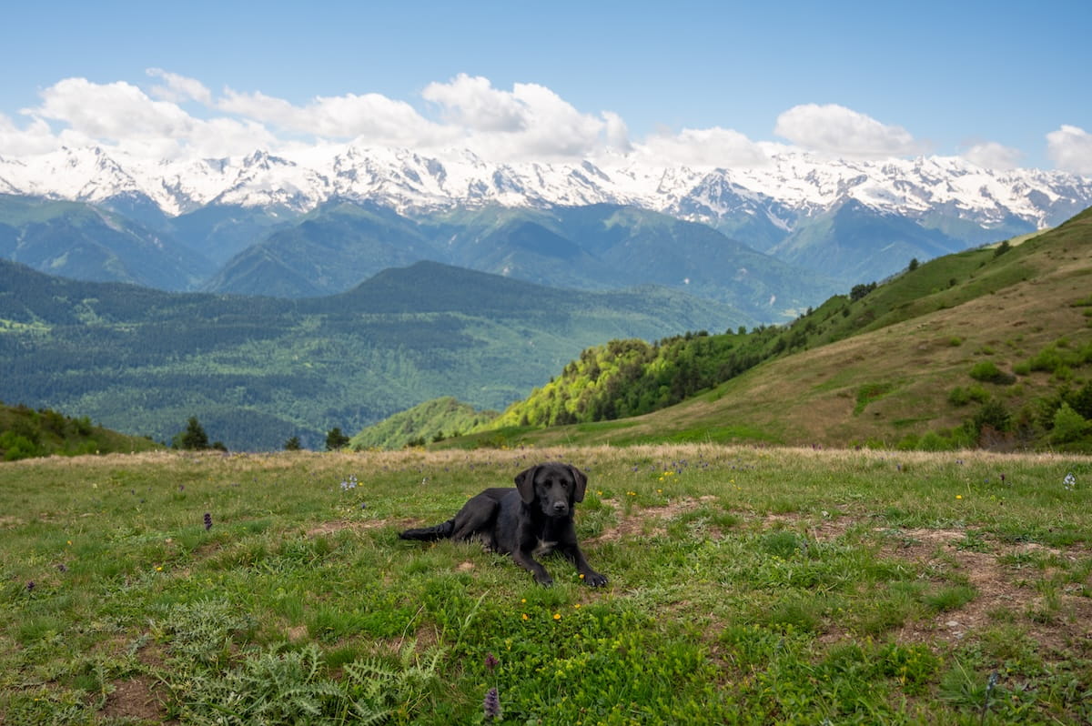
4) Don’t feed the dogs. You will encounter dogs everywhere you go in Georgia. Most are incredibly friendly and many actually have owners. Avoid feeding them along the trail, as it encourages them to follow hikers away from their villages and makes them less likely to return home.
5) Download the Bolt app. While it won’t help you on the trail itself, having Georgia’s primary ride-share app installed and set up on your phone is essential for getting around Tbilisi smoothly before and after the trek. To set it up, Bolt will text you a code, so it’s easiest to set up before you leave home.
6) Bring cash in small denominations. Small bills are especially helpful when stopping at trailside cafes or buying additional beverages at guesthouses. Make sure to have 5s and 10s on hand, as even a 20-Lari note can sometimes be difficult for vendors in remote villages to break.
7) Budget for guide tips. While optional, if you are trekking with a guide and enjoy your experience, remember to factor a gratuity into your cash budget. Personally, I tipped 10% of the trip cost.
Svaneti Trekking Packing List
When trekking in Svaneti, some essential items include:
- 20-35 liter day pack. I use the G4Free 35L Day Pack, which has important features like padded and adjustable hip and shoulder straps, a chest strap to distribute weight more evenly, 7+ different pockets and compartments, a water bladder exit on the top, and a rain cover.
- Water bladder. My pick is the 3L Platypus Big Zip EVO Water Reservoir. While 3L is pretty large, having the extra space provides peace of mind — plus you don’t have to fill it up all the way if you don’t want.
- Sun protection. This includes SPF 30+ broad spectrum sunscreen, polarized sunglasses, a sun hat, and SPF lip balm.
➡️ Click here for a detailed Svaneti hiking packing list!
Georgia Travel Insurance (Required!)
While it’s always wise to get travel insurance, it’s actually required for tourists visiting Georgia. In fact, I recommend printing out your policy and purchase receipt, as Georgian border officials may check for it.
If you’re looking for something straightforward, comprehensive, and budget-friendly, SafetyWing is an excellent choice. They offer two plan options:
🟡 Essential, for mid-to-short-term travelers
- Covers emergency medical care, trip delays, and evacuations
- Flexible 28-day subscription or fixed-date coverage for specific trips
- Add-ons available for adventure sports, electronics theft, and U.S. coverage
🔵 Complete, for long-term travelers and digital nomads
- Includes most Essential benefits, plus routine care, mental health support, and maternity coverage
- Covers you both abroad and in your home country
- Comes with adventure sports coverage, cancer screenings, outpatient services, and therapies like chiropractic care
➡️ Click here to compare plans and protect your trip.
Svaneti Trekking FAQ
Now let’s answer some frequently asked questions about this unforgettable Georgia hike:
Q) Are there ATMs along the trail?
ATMs are readily available in Mestia, but they are nonexistent in the smaller villages like Mazeri, Chvabiani, Adishi, and Iprali. Power outages can also take machines offline, so pull out all the cash you need while in Tbilisi or Mestia.
Q) Is there cell service on the trek?
Yes, there is surprisingly good service! My Saily eSIM worked in all of the Svaneti villages, and even frequently along the trail itself.
Q) Is the trail well-marked?
The main Mestia-to-Ushguli path is highly visible and generally well-marked with red and white trail blazes. However, the written difficulty markers on physical signage are often inaccurate.
Your Svaneti Hiking Action Plan
The Mestia to Ushguli hike with Ushba Waterfall extension is a stunning adventure that immerses you in medieval history, alpine beauty, and small village life.
To move from planning to hiking, you’ll first want to decide on your support level. While I loved the ease of a guided trek with TrekGeorgia, many solo hikers successfully navigate the trail using offline digital maps.
Don’t worry about the logistics feeling overwhelming; once your travel insurance is printed, your transportation from Tbilisi is arranged, and your guesthouses are secured, the incredible trail community and local hosts make the day-to-day journey much simpler.
What tips would you add to this Svaneti trekking guide?
Enjoyed this post? Pin it for later!