
11 Best Hikes Near Grand Marais, MN Not To Be Missed
This post contains affiliate links, including Amazon affiliate links. If you purchase through these links, I may earn a commission at no extra cost to you. As an Amazon Associate, I earn from qualifying purchases. Thank you for your support!
Looking for the best hikes near Grand Marais, Minnesota?
Then you’re in the right place, as we’ll be going over some epic Grand Marais hiking trails that you will absolutely want to add to your itinerary.
Known for its rugged beauty, Grand Marais has long attracted outdoor enthusiasts.
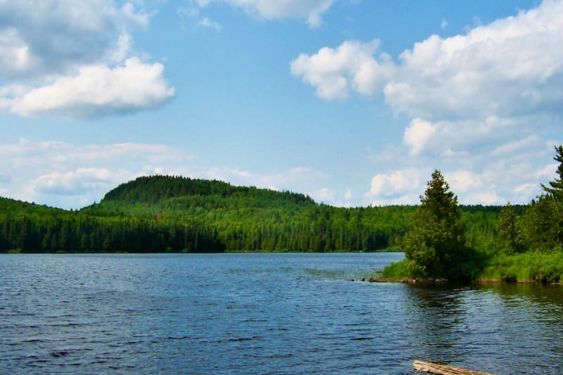
Located in Cook County, this North Shore harbor town offers fantastic access to hikes in the Superior National Forest, Boundary Waters Canoe Area Wilderness, multiple Minnesota state parks, and up the Gunflint Trail.
As a local, I’ve spent a lifetime exploring the town’s plethora of hiking trails – which I’m excited to share with you in this Grand Marais hiking guide.
Even if you’re familiar with this area of Minnesota, this list will likely provide some inspiring new North Shore hiking ideas as you’re transported to scenic overlooks and waterfalls while enjoying opportunities to explore unique geology, ecology, and history.
Pro tip: Before hiking Grand Marais MN, make sure to download the AllTrails app to have trail guides, maps, photos, and reviews right at your finger tips. You can also sign up for a free trial of AllTrails+ to download offline maps, get alerts for wrong turns, find trails by distance from you, and more!
What Type Of Hiker Are You? [Free Quiz]
But first, before we dive into some unforgettable hikes near Grand Marais, I want to share a free personality quiz I think you’ll love!
Discover your hiking persona in this fun and short hiker personality quiz, which also shares trail suggestions based on your results.
Once you’ve grabbed the quiz, let’s discuss where to go hiking near Grand Marais MN, a fabulous destination for outdoor adventure when traveling the USA.

Grand Marais Trail Map
Before going hiking near Grand Marais, it’s recommended to print out a map of the local trails. Here are a few from the major local parks:
You’ll also find maps for each individual trail listed below.
Renting A Car For Hiking Near Grand Marais
When exploring the best hiking trails near Grand Marais, you’ll need a car for your adventure. And if you need to rent a car, you can use Discover Cars to quickly compare your rental options.
Their comparison tool does the homework for you, so there’s no need to have up 10+ tabs trying to figure out which company is the most affordable. Actually, you can save up to 70% using their tool!![]()
Best Hikes Near Grand Marais, MN
1. Grand Marais Lighthouse & Artist Point Walk
Trail Difficulty: Easy
Trail Length: 1 mile
Driving Directions From Downtown Grand Marais: Located at the far southern end of Broadway Ave.
Trailhead: Park in the large municipal parking lot at the end of Broadway and hike down the driveway past the old Coast Guard Station. An informational U.S. Forest Service kiosk marks the trailhead.
Trail Map: Click here for a trail map of the Grand Marais Lighthouse & Artist Point Walk.
About This Grand Marais Hike:
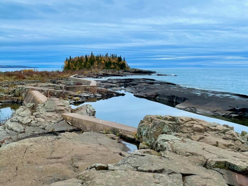
No North Shore, MN vacation would be complete without doing this scenic walk!
More of a leg stretch than a true hike, it’s basically sacrilege to visit Grand Marais and not hike to “The Point”.
At the trailhead, turn right onto the poured cement walkway to head towards the Grand Marais break wall and lighthouse. The path is easy and relatively narrow, so be sure to pause for passing hikers in the “single file only” spots.
Look carefully at the rocks on the lakeside to see if you can spot any 19th-century graffiti. Additionally, visit at sunrise or sunset to catch beautiful reflections in the rock pools.
On the way back from the lighthouse, continue past the trailhead for a slightly more challenging .3-mile loop on the wooded basalt outcropping known as Artist Point.
Here you’ll find craggy cliffs to clamor over as well as views of Grand Marais’ East Bay and Five Mile Rock. Moreover, if you explore the Point’s small grove of trees, you’ll find the remnants of an old fire tower from the early 20th century.
People go out to The Point year-round, but the path is very icy in the winter, so put crampons or some sort of traction control on your boots before heading out and exercise extreme caution during a winter hike.
On stormy days when gale winds send waves crashing over the break wall, the trail may be inaccessible.
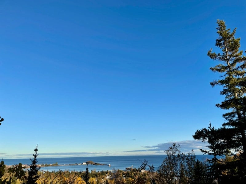
2. Sweetheart’s Bluff
Trail Difficulty: Very easy to moderately challenging
Trail Length: .3 – 1 mile
Driving Directions From Grand Marais: Drive .5 miles west out of Grand Marais on Highway 61. Turn at the Grand Marais RV Park and Municipal Campground and drive another .4 miles through the campground. Park in front of the baseball field.
Trailhead: From the Municipal Campground parking lot, continue west to a large metal gate. Walk around the gate, skirt the base of the town sledding hill, and you’ll reach a map sign at the trailhead at the edge of the forest.
Trail Map: Click here for a Sweetheart’s Bluff trail map.
About This Grand Marais Hike:
Given the popularity of the Lighthouse and Artist Point Hike, you might think it was the only game in town.
Not so! Grand Marais offers a second hike completely within city limits; however, the hidden location of Sweetheart’s Bluff behind the municipal campground keeps this sweet spot a bit of a local secret.
The trail starts with a .2-mile gravel loop. Meant to be ADA-accessible, this path is very level and leads you to a secluded Lake Superior pebble beach.
When you turn onto the Overlook Loop, the trail narrows into a wilderness-style path. Watch for rocks and roots!
The name “Bluff” is no misnomer. In fact, the trail gains about 200 feet of elevation very quickly. Be prepared for a couple steep spots where you may need to use your hands to clamor up.
The trail is too short to be classified as difficult, but if you opt for the Sweetheart Bluff Overlook Loop, you’re getting into more than a walk in the park.
After your rapid uphill climb, you’ll reach a small clearing with views of the Grand Marais Harbor.
Although you won’t see this on the trail maps or signs, you can extend your hike slightly here. There’s a short spur trail to a dismantled fire tower.
FYI: Grand Marais almost burned to a crisp in a massive wildfire in 1908, hence the fire tower remains everywhere.
As the trail turns back downhill, you come to a beautiful clearing with exposed basalt rock criss-crossed by glacial scars.
Pro tip:
A lovely picnic pavilion nestled into the foot of the bluff just off the ADA-accessible path offers a peaceful spot to enjoy lunch beside Lake Superior.
3. Pincushion Mountain Overlook
Trail Difficulty: Easy
Trail Style: Loop or Out and Back – you choose!
Trail Length: 3.8 miles
Driving Directions From Grand Marais: Turn onto the Gunflint Trail (Cook County Highway 12) and drive for 2 miles. Turn right onto Pincushion Drive and drive for .25 miles to reach the Pincushion Mountain Overlook parking lot.
Trailhead: From the Pincushion Mountain Overlook parking lot, head north past the warming house and connect to the trail.
Trail Map: Click here for a Pincushion Mountain hiking trail map.
About This Grand Marais Hike:
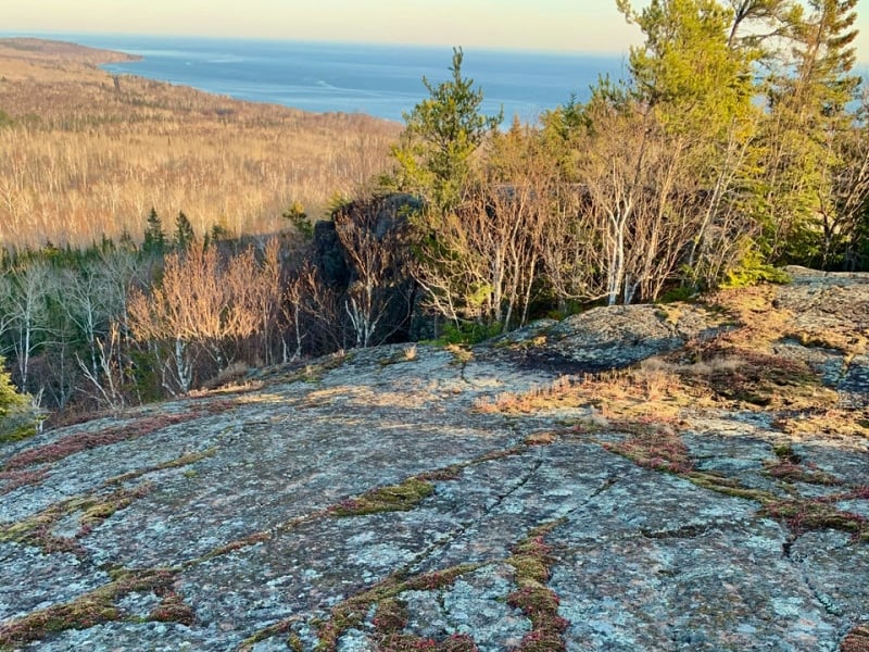
Hike from one overlook to another on this beautiful wooded trail right outside of Grand Marais. At the trailhead parking lot, enjoy a sweeping view of the Grand Marais harbor and town.
After an easy 1.9-mile hike and one steep scramble up a granite rock knob, you’ll reach another stunning Lake Superior view from the summit of Pincushion Mountain. It’s a perfect early morning hike if you want to catch the sun rising over Lake Superior.
Many people prefer to use a section of the Superior Hiking Trail – a long-distance trail stretching from Duluth to the Canadian border – to access the Pincushion Mountain Overlook. Rather than having the hike be an out and back on the same track, I prefer to use the Pincushion Mountain Trail ski trails in addition to the Superior Hiking Trail to make a nice loop back to the trailhead.
Recently, trail crews installed extensive boardwalks to make the Pincushion Mountain Trails more user-friendly to mountain bikers. These boardwalks make this trail a great rainy weather hike option.
The trail to and from the overlook isn’t particularly exciting, but it is wide and well-traveled. If you’re looking to log some miles, but don’t want to venture too far from Grand Marais, Pincushion Mountain Overlook is the hike for you.
Important:
This Grand Marais hiking trail becomes a cross-country ski trail as soon as there’s sufficient snow cover, usually in early December. Do not hike this trail during the winter ski season.
Hikes West Of Grand Marais, MN
4. Gitchi-Gami State Trail from Cut Face Creek to Rosebush Falls
Trail Difficulty: Easy
Trail Style: Out and back
Trail Length: 5 miles round trip
Driving Directions From Grand Marais: Head south on U.S. Highway 61 for 5 miles. Turn left into Cut Face Creek Rest Area.
Trailhead: At Cutface Creek Rest Area, pick up the Gitchi-Gami State Trail near the east end of the rest area, behind the toilets.
Trail Map: Click here for a Gitchi-Gami State Trail map.
About This Grand Marais Hike:
Someday, the Gitchi-Gami State Trail Bike Path will run for 89 miles on the Lake Superior side of Highway 61.
Although this project is far from complete, in 2021, construction crews completed a 3.7-mile section of Gitchi-Gami State Trail west of Grand Marais. This paved trail open for non-motorized use makes a great hiking option near Grand Marais for anyone needing an even hiking surface.
For an easy 5-mile hike, park at the Cut Face Creek Wayside Rest and hike east for 2.5 miles towards Grand Marais.
Despite the trail’s ease, it doesn’t skimp on Lake Superior views. During the spring melt or after significant rainfall, you’ll pass a number of “pop up” waterfalls.
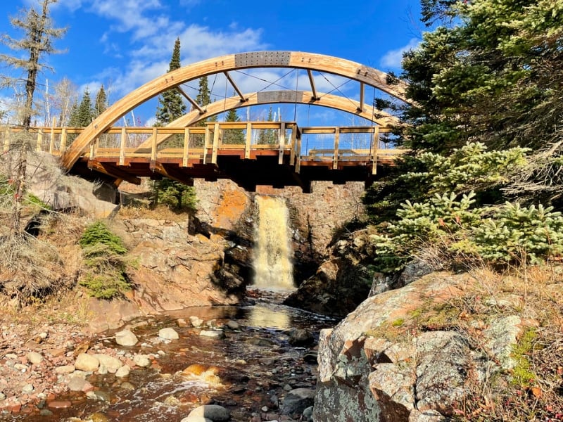
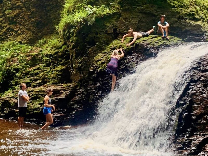
After about 2.3 miles, the trail dips down to reveal a 15-foot waterfall and an elaborate pedestrian bridge spanning a river known both as Fall River and Rosebush Creek. Veer off the paved trail onto user-established trails for better waterfall views and to access a small Lake Superior beach.
Most people prefer to turn around after spending some time at the Rosebush Falls and Beach, but the Gitchi-Gami State Trail does continue for another 2 miles into Grand Marais.
At the intersection with 8th Avenue West, the trail becomes the Grand Marais Corridor Trail. This trail proceeds downtown, then terminates at the intersection of the Gunflint Trail (Cook County Highway 12) and U.S. Highway 61.
Pro tip:
Cut Face Creek Rest Area closes during the winter. You can still access the trail by using the wide shoulders of Highway 61 for parking. Before returning to your car, try to find some beautiful agate rocks on the beach near the rest area.
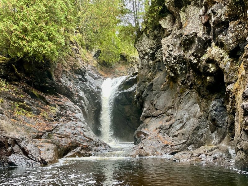
5. Cascade River State Park
Trail Difficulty: Easy – hard
Trail Style: Loop
Trail Length: .5 – 7.3 miles
Driving Distance From Grand Marais: From Grand Marais, drive 10 miles southwest on Highway 61. Parking is located on the north side of the highway, right after crossing the Cascade River.
Trailhead: Located at the Cascade River State Park Highway 61 pull off. The trail begins near a large arrowhead-shaped sign.
Trail Map: Click here for a Cascade River State Park trail map.
About This Grand Marais Hike:
Looking for the best waterfalls near Grand Marais MN?
Cascade River State Park offers a variety of hikes of all difficulties and distances. Known as the “root beer river” because of its dark, foamy water, Cascade River lives up to its name with a number of easily accessible waterfalls. The river is at its most dramatic in April during the spring melt.
Choose the Cascade River Lower Loop for a quick, easy waterfall hike near Grand Marais.
For this hike, start at the Highway 61 trailhead and hike .2 miles up the south side of the river to a bridge. Cross the bridge, then return to your vehicle via a .3 mile hike down the north side of the river.
If you enjoy longer moderate hikes, you can choose from the Lookout Mountain Loop (3.2 miles) farther inland from the river or the Cascade River State Park Lake Trail (3.3 miles), which loops near the river along the Lake Superior shoreline and through the forest behind Cascade Lodge.
For a strenuous hike, hop onto a section of the Superior Hiking Trail to make a 7.3-mile loop up the south side of the river, crossing at County Road 45 and returning on the north side.
Keep in mind, the trail becomes increasingly rugged the further you get from the parking area. Be prepared for the path to narrow and watch for rocks and washouts, especially if you opted for the 7.3 mile Cascade River Loop Hike via the Superior Hiking Trail.
It’s always a good idea to check in at the park headquarters for the most up-to-date trail conditions.
Gunflint Trail Hikes North Of Grand Marais, MN
6. Centennial Trail
Trail Difficulty: Moderate, with one challenging section
Trail Style: Loop
Trail Length: 3.3 miles
Driving Directions From Grand Marais: Turn onto the Gunflint Trail (Cook County Highway 12) and drive for 47 miles. Park in the Kekekabic Hiking Trail parking lot.
Trailhead: The Centennial Trail shares its trailhead with the Kekekabic Trail, a long-distance hike that runs through the Boundary Waters Canoe Area Wilderness for 42 miles.
Trail Map: Click here for a Centennial Trail map.
About This Grand Marais Hike:
One of the newest hiking trails in the Grand Marais area, the Superior National Forest constructed the Centennial Trail in 2009 – the year of the Forest’s Centennial celebration.
In 2007, the Ham Lake Wildfire had swept through the Centennial Trail area, exposing a railroad bed laid in the late 1890s. U.S. Forest Service officials seized their opportunity to tell a tale of riches sought – and lost – in this rugged wilderness setting.
Grab an interpretative brochure at the trailhead to read along your hike. The brochure corresponds with numbered signposts along the trail.
You’ll start out hiking 1.2 miles on the Kekekabic Trail before turning onto a trail built atop the old railroad bed.
Along the way, you pass several test mine shafts dug by Victorian entrepreneurs hoping to find mineral riches just like on Minnesota’s Iron Range.
Spoiler alert: it was maybe a Ponzi scheme?
The trail isn’t just about history, though. It also showcases wildfire ecology, the area’s unique geology, and several beaver ponds and unnamed lakes.
Near the 2-mile point of the trail, you’ll get a stunning panoramic view of the Gunflint Trail forest. If you look carefully, you’ll be able to spy Gunflint Lake sparkling in the distance.
For the most part, you just need to watch for rocks and roots as you hike this moderately difficult trail; however, be prepared for one very challenging section.
Once upon a time, a railroad trestle spanned a dramatic ravine. The trestle is long gone and that means hikers need to climb down into the gorge and back out. This steep downhill may involve doing a little crab walk.
After you climb out of the ravine, you’ll have it made. The trail continues on a gentle downhill grade before popping out onto the Round Lake Trail. From there, it uses a short section of snowmobile trail to return you to your vehicle at the Kekekabic parking lot.
7. Blueberry Hill
Trail Difficulty: Moderate
Trail Style: Out and back
Trail Length: 2 miles round trip
Driving Directions From Grand Marais: Turn onto the Gunflint Trail (Cook County Highway 12) and drive for 55 miles. Turn right onto Moose Pond Drive (Cook County Road 81) and drive to Chik-Wauk Museum and Nature Center. If visiting during the museum operating hours (10am-5pm every day from Memorial Day weekend until mid-October), park in the museum parking lot. After hours, park to the side of the entrance and hike in on the driveway.
Trailhead: The trail starts on the Amikwiish Trail located on the right-hand side of the Chik-Wauk Museum and Nature Center driveway.
Trail Map: Click here for a Blueberry Hill trail map.
About This Grand Marais Hike:
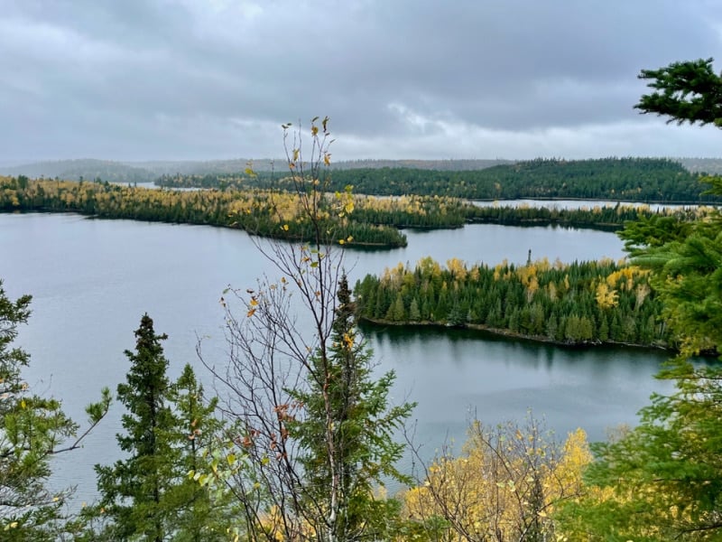
This underutilized hiking trail is located near the end of the Gunflint Trail – which is a 57-mile long corridor between two sections of the Boundary Waters Canoe Area Wilderness that ends close to the Canadian border.
The wilderness hike winds through forest recovering from the 2007 Ham Lake Wildfire, with the trail starting on a wide gravel path that loops around a bay of Saganaga Lake for a nice view of the museum complex, including a 1930s stone lodge.
When you turn onto the actual Blueberry Hill Trail expect a narrow, rocky path with a gradual uphill grade.
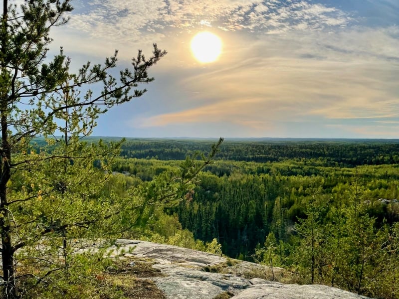
A half-mile in, you start to climb the first of the trail’s two granite knobs. These rocky hills provide 360-degree views of the Boundary Waters Canoe Area Wilderness, Saganaga Lake, and Canada.
While the view from the first hill is slightly better, you don’t want to skip the second hill. You’ll know you’ve reached Blueberry Hill proper when you come to the top of a hill with a log bench.
Blueberry Hill makes an especially beautiful sunset hike. And yes, you’ll find wild blueberries growing on Blueberry Hill. If you hike this trail in late July or August, be sure to bring a berry bucket!
Pro tip:
Believe it or not, there’s another Blueberry Hill hike closer to Grand Marais near Northern Light Lake! Click here for a trail map.
This nondescript forest hike gets you to an overlook of the Brule River and lower Gunflint Trail forest. By all means, you can do both Blueberry Hill hikes on your trip up the Gunflint Trail, but if you only have time for one, I highly recommend doing the one near Chik-Wauk Museum and Nature Center.
8. Honeymoon Bluff
Trail Difficulty: Easy
Trail Style: Loop
Trail Length: 0.5 miles
Driving Directions From Grand Marais: Turn onto the Gunflint Trail (Cook County Highway 12) and drive 27 miles. Turn right onto the Clearwater Road (Cook County Road 66) and drive for 2.2 miles.
Trailhead: Located on the north side of the Clearwater Road directly across from Wampus Lake, the Honeymoon Bluff trailhead has a small parking lot. The trail picks up on the west side of the parking lot.
Trail Map: Click here for a Honeymoon Bluff trail map.
About This Grand Marais Hike:
Looking to enjoy some beautiful lakes near Grand Marais MN? Then this hike is for you!
Not to be confused with the previously described Sweetheart’s Bluff, Honeymoon Bluff – sometimes called Mount Anna by locals – is one of the most popular views in the Grand Marais area.
A very brief and not particularly scenic trail gets you to an amazing panoramic view of both Hungry Jack and West Bearskin Lakes.
The trail utilizes a couple long flights of wooden steps. After the steps, the path follows a power line for about .1 miles, then opens up into a stunning view of the Superior National Forest.
The trail might be short, but you’ll want to stay a while to soak up the vista!
You can enjoy this trail year-round. The view is especially striking after a snowfall, but exercise caution on the steps.
Due to its popularity, unless you’re the first on the trail after a snowstorm, you likely won’t need snowshoes since previous hikers will have packed down the path for you.
No matter what time of year you visit, use extreme caution at the top. Although wooden fencing keeps hikers well away from the edge of this 200+ foot cliff, many opt to jump the fence for better photo opportunities.
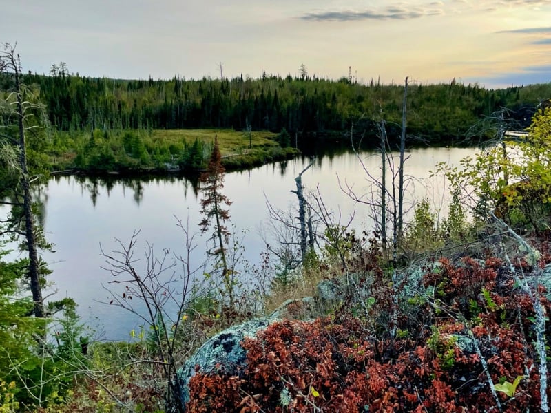
Boundary Waters Hikes Near Grand Marais, MN
9. Eagle Mountain
Trail Difficulty: Moderate – challenging
Trail Style: Out and back
Trail Length: 7 miles round trip
Driving Directions From Grand Marais: Turn onto the Gunflint Trail (Cook County Highway 12) and drive 3 miles. Turn onto the Devil Track Road (County Road 8), drive for 5.7 miles, then turn onto Ball Club Road (County Road 27) and drive for 5 miles. Turn left onto The Grade (Forest Road 153) and drive for 5.3 miles. The parking lot for the trailhead is on the right hand side.
Trailhead: Located on the east side of the parking lot, by an informational kiosk.
Trail Map: Click here for an Eagle Mountain trail map.
About This Grand Marais Hike:
What if I told you that you could hike into the Boundary Waters Canoe Area Wilderness as well as visit the highest point in Minnesota on one hike?
On the Eagle Mountain Trail, you can visit the most popular federal wilderness in the United States and summit a 2,301-foot-tall mountain! These claims to fame make Eagle Mountain one of the most popular hiking trails near Grand Marais.
While the hike isn’t particularly challenging, the rock-strewn path requires near constant attention on your footing. Depending on the season, small portions of the trail may be flooded, but there are extensive boardwalks in place over most low areas.
The most challenging aspect of the Eagle Mountain Trail is its length. Make sure you’ve budgeted enough time to get back to the parking area before dark.
Also note that this isn’t a great option for hiking with young kids unless you’re willing to carry them the entire way.
The beginning of the trail is fairly nondescript. Then, at the 3-mile point, you reach the edge of beautiful Whale Lake – which is especially lovely in spring when wildflowers bloom along the shore.
After looping around the lake, you’ll start a steep 500-foot climb to the summit. At the top, you’ll find a plaque as well as fabulous views of the surrounding wilderness.
Important:
Since the Eagle Mountain Trail crosses into the Boundary Waters Canoe Area Wilderness, you’ll need a self-issued permit for the hike. You can find these free permits at the trailhead kiosk. Simply fill it out, throw it in your pack, and you’re good to go.
Hikes East Of Grand Marais, MN
10. Kadunce River
Trail Difficulty: Moderate
Trail Style: Out and back
Trail Length: 2.2 miles round trip
Driving Directions From Grand Marais: Drive 9 miles east of Grand Marais on Highway 61. Park at Kadunce River State Wayside on the south side of the highway.
Trailhead: The trailhead is located on the north side of Highway 61 on the east side of the river. Look for the Superior Hiking Trail sign.
Trail Map: Click here for a Kadunce River trail map.
About This Grand Marais Hike:
Explore a magical, moss-covered river canyon and multiple small waterfalls along the Kadunce River on this moderate two-mile trek.
Easily one of the most beautiful hikes near Grand Marais, this riverside trail features a gradual uphill grade that leads to a bridge spanning the Kadunce River.
At the bridge, the trail connects with the Superior Hiking Trail. Although many hikers prefer to turn around after taking a few photos from the bridge, you can extend your hike indefinitely by hopping onto the long-distance Superior Hiking Trail.
In the summer and deep winter you can actually hike in the river itself. This involves scrambling up waterfalls, so don’t forget your closed-toe shoes, quick dry athletic wear, and common sense!
In the deep winter, wear snowshoes and stay well away from any moving water where the ice will be dangerously thin.
If you prefer to stick with the developed trail, you’ll spend most of the hike about 30 feet above the river.
The trail hike isn’t as dramatic as the canyon, but it’s safe and well-used year-round.
11. Superior Hiking Trail Lake Walk
Trail Difficulty: Easy – moderate
Trail Style: Out and back
Trail Length: 3 miles round trip
Driving Directions From Grand Marais: Drive 11 miles north on Highway 61 towards Hovland. The trailhead is on the lakeside of the highway, just after you pass Kelly’s Hill Road.
Trailhead: You’ll see a sign for the Superior Hiking Trail right along Highway 61, but there’s actually a small parking lot located down a short, but rough, driveway. Only attempt to reach the parking area if your vehicle has good suspension and 4-wheel drive. Otherwise, there’s plenty of room on the highway shoulder to park.
Trail Map: Click here for a Superior Hiking Trail Lake Walk map.
About This Grand Marais Hike:
The Superior Hiking Trail travels nearly the entire length of Minnesota’s North Shore, but only 1.5 miles of this 310-mile long-distance hiking trail actually travel next to Lake Superior.
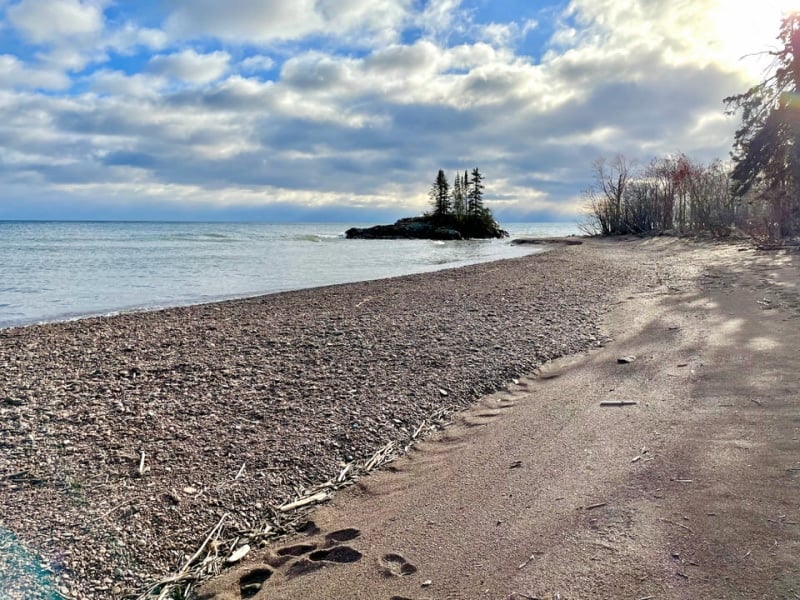
Located just north of Grand Marais, this section of the trail gives you fantastic access to a quiet Lake Superior gravel beach.
Just be forewarned that there’s no developed trail infrastructure other than a brief boardwalk at the far east end of this section of trail. Hiking for 3 miles on a pebbled Lake Superior beach is no joke!
If you’re not set on getting a real hike in, this is a great spot to bring kids for private Lake Superior beach exploring.
Keep in mind, the trail offers more than just fantastic beach access.
On the western edge of this Superior Hiking Trail section, you’ll pass a rare Icelandite fen that was recently designated as a Scientific and Natural Area. It will be specially preserved by the Minnesota Department of Resources.
At the far east of the section, the boardwalk passes the lowest point on the Superior Hiking Trail – an elevation of 610 feet. A small island rests just off the eastern end of the Lake Walk section.
Hint:
If you’re into geocaching, dress appropriately for wading to the island!
Tips For Hiking Near Grand Marais MN
To help you have the best trip possible, here are some general tips to keep in mind when hiking in Grand Marais MN:
-Grand Marais is a small rural community on the edge of rugged wilderness and these hikes reflect that. Don’t expect many, or any, amenities at the trailheads.
-Once you’re more than 4 miles inland from Lake Superior, cell service drops off almost completely. Therefore, it’s wise to download all directions and maps in Grand Marais before departing for a trailhead.
-It’s best to consider Grand Marais your last opportunity to fuel up your vehicle, grab water and snacks, and use the toilet before heading out on your hike.
-Expect most hikes near Grand Marais, MN to be narrow, windy wilderness paths. Shoes with ankle support – or at the very least, toe coverage – should be worn.
-You can certainly hike near Grand Marais year-round, but make sure you dress appropriately if you’re venturing out in the notoriously harsh winter months.
-Lastly, be prepared to go it alone (especially if you’re hiking solo). Make sure you have a simple first-aid kid and a flashlight or headlamp along. If you twist your ankle or otherwise require assistance hiking out, it could be hours before volunteer first responders can reach you.
Hotels Near Grand Marais MN
Looking for places to stay in Grand Marais?
Click here for a full list of Grand Marais hotels!
Prefer self-contained stays?
Click here to check out self-contained stays!
You can also use this map to search for local stays and experiences:
Grand Marais Travel Insurance
When visiting Grand Marais – or anywhere else in the world – it’s wise to get travel insurance.
One of the best travel medical insurance for travelers is SafetyWing as they’ve got a large network and offer both short-term and long-term coverage — including coverage if you’re traveling for months as well as limited coverage in your home country).
Additionally, SafetyWing is budget-friendly and offers $250,000 worth of coverage with just one low overall deductible of $250.
Click here to price out travel insurance for your trip in just a few clicks.
What hikes near Grand Marais MN would you add to this list?
Enjoyed this guide to hiking near Grand Marais, MN? Pin it for later!